
Path planning system and method

A path planning and routing technology, which is applied in the traffic control system of road vehicles, traffic control system, road network navigator, etc., to achieve the effect of shortening the moving time and improving the traffic state

Inactive Publication Date: 2006-07-12
GIGA BYTE COMM INC +1
View PDF2 Cites 38 Cited by
  • Summary
  • Abstract
  • Description
  • Claims
  • Application Information

AI Technical Summary

Problems solved by technology

[0004] In addition, U.S. Patent No. 6,804,524 discloses using multiple stations to obtain traffic information of vehicles wirelessly, and then know the current traffic status, but it still cannot provide users with the service information of the route with the shortest travel time and estimated travel time

Method used


Image

  • Path planning system and method
  • Path planning system and method
  • Path planning system and method

Examples


Embodiment Construction

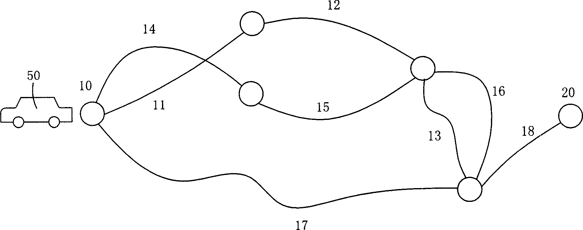
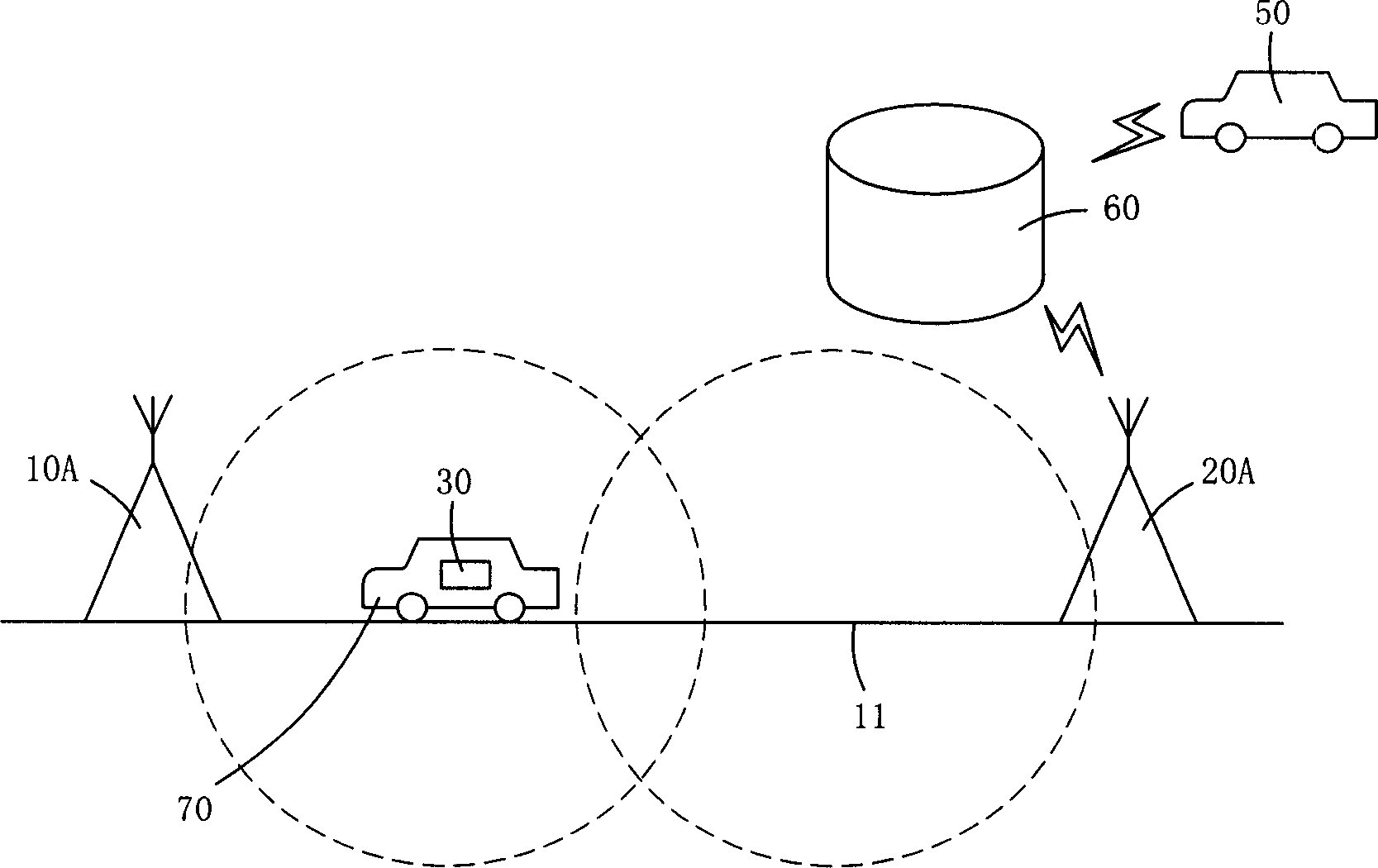
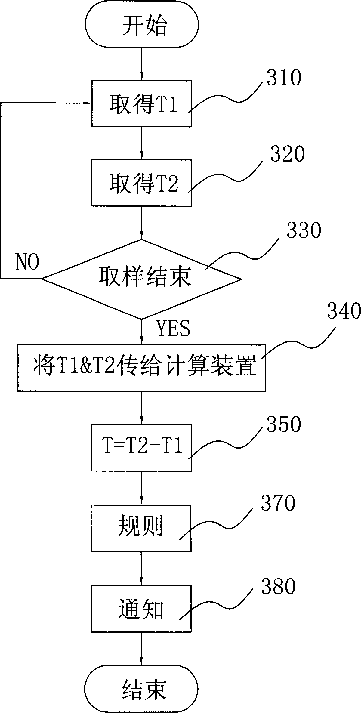
[0012] The invention discloses a method and system for planning an optimal route, which is used by a first vehicle, and the first vehicle moves from a first position (ie, a starting point) to a second position (ie, a destination). The present invention plans multiple road sections between the starting point and the destination, and judges the traffic conditions of the multiple road sections by detecting the moving time or speed of the wireless communication device moving on the multiple road sections, and obtains the traffic conditions of the multiple road sections. After the traffic situation, the optimal route with the shortest time can be planned.

[0013] Such as figure 1 As shown, the route planning system of the present invention is used to plan an optimal route for a first vehicle 50 to move from a first position 10 to a second position 20, between the first position 10 and the second position 20 There are multiple road sections, such as road sections 11, 12, 13, 14, 1...


PUM


Abstract

This invention discloses a path program system and its method, which is to program the optimum path of the first vehicle that moves from the start to the aim. This invention plans a plurality of sections between the start and the aim, it adjusts the traffic condition of these sections by checking the moving time or velocity of the radio device when the second vehicle moving on the sections, and then it provides the information to the first vehicle, after obtaining a polarity of the traffic conditions it can program a optimum path that costs least time. This invention includes the following steps: (a) obtaining the average moving time of a plurality of sections; (b) determining the optimum path according to the average moving time of the sections; (c) informing the optimum path of the first vehicle.

Description

technical field [0001] The present invention relates to a method and system for planning an optimal path, in particular to a method and system for planning a path with the shortest time. Background technique [0002] The current GPS system can only be used to display the location, and other systems used in combination with the GPS system, such as satellite navigation systems, can plan a shortest driving route according to the user's starting point and destination. However, what is more helpful to the user is to provide a path with the shortest travel time and an estimated travel time. None of the current systems can provide such a service. [0003] In US Patent No. 6,611,687, it is disclosed that when the car with the wireless device enters the designated area, the message of the designated area is sent to the car with the wireless device. It only sends information to the car for a specified area (perhaps a station or town along the way), not for the entire route. [0004...

Claims


Application Information

Patent Timeline
Patent Type & Authority Applications(China)
IPC IPC(8): G01C21/26G08G1/00
Inventor 简焕文
Owner GIGA BYTE COMM INC
Learn More