
High altitude UAV for monitoring meteorological parameters

a meteorological and high-altitude technology, applied in the direction of instruments, fuselages, transportation and packaging, etc., can solve the problems of difficult to obtain all these measurements in the local or regional area, the change of water phase consumes energy, and the storm disperses quickly

Active Publication Date: 2021-02-23
NASA
View PDF18 Cites 1 Cited by
  • Summary
  • Abstract
  • Description
  • Claims
  • Application Information

AI Technical Summary

Benefits of technology

Enables accurate measurement and tracking of severe weather events in real-time, providing comprehensive data for improved weather forecasting and monitoring, overcoming the limitations of existing technologies.

Problems solved by technology

Due to pressure differences, when air is forced to ascend, it expands and cools resulting in condensation, hence clouds.
The change in water phase consumes the energy which fuels weather on Earth.
In these storms, the updraft and downdraft are often spaced closely, so the downdraft is blocked with an updraft and the storm dissipates quickly.
Obtaining all these measurements in the local or regional area may be difficult.
Radiosondes and radar have certain limitations and do not provide all required information for accurate weather forecast.
Radar is an active remote sensor which has limited range and sometimes radar beams overshoot the mesocyclonic circulation limiting radar's effectiveness.
There is also a possibility that mesocyclonic circulation cannot be detected when above a radar set because the conal region immediately above the radar set may be an area from which radar returns may not be received.
Radiosondes are not re-usable and used only at pre-determined locations around the globe.
Additionally, radiosondes are disposable and do not provide all required information for accurate weather forecasts.
As examples, radiosondes do not provide tornadoes or microburst information at infancy of the event and radiosondes do not provide wind shear information over a wide range area.
Further, there are several shortcomings to using radiosondes for tracking storms around the clock, two of which are: 1) that the radiosondes do not have capability to measure wind shear; and 2) that the radiosondes are launched at particular locations around the globe after every 12 hours (giving the radiosondes limited capacity and tracking).

Method used


Image

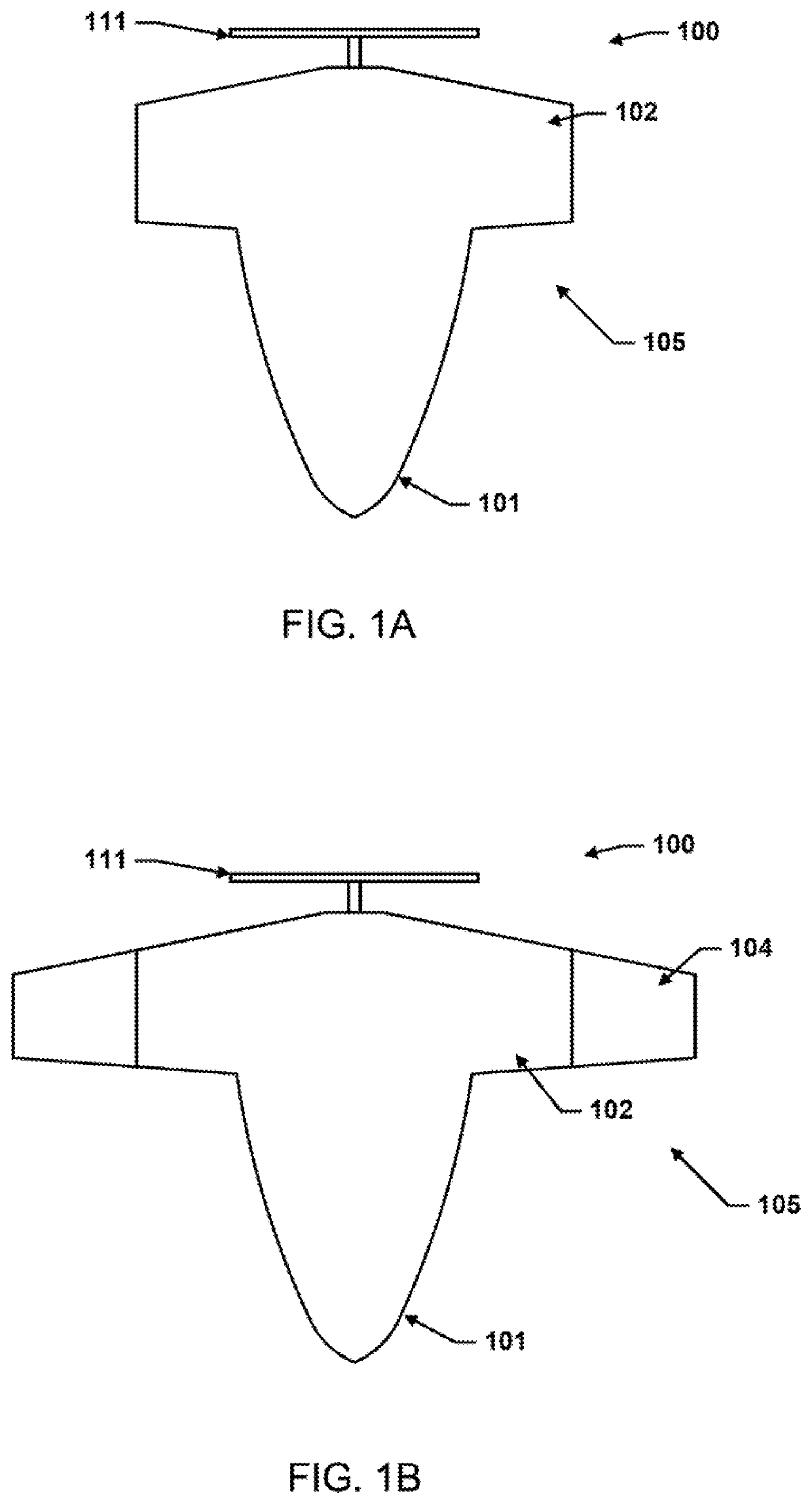
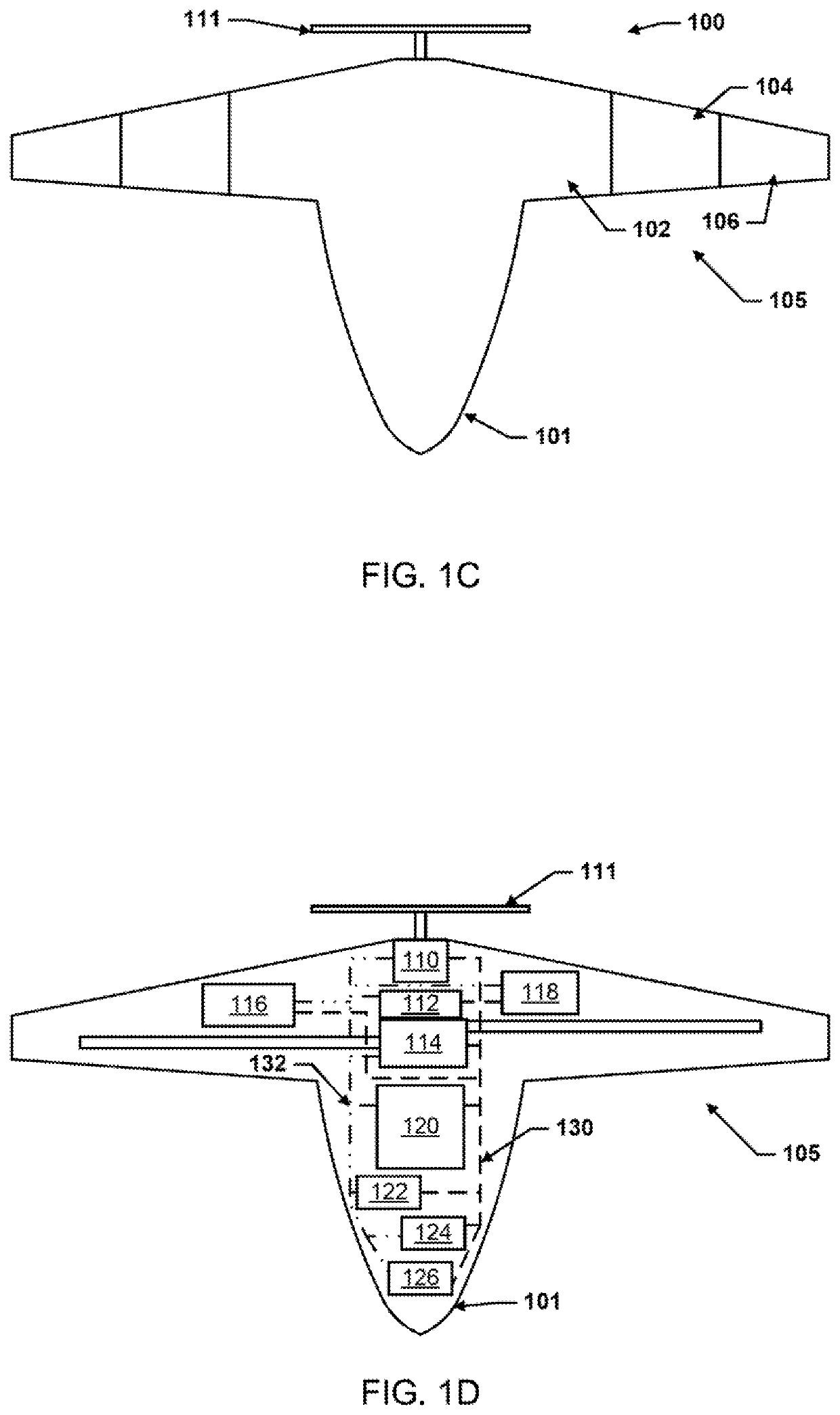
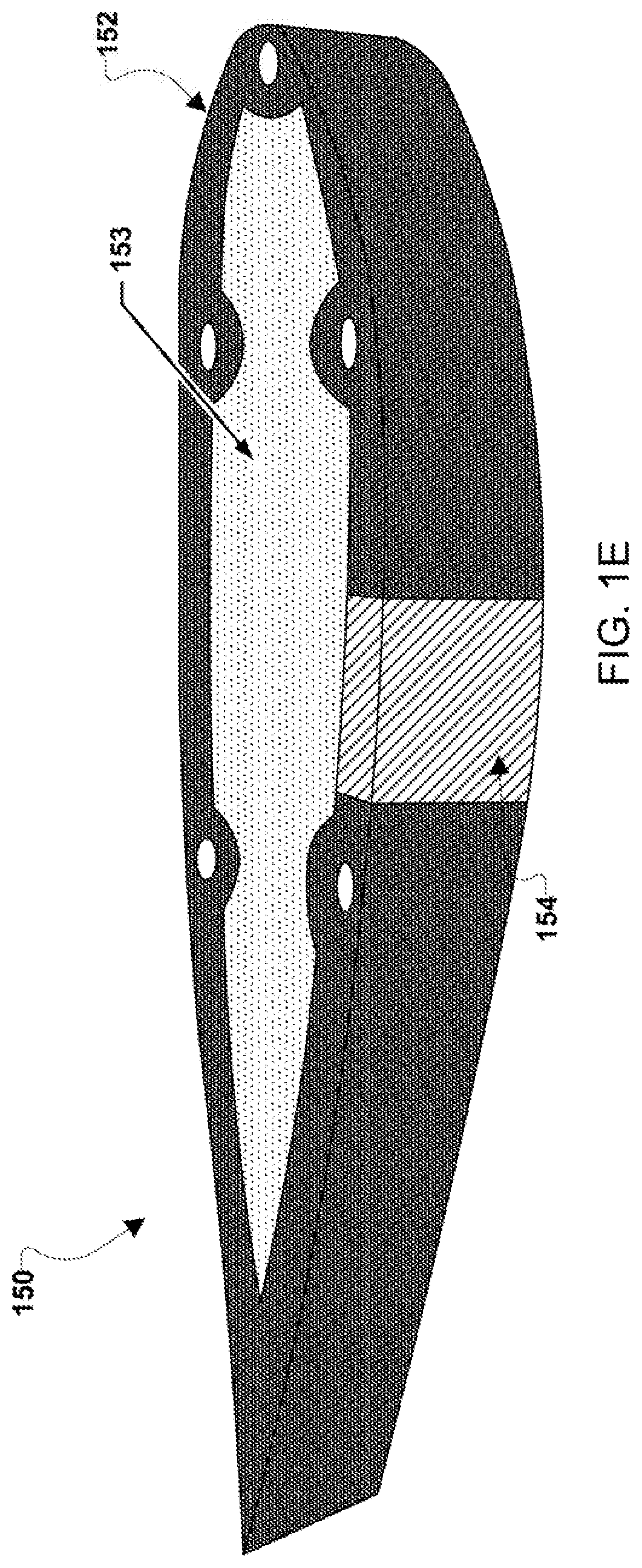
  • High altitude UAV for monitoring meteorological parameters
  • High altitude UAV for monitoring meteorological parameters
  • High altitude UAV for monitoring meteorological parameters

Examples


Embodiment Construction

[0022]For purposes of description herein, it is to be understood that the specific devices and processes illustrated in the attached drawings, and described in the following specification, are simply exemplary embodiments of the inventive concepts defined in the appended claims. Hence, specific dimensions and other physical characteristics relating to the embodiments disclosed herein are not to be considered as limiting, unless the claims expressly state otherwise.

[0023]The word “exemplary” is used herein to mean “serving as an example, instance, or illustration.” Any implementation described herein as “exemplary” is not necessarily to be construed as preferred or advantageous over other implementations.

[0024]The various embodiments will be described in detail with reference to the accompanying drawings. Wherever possible, the same reference numbers will be used throughout the drawings to refer to the same or like parts. References made to particular examples and implementations are...


PUM


Abstract

Various embodiments may provide an airborne system for measuring meteorological parameters, including a high altitude unmanned aerial vehicle (UAV) formed completely or partially of closed-cell polyurethane foam. In various embodiments, the UAV may include extendable wings configured to extend and retract as the UAV climbs and descends to different altitude levels. In various embodiments, the UAV may include one or more infrasonic sensors and wind screening configured to measure one or more meteorological parameters, such as wind shear, seismic waves, magnetic storms, magnetohydrodynamic waves, severe weather, tornadoes, hurricanes, meteors, and lighting. The infrasonic sensors may be configured to determine wind shear at the local and regional level. In various embodiments, other meteorological sensors may also be included in / on the UAV in addition to the infrasonic sensors.

Description

CROSS-REFERENCE TO RELATED PATENT APPLICATIONS[0001]This patent application claims the benefit of and priority to U.S. Provisional Patent Application No. 62 / 589,003, filed on Nov. 21, 2017, the contents of which are hereby incorporated by reference in their entirety.STATEMENT REGARDING FEDERALLY SPONSORED RESEARCH OR DEVELOPMENT[0002]The invention described herein was made by employees of the United States Government and may be manufactured and used by or for the Government of the United States of America for governmental purposes without the payment of any royalties thereon or therefore.BACKGROUND OF THE INVENTION[0003]Meteorology events can be microscale or macroscale events. Microscale events are events approximately 1 km in size. Macroscale events are events spread between 10 to 1000 km in size. Some meteorology events may be extreme weather phenomena, such as convective storms, tornadoes, shear-induced turbulence, microbursts, acoustic gravity waves, and hurricanes. Meteorology...

Claims


Application Information

Patent Timeline
Patent Type & Authority Patents(United States)
IPC IPC(8): G01W1/08B64C3/54B64C39/02B64C1/00
CPCG01W1/08B64C1/0009B64C3/54B64C39/024B64C2001/0072B64C2201/125Y02T50/40B64U30/12B64U2101/35B64U20/60B64U50/13
Inventor SHAMS, QAMAR A.COFFEY, NEIL C.
Owner NASA
Learn More