System, method, and apparatus for satellite remote sensing

a satellite remote sensing and satellite technology, applied in the field of remote sensing satellite imaging, can solve the problem of inadequate resolution of these images, and achieve the effect of high resolution and lower resolution images

Inactive Publication Date: 2003-08-14
DIGITALGLOBE INC
View PDF8 Cites 30 Cited by
  • Summary
  • Abstract
  • Description
  • Claims
  • Application Information

AI Technical Summary

Benefits of technology

0004] The present invention provides a system, method, and apparatus for remote sensing that captures raw image data from outer space at a first resolution and is adapted to provide multiple resolution images from this raw image data without requiring multiple-resolution image data to be captured. The present invention utilizes the raw image data to provide both a high resolution image directly from the data and also aggregates the raw image data to provide a lower resolution image.

Problems solved by technology

Often, however, the resolution of these images is inadequate.

Method used


Image

  • System, method, and apparatus for satellite remote sensing
  • System, method, and apparatus for satellite remote sensing
  • System, method, and apparatus for satellite remote sensing

Examples


Embodiment Construction

[0013] Each of the figures described below depict exemplary embodiments. None of these figures are intended to be limiting, but rather provide differing examples of embodiments that may be used within the scope of the present invention as defined below in the claims.

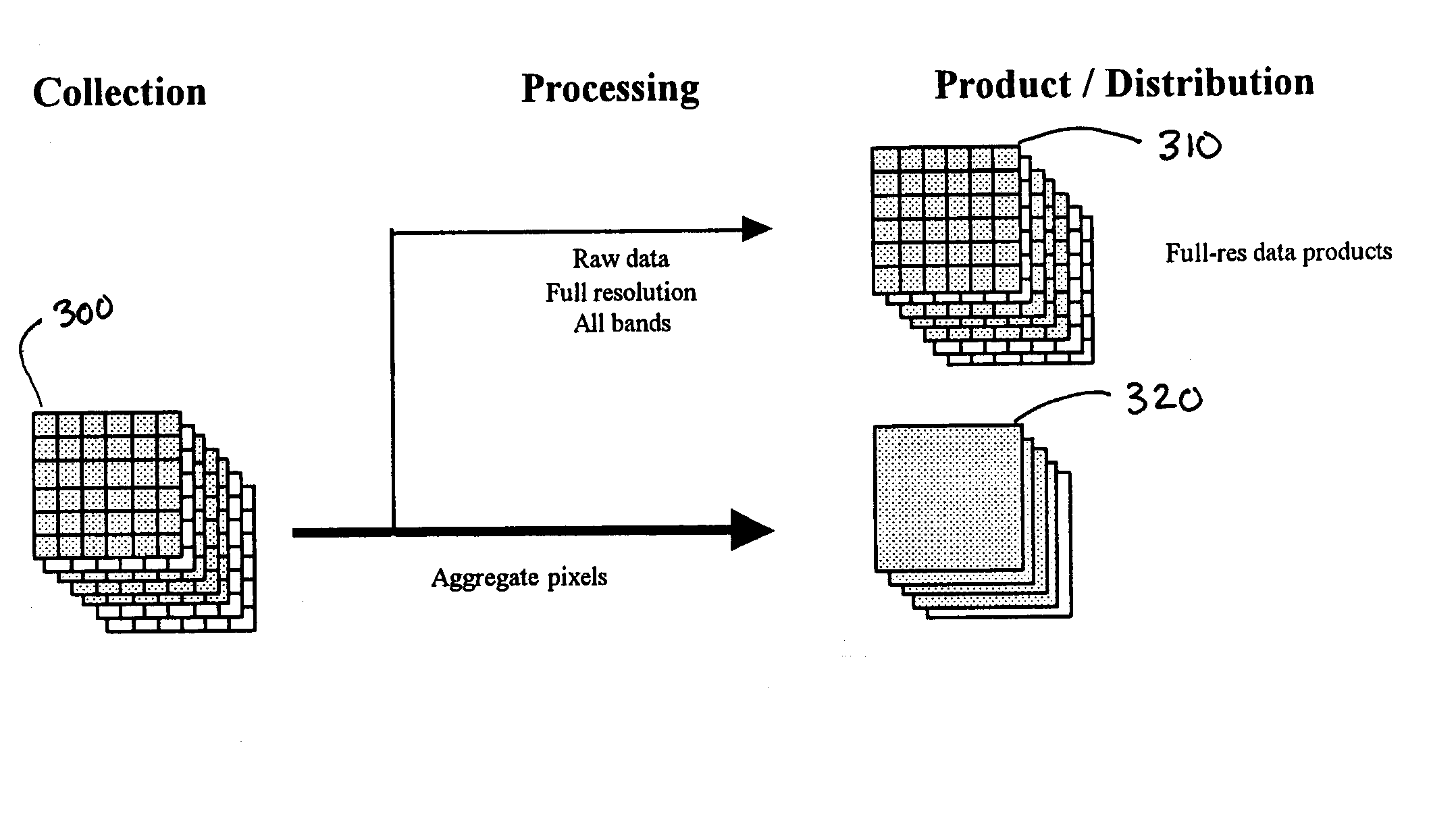
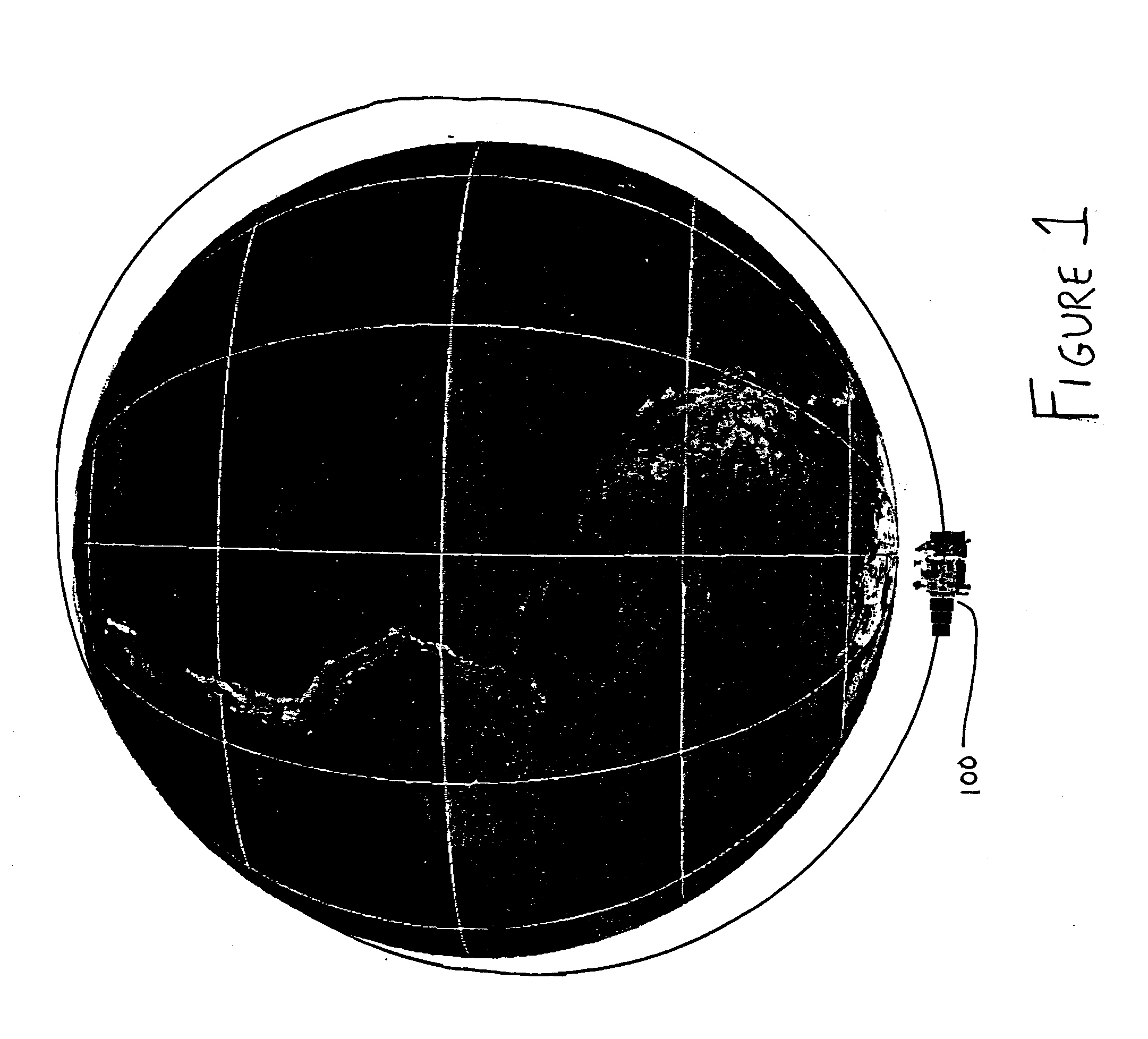
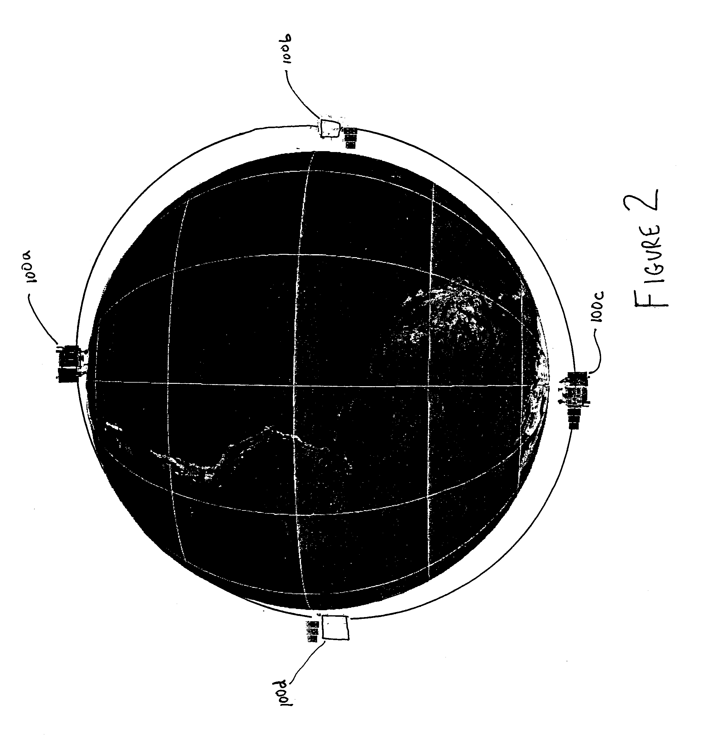
[0014] Figure 1 depicts a satellite 100 in orbit around the earth. The satellite, in one exemplary embodiment, maintains a precision-controlled sun-synchronous, near-polar, Worldwide Reference System-2 (WRS-2) orbit at a nominal altitude of 705 kilometers, which provides a ground track suite of 233 orbits and repeats every sixteen days. The satellite preferably captures at least a 185 kilometer wide swath and maintains its orbit within .+-. 5 kilometers of the WRS-2 nadir track. The satellite may include various types of remote sensing equipment as is known in the art. For example, the satellite may includes a wide pushbroom array scanner that utilizes time delay and integration (TDI) to increase the signal to noise rati...


PUM


Abstract

Abstract of Disclosure A system, method, and apparatus for remote sensing is disclosed. The system method, and apparatus can capture raw image data from outer space at a first resolution and provide multiple resolution images from this raw image data without requiring multiple-resolution image data to be captured. The raw image data is utilized to provide both a high resolution image directly from the data and also aggregates the raw image data to provide a lower resolution image. The system, method, and apparatus can further utilize a red edge band of the near infrared band for remote sensing.

Description

Cross Reference to Related Applications[0001] This application claims the benefit of United States Provisional Application No. 60 / 341,722, entitled SATELLITE CONSTELLATION AND METHOD FOR USING INFORMATION PRODUCED BY THE SATELLITE CONSTELLATION and filed by Walter S. Scott et al. on December 17, 2001, which application is incorporated by reference into this application in its entirety.Field of the Invention[0002] This invention relates to remote sensing satellite imaging, and more particularly to aggregating raw image data from a remote sensing satellite to provide lower resolution image data.Background of the Invention[0003] Landsat and other remote sensing satellites currently provide relatively low-resolution image detection from space. These images are commonly used for agricultural and other purposes for monitoring large areas. Often, however, the resolution of these images is inadequate. In these situations, a completely independent satellite system must be utilized to provide...

Claims


Application Information

Patent Timeline
Patent Type & Authority Applications(United States)
IPC IPC(8): G06K9/00G06K9/32G06K9/40G06K9/54G06K9/60G06T5/50
CPCG06T3/4053G06T2207/30181G06T2207/10036G06T5/50
Inventor SCOTT , WALTER S.KNOBLAUCH , GREGORY E.CHICOINE , GERALD M.MCCLELLAND , JAMES G.SCOTT , PAUL W.PARIS , JACK F.
Owner DIGITALGLOBE INC
Why Eureka
Try Eureka