

System for processing digital map data
a digital map and data processing technology, applied in the field of system and method for processing digital map data, can solve the problems of cost and time-consuming computation, and achieve the effect of simplifying further processing
- Summary
- Abstract
- Description
- Claims
- Application Information
AI Technical Summary
Benefits of technology
Problems solved by technology
Method used
Image

Examples
Embodiment Construction
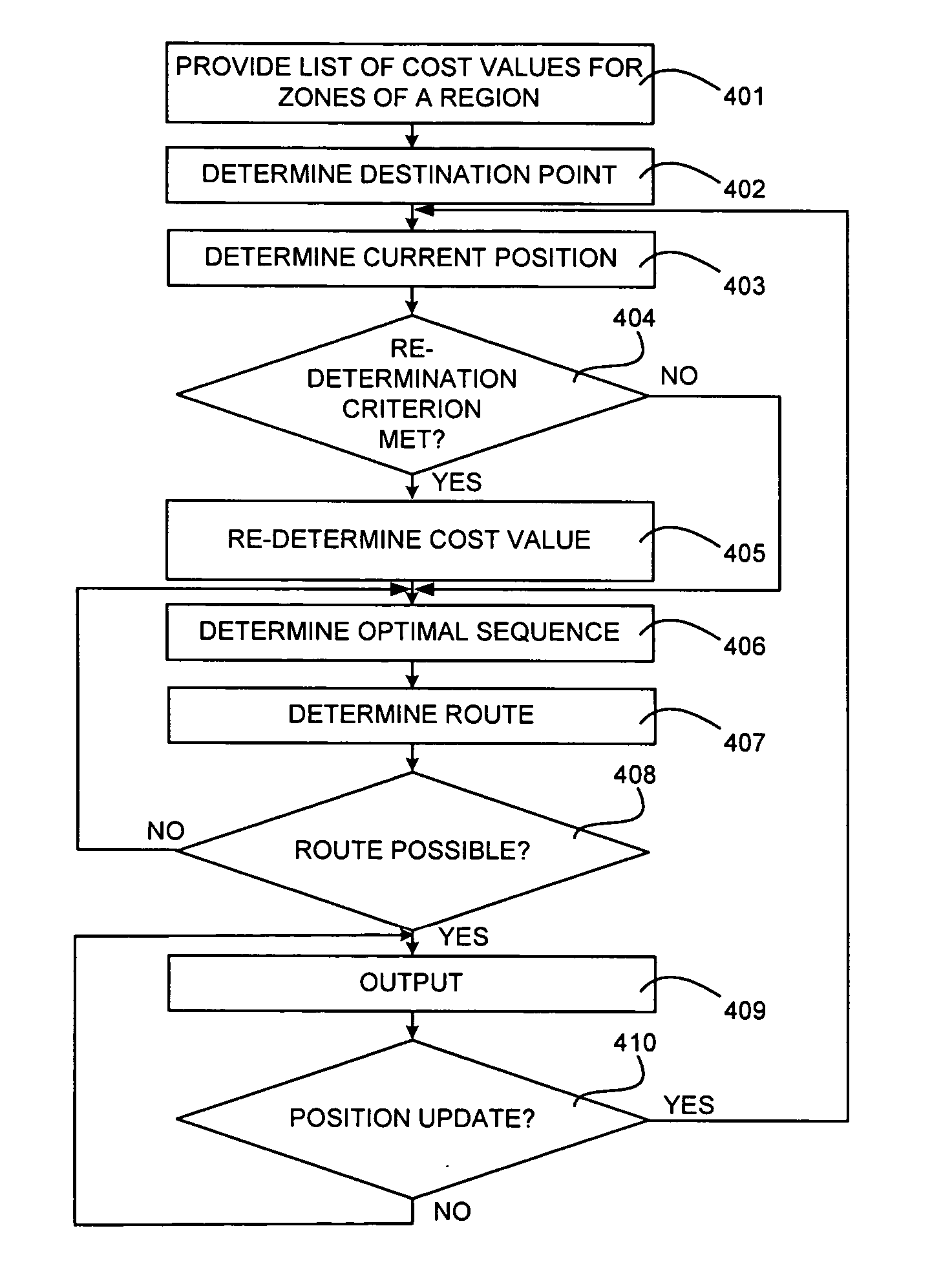
[0019] This application relates to a system for processing digital map data. In particular, this application relates to a system for processing digital map data for route determination and determining a route between two points. The system includes methods for processing digital map data for route determination and for determining a route between two points.
[0020] Digital map data may include map data representing a region that is divided into a plurality of zones. A cost value may be assigned to each zone based on predetermined cost criterion. A cost value may be a numerical value that represents some aspect related to traveling through the zone. For example, a cost value may represent the amount of estimated time it should take to travel through the zone. A cost value may also represent the distance that may be required to pass through the zone. In another example, the cost value may be related to the amount of tolls that must be paid to pass through the zone. Each of these crite...
PUM
 Abstract
Description
Claims
Application Information