

Method for combined use of a local positioning system, a local RTK system, and a regional, wide-area, or global carrier-phase positioning system
a positioning system and local positioning technology, applied in satellite radio beaconing, measurement devices, instruments, etc., can solve the problems of only determining the whole cycle ambiguity and the long elapsed time of the navigation receiver
- Summary
- Abstract
- Description
- Claims
- Application Information
AI Technical Summary
Benefits of technology
Problems solved by technology
Method used
Image

Examples
Embodiment Construction
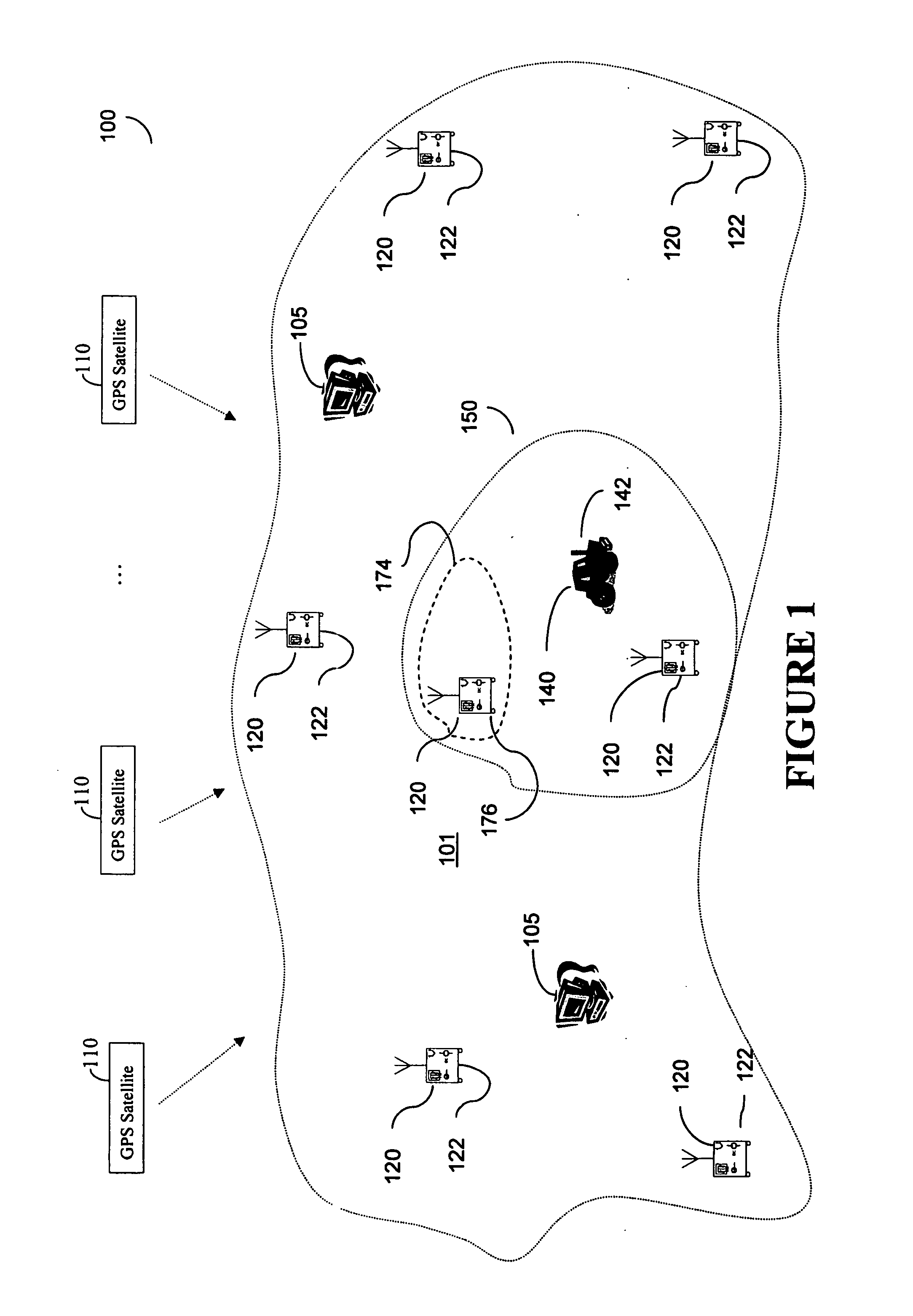
[0021]FIG. 1 illustrates a wide-area or global differential GPS (WADGPS) system 100 according to one embodiment of the present invention. As shown in FIG. 1, the WADGPS system 100 includes a network of reference stations 120 each having a GPS receiver 122, and one or more processing hubs 105. The reference stations 120 continuously provide raw GPS observables to the hub 105 for processing. These observables include GPS code and carrier phase measurements, ephemerides, and other information obtained according to signals received from a plurality of satellites 110 at the reference stations 120. The reference stations 120 are placed at known locations across a wide area 101, such as a continent, for a wide-area DGPS system, or across the globe for a global DGPS network. The hubs 105 are facilities at which the GPS observables are processed and DGPS corrections are computed. If multiple independent hubs are provided, it is preferred that they are geographically separated and operate in ...
PUM
 Abstract
Description
Claims
Application Information