Satellite beacon for faster sky-search and pointing error identification

Active Publication Date: 2006-12-28
GULA CONSULTING LLC
View PDF4 Cites 7 Cited by
  • Summary
  • Abstract
  • Description
  • Claims
  • Application Information

AI Technical Summary

Benefits of technology

[0009] In an exemplary embodiment, a system is provided for quickly identifying a detected satellite to determine if the detected satellite corresponds to a satellite of interest. In an example, the system uses a unique beacon or identifier for each satellite which may be quickly analyzed to determine the identit

Problems solved by technology

A problem with conventional tracking systems is the initial acquisition of a satellite of interest out of a plurality of possible satellites and / or the reacquisition of a satellite of interest following a period of time that the signal from the satellite of interest has been blocked.
Such blockages may occur frequently in the automotive environment.
Acquisition of one of these geo-stationary satellites is typically a time consuming process especially for mobile receivers whose Earth bound position and / or heading is likely to change.
The area that must be scanned may be quite large due to a lack of knowledge of the current position of the vehicle and / or a lack of knowledge of the vehicle heading.
Often times the same portion of the sky is re-swept because of a lack of knowledge of the current location and / or heading of the vehicle.
The use of signal strength alone also does not provide an adequate method for locating a satellite because many satellites have relatively strong signal strengths.
Once again the determination that the incorrect satellite has been detected is only discovered after a lengthy failure to decode or descramble the satellite's data stream.

Method used


Image

  • Satellite beacon for faster sky-search and pointing error identification
  • Satellite beacon for faster sky-search and pointing error identification
  • Satellite beacon for faster sky-search and pointing error identification

Examples


Embodiment Construction

[0022] The embodiments discussed below are not intended to be exhaustive or limit the invention to the precise forms disclosed in the following detailed description. Rather, the embodiments are chosen and described so that others skilled in the art may utilize their teachings.

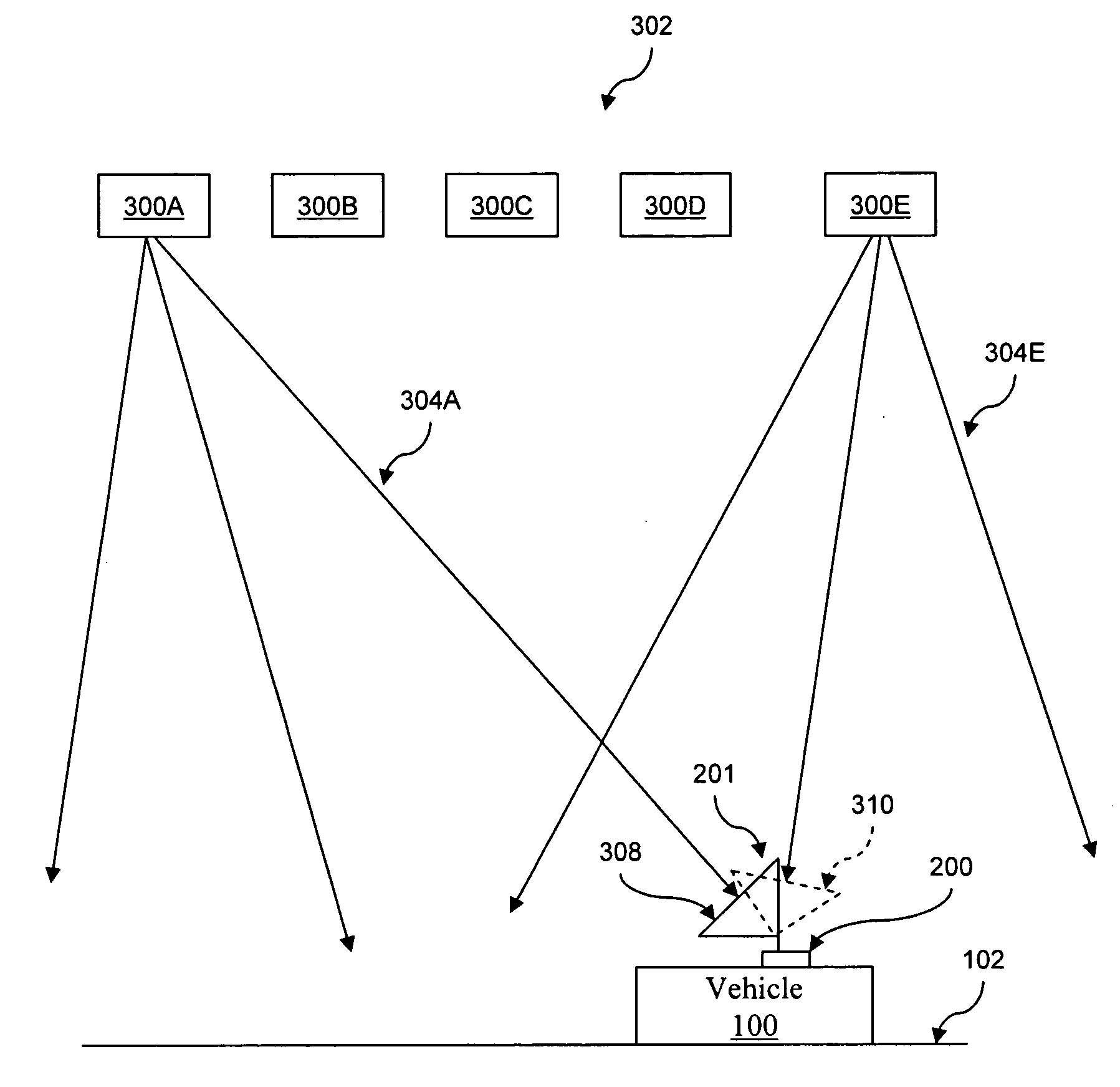
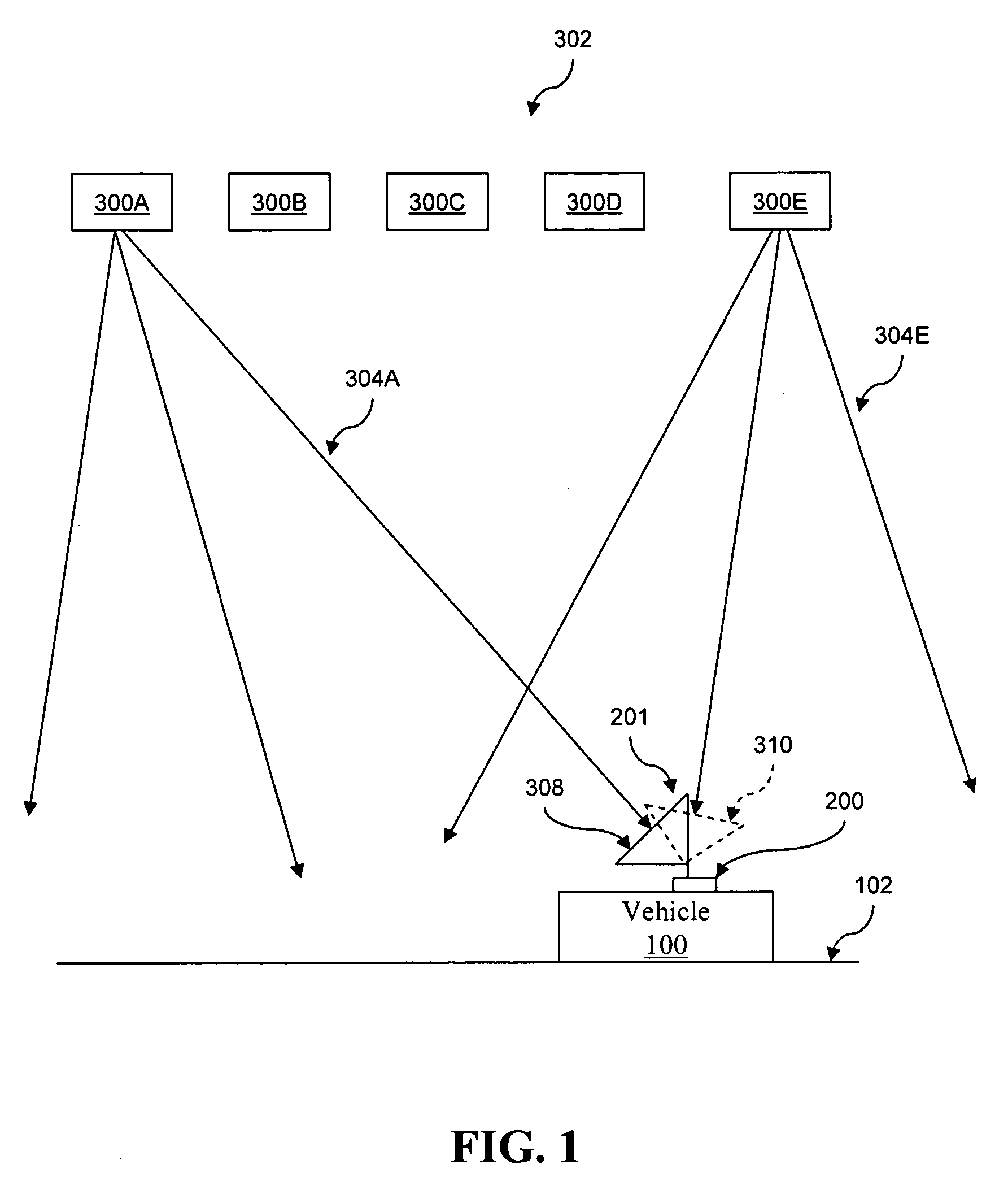
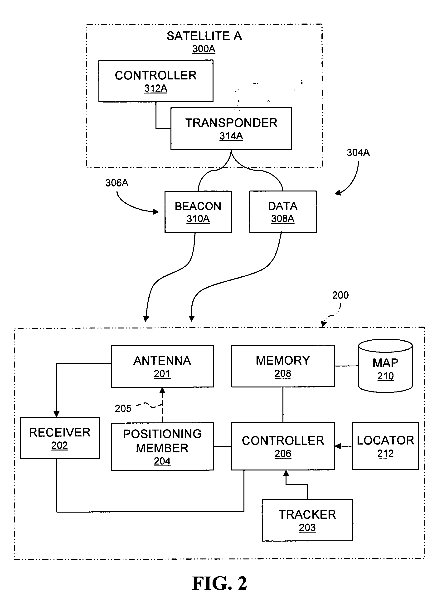
[0023] Referring to FIG. 1, a vehicle 100 is shown with a base unit 200 mounted or otherwise coupled thereto. Base unit 200 is positionable such that an antenna 201 of base unit 200 is able to scan the sky in order to locate and receive data from a satellite of interest 300E which is one of a plurality of satellites 302, illustratively shown as satellites 300A, 300B, 300C, 300D, and 300E. As is well known in the art, each satellite 300 is capable of generating one or more signals which are broadcast in multiple directions for reception by an antenna and decoding by a receiver, such as antenna 201 and receiver 202 of base unit 200. As illustratively shown in FIG. 1 signals 304A and 304E for respective satellite...


PUM


Abstract

An apparatus for determining the identity of a first detected satellite and to determine a second scan position for a satellite of interest based in part on the identity of the first detected satellite is disclosed. In one example the identity of the first detected satellite may be determined based on a satellite beacon or identifier.

Description

TECHNICAL BACKGROUND [0001] The present invention relates to systems and methods to locate and / or identify satellites and in particular systems and methods to locate and / or identify satellites relative to a mobile receiver. BACKGROUND OF THE INVENTION [0002] Geo-stationary satellites are positioned generally directly above the equator of the Earth and stay generally fixed in position relative to the Earth as the Earth rotates. Each of these satellites typically have multiple transponders, each transponder having multiple data channels. In one example, a satellite might have thirty-two transponders, each transponder having about six or more data channels. A satellite spectra for a satellite is provided based on which transponders are used and the manner in which each transponder is used. [0003] These geo-stationary satellites are generally spaced apart, such as a first satellite may be at 85° west longitude, a second satellite may be at 101° west longitude, and a third satellite may ...

Claims


Application Information

Patent Timeline
IPC IPC(8): H04B7/185
CPCH01Q1/125G01S3/42
Inventor FALL, TERRENCE L.HULES, FRANK J.
Owner GULA CONSULTING LLC
Why Eureka
Try Eureka