Method and apparatus for emergency map display system
a map display and emergency technology, applied in television systems, frequency-division multiplexes, instruments, etc., can solve the problems of difficult coordination of a proper evacuation, difficult to access private service infrastructure, and inability to use public transportation
- Summary
- Abstract
- Description
- Claims
- Application Information
AI Technical Summary
Benefits of technology
Problems solved by technology
Method used
Image
Examples
Embodiment Construction
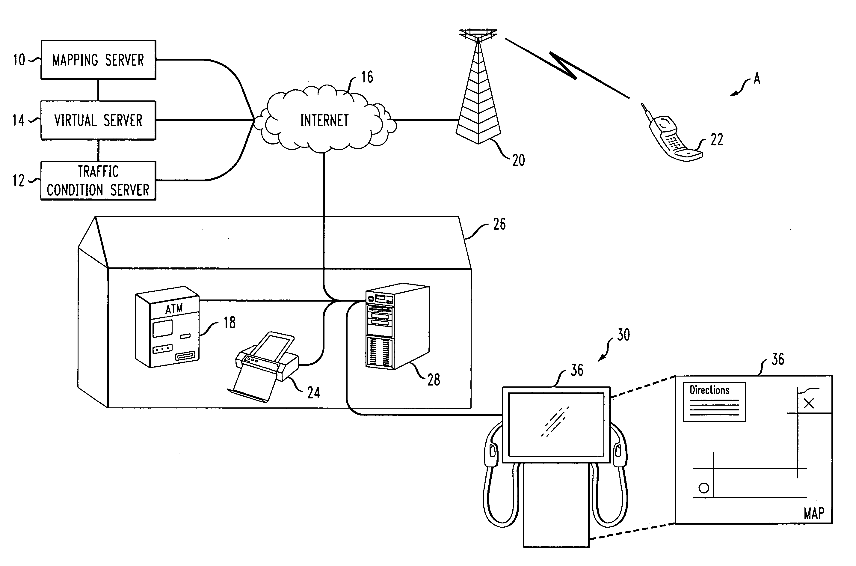
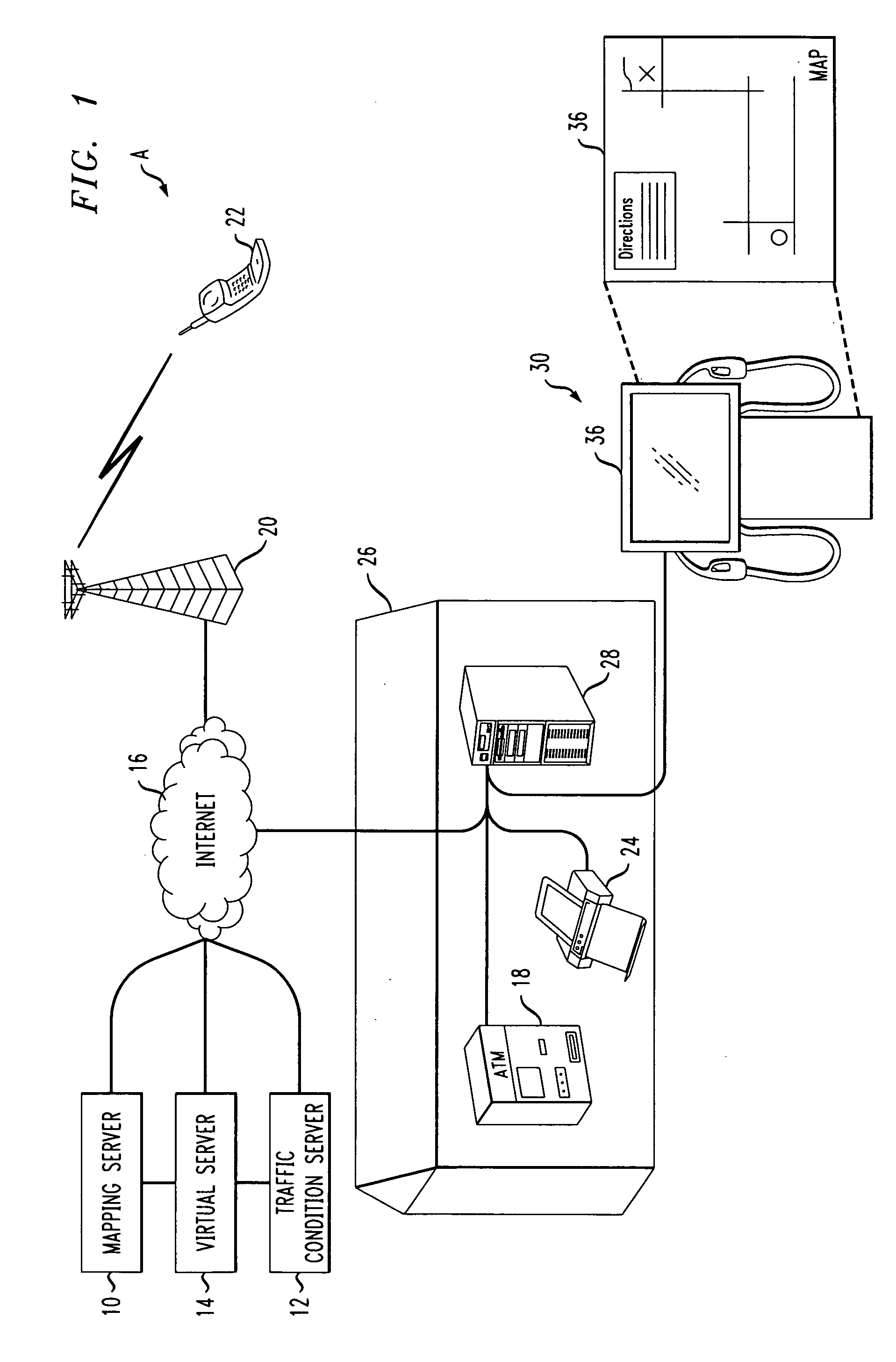
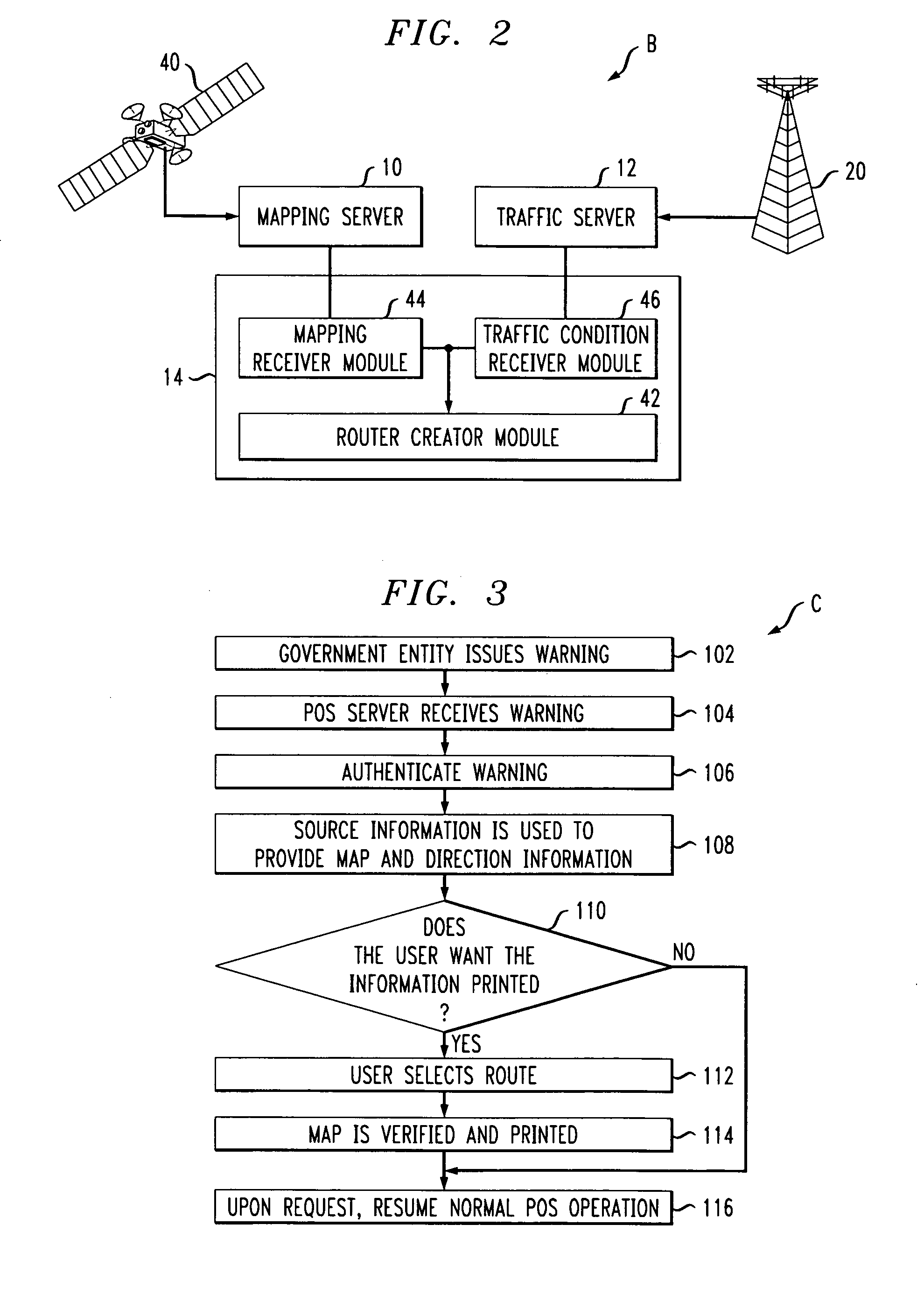
[0033]The presently described embodiments are directed, in at least one form, to a system and method of delivering emergency directions from the government to potential evacuees. The system and method has a function that will show the users of a point of service (POS) terminal the most efficient route away from a potential disaster area. However, it is contemplated that the user may provide input, including but not limited to, a specific destination and / or route, which can also be mapped out and taken into account when detailing a route of escape. Through this disclosure, the route calculated may not be the most direct, however, it is designed to direct an end user to get from their current position to a position of safety. Furthermore, the system takes into account current traffic conditions and updates these conditions in real time to provide accurate and efficient mapping.
[0034]Referring now to the drawings wherein the showings are for purposes of illustrating the exemplary embod...
PUM
 Abstract
Description
Claims
Application Information
 - R&D
- Intellectual Property
- Life Sciences
- Materials
- Tech Scout
- Unparalleled Data Quality
- Higher Quality Content
- 60% Fewer Hallucinations
Browse by: Latest US Patents, China's latest patents, Technical Efficacy Thesaurus, Application Domain, Technology Topic, Popular Technical Reports.
© 2025 PatSnap. All rights reserved.Legal|Privacy policy|Modern Slavery Act Transparency Statement|Sitemap|About US| Contact US: help@patsnap.com


