
Method of planning pedestrian navigation route

a pedestrian navigation and route technology, applied in the direction of navigation instruments, surveying and navigation, instruments, etc., can solve the problems of inconvenient marking, inability to meet the requirements of pedestrians and consumers, and the navigation function of the vehicle navigation device is not suitable for pedestrian navigation

Inactive Publication Date: 2009-07-09
MITAC INT CORP
View PDF13 Cites 26 Cited by
  • Summary
  • Abstract
  • Description
  • Claims
  • Application Information

AI Technical Summary

Benefits of technology

[0007]Therefore, it is a primary objective of the present invention to provide a method of planning a pedestrian navigation route, and the method is applied to a pedestrian navigation device. The pedestrian navigation device comprises a map database having a pedestrian road data and a driving route data of at least one public transportation means (such as bus, mass rapid transit, train and air transport). In the method, when the pedestrian navigation device is planning a pedestrian navigation route, the pedestrian navigation device reads start position i

Problems solved by technology

Since a pedestrian route may vary unexpectedly and people would do things like taking a shortcut, entering and exiting buildings, stopping, taking off or changing the walking direction all in a sudden, these walking behaviors make the positioning and navigation functions of the vehicle navigation device unable to satisfy the requirement of pedestrians and the expectation of consumers.
However, the navigation route of the vehicle navigation device is designed primarily for driving on a road such as a highway or an expressway, but the design has not taken the roads for pedestrians into consideration, and thus the navigation route provided by the vehicle navigation device is not suitable for pedestrian navigations.
Although the pedestrian navigation route can provide a pedestrian road, it is inappropriate to mark a navigation route if the distance between the current position (start position) and the end position is over tens of kilometers or even hundreds of kilometers.

Method used


Image

  • Method of planning pedestrian navigation route
  • Method of planning pedestrian navigation route
  • Method of planning pedestrian navigation route

Examples


Embodiment Construction

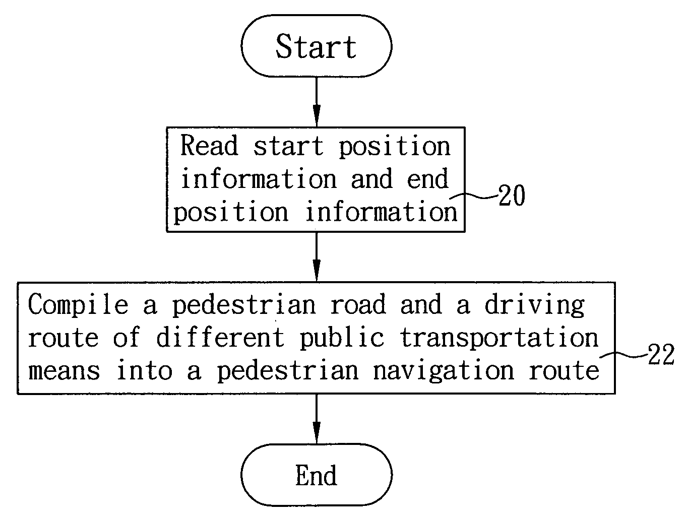
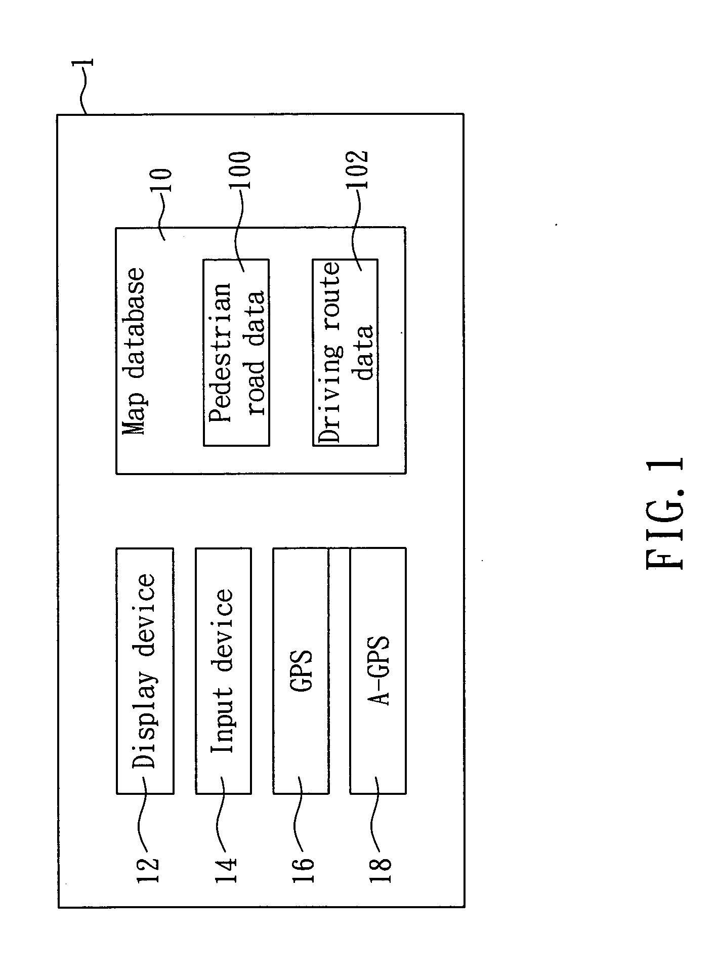
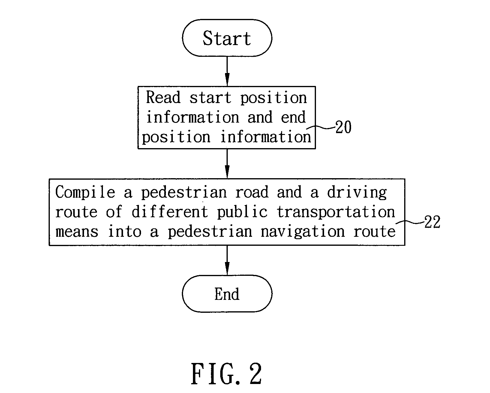
[0014]With reference to FIG. 1 for a method of planning a pedestrian navigation route in accordance with the present invention, the method is applied to a pedestrian navigation device. The pedestrian navigation device 1 comprises a map database 10 having a pedestrian road data 100 and a driving route data 102 of at least one public transportation means (such as a bus, a mass rapid transit, a train, an air transport and a sea transport). When the pedestrian navigation device 1 is planning a pedestrian navigation route according to the method as shown in FIG. 2, the pedestrian navigation device 1 processes a procedure comprising the steps of:[0015](20) reading start position information and end position information; wherein the procedure for the pedestrian navigation device 1 to read the start position information and the end position information in accordance with the method as shown in FIG. 3 comprises the steps of:[0016](200) outputting a map by the pedestrian navigation device 1 t...


PUM


Abstract

The present invention discloses a method of planning a pedestrian navigation route, and the method is applied to a pedestrian navigation device. The pedestrian navigation device includes a map database having a pedestrian road data and a driving route data of at least one public transportation means. In the method, when the pedestrian navigation device is planning a pedestrian navigation route, the pedestrian navigation device reads start position information and end position information, plans a pedestrian road and a driving route of different public transportation means between a start position and an end position according to a pedestrian road data and a driving route data, and then compiles the same into a pedestrian navigation route. The invention allows a pedestrian to reach an end position (or destination) selectively by walking along the planned pedestrian road or taking a ride of the selected public transportation means.

Description

FIELD OF THE INVENTION[0001]The present invention relates to a method of planning a route, and more particularly to a method of planning a pedestrian navigation route for allowing a pedestrian to reach a destination selectively by walking along a pedestrian road or taking a ride of a public transportation means.BACKGROUND OF THE INVENTION[0002]At early stage, Global Positioning System (GPS) was applied in the area of navigation for transportation means such as airplanes, motor vehicles and motorcycles. For instance, a vehicle navigation device used in a car comprises a GPS and a map database, and the vehicle navigation device outputs a map on a display device of the vehicle navigation device according to the map database, calculates the speed and direction of a car at a position from the current position of the car by a dead-reckoning principle, and marks a sign on the map to indicate the current position of the car.[0003]The vehicle navigation device further installs pedestrian sof...

Claims


Application Information

Patent Timeline
IPC IPC(8): G01C21/34
CPCG01C21/3423G01C21/20
Inventor LIU, NENG
Owner MITAC INT CORP
Learn More