Methods for controlling towed marine sensor array geometry

a geophysical sensor and array technology, applied in seismology, seismology, instruments, etc., can solve the problems of affecting the diameter of the streamer, providing no active control of the direction or depth of the streamer,

Active Publication Date: 2009-10-22
PGS GEOPHYSICAL AS
View PDF63 Cites 88 Cited by
  • Summary
  • Abstract
  • Description
  • Claims
  • Application Information

AI Technical Summary

Problems solved by technology

The device disclosed in the Owsley et al. patent provides no active control of direction or depth of the streamer, however.
Generally, the device described in the Ambs et al. pate...

Method used


Image

  • Methods for controlling towed marine sensor array geometry
  • Methods for controlling towed marine sensor array geometry
  • Methods for controlling towed marine sensor array geometry

Examples


Embodiment Construction

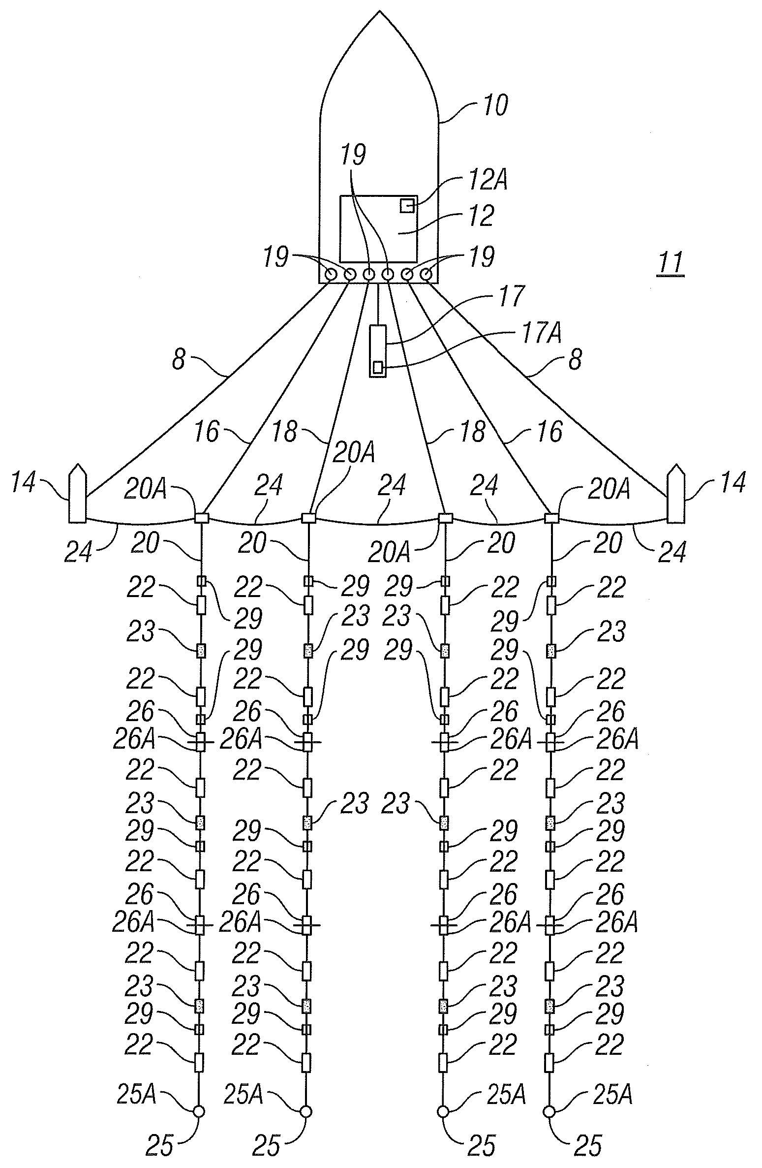
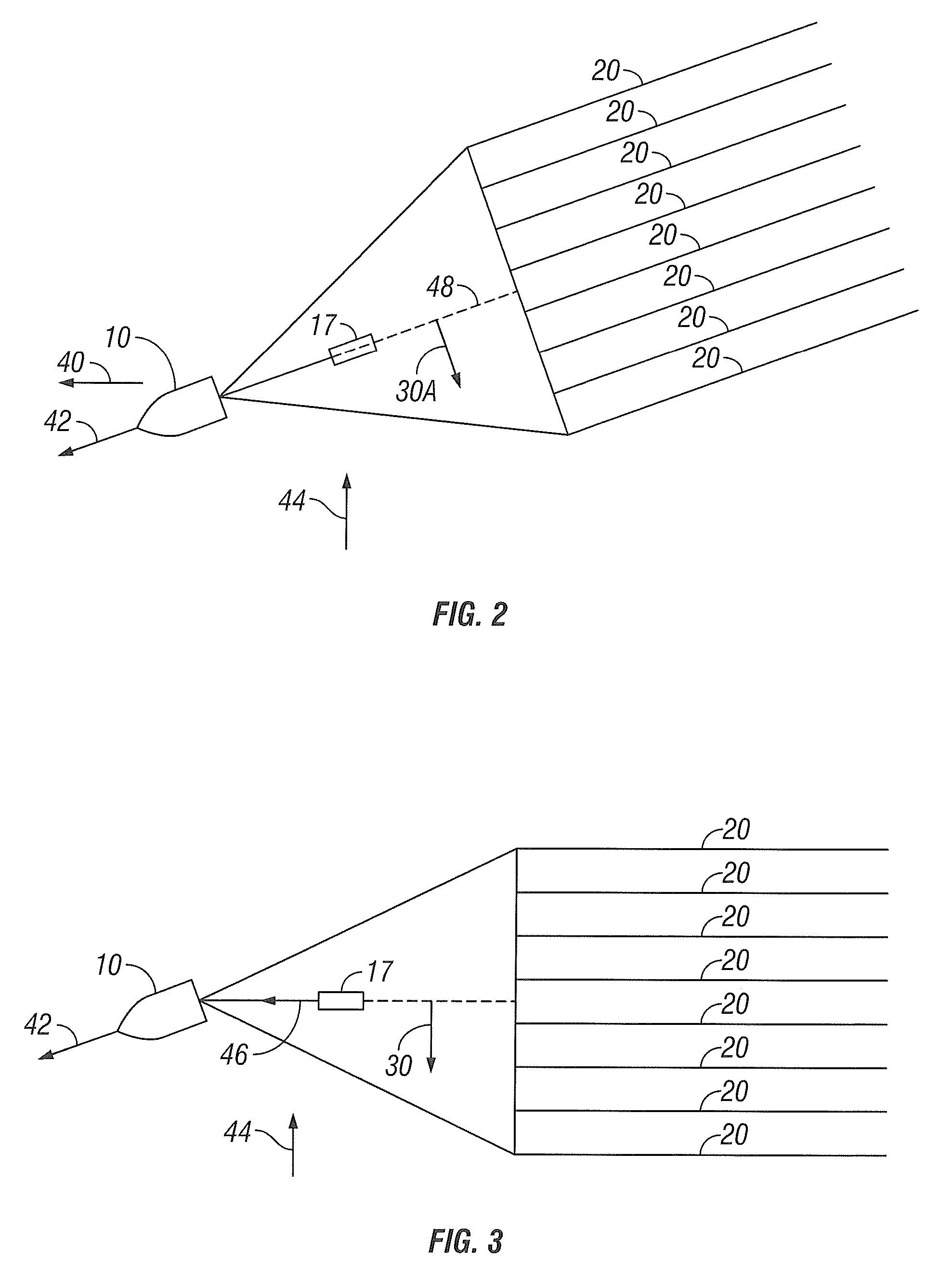
[0021]FIG. 1 shows a typical marine geophysical survey system that can include a plurality of sensor streamers. Each of the sensor streamers can be guided through the water by one or more lateral force and depth (“LFD”) control devices cooperatively engaged with each of the streamers. As will be explained further below, the use of LFD devices, which provide depth control capability in addition to horizontal position control, is a matter of choice. It is only necessary for purposes of the invention that the devices associated with the sensor streamers provide directional control, that is, to affect the direction of the streamer parallel to the plane of the water surface as it moves through the water. The geophysical survey system includes a survey vessel 10 that moves along the surface of a body of water 11 such as a lake or the ocean. The survey vessel 10 may include thereon equipment, shown generally at 12 and for convenience collectively referred to as a “recording system.” The re...


PUM


Abstract

A method for towing a streamer array includes moving a vessel along a body of water. Streamers are towed by vessel. A relative position is determined at selected points along each streamer with respect to the vessel. At least one of the streamers is deflected at at least one longitudinal position along the streamer in response to the determined positions to maintain the streamers in a selected geometry. The selected geometry is related to one of survey vessel heading, energy source trajectory, previously plotted sensor trajectory and a lateral separation related to distance from the towing vessel.

Description

CROSS-REFERENCE TO RELATED APPLICATIONS[0001]The present application is a Continuation-In-Part of U.S. patent application Ser. No. 12 / 148,610 filed on Apr. 21, 2008.STATEMENT REGARDING FEDERALLY SPONSORED RESEARCH OR DEVELOPMENT[0002]Not applicable.BACKGROUND OF THE INVENTION[0003]1. Field of the Invention[0004]The invention relates generally to the field of marine geophysical surveying. More particularly, the invention relates to methods for controlling the spatial distribution or geometry of an array of geophysical sensor streamers towed behind a survey vessel.[0005]2. Background Art[0006]Marine geophysical surveying systems such as seismic acquisition systems and electromagnetic survey systems are used to acquire geophysical data from formations disposed below the bottom of a body of water, such as a lake or the ocean. Marine seismic surveying systems, for example, typically include a seismic survey vessel having onboard navigation, seismic energy source control, and geophysical ...

Claims


Application Information

Patent Timeline
IPC IPC(8): G01V1/38
CPCG01V1/3826G01V1/3817G01V1/3835
Inventor HILLESUND, OYVINDLUNDE, NILS
Owner PGS GEOPHYSICAL AS
Why Eureka
Try Eureka