
Spatial source collection and services system

a technology of spatial source and service system, applied in the field of data process system, can solve the problems of time-consuming and expensive process types

Active Publication Date: 2009-11-19
THE BOEING CO
View PDF17 Cites 88 Cited by
  • Summary
  • Abstract
  • Description
  • Claims
  • Application Information

AI Technical Summary

Benefits of technology

The patent describes a method and apparatus for obtaining data about spatial objects in real-time using a set of sensor units. The sensor units are associated with the objects and generate data based on changes in their measurements. This data is received and updated in real-time to create a collection of data for the spatial objects. The invention allows for the efficient and accurate collection and utilization of data about spatial objects, which can be useful in various applications.

Problems solved by technology

This type of process is time consuming and expensive.

Method used


Image

  • Spatial source collection and services system
  • Spatial source collection and services system
  • Spatial source collection and services system

Examples


Embodiment Construction

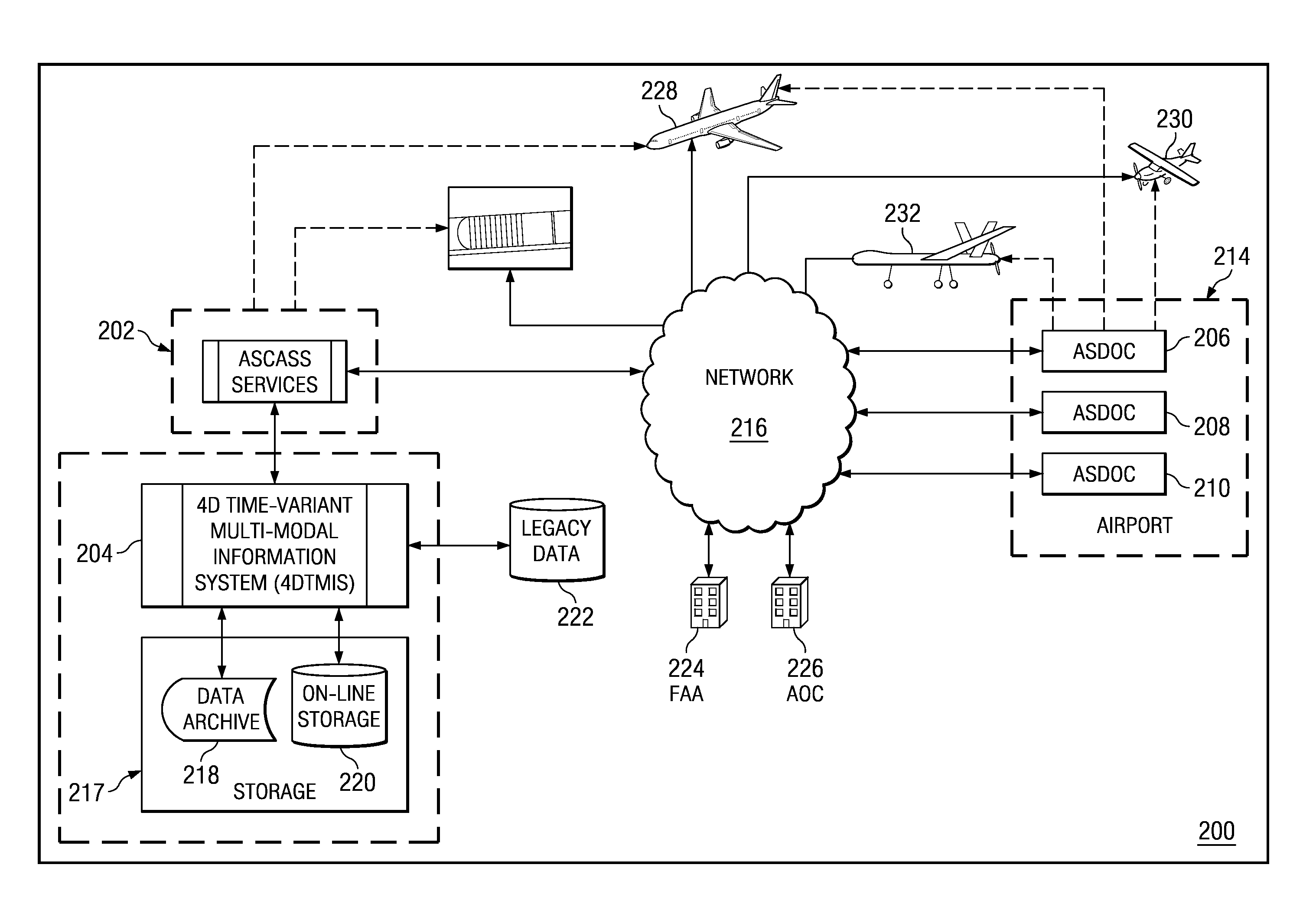
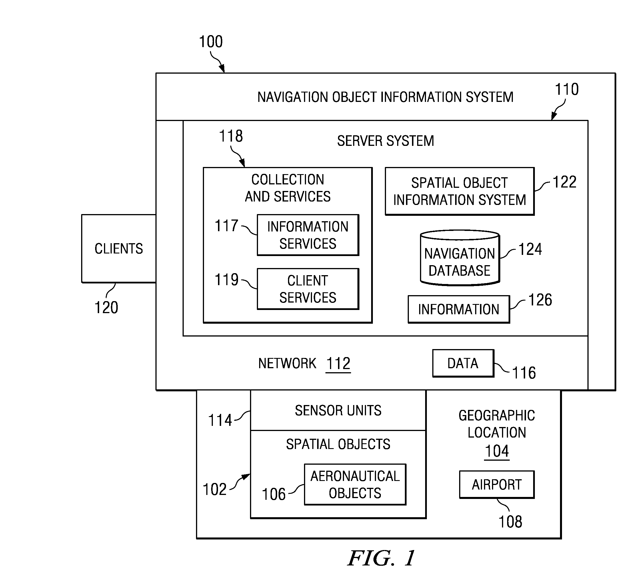
[0027]With reference now to the figures and in particular with reference to FIG. 1, a block diagram of a spatial object information system is depicted in accordance with an advantageous embodiment. Spatial object information system 100 includes server system 110, network 112, and sensor units 114. In these examples, sensor units 114 are wireless sensor units and are placed on and / or around spatial objects 102. These sensor units transmit data 116 across network 112 to server system 110.

[0028]In this example, spatial object information system 100 provides a capability to obtain information about spatial objects 102 at geographic location 104. In these examples, spatial objects 102 may take the form of aeronautical objects 106 located at airport 108. These aeronautical objects may include, for example, without limitation, buildings, barriers, cranes, runways, taxiways, vehicles, and other suitable physical objects.

[0029]Spatial objects 102 also may be virtual objects at geographic loc...


PUM


Abstract

A method is provided for obtaining data about spatial objects. The data is received from a set of adaptable and programmable sensor units associated with a set of spatial objects in real time to form received data, wherein the data is generated in response to a change in a measurement or time of a sensor unit in the set of sensor units. A collection of data for spatial objects is updated with the received data.

Description

BACKGROUND INFORMATION[0001]1. Field[0002]The present disclosure relates generally to an improved data process system and in particular to a method and apparatus for processing spatial data. Still more particularly, the present disclosure relates to a computer implemented method, apparatus, and computer usable program code for collecting and providing services that utilize spatial object information.[0003]2. Background[0004]Geographic information system databases contain data representing real world objects, such as roads, land use, and elevation, and virtual objects such navigation waypoints, using digital data. This data may relate information about a real world object to a digital representation of the real world object. This data may also relate to virtual objects which may be defined in a number of different ways. These objects may be, for example, three dimensional and / or four dimensional objects.[0005]An example of a spatial object as a virtual object is a dataset consisting ...

Claims


Application Information

Patent Timeline
Patent Type & Authority Applications(United States)
IPC IPC(8): G06K9/46
CPCG08G5/06
Inventor RAVENSCROFT, DONALD L.WIESEMANN, THORSTEN
Owner THE BOEING CO
Learn More