

Automated atmospheric characterization of remotely sensed multi-spectral imagery
a multi-spectral imagery and automatic processing technology, applied in the field of image processing, can solve the problems of not being able to be used for atmospheric characterization, reflected visible and near-infrared imagery is typically collected, and tools typically require specialized data
- Summary
- Abstract
- Description
- Claims
- Application Information
AI Technical Summary
Benefits of technology
Problems solved by technology
Method used
Image

Examples
Embodiment Construction
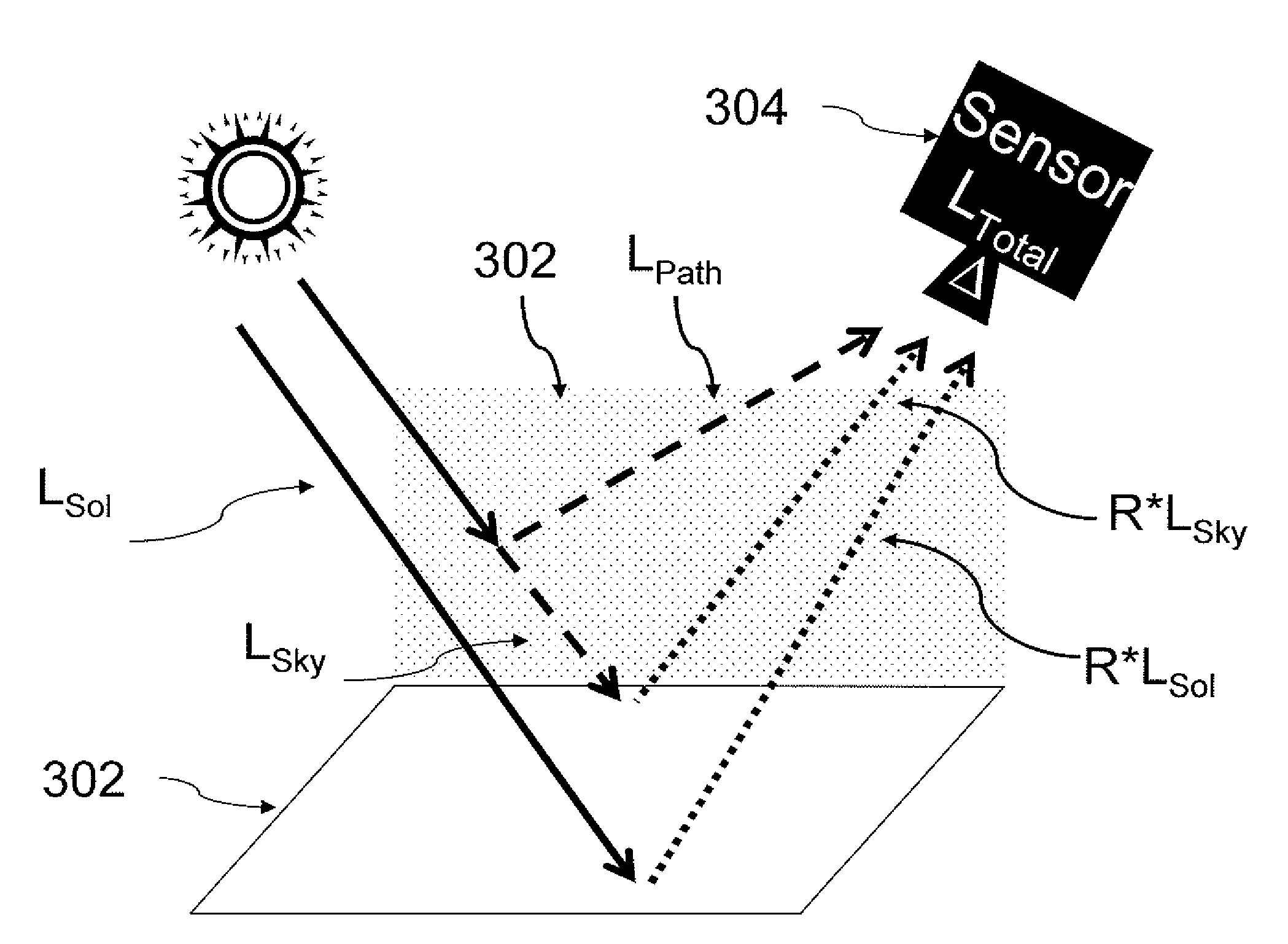
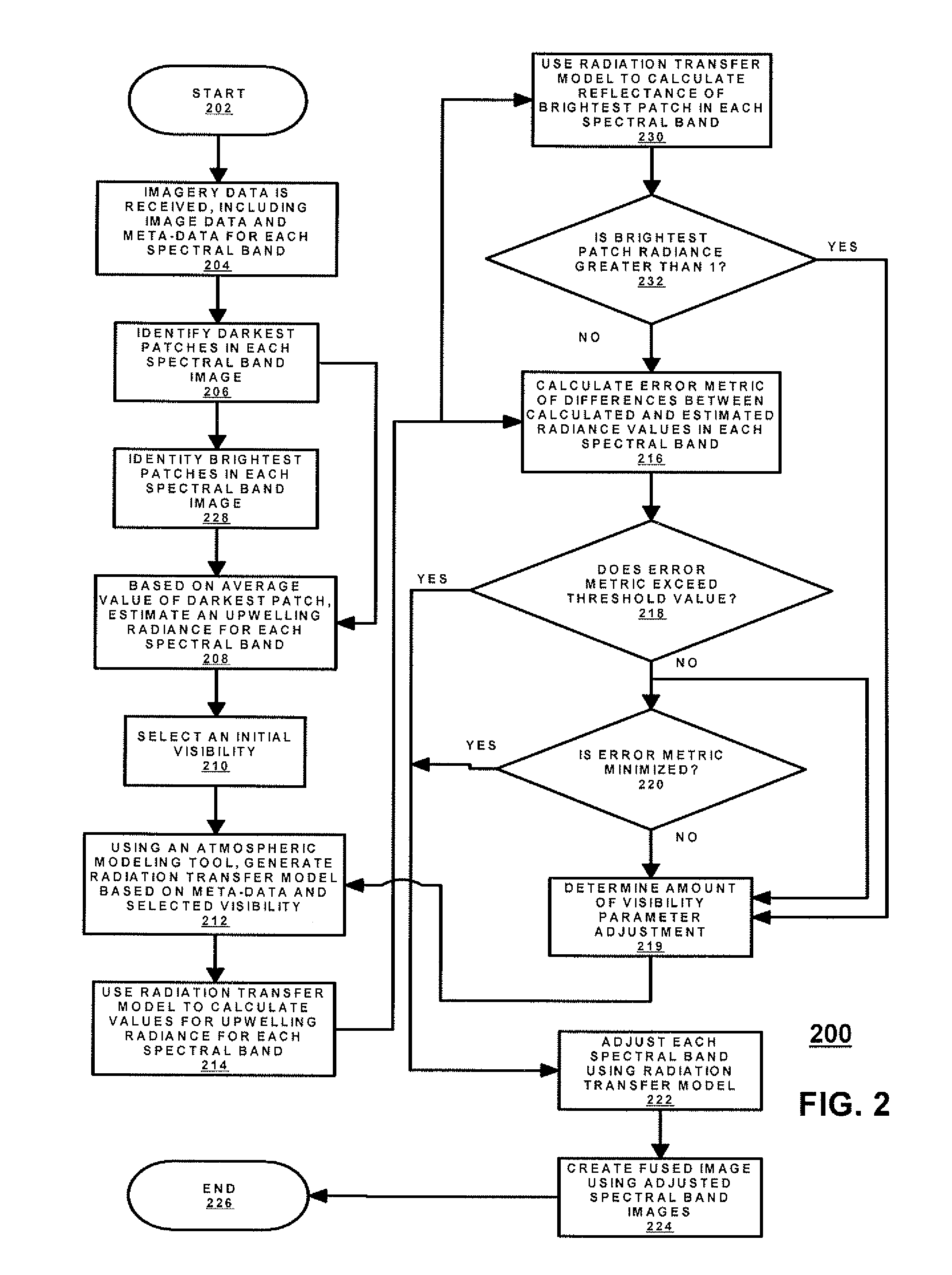
[0015]Embodiments of the present invention provide systems and methods for adjusting remotely acquired imagery, such as image data from multi-spectral imaging, based on atmospheric effects and data within the acquired imagery. As previously described, some atmospheric effects, such as haze caused by aerosols, cannot be directly obtained from the multi-spectral imagery. Therefore, the impact of such effects on remotely acquired images is typically modeled by calculating a surface reflectance using a generic model. Unfortunately, most generic models have only a limited number of parameters for capturing various types of atmospheric effects on reflectance of light. For example, one atmospheric modeling tool, MODTRAN, developed by the U.S. Air Force, provides only a generic model for atmospheric conditions and does not provide for adjustments based on other conditions. Instead, atmospheric effects, such as haze due to aerosols, are typically modeled by adjusting one or more other parame...
PUM
 Abstract
Description
Claims
Application Information