Integrated dead reckoning and gnss/ins positioning

a dead reckoning and positioning technology, applied in the field of integrated dead reckoning and gnss positioning, can solve the problems of signal loss, inability to rely on gnss along, and often compromised satellite acquisition and signal lock,

Inactive Publication Date: 2010-06-24
AGJUNCTION
View PDF103 Cites 66 Cited by
  • Summary
  • Abstract
  • Description
  • Claims
  • Application Information

AI Technical Summary

Problems solved by technology

Such vertical storage at containerized ports can create problems with using conventional GNSS guidance because the ships, container stacks and equipment often block the satellite signals.
For example, dockside forklifts and gantries often operate within stacks of containers, which can create relatively deep “valleys” from which satellite acquisition and signal lock are often compromised.
An interruption of such access causes signal loss whereby accurate positioning can no longer be based on GNSS along.
However, cargo container handling and other logistics operations may require greater accuracy and more consistency than have previously been available.

Method used


Image

  • Integrated dead reckoning and gnss/ins positioning
  • Integrated dead reckoning and gnss/ins positioning
  • Integrated dead reckoning and gnss/ins positioning

Examples


Embodiment Construction

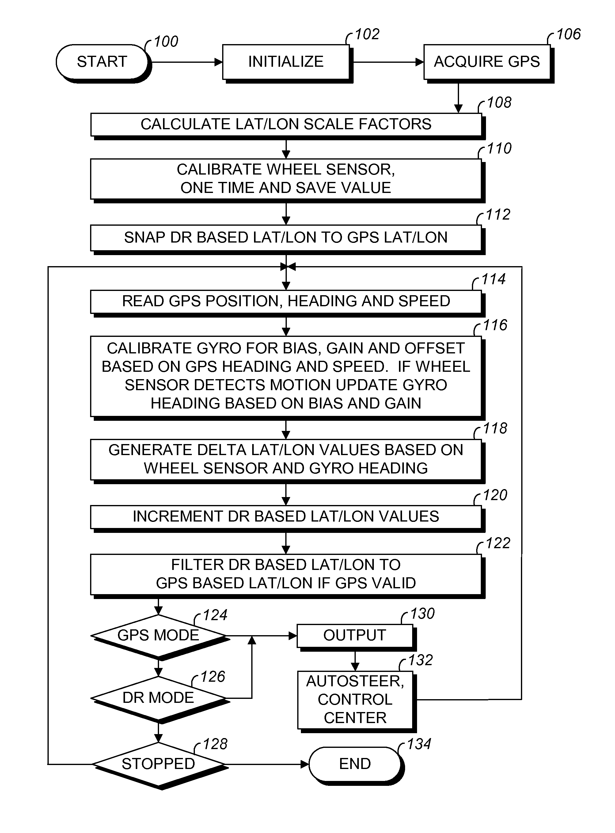
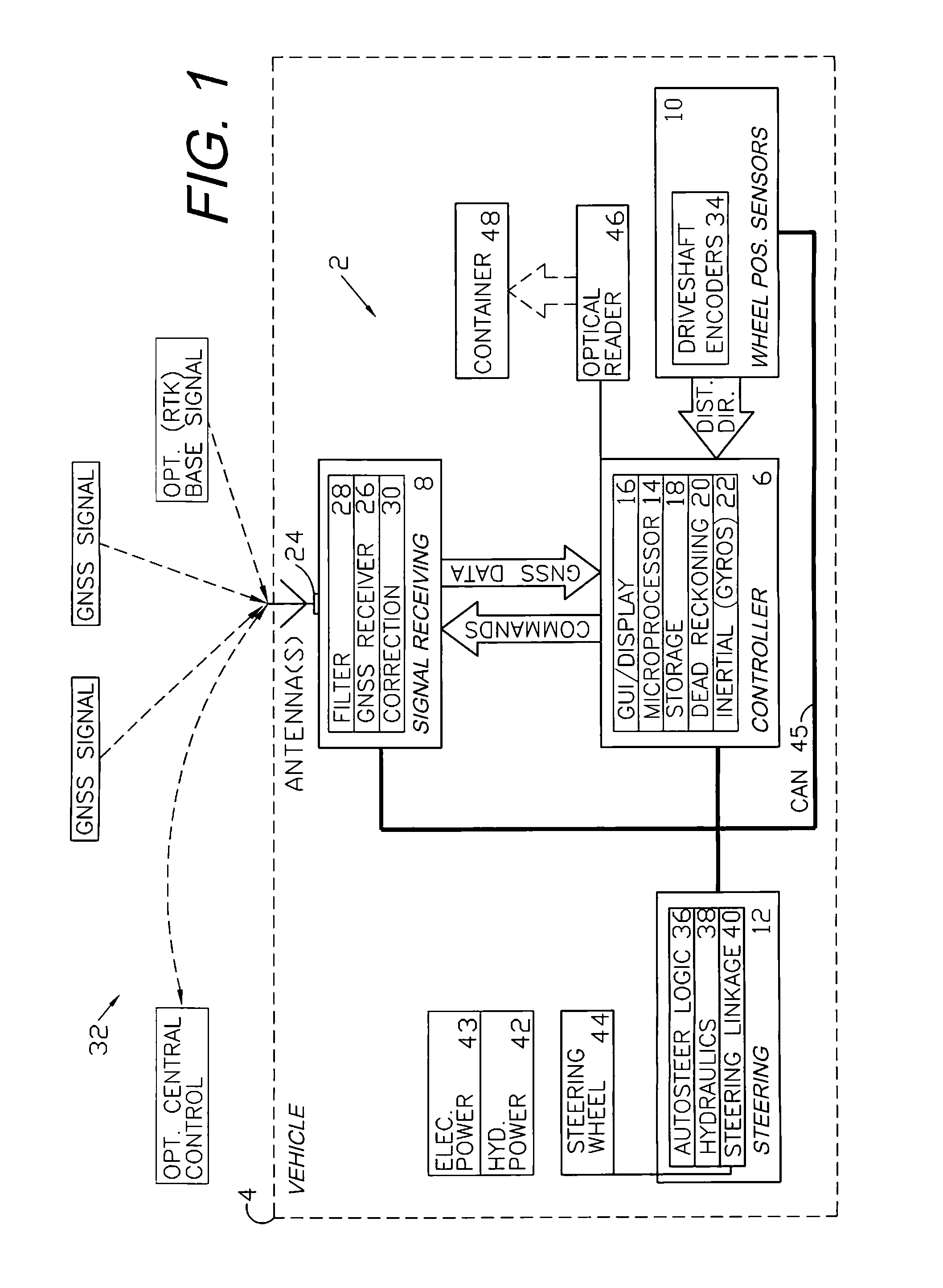
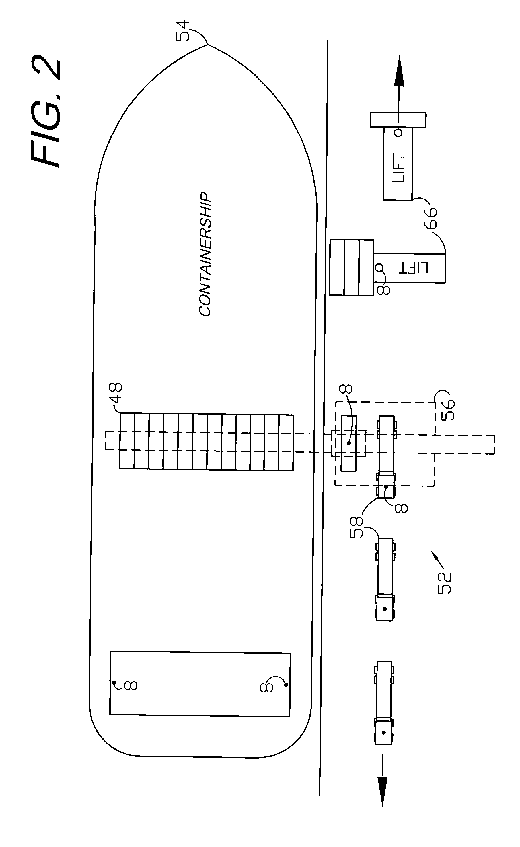
I. Introduction and Environment

[0014]As required, detailed embodiments of the present invention are disclosed herein; however, it is to be understood that the disclosed embodiments are merely exemplary of the invention, which may be embodied in various forms. Therefore, specific structural and functional details disclosed herein are not to be interpreted as limiting, but merely as a basis for the claims and as a representative basis for teaching one skilled in the art to variously employ the present invention in virtually any appropriately detailed structure.

[0015]Certain terminology will be used in the following description for convenience in reference only and will not be limiting. For example, up, down, front, back, right and left refer to the invention as oriented in the view being referred to. The words “inwardly” and “outwardly” refer to directions toward and away from, respectively, the geometric center of the embodiment being described and designated parts thereof. Global na...


PUM


Abstract

An integrated dead reckoning (DR) and GNSS / INS control system and method are provided for guiding, navigating and controlling vehicles and equipment. A controller generally prioritizes GNSS navigation when satellite signals are available. Upon signal interruption, DR guidance can be integrated with INS to continue autosteering and other automated functions. Exemplary applications include logistics operations where ships, cranes and stacked containers can block satellite signals.

Description

CROSS-REFERENCE TO RELATED APPLICATION[0001]This application claims priority in U.S. Provisional Application No. 60 / 016,451, filed Dec. 22, 2007, which is incorporated herein by reference.BACKGROUND OF THE INVENTION[0002]1. Field of the Invention[0003]The present invention relates generally to integrated dead reckoning and GNSS positioning, and in particular to applications on cargo-handling logistics equipment.[0004]2. Description of the Related Art[0005]Global Navigation Satellite Systems (GNSS), such as the Global Positioning System (GPS), have significantly advanced navigation, machine control and related fields. Accuracy can be significantly improved through the use of differential techniques, which encompass a wide variety of GPS accuracy enhancements, collectively referred to as differential GPS (DGPS). Such systems accurately locate points on a universal coordinate system, which facilitates vehicle and equipment operations. For example, the logistics field includes cargo-han...

Claims


Application Information

Patent Timeline
Patent Type & Authority Applications(United States)
IPC IPC(8): G01C21/12B62D6/00
CPCB63B27/02G01C21/165G01S19/49G05D2201/0205G05D1/027G05D1/0272G05D1/0278G05D1/0261B63B27/19
Inventor MCCLURE, JOHN A.STICHTER, AARON C.
Owner AGJUNCTION
Why Eureka
Try Eureka