System and Method for Satellite Enhanced Command, Control, and Surveillance Services Between Network Management Centers and Unmanned Land and Aerial Devices

a network management center and enhanced technology, applied in the field of satellite enhanced command, control, surveillance services between network management centers and unmanned land and aerial devices, can solve the problems of limited geographic area of coverage, inability to respond to concerns and considerations, and difficulty in achieving wide-area coverage or multi-area coverage, etc., to extend the geographic range of network management centers and extend the operational life on location

Inactive Publication Date: 2010-10-21
RABOWSKY IRVING
View PDF7 Cites 136 Cited by
  • Summary
  • Abstract
  • Description
  • Claims
  • Application Information

AI Technical Summary

Problems solved by technology

First, the geographic area of coverage is limited by the radio or satellite area of coverage.
Second, the command and control actions are defined by the local Command and Control Center, and thus are not readily responsive to concerns and considerations by the User's central management.
Third, wide-area coverage or multi-area coverage are difficult to achieve, or may be impossible to achieve with the current systems.
Fourth, video and other information transmitted by the vehicles and devices cannot be viewed in real-time at a number of User specified locations simultaneously.
Fifth, real-time redefinition of system mission, resources, command and control instructions and functions, and reconfiguration of areas of coverage and data outputs of vehicles and devices cannot be done on a regional or global basis.
Sixth, display of surveillance data as an overlay on an associated geographic area map is not available in network management centers.
Seventh, response devices are not included in current system architectures, making real-time response unavailable.

Method used


Image

  • System and Method for Satellite Enhanced Command, Control, and Surveillance Services Between Network Management Centers and Unmanned Land and Aerial Devices
  • System and Method for Satellite Enhanced Command, Control, and Surveillance Services Between Network Management Centers and Unmanned Land and Aerial Devices
  • System and Method for Satellite Enhanced Command, Control, and Surveillance Services Between Network Management Centers and Unmanned Land and Aerial Devices

Examples


Embodiment Construction

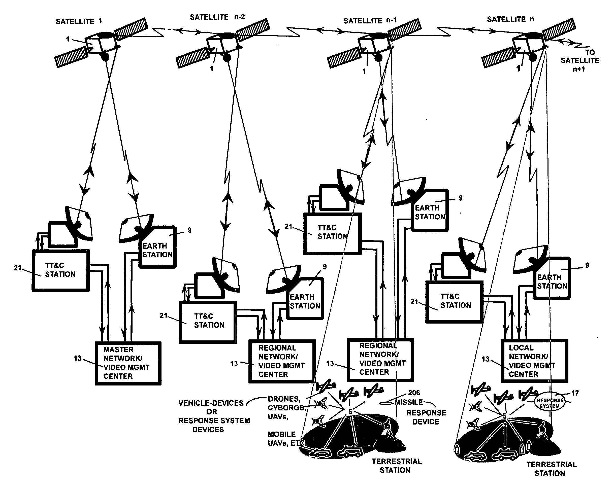
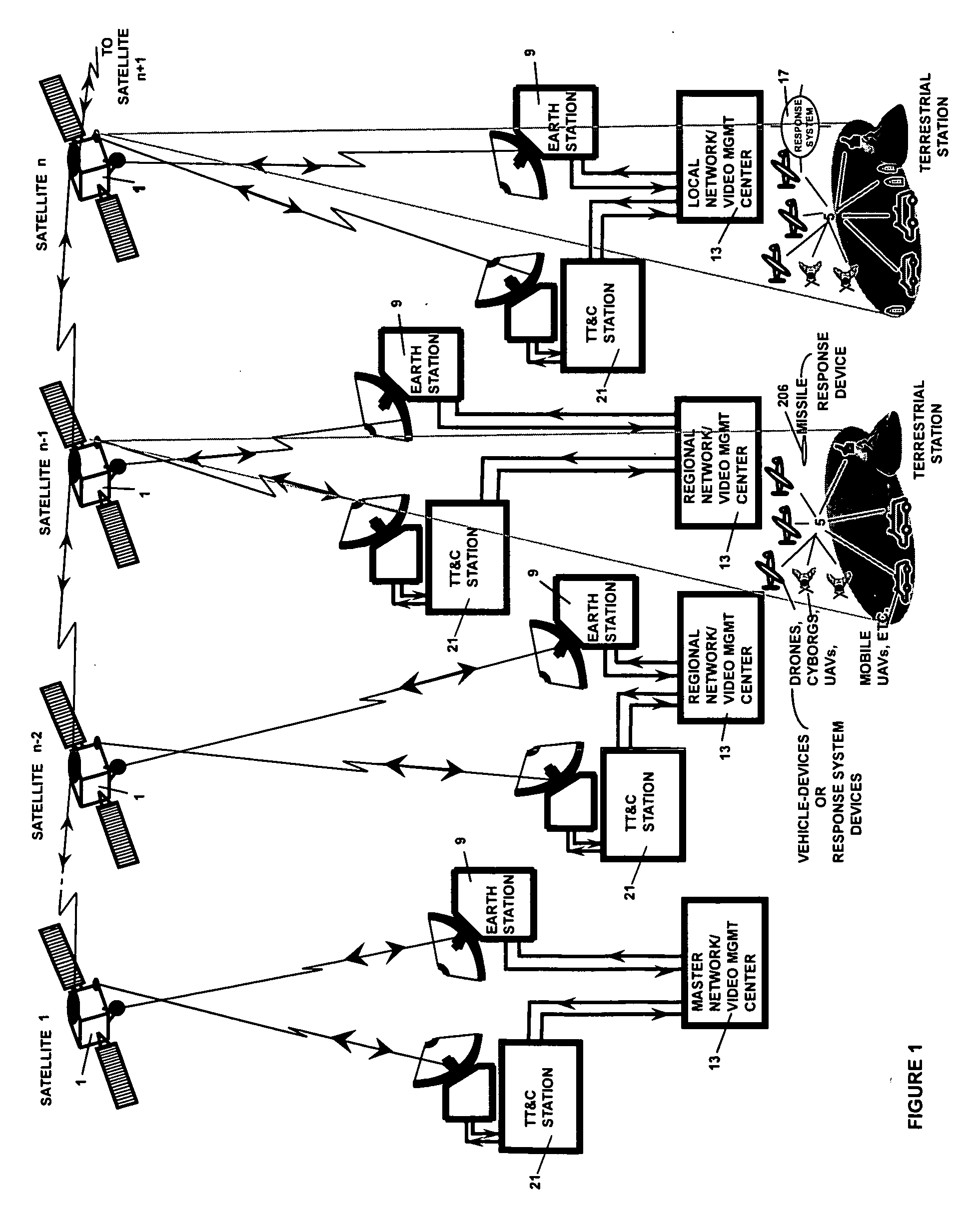
[0014]Referring to FIG. 1, the overall system architecture of the present invention comprises five main systems of the Communications Satellites System, the Satellite Payload System which is an internal subsystem of the Communications Satellites(1), the Satellite Terminal System, an internal subsystem of the Vehicle / Device System(5), the Network / Video Management System which consists of a Satellite Earth Station (9) and a Network / Video Management Center (13), Response System, an internal subsystem of a variety of vehicles and / or other equipments (17) and the Satellite Telemetry, Tracking, and Control Station (21).

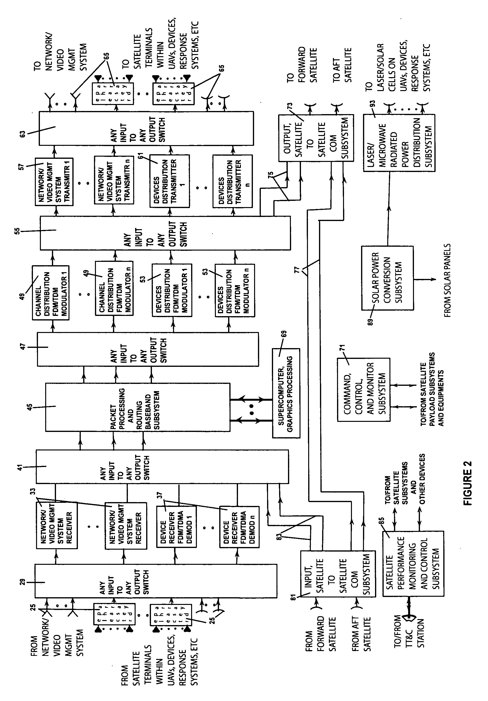
[0015]Referring to FIG. 2, the first system is the Satellite Payload System which comprises input antennas (25) which receive RF transmissions from Network / Video Management Systems, and Satellite Terminals within Vehicle-Devices and Response Systems, an Input RF Any Input to Any Output Switch (29), Network / Video Management System (33), and Devices Receivers (37), an Input B...


PUM


Abstract

A novel system and method for electronic delivery of command, control information to many land and aerial devices, simultaneously or individually, and transmission of video, audio, location, and other information from devices to user defined entities such as network management centers, and devices over defined geographic areas utilizing inter-connected communications satellites. Satellites receive data packets which may include command, control, monitoring, video, audio, sensor, graphics, response, and other data, redistributes them to multiple destination addresses within other systems and subsystems and radiates source power to devices. Display centers receive video, audio, and sensor data, stores the data files for playback on command, and creates maps utilizing geographic information software and other displays suitable for electronic displays. Operators are able to view and hear video camera output in real-time, or delayed, and issue commands, in any geographic area where devices are present.

Description

BACKGROUND OF THE INVENTION[0001]1. Field of the Invention[0002]This invention concerns delivery of command, control, video, audio, maps, response, and other data services to and from many land based and aerial devices over user defined geographic areas utilizing special purpose communications satellites. Specifically, this invention relates to a system, and methods for electronic delivery of command, control information to many mobile vehicles and devices simultaneously or individually, and the transmission of video, audio, location, status, and other information from such vehicles and devices to user defined entities such as Network Management Centers and / or groups of user defined vehicles and devices. Depending on the user requirement, one or more communications satellites can be configured to provide from wide area geographic coverage to local coverage anywhere in the world.[0003]2. Description of the Related Art[0004]The current method of delivery of command, control, and video...

Claims


Application Information

Patent Timeline
Patent Type & Authority Applications(United States)
IPC IPC(8): H04N7/20H04B7/185
CPCH04N7/20H04B7/18591
Inventor RABOWSKY, IRVING
Owner RABOWSKY IRVING
Why Eureka
Try Eureka