Geographic identification system

a technology of geographic identification and information system, applied in the field of mapping services, can solve the problems of cumbersome input of information into the device while driving, affecting the accuracy of the map, so as to achieve efficient representation of geographic locations

Inactive Publication Date: 2011-01-13
KAVRANOGLU DAVUT
View PDF23 Cites 9 Cited by
  • Summary
  • Abstract
  • Description
  • Claims
  • Application Information

AI Technical Summary

Benefits of technology

[0005]Geographic identification systems and methods for efficiently representing geographic locations for retrieval by mapping services are described. Systems and methods in accordance with embodiments of the invention address a need to be able to more efficiently represent geographic locations and to verify the accuracy of an address associated with a geographic location.

Problems solved by technology

While many devices include audio turn-by-turn directions to limit the extent to which a driver is distracted while using the device, the input of information into the device while driving is cumbersome and can distract a driver's attention from the operation of the vehicle.
The problem of distracted attention can be particularly acute when a driver is entering a street address, which can include a street name, street number, city, state and / or zip code.
Furthermore, mapping services often include unreliable information.
Therefore, entry of an address can occasionally lead to wrong positioning and incorrect navigation information.
Even when the operator of a mobile device is not driving, entering an address into a mobile device can be cumbersome and frustrating due to the inherent limitations of the user interface of the device.

Method used


Image

  • Geographic identification system
  • Geographic identification system
  • Geographic identification system

Examples


Embodiment Construction

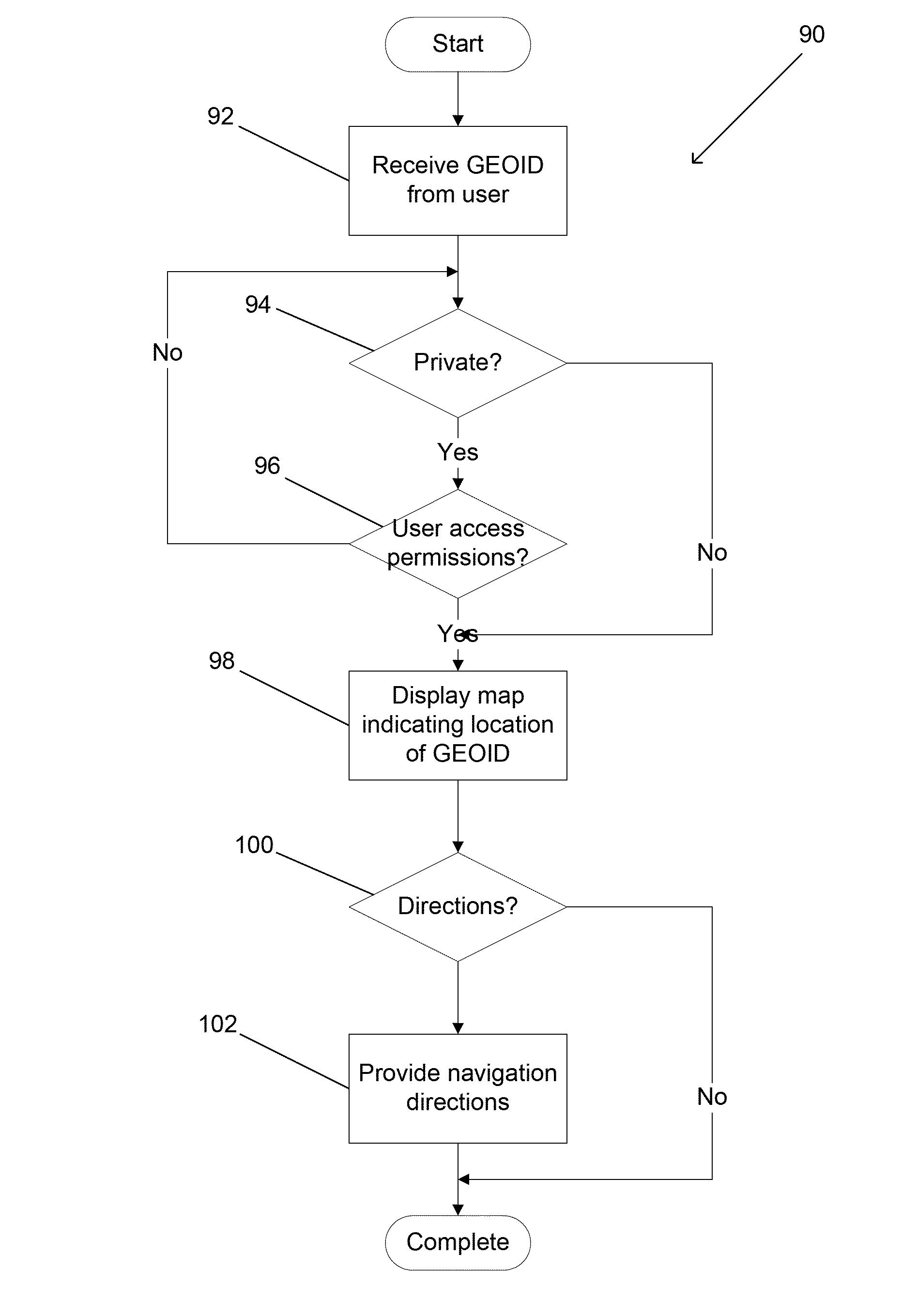
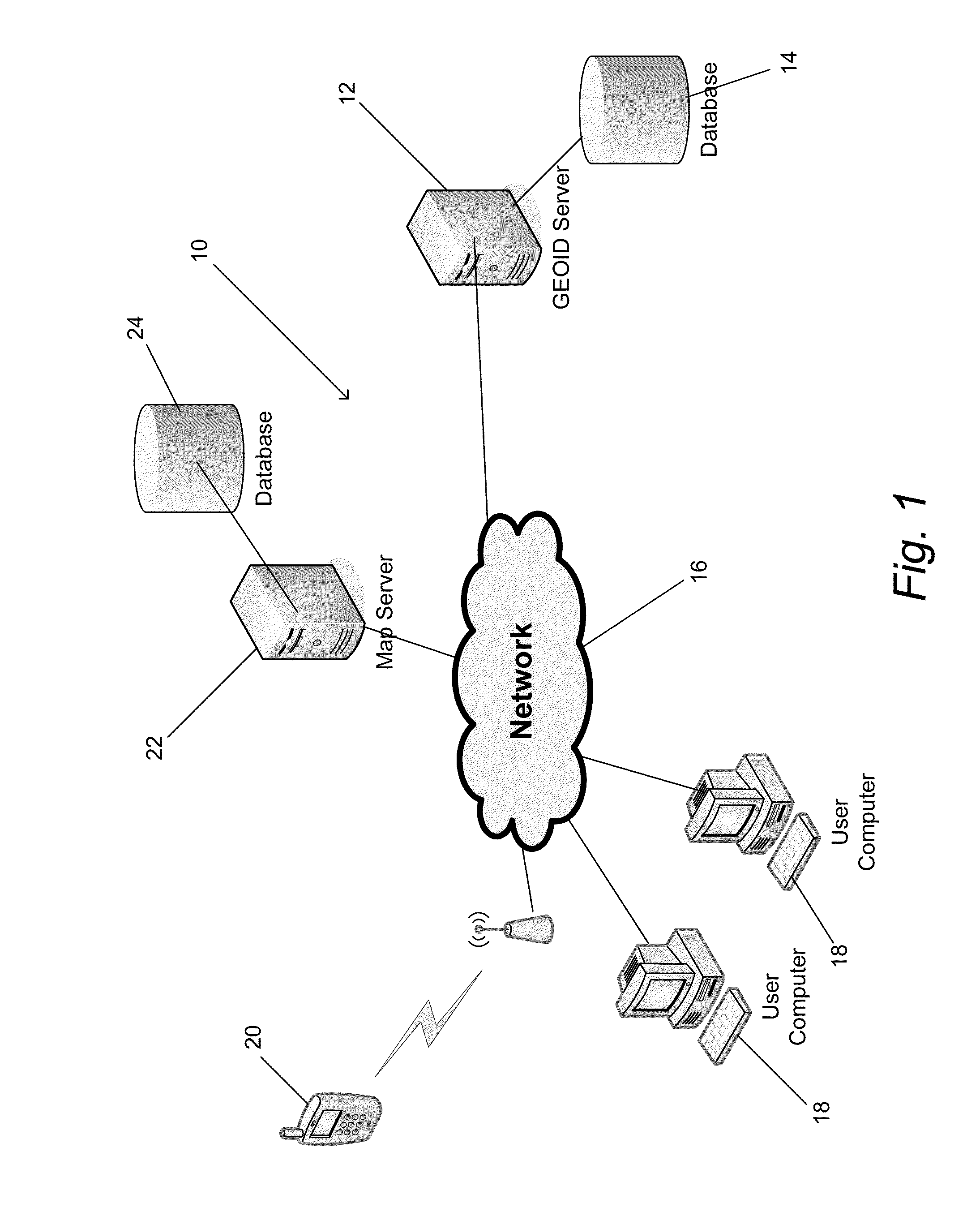
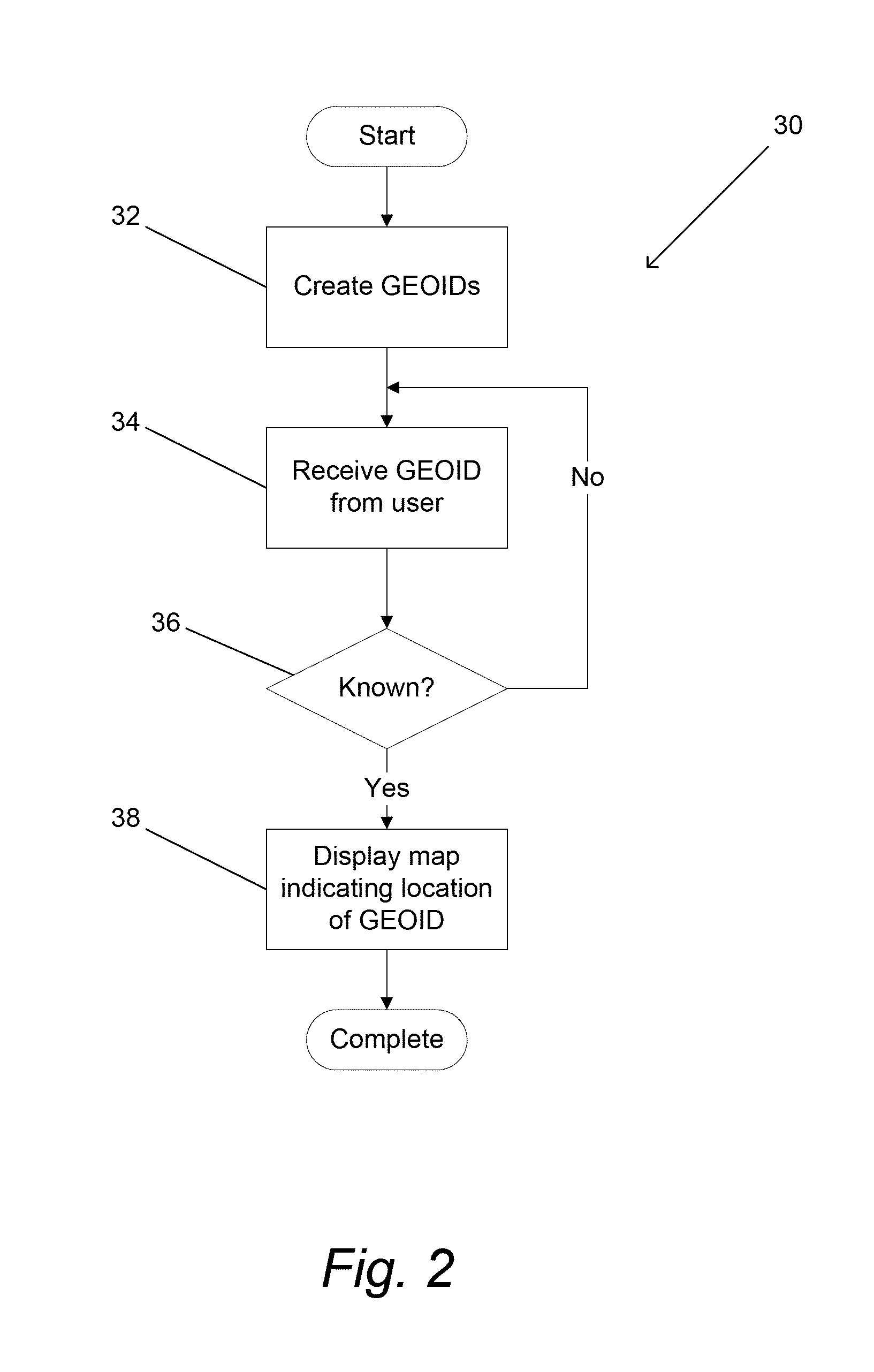
[0062]Turning now to the drawings, geographic identification systems and methods of displaying geographic locations on maps and providing related location based services in accordance with embodiments of the invention are illustrated. The geographic location of an object can be expressed via any of a number of different coordinate systems including but not limited to latitude and longitude on the surface of the Earth, and / or a street address including a street address, a city, and / or a postal or ZIP code. The term “geographic identification”, which can be shortened to GEOID, includes an alphanumerical label (GEOID label), which may be unique, and a set of specific geographic information assigned to aforementioned GEOID label. The set of geographic information includes but is not limited to one or more static geographic locations, one or more routes, and / or information identifying one or more mobile assets. The geographic location to which the GEOID label points, can be a fixed geogr...


PUM


Abstract

Geographic identification systems and methods of displaying geographic locations on maps and providing related location based services in accordance with embodiments of the invention are disclosed. One embodiment includes a GEOID server configured to communicate with a database containing GEOIDs, where each GEOID comprises a label and geographic information. In addition, the GEOID server is configured to communicate with a mapping server via a network, the GEOID server is configured to communicate with a plurality of user devices via the network, the GEOID server is configured to store GEOIDs in the database in response to information received from user devices via the network, the GEOID server is configured to retrieve geographic information in response to GEOID labels received from user devices via the Internet, and the GEOID server is configured to cause the display of a map provided by a mapping server on a user device, where the map indicates at least one location associated with the geographic information retrieved by the GEOID server in response to the GEOID label received from the user device.

Description

CROSS-REFERENCE TO RELATED APPLICATIONS[0001]The current application claims priority under 35 U.S.C. §119(e) to U.S. Provisional. Application No. 61 / 224,786, entitled “Geographic Identification System”, filed Jul. 10, 2010, and to U.S. Provisional. Application No. 61 / 293,671, entitled “Geographic Identification System for Mobile Destinations” filed Jan. 10, 2010, the disclosure of which is incorporated herein by reference.FIELD OF THE INVENTION[0002]The present invention relates to mapping services and more specifically to the manner in which mapping services identify geographic locations.BACKGROUND[0003]Web mapping services and applications, such as the Google Maps service provided by Google, Inc. of Mountain View, Calif., power various web sites such as the Google Maps website and other web sites and mobile applications that access the mapping service via Application Programming Interfaces (APIs). Such mapping services are extremely popular in the provision of navigation and locat...

Claims


Application Information

Patent Timeline
Patent Type & Authority Applications(United States)
IPC IPC(8): G01C21/00G06F15/16G01C21/36G06F17/30
CPCG06F17/30241G06F16/29G06F16/58G06F16/5866G06F16/587
Inventor KAVRANOGLU, DAVUT
Owner KAVRANOGLU DAVUT
Why Eureka
Try Eureka