

Method for a deeper search in a time-limited image satellite planning environment
a satellite planning and deep search technology, applied in the field of image satellite planning, can solve the problem of estimated cost and estimated maneuver time for reorienting the satellite, and achieve the effect of reducing the calculation time and less tim
- Summary
- Abstract
- Description
- Claims
- Application Information
AI Technical Summary
Benefits of technology
Problems solved by technology
Method used
Image

Examples
Embodiment Construction
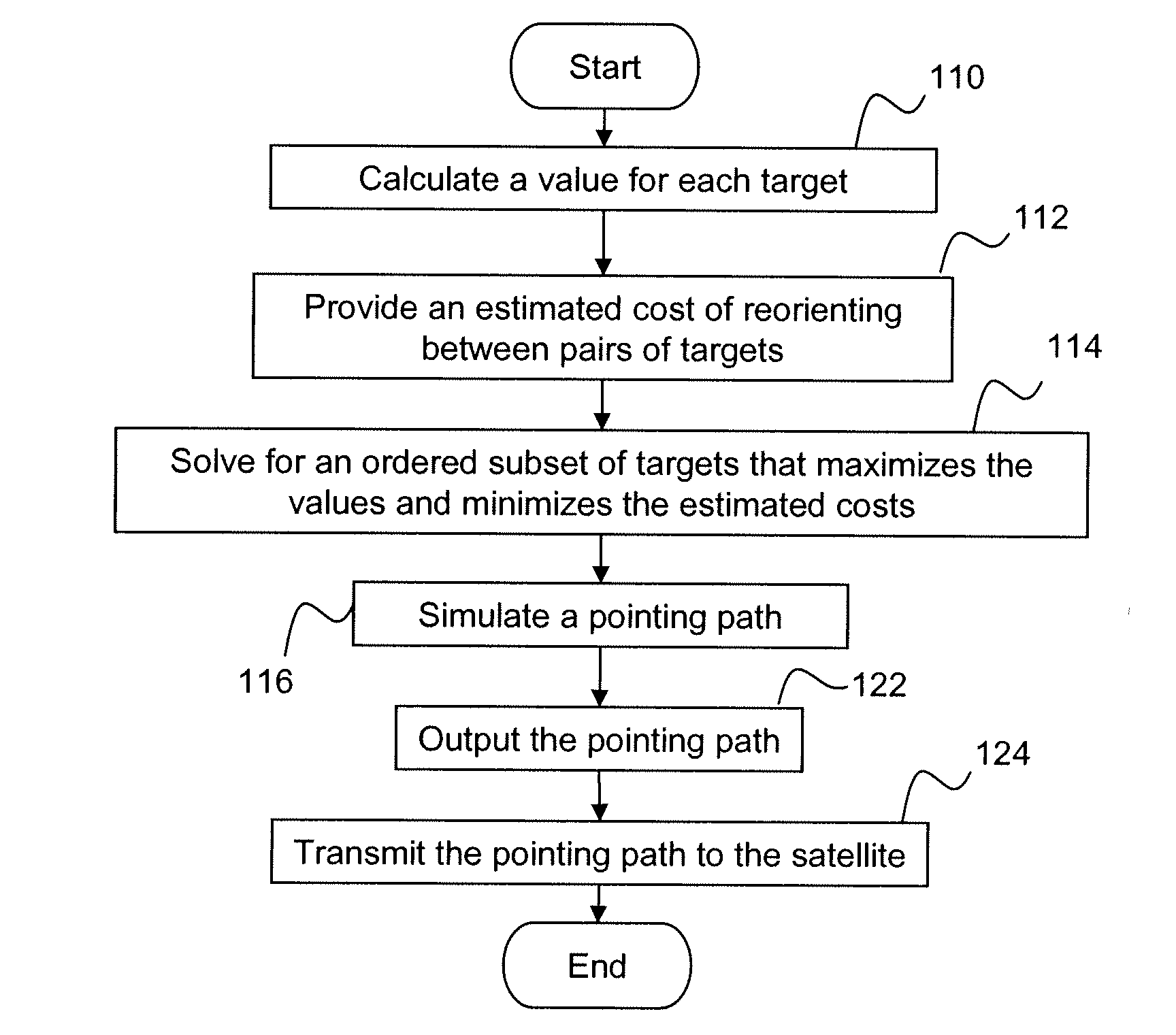
[0019]The present invention relates to image satellite planning, and more particularly to a method for allowing a deeper search for high value targets in a time-limited planning environment. In an exemplary embodiment, a method of determining a pointing path for a satellite includes using an approximation for the time needed for the satellite to re-orient to a new target (the maneuver time), rather than calculating each maneuver time between targets. That is, rather than calculating an actual time for the satellite to maneuver to point to the next target, this maneuver time is estimated. By approximating the maneuver time rather than calculating it, the calculation time is reduced. As a result, each iteration through the traveling salesman problem takes less time, and more iterations can be accomplished between imaging windows. The iterative process can search deeper into the traveling salesman problem to find a better solution.
[0020]Prior art methods of determining a pointing path ...
PUM
 Abstract
Description
Claims
Application Information