

Efficient location referencing method
a location and map technology, applied in the field of efficient map agnostic on, can solve the problems of excessive system and possibly redundant in certain aspects, and the average size of agora-c messages is significantly higher, and achieve the effect of useful efficiency
- Summary
- Abstract
- Description
- Claims
- Application Information
AI Technical Summary
Benefits of technology
Problems solved by technology
Method used
Image

Examples
Embodiment Construction
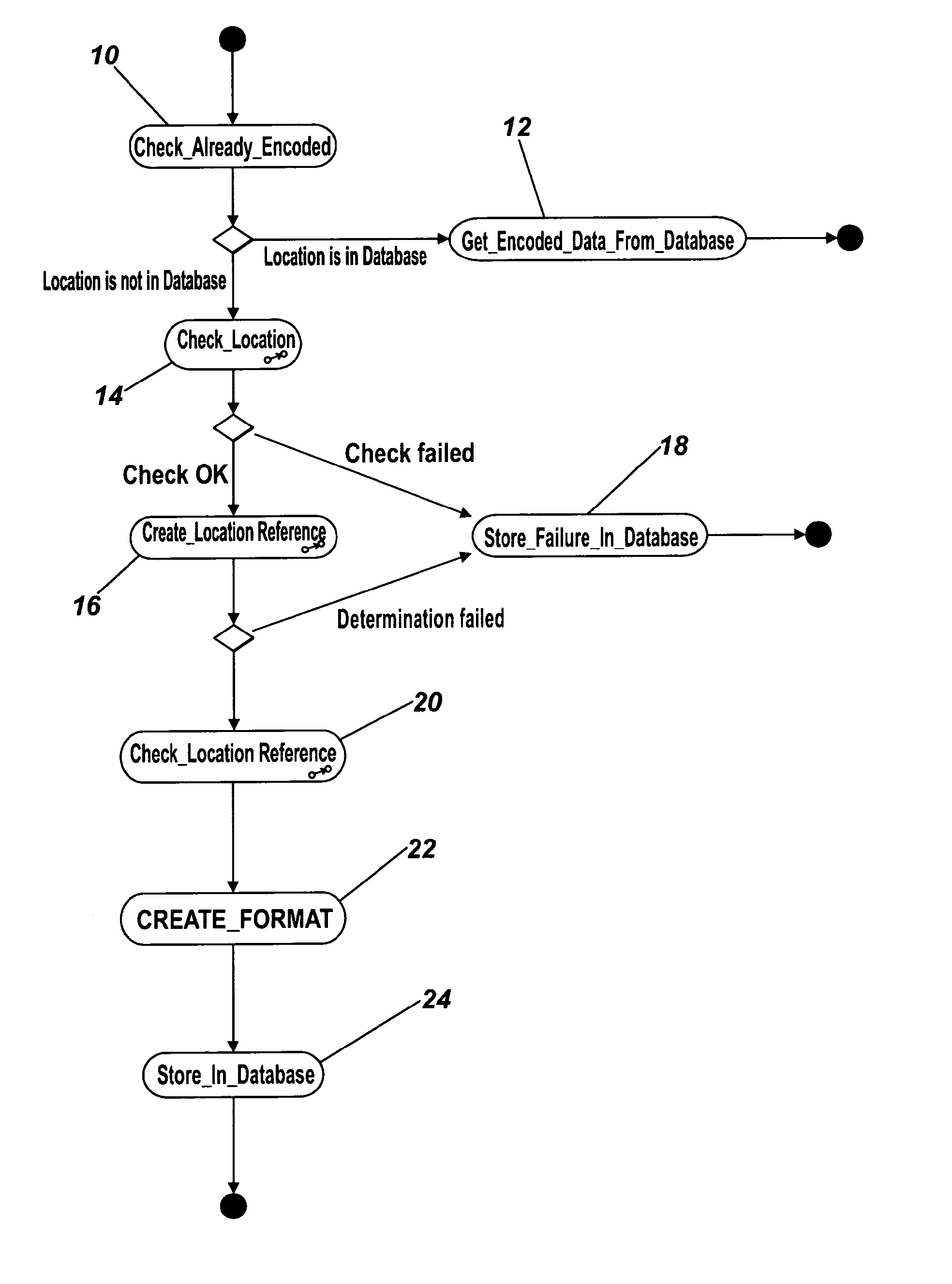
[0047]The following description of the invention is provided in terms of segments, but it is to be understood that the method can be applied equally to lines, or to combinations of lines and segments which together are representative of a continuous path through a road network.
[0048]Referring firstly to FIG. 1, and as previously mentioned, it is possible to store complete location references having previously been successfully encoded according to the present invention in a database, and therefore in FIG. 1 at step 10, a check is made of such database to establish whether the location desired to be encoded has already been encoded. If so, then the previously encoded location can be retrieved from the database, without any further processing.
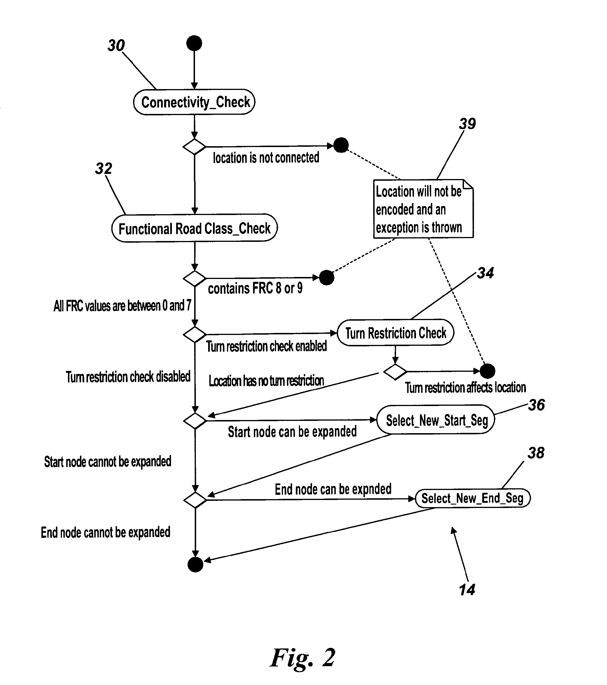
[0049]If the location is not present in the database, then a validity check 14 is performed on the location and its constituent segments to determine whether the location meets certain criteria hereinafter described, and provided that the locatio...
PUM
 Abstract
Description
Claims
Application Information