
Environmental map correction device and autonomous mobile device

a technology of environmental map and correction device, which is applied in the direction of distance measurement, process and machine control, instruments, etc., can solve the problems of not being able to pass through and disposing of objects that are to become obstacles

Active Publication Date: 2011-07-21
MURATA MASCH LTD
View PDF10 Cites 26 Cited by
  • Summary
  • Abstract
  • Description
  • Claims
  • Application Information

AI Technical Summary

Benefits of technology

[0008]According to the environmental map correction device of a preferred embodiment of the present invention, the user can correct the environmental map on the display device by performing correcting operations via the input device. Thus, the difference between the environmental map and the actual ambient environment can be corrected based on the manual operation of the user. Consequently, it is possible to acquire an environmental map which matches the actual ambient environment.
[0010]In the foregoing case, the conversion / inversion is performed mutually between the object existence probability information and the image information. Thus, it is possible to acquire an environmental map that was corrected as a result of converting the environmental map into an environmental map image and displaying such environmental map image, and correcting the environmental map image displayed on the display device. Accordingly, the environmental map can be corrected more easily.
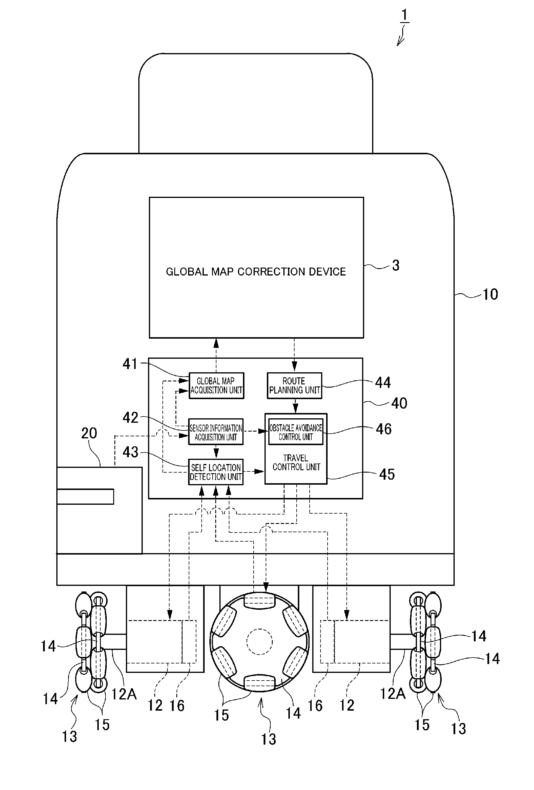
[0014]According to the autonomous mobile device of a preferred embodiment of the present invention, since the autonomous mobile device includes any one of the environmental map correction devices, it is possible to acquire an environmental map which matches the actual ambient environment. Thus, for example, upon planning a travel route from an environmental map, it is possible to prevent drawbacks such as determining that it is not possible to pass through a passage, which in reality can be passed through, due to the existence of an obstacle. Consequently, it is possible to move along an optimal travel route that matches the actual ambient environment which is comprehended by the user. Moreover, since the autonomous mobile device is mounted with the environmental map correction device, the successive processes of generating an environmental map, correcting an environmental map, and route planning based on an environmental map can be performed efficiently.
[0015]According to various preferred embodiments of the present invention, since the configuration is such that the displayed environmental map is corrected based on the correcting operations made by a user, it is possible to acquire an environmental map which better matches the actual ambient environment.

Problems solved by technology

Meanwhile, even in cases of generating an environmental map from CAD data, there are cases where an object that is to become an obstacle is disposed after the CAD data is created.
Here, if the generated or acquired environmental map and the actual ambient environment are different, for example, upon planning a travel route from the environmental map, there is a possibility of determining that it is not possible to pass through a passage, which in reality can be passed through, due to the existence of an obstacle, and consequently selecting a detour route.

Method used


Image

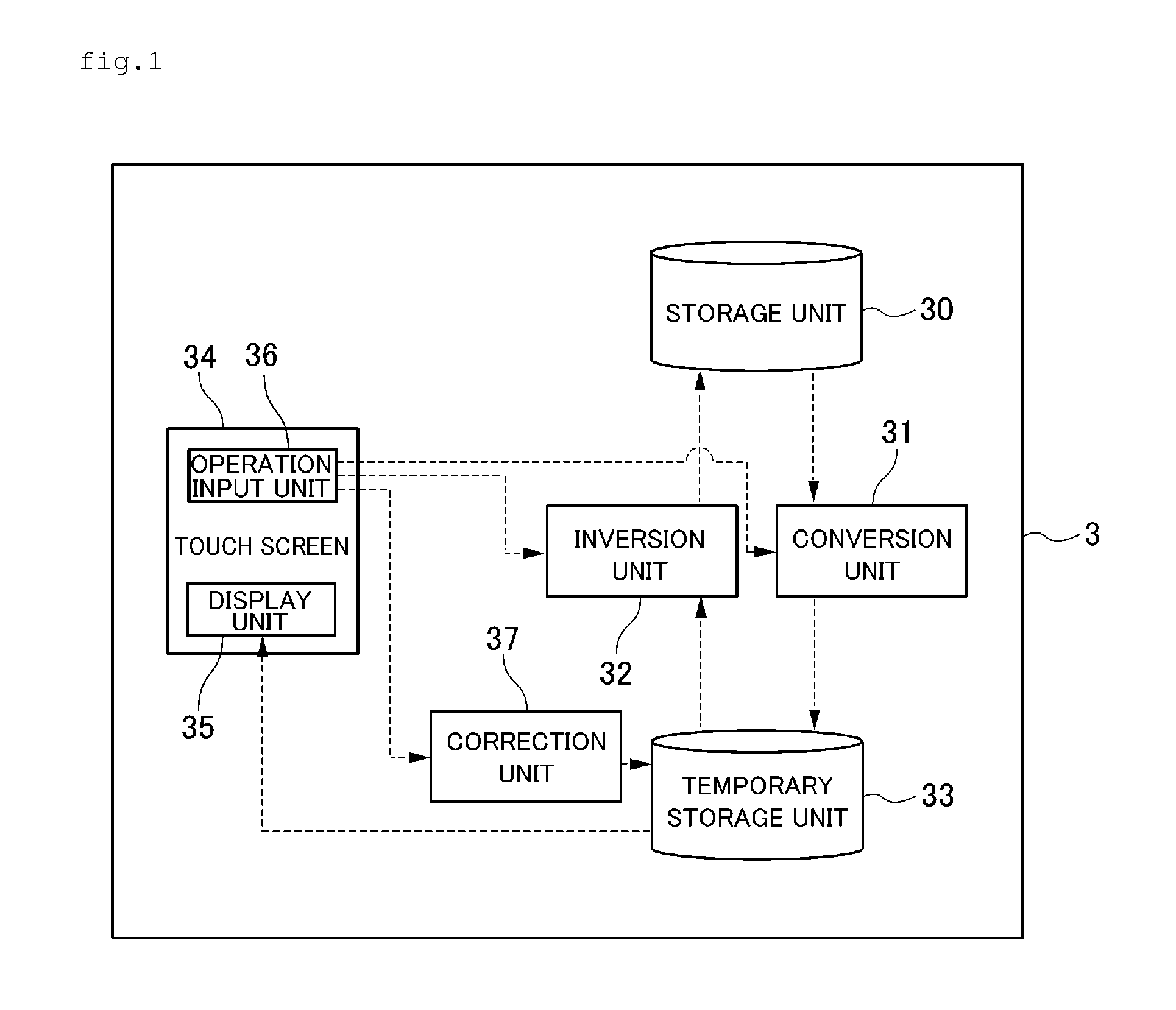
  • Environmental map correction device and autonomous mobile device
  • Environmental map correction device and autonomous mobile device
  • Environmental map correction device and autonomous mobile device

Examples


Embodiment Construction

[0024]The preferred embodiments of the present invention are now explained in detail with reference to the appended drawings. Note that, in the respective drawings, the same elements are given the same reference numeral and redundant explanations are omitted.

[0025]The configuration of an environmental map correction device (hereinafter referred to as the “global map correction device”) 3 according to a preferred embodiment of the present invention is foremost explained with reference to FIG. 1. FIG. 1 is a block diagram showing the configuration of the global map correction device 3.

[0026]The global map correction device 3 is preferably used for correcting an environmental map (map showing an area with objects (obstacles) and an area without objects (obstacles); hereinafter referred to as the “global map”) based on operations made by a user. The global map correction device 3 preferably includes a microprocessor that performs operations, a ROM that stores programs and the like to ca...


PUM


Abstract

An environmental map correction device that acquires an environmental map that matches an actual ambient environment includes a conversion unit arranged to convert object existence probability information of respective grids configuring a global map into image information (shading information of a black and white image, a display unit arranged to display a global map image based on the converted image information, an operation input unit arranged to receive a correcting operation from a user, a correction unit arranged to correct the global map image displayed by the display unit according to the correcting operation by the user, and an inversion unit arranged to acquire a corrected global map by inverting the corrected global map image (shading information) into the object existence probability information.

Description

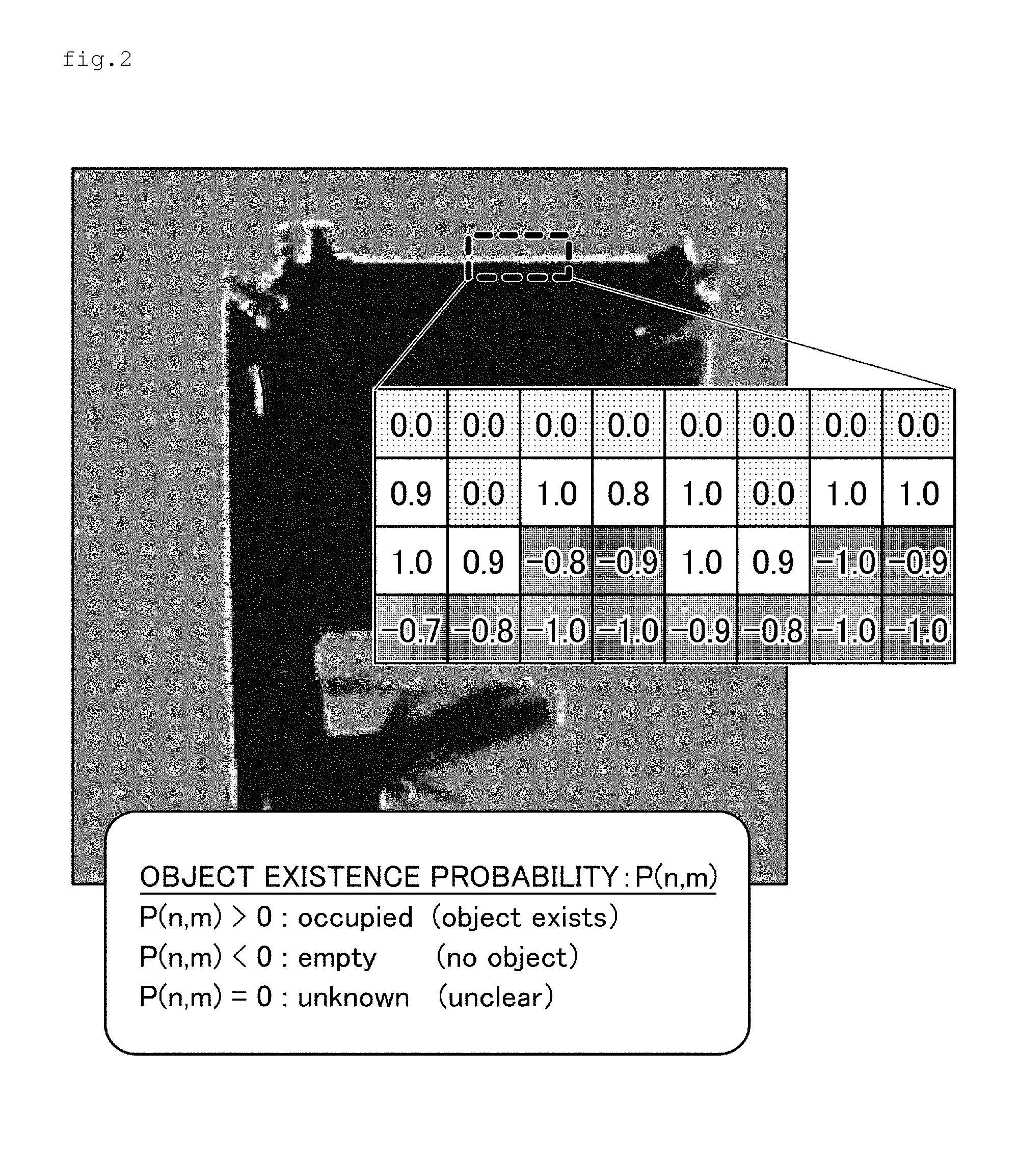
BACKGROUND OF THE INVENTION[0001]1. Field of the Invention[0002]The present invention relates to an environmental map correction device, and an autonomous mobile device including the environmental map correction device.[0003]2. Description of the Related Art[0004]An autonomous mobile device which autonomously travels in an ambient environment is known. In order for an autonomous mobile device to autonomously travel in an ambient environment, an environmental map showing an area with objects (hereinafter also referred to as the “obstacles”) and an area without objects within the travel space is required. Here, Japanese Published Unexamined Patent Application No. H7-129238 discloses a mobile robot which generates a topographic map (environmental map) using topographic data obtained as a result of measuring distances using a laser range finder (or a camera).[0005]The detection results of a laser range finder and the like sometime contain noise. Moreover, during the creation of an envir...

Claims


Application Information

Patent Timeline
IPC IPC(8): G05D1/00G06F15/18
CPCG09B29/106G05D1/024G05D1/0274G05D1/0246
Inventor TANAKA, SHOJINAKANO, TSUYOSHI
Owner MURATA MASCH LTD
Learn More