Chart specific navigation plotter and method for inexpensive production thereof

Active Publication Date: 2012-05-10
VAUGHT GREGORY V
View PDF11 Cites 7 Cited by
  • Summary
  • Abstract
  • Description
  • Claims
  • Application Information

AI Technical Summary

Problems solved by technology

Despite the automated abilities present in electronic navigational chart systems, certain limitations still exist.
However, an unavoidable east-west stretching of the chart occurs, such that degrees of longitude become progressively short as the as distance away from the equator increases.
Nonetheless, this preservation of angles comes at the cost of a predictable and calculable distortion of scale.
Despite its advantages, the WEEMS plotter also has some significant drawbacks and limitations for modern day use.
Like the WEEMS, however, the Warner plotter is not suitable for use on a paper chart in a small craft.
All these plotters fail as

Method used


Image

  • Chart specific navigation plotter and method for inexpensive production thereof
  • Chart specific navigation plotter and method for inexpensive production thereof
  • Chart specific navigation plotter and method for inexpensive production thereof

Examples


Embodiment Construction

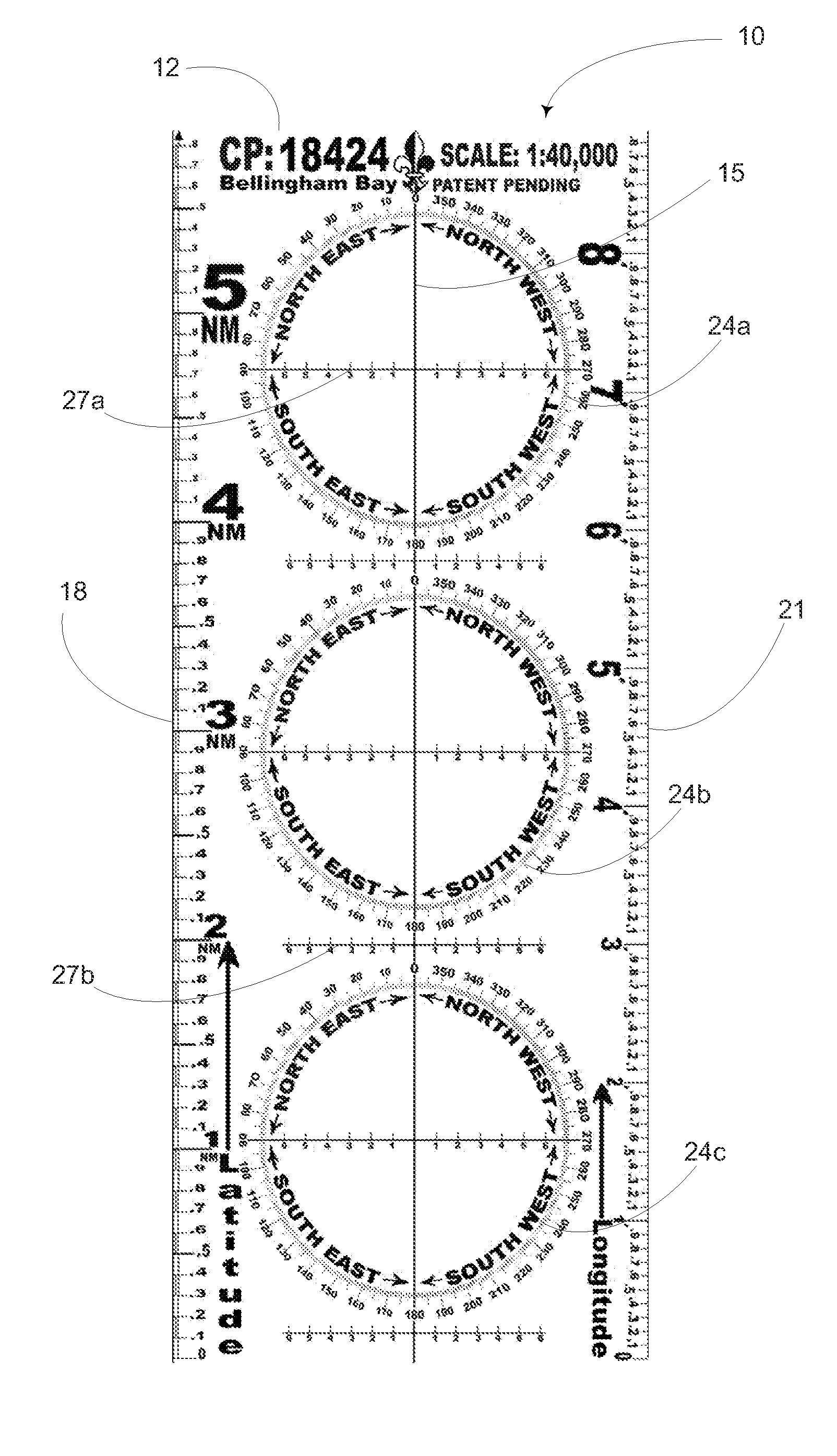
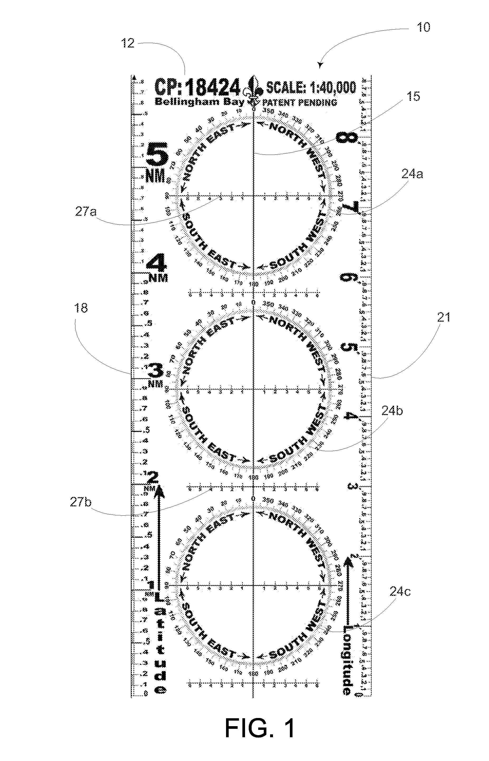
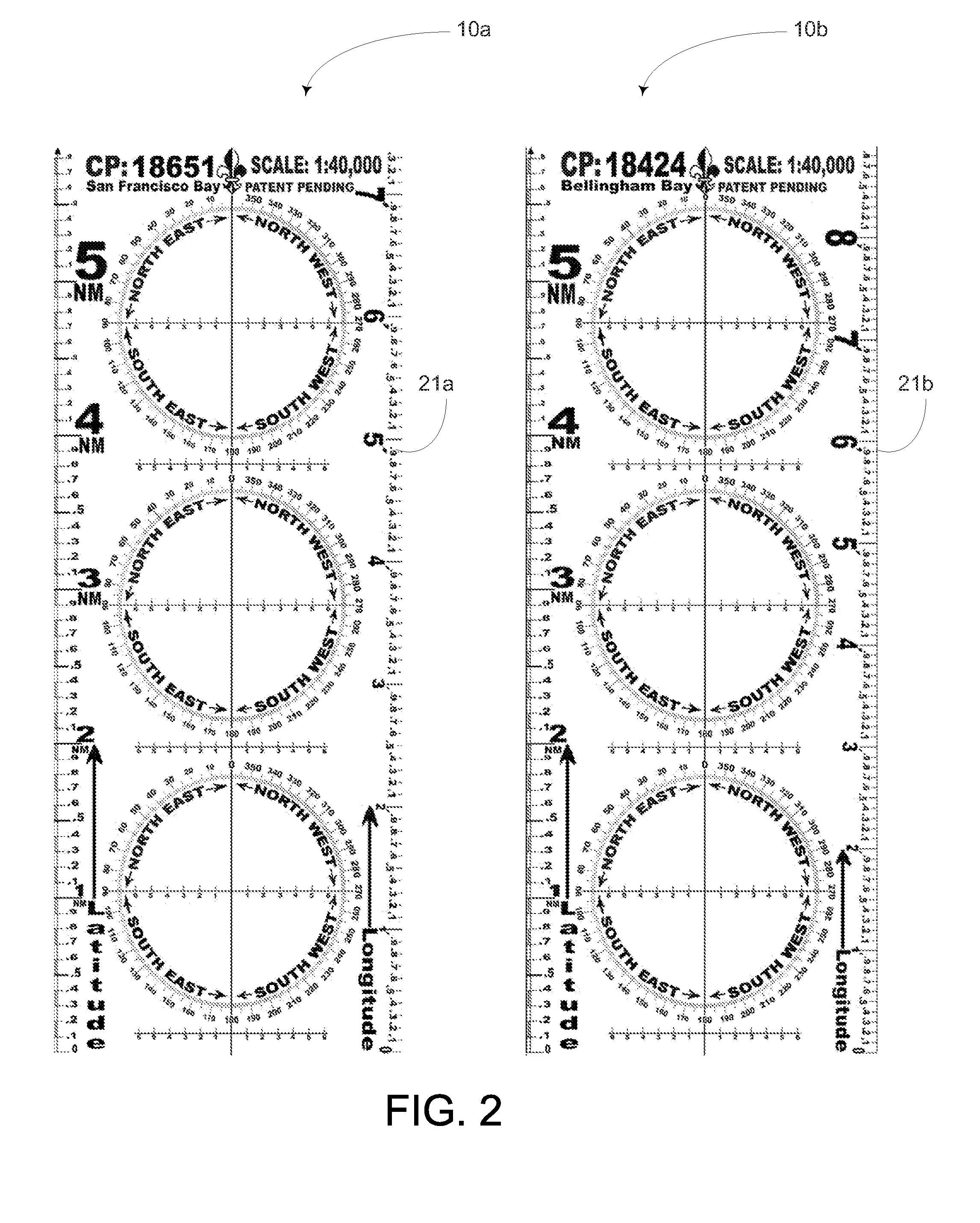
[0031]FIG. 1 depicts an inventive plotter 10 which comprises a legend 12 indicating the particular chart name and number as that chart is enumerated in the NOAA catalogue of navigation charts. NOAA is responsible for providing nautical charts for most of the nation, with a suite of over 1000 charts encompassing the coasts of the U.S., the Great Lakes, and the U.S. territories. The National Geospatial-Intelligence Agency (formerly NIMA) is responsible for producing deep water and charts in foreign waters. The U.S. Army Corps of Engineers produces charts on the Mississippi River and other inland waterways. For foreign waters, other local authorities produce suitable charts that will facilitate the use of the plotter equally. While this embodiment of the invention is configured to correspond to the NOAA catalogue of charts, there is nothing in the nature of the invention which is inherently limited to the NOAA catalogue. Any reference to the catalogue of charts is not strictly limited ...


PUM


Abstract

A navigational plotter for use with a selected navigational chart and its method for production include providing a generally transparent elongated planar straight edge member having each of a first and a second straight edges parallelly disposed opposite one another bounding a generally rectangular interior surface. A printed central axis bisecting the rectangular interior surface and at least one compass rose arranged to have its North/South ordinal points to lie upon the printed central axis thus to allow the user to maintain orientation of the plotter on the chart. A first distance scale is calibrated in accord with the scale of the selected chart along a selected line of latitude. The first distance scale is printed to span the East/West ordinal points on the compass rose and along the first straight edge. A second distance scale is calibrated in accord with longitude according to a Mercator projection.

Description

FIELD OF THE INVENTION[0001]This invention relates generally to naval and aerial navigation.BACKGROUND OF THE INVENTION[0002]The paper chart and magnetic compass lie at the very foundation of navigation. Ever since the first explorers began to navigate the seas better navigational practices, equipment and charts have also been explored and discovered. Currently, N.O.A.A. (National Oceanic and Atmospheric Administration) and others publish a variety of charts to facilitate safe navigation, including one of the best and most widely known types of charts used for navigation today called the “Mercator projection.”[0003]Despite the automated abilities present in electronic navigational chart systems, certain limitations still exist. Furthermore, inherent in the very nature of electronic systems is the reliance upon external power. Prudent navigators still maintain their proficiency by planning, preparing, and tracking their voyages upon paper charts.[0004]Either as a substitute for and a...

Claims


Application Information

Patent Timeline
IPC IPC(8): G01C21/20
CPCB43L7/005G01C21/22B43L13/028
Inventor VAUGHT, GREGORY V.
Owner VAUGHT GREGORY V
Why Eureka
Try Eureka