System and method for GPS lane and toll determination and asset position matching

a technology of gps lane and toll determination, applied in the field of vehicle tolling, can solve the problems of large up-front infrastructure cost, inflexibility, and inability to monitor the high-occupancy vehicle lane of conventional tolling systems

Inactive Publication Date: 2012-08-23
AMTECH SYST
View PDF25 Cites 146 Cited by
  • Summary
  • Abstract
  • Description
  • Claims
  • Application Information

AI Technical Summary

Benefits of technology

[0018]FIG. 6 is a block diagram showing the overall architecture of ...

Problems solved by technology

These systems require large up-front infrastructure costs and are thus, not very flexible when new tolling schemes are proposed or when new traffic patterns or legislation changes desired tolling points.
Conventional tolling systems are incapable of mon...

Method used


Image

  • System and method for GPS lane and toll determination and asset position matching
  • System and method for GPS lane and toll determination and asset position matching
  • System and method for GPS lane and toll determination and asset position matching

Examples


Embodiment Construction

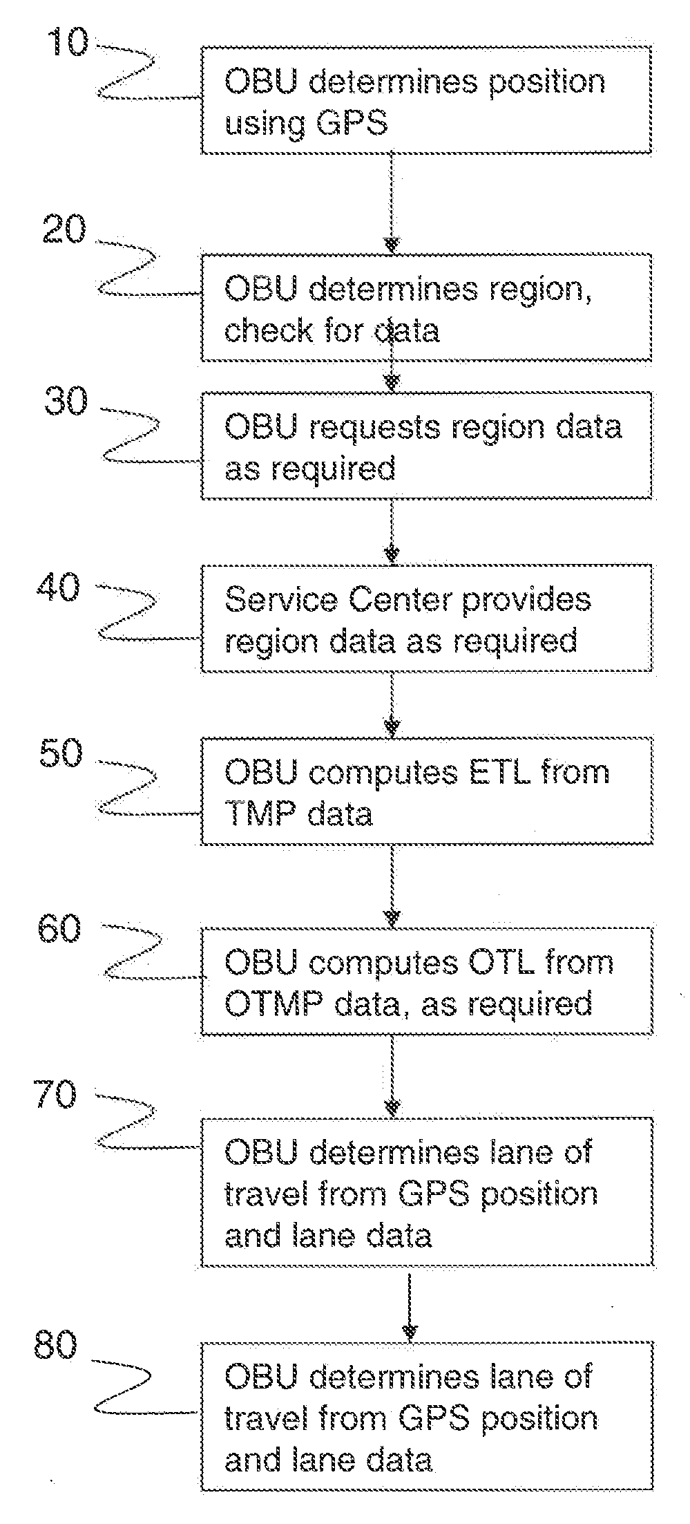
[0020]Referring to FIG. 1, in step 10 an onboard unit (OBU) carried by a vehicle determines its geographic position using a global positioning satellite system (GPS) receiver. Next, in step 20, the OBU determines the region in which the vehicle is located, and checks to see whether it has necessary data in memory to compute tolls in that region. In step 30, if the OBU determines that its data for the region is somehow deficient (e.g., incomplete or not current) then it requests data for the region from a service center. If required, the service center responds by transmitting the needed data in step 40.

[0021]Note that these steps illustrate just one of many equivalent ways of implementing the inventive method. For example, in place of steps 20-40, the OBU could periodically transmit its location and / or its identity to a regional, national, or global service center, and the service center could then respond according to its records with whatever data a vehicle with those latitude and...


PUM


Abstract

A system carried by a vehicle for computing tolls using a global position satellite (GPS) signal receiver, a communications link, and compact toll lane information provided by a service center. Toll lane information is organized by travel monitoring point. Data for each point includes a latitude and longitude coordinate and either lane shape information or a coordinate offset from a similar lane. A driver interface module is used in conjunction with the OBU to allow selection of occupancy and to display toll information to the driver to allow for use in HOT lanes and to support congestion pricing models with zero or minimal infrastructure cost.

Description

CROSS-REFERENCE TO RELATED APPLICATIONS[0001]This utility application claims the benefit under 35 U.S.C. §119(e) of provisional application Ser. No. 61 / 444,286 filed on Feb. 18, 2011; 61 / 445,636 filed on Feb. 23, 2011; 61 / 477,962 filed on Apr. 21, 2011; 61 / 545,650 filed on Oct. 11, 2011; 61 / 550,851, filed on Oct. 24, 2011, and all entitled “System and Method for GPS Lane and Toll Determination”; Ser. No. 61 / 498,453 filed on Jun. 17, 2011 and 61 / 510,933 filed on Jun. 22, 2011, both entitled “System and Method for Driver Performance Tracking” and Ser. No. 61 / 568,472 filed on Dec. 8, 2011, entitled “System and Method for GPS Lane and Toll Determination and Asset Position Matching.” The entire disclosures of these provisional applications are included herein by reference.FIELD OF THE INVENTION[0002]The invention relates generally to the field of vehicle tolling and particularly to tolling accomplished or computed using GPS. The invention also can be used to allow for effective matching ...

Claims


Application Information

Patent Timeline
IPC IPC(8): G07B15/00
CPCG07B15/063G07B15/02
Inventor GRAVELLE, KELLY
Owner AMTECH SYST
Why Eureka
Try Eureka