Map corrections via human machine interface

a human machine interface and map technology, applied in the field of navigation devices, to achieve the effect of facilitating the map correction process, ensuring accuracy, and ensuring accuracy

Inactive Publication Date: 2012-12-13
TOMTOM GERMANY
View PDF2 Cites 49 Cited by
  • Summary
  • Abstract
  • Description
  • Claims
  • Application Information

AI Technical Summary

Benefits of technology

[0011]The method of this invention provides a convenient process for a user to input map corrections in real time with minimal distraction, without the need for a co-driver, and which can be more reliably assessed by map database editors at an update center. In other words, the method of this invention both optimizes and simplifies the map correction process using a navigation device via convenient human machine interface techniques.

Problems solved by technology

As a result, the reported error will include corroborating screen shot and road information imprinted with the current geo-position of the navigation device at the time the error report is executed.

Method used


Image

  • Map corrections via human machine interface
  • Map corrections via human machine interface
  • Map corrections via human machine interface

Examples


Embodiment Construction

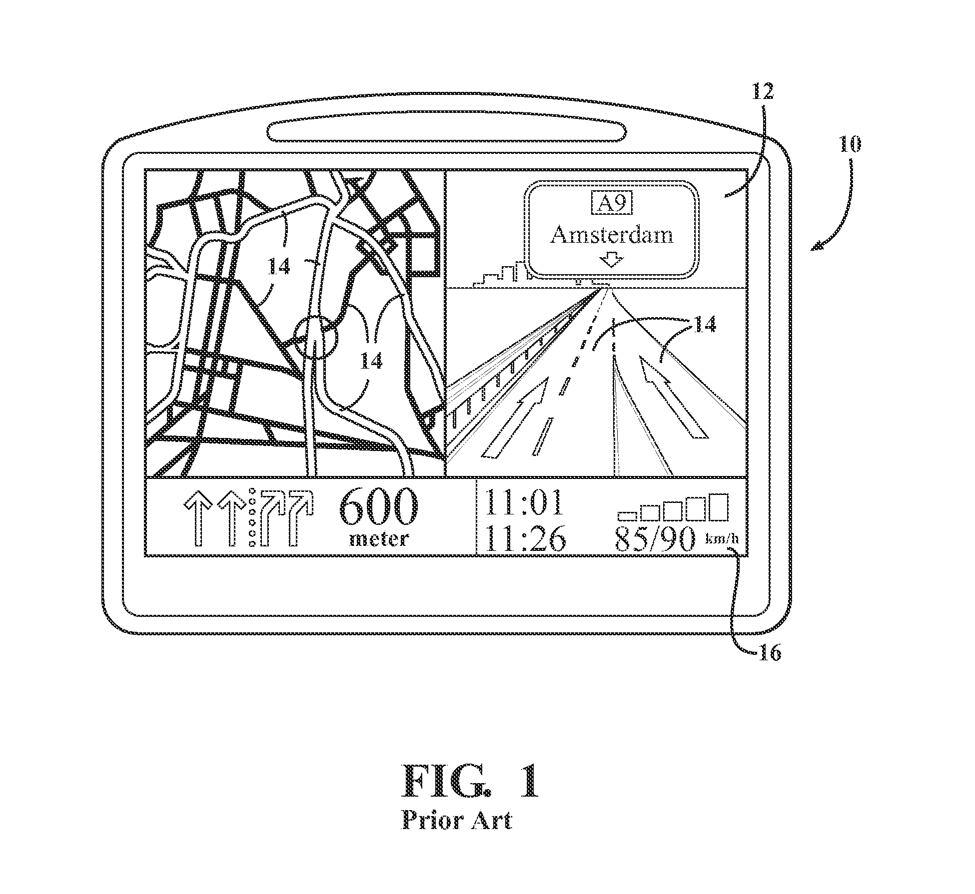
[0025]Referring to the figures wherein like numerals indicate like or corresponding parts throughout the several views, a personal navigation device 20 is shown in FIG. 7 having a display screen 22 representing a portion of a digital map containing road segments 14 as previously described in connection with FIGS. 1-6. The navigation device 20 may be an in-dash system in a motor vehicle, as well as any personal, portable or handheld device appropriately enabled with position determining features including cell phones, PDAs, and the like. The invention is particularly adapted for land-based navigation applications, although those of skill in the art will perceive application opportunities in connection with marine and / or aviation navigation settings.

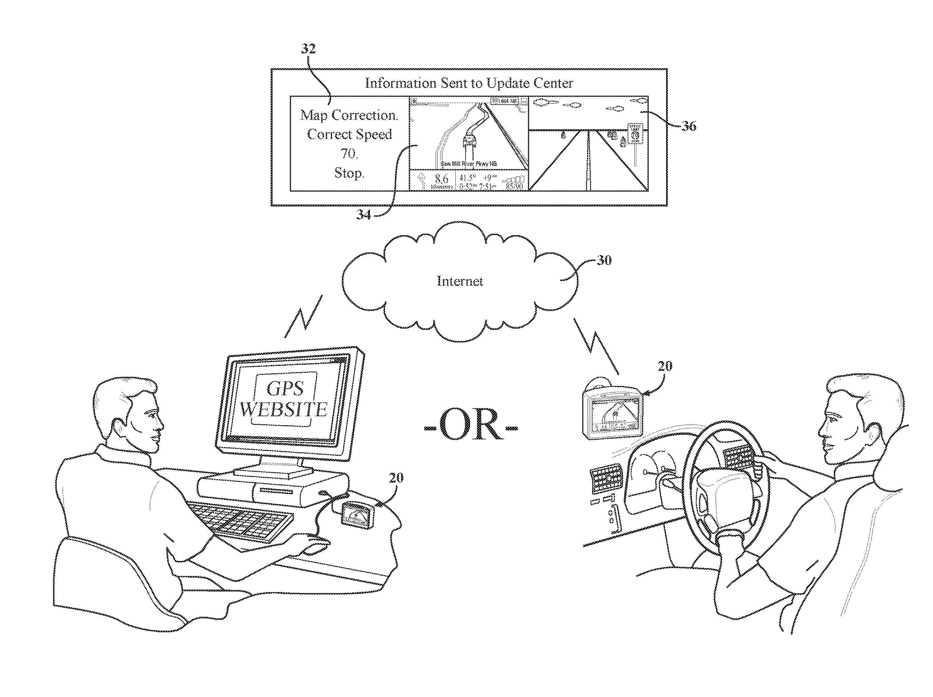
[0026]It is well known that roadway interchanges and other road features change over time. For example, a particular roadway may undergo construction, expansion, or closure. In addition to changes in roadways, roadway attributes may change...


PUM


Abstract

A method is provided for user input of map corrections via voice controlled human machine interface (HMI). A navigation device (20) is voice control enabled to respond to a defined set of commands. The navigation device (20) further includes display screen shot functionality, together with a camera (28) for taking real-world snapshots and / or recording video segments. Using voice control, a driver can make map update corrections (32) which are associated with a screen shot (34) of the display screen (22) of the navigation device (20), together with the captured image (36) from the camera (28). This information, together with optional additional meta information, may be transmitted to a collection service or update center.

Description

CROSS REFERENCE TO RELATED APPLICATIONS[0001]This application claims priority to U.S. Provisional Patent Application No. 61 / 257,873 filed 4 Nov. 2009, the entire disclosure of which is hereby incorporated by reference and relied upon.BACKGROUND OF THE INVENTION[0002]1. Field of the Invention[0003]This invention relates to navigation devices of the type used by motorists and travelers, and more particularly toward an improved method for submitting map corrections to a database update center.[0004]2. Related Art[0005]Navigation devices like that shown for example at 10 in FIG. 1 utilize internally stored digital maps combined with accurate positioning data transmitted from a constellation of satellites or other data streams in order to locate the navigation device within the digital map relative to the surrounding reality. Such GPS-enabled navigation devices may include portable, personal units such as those manufactured by TomTom NV (www.tomtom.com), as well as those which are integr...

Claims


Application Information

Patent Timeline
Patent Type & Authority Applications(United States)
IPC IPC(8): G01C21/26
CPCG01C21/36G01C21/3691G09B29/10G09B29/004
Inventor HUTH, ACHIM
Owner TOMTOM GERMANY
Why Eureka
Try Eureka