Detecting location, timetable and travel time estimations for barrier crossings in a digital map

Active Publication Date: 2013-04-04
TOMTOM GLOBAL CONTENT
View PDF7 Cites 24 Cited by
  • Summary
  • Abstract
  • Description
  • Claims
  • Application Information

AI Technical Summary

Benefits of technology

The invention can help locate places where there are no borders or borders are not clearly indicated in a digital map. It can also help create schedules or timetables for crossings based on the changes in movement and timing information. This could be useful for navigation and routing purposes.

Problems solved by technology

Inaccurate data, for example, may be unsuitable to compute optimal routes in response to a navigation query, or to provide other reliable information to a traveler.
Inaccurate or incomplete information contained in a digital map can result in poor or erroneous navigation instructions and lead to undesirable navigation decisions.
Detecting barrier crossing locations, such as ferry crossings, by simply matching trajectories to a preexisting water map or digital road map is not effective when the digital map does not recognize a ferry crossing in the first place.
It is likewise not effective when the digital map (e.g., the water map) is not sufficiently accurate.
Techniques have been proposed for detecting groups of moving objects and trajectories using computationally expensive methods that cluster large numbers of trajectories based on distance measures.
Such methods, however, are shown to be ineffective at finding convoys—that is of finding groups of objects that have moved together for a period of time.
Furthermore, the techniques available in the prior art do not exploit the repetitive day-to-day nature of certain types of barrier crossings such as ferry boats and other controlled crossing locations so as to detect these well defined and perhaps least complex types of convoys and then to extrapolate departure timetables and crossing frequencies.

Method used


Image

  • Detecting location, timetable and travel time estimations for barrier crossings in a digital map
  • Detecting location, timetable and travel time estimations for barrier crossings in a digital map
  • Detecting location, timetable and travel time estimations for barrier crossings in a digital map

Examples


Embodiment Construction

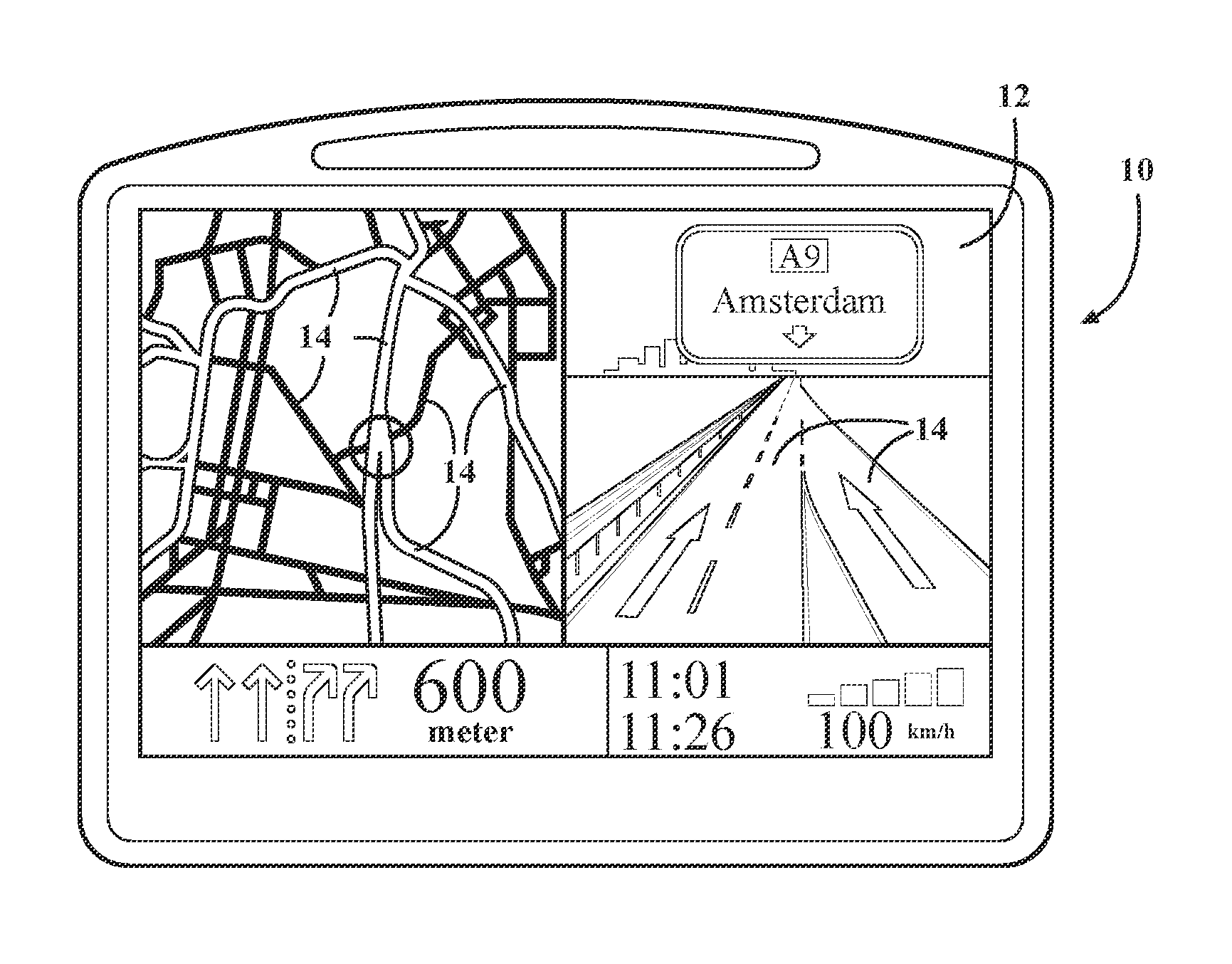
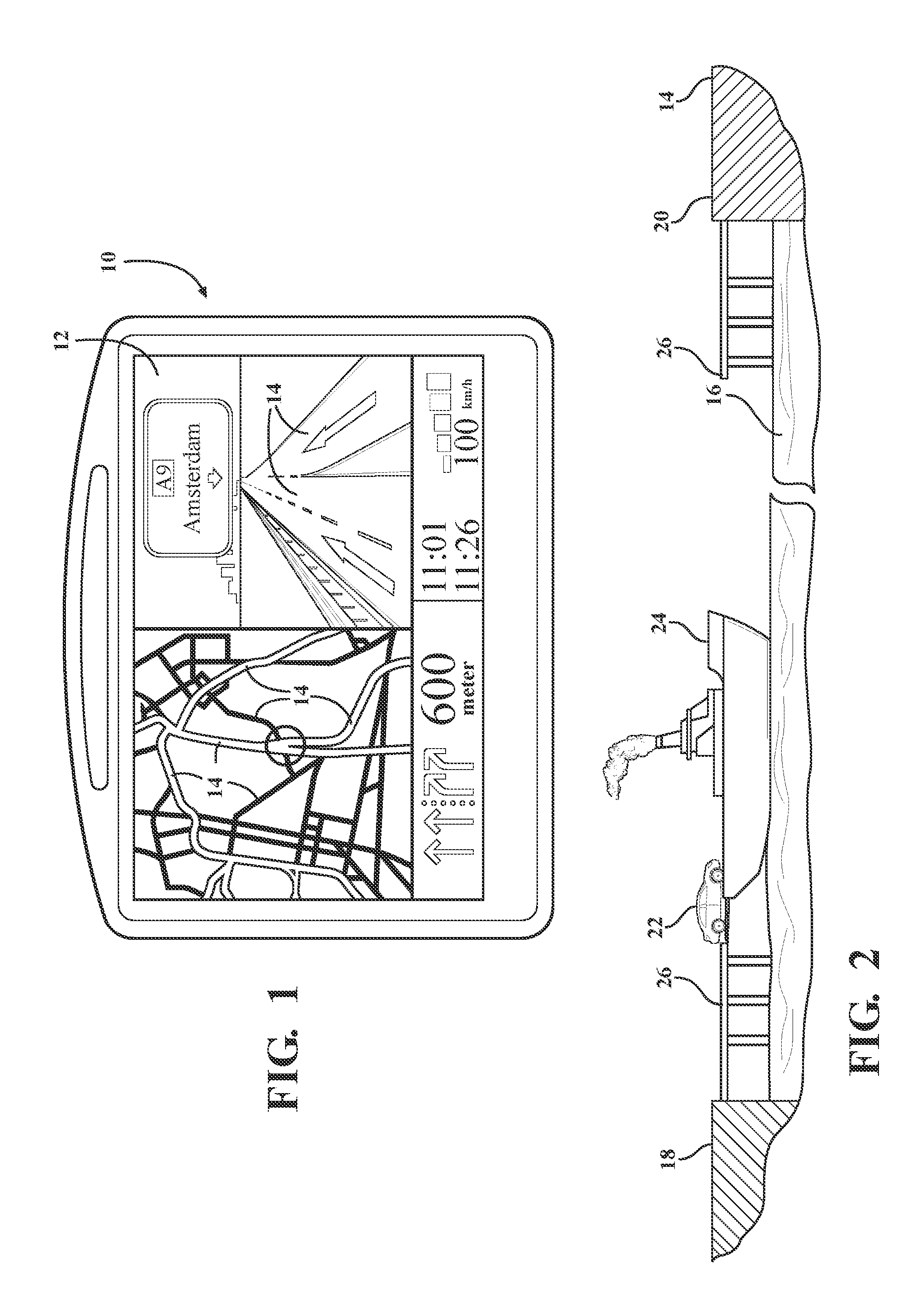
[0027]Referring to the figures wherein like numerals indicate like or corresponding parts throughout the several views, this invention pertains to digital maps as used by navigation systems, as well as other map applications which may include those viewable through internet enabled computers, personal digital assistants (PDAs), cellular phones, portable navigation devices, in-dash car mounted navigation systems, and the like.

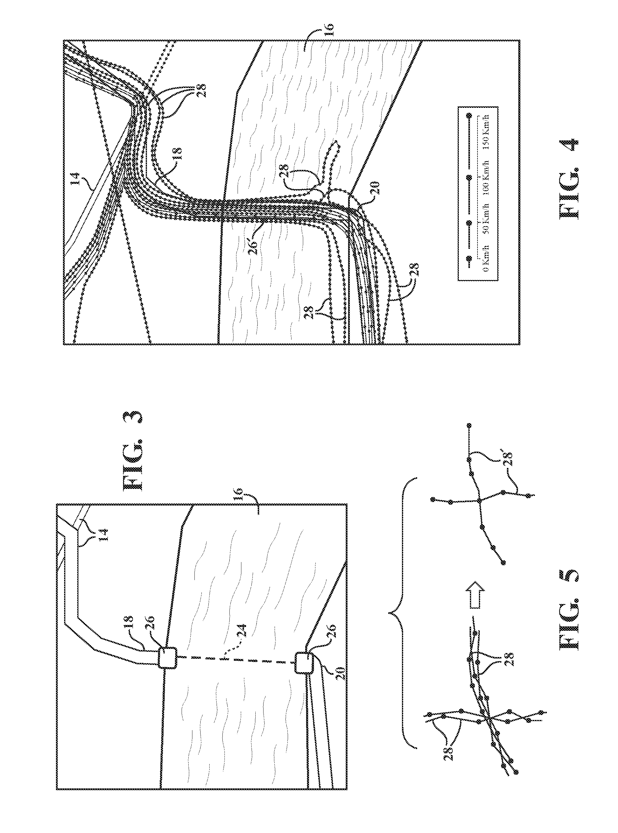
[0028]FIG. 2 depicts, in highly simplified form, a water barrier in the form of a river, lake or sea 16. This water barrier 16 is merely an example of one type of traffic barrier; non-water type barriers are also contemplated within the broad definition of barrier and may include valleys, railroad crossings, construction / repair projects, and other features which periodically impede or restrict the free flow of motor vehicles or other convoyed objects along a roadway or other traveled path. First 18 and second 20 road segments comprise those portions of an overal...


PUM


Abstract

A method for determining barrier crossing information for convoyed objects (22) using historic trajectory data (28). Trajectories (28) having similar geographical and directional properties are bundled so that trajectory density can be measured as a function of position and time (s, t). Visual presentation of the trajectory information can be used to determine certain types of barrier crossing information useful in a digital map. Frequency analysis on a number of trajectory density time series may be performed to determine specific barrier crossing locations (26) through the detection of vehicle bursts. Such frequency analysis may also indicate barrier crossing times and schedules in the case of crossing patterns.

Description

BACKGROUND OF THE INVENTION[0001]1. Field of the Invention[0002]This invention relates to digital maps of the type for displaying road or pathway information, and more particularly toward a method for determining barrier crossing schedules, crossing times and / or locations for convoyed objects such as motor vehicles transported by ferry boat.[0003]2. Related Art[0004]Personal navigation devices utilize digital maps combined with accurate positioning data from GPS or other data streams. Digital maps can also be accessed by personal computers, mobile devices, and other systems. These devices have been developed for many applications, such as navigation assistance for automobile drivers. The effectiveness of these navigation systems is inherently dependent upon the accuracy of digital maps stored in its memory or otherwise accessed through a suitable database connection such as wireless signal, cable, telephone line, etc.[0005]The navigation system 10 shown in FIG. 1 includes a display ...

Claims


Application Information

Patent Timeline
IPC IPC(8): G08G9/00
CPCG01C21/26G01C21/32G08G9/00G08G1/0129G08G1/0969G08G1/0104
Inventor BEKAERT, TIM
Owner TOMTOM GLOBAL CONTENT
Why Eureka
Try Eureka