Roadway mark data acquisition and analysis apparatus, systems, and methods

a technology of roadway marks and data acquisition, applied in satellite radio beaconing, underwater vessels, non-deflectable wheel steering, etc., can solve the problems of significant potential collision of oncoming traffic, impede traffic visibility, and manual intensive current system, so as to and minimize the amount of imaged roadway area data

Active Publication Date: 2013-07-25
LIMNTECH
View PDF29 Cites 77 Cited by
  • Summary
  • Abstract
  • Description
  • Claims
  • Application Information

AI Technical Summary

Benefits of technology

This patent describes an inventive system that reduces the amount of data required to analyze roadway markers captured through cameras on moving vehicles. By filtering out unnecessary background material and compressing the marker image, this technology can save considerable amounts of computing power and reduce bandwidth requirements for storing and transferring the data. Additionally, it allows for accurate detection and measurement of roadway markers even at high speeds. Overall, this innovation improves efficiency and reliability when collecting and analyzing roadway marker data.

Problems solved by technology

The technical problem addressed in this patent text relates to the limitations of current road way marking technologies. These methods require much manual labor, often resulting in unsafe conditions for workers, and fail to provide uniform markers. There is a need for a more efficient and safe automatic road way marking system that reduces human error and provides better results.

Method used


Image

  • Roadway mark data acquisition and analysis apparatus, systems, and methods
  • Roadway mark data acquisition and analysis apparatus, systems, and methods
  • Roadway mark data acquisition and analysis apparatus, systems, and methods

Examples


Embodiment Construction

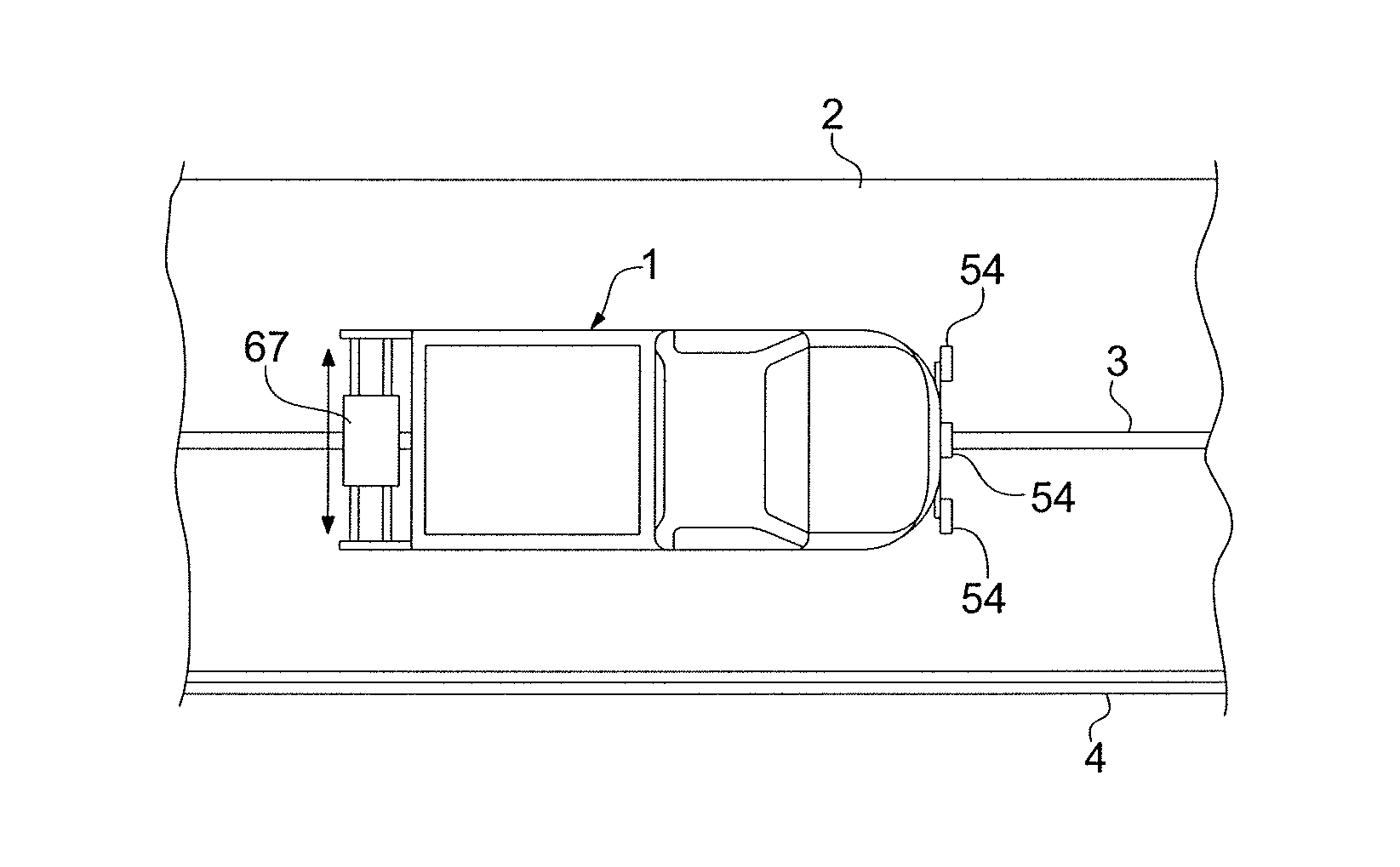
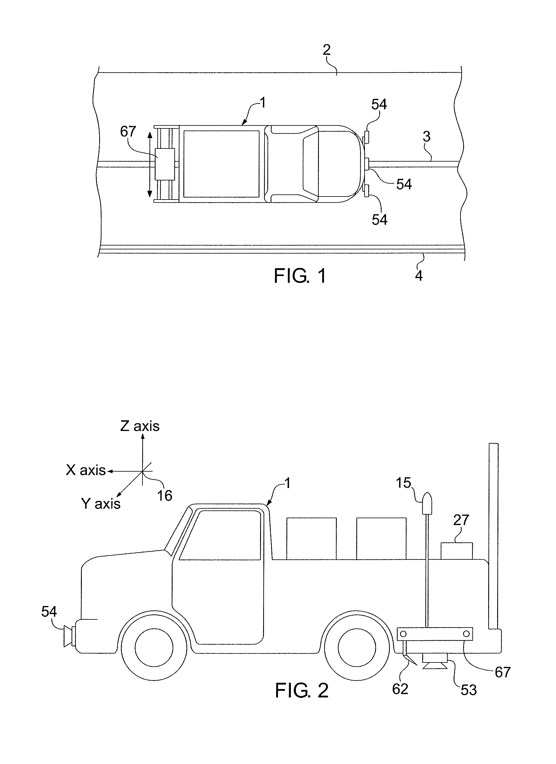
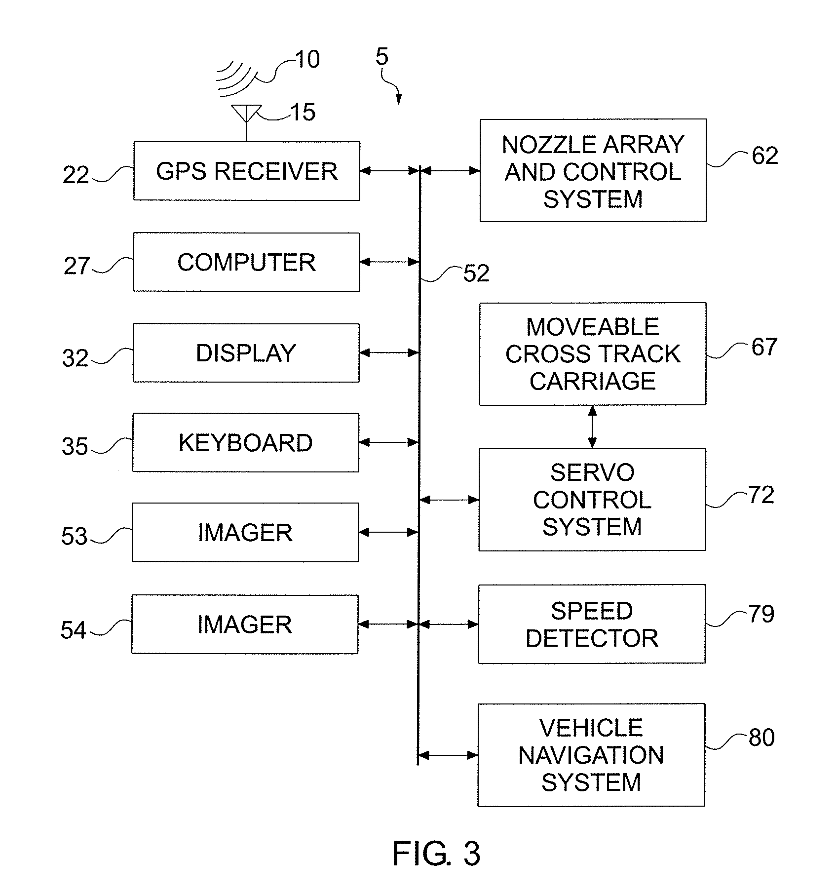
[0095]The present invention provides GPS-based systems used for painting or otherwise marking roadway traffic lane demarcation lines, vehicle mounted locating and inspection systems for determining the geographical location and condition of roadway marks, and apparatus, systems, and methods for acquiring and remotely analyzing roadway mark location and inspection data. Referring now to the drawing, in which like reference numbers refer to like elements throughout the various figures that comprise the drawing, FIG. 1 shows a moving or self-propelled vehicle 1 which is located on a road or roadway 2 near a line 3 applied to the surface of the road 2. Also shown is a roadway edge boundary line 4. The term “vehicle” used in this document is given its broadest meaning, including any conveyance, motorized device, or moving piece of mechanical equipment for transporting passengers or apparatus. More specific and preferred examples of vehicles 1 are cars, vans, trucks, snow plows, construct...


PUM


Abstract

An apparatus, system, and method for determining characteristics of a roadway mark at a remote location. The system includes a vehicle having at least one imager for producing image data containing at least one actual roadway mark evident on a roadway surface. A GPS antenna is mounted on the vehicle. A GPS receiver is responsive to the GPS antenna for determining a GPS location of the GPS antenna. An apparatus responsive to the imager and the GPS receiver determines a GPS location of the roadway mark and filters and compresses the image data, the filtered and compressed image data containing the image data of the roadway mark. An apparatus communicates the filtered and compressed image data to the remote location for analyzing the roadway mark characteristics from the image data.

Description


Claims


Application Information

Patent Timeline
Owner LIMNTECH
Why Eureka
Try Eureka