Method and system for adaptive location determination for mobile device

a mobile device and location determination technology, applied in the field of mobile device location determination methods and systems, can solve problems such as inability to fix a position, multipath propagation of signals, and inability to function effectively,

Active Publication Date: 2014-04-17
CELLCO PARTNERSHIP INC
View PDF2 Cites 192 Cited by
  • Summary
  • Abstract
  • Description
  • Claims
  • Application Information

AI Technical Summary

Problems solved by technology

For example, when signal conditions are poor (e.g., in a city or building), these signals may suffer multipath propagation where signals bounce off buildings, or may be weakened by passing through atmospheric conditions, walls, or tree cover.
When a GPS location determination is attempted in these conditions, some standalone GPS navigation devices may not be able to fix a position due to the poor signal quality.
A fix may take several minutes (if at all possible) rendering them unable to function effectively until a clearer signal can be received continuously for a long enough period of time.
Determining the location of a mobile device while the mobile device is in use is often problematic.
For example, when a mobile device is indoors, both GPS and AGPS may fail to provide the location information because of a substantial degradation of the GPS satellite signals.
Further, even if there are some GPS signals, a mobile device may not be able to be assisted in determining its location because the communication channel is preoccupied with voice communication.
Put differently, some wireless technology, (e.g., CDMA) does not support simultaneous voice and IP data communication.
However, the satellite signal may be poor, due to obstructions such as large buildings, trees, etc.
In one example, both GPS and AGPS may fail to provide the location information because of a substantial degradation of signals.
In such a scenario, the PERS device may not store the user identification.
However, since there is a voice call in progress, whether or not a completed connection to the call center has been established, such GPS assistance cannot be readily provided.
For example, the time that a device may be in the pseudo-hold mode for a may be limited.
Sending data over the IP data channel to the call center may conflict with the operation of the voice call.
In one aspect, both GPS and AGPS approaches may not provide an efficient way of determining the location of a mobile device.
Thus, any satellite GPS signal may not effectively reach the mobile device and any additional assistance through AGPS may fail.
This delay adds hysteresis to the determination, reducing the messaging that may occur, for example, when the mobile device is near the limit of the pilot beacon range.
The mobile device may not be able to use standalone GPS if it cannot identify a sufficient number (e.g. 4) of satellites having sufficient signal strength.
For example, in an emergency scenario, a user may accidentally press the “end-call” button and then not be able to re-establish a connection (e.g., due to an injury).
These nulls may occur, for example, due to reflected signals that negatively reinforce each other.
Since the mobile device may now be indoors, the GPS signals may be obstructed and therefore not effective.

Method used


Image

  • Method and system for adaptive location determination for mobile device
  • Method and system for adaptive location determination for mobile device
  • Method and system for adaptive location determination for mobile device

Examples


Embodiment Construction

[0019]In the following detailed description, numerous specific details are set forth by way of examples in order to provide a thorough understanding of the relevant teachings. However, it should be apparent to those skilled in the art that the present teachings may be practiced without such details. In other instances, well known methods, procedures, components, and / or circuitry have been described at a relatively high-level, without detail, in order to avoid unnecessarily obscuring aspects of the present teachings.

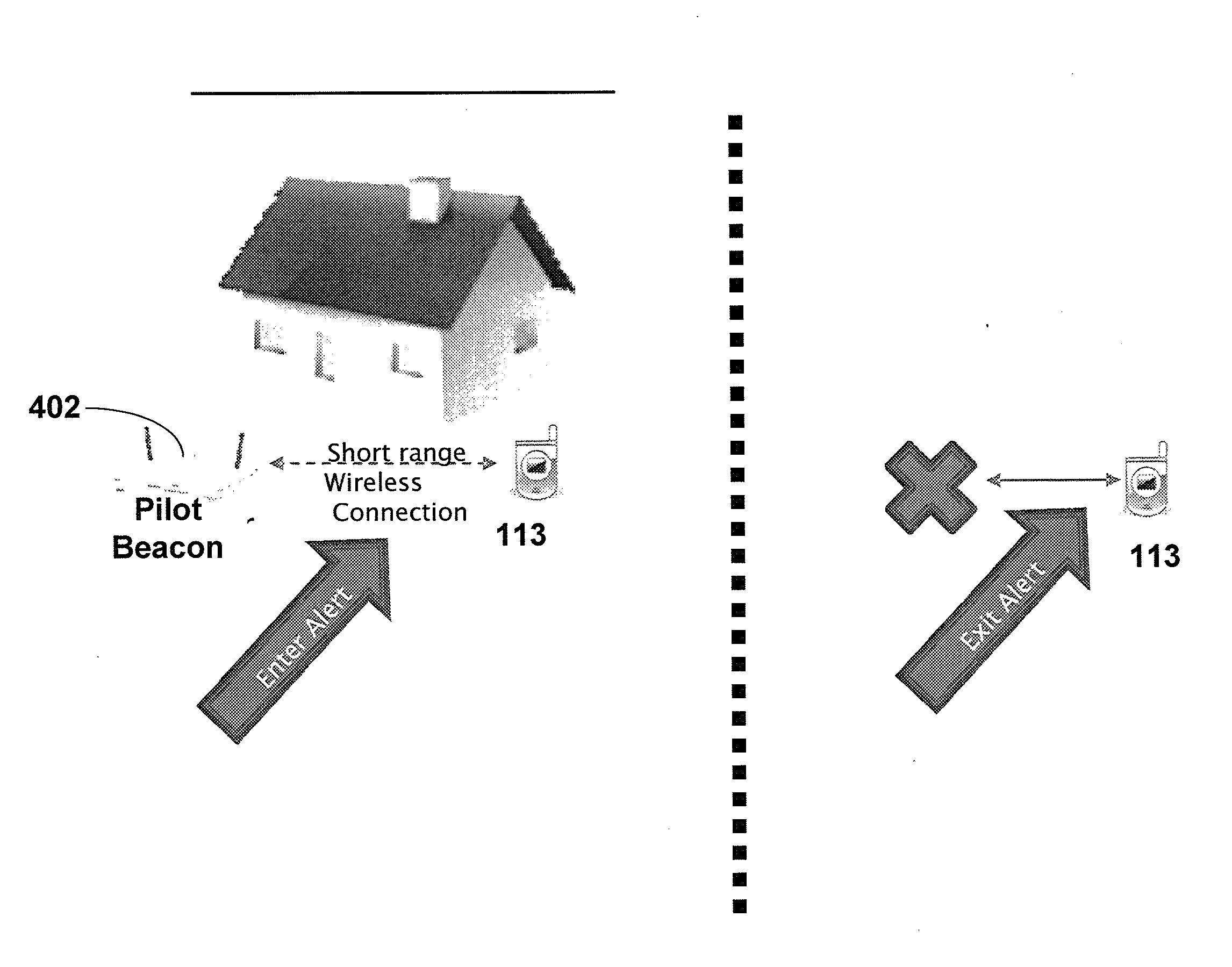
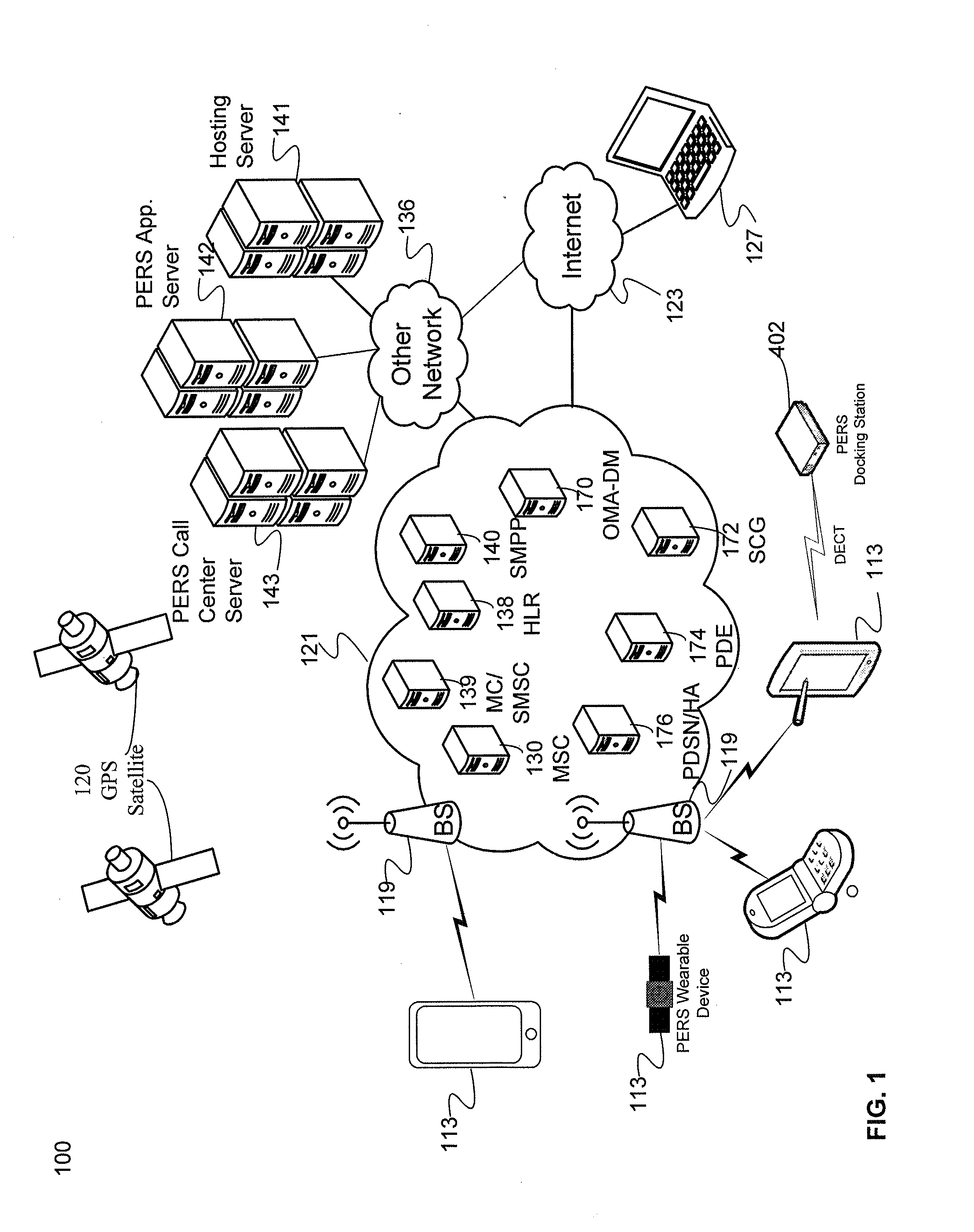
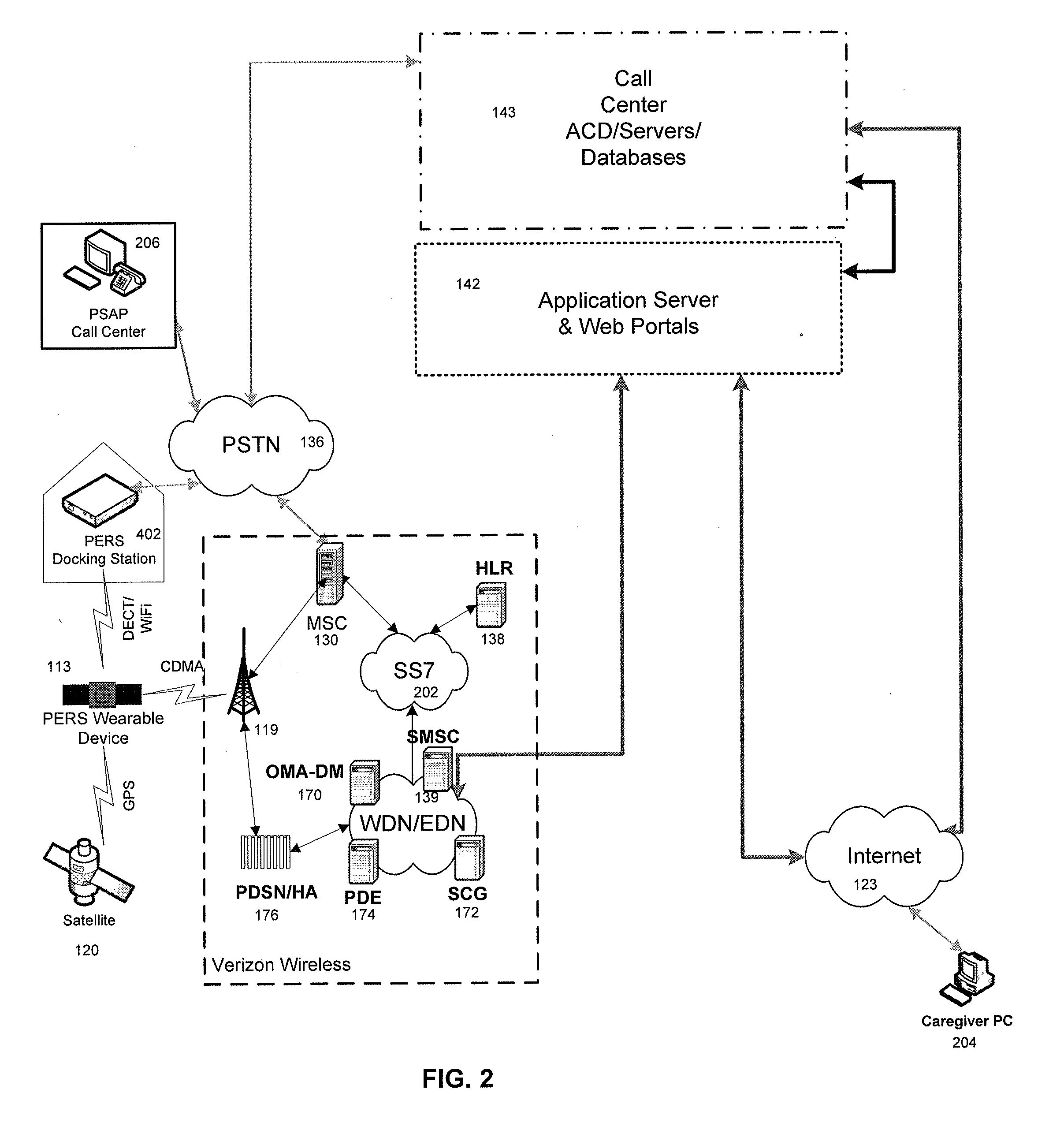
[0020]The various examples disclosed herein relate to quickly determining and / or tracking the location of a mobile device. The examples described herein, quickly determine a coarse location of the device. In response to an emergency, the coarse location may be sufficient to guide emergency personnel to the area. The location estimate may be further refined after the initial coarse location has been provided to give better guidance to the emergency personnel as they approa...


PUM


Abstract

An example method includes connecting to a call center by a user equipment (UE) device via a voice call and receiving a request for a current location. The device is determined to be in an outdoor environment if the signal strength of satellite signals used by a global positioning system (GPS) is greater than a threshold. The device is determined to be in an indoor environment if a beacon signal strength is greater than a further threshold. If the device is in an outdoor environment, the current location is determined using a standalone or assisted GPS method. If the device is in an indoor environment, the current location is the known location of the beacon or an assisted GPS method. If neither the signal strength of the satellite signals nor the signal strength of the beacon exceeds its respective threshold, the current location is determined as a last stored location.

Description

BACKGROUND[0001]In recent years, mobile devices have increasingly provided users with an elevated level of safety and security. In addition to being able to wirelessly contact another individual or service by dialing a number, mobile devices can be used as part of a Personal Emergency Response Systems (PERS). PERS devices and equipment are user-installed devices (wired or wireless) that may also attach to a landline network. The general concept is that the PERS user is able to provide location information for general monitoring and / or to alert an emergency response call center that they are in distress and need immediate assistance. Some PERS devices are capable of detecting events such as falls or extended periods of inactivity and alert the call center to these conditions. Regardless of the specific type of PERS device, the location of the mobile device is an important determination.[0002]In modern mobile communication networks, the current position determination technologies use ...

Claims


Application Information

Patent Timeline
Patent Type & Authority Applications(United States)
IPC IPC(8): H04W4/04H04W4/021H04W4/33H04W4/90
CPCH04W4/043H04W4/90H04W4/021H04W4/33
Inventor CHITRE, MONICARAJALA, YOGANANDBATES, PETER C.TUSCANO, PAULNADLER, MATTBLUM, BRENT ROBERT
Owner CELLCO PARTNERSHIP INC
Why Eureka
Try Eureka