Geographic Information System For Researching, Identifying and Comparing Locations for Economic Development

a technology of geographic information system and economic development, applied in the field of geographic information system for economic development research, identifying and comparing locations, can solve the problems of insufficient existing system, inability to search, system is not useful for business formation, expansion or relocation decision-making,

Active Publication Date: 2015-07-02
STATEBOOK INT INC
View PDF15 Cites 20 Cited by
  • Summary
  • Abstract
  • Description
  • Claims
  • Application Information

AI Technical Summary

Benefits of technology

[0017]In another embodiment, a computer-readable medium for providing the foregoing functionality is disclosed. Within such embodiment, the computer-readable medium has computer executable instructions, to be executed on a processor, and which include the step of integrating GIS data received from a plurality of sources, storing the data in a searchable database, pro

Problems solved by technology

However, existing systems are inadequate in that they do not enable businesses to search for geographical regions using criteria relevant to the particular business and to its plans.
As such, these systems are not useful for business formation, expansion or relocation decision-making, in that they do not provide data relating to regional economic growth rates, tax rates, and available state and local incentives, accessibility to transport centers and utilities, nearby technological expertise such as local universities and businesses, together with location demographics, such as cost of living factors, and local income and education levels.
Furthermore, existing systems do not enable a user to compare data associated with one prospective region to data associated with another prospective region.
Consequently, most businesses rely upon consulting firms, realtors, and site location professionals to compile such data and make recommendations, often based upon limited and incomplete information.
These entities oft

Method used


Image

  • Geographic Information System For Researching, Identifying and Comparing Locations for Economic Development
  • Geographic Information System For Researching, Identifying and Comparing Locations for Economic Development
  • Geographic Information System For Researching, Identifying and Comparing Locations for Economic Development

Examples


Embodiment Construction

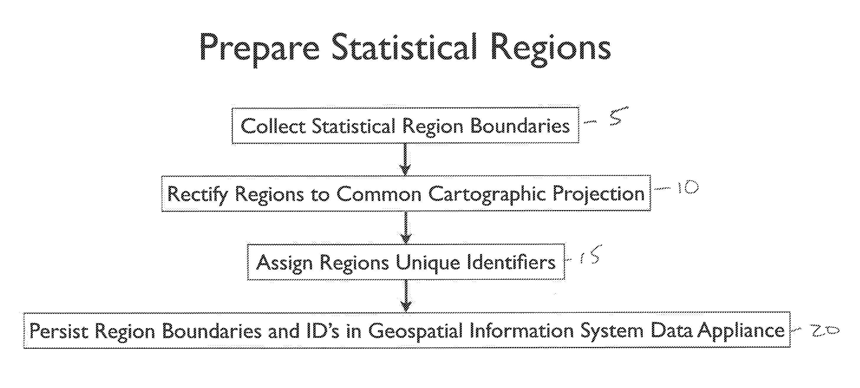
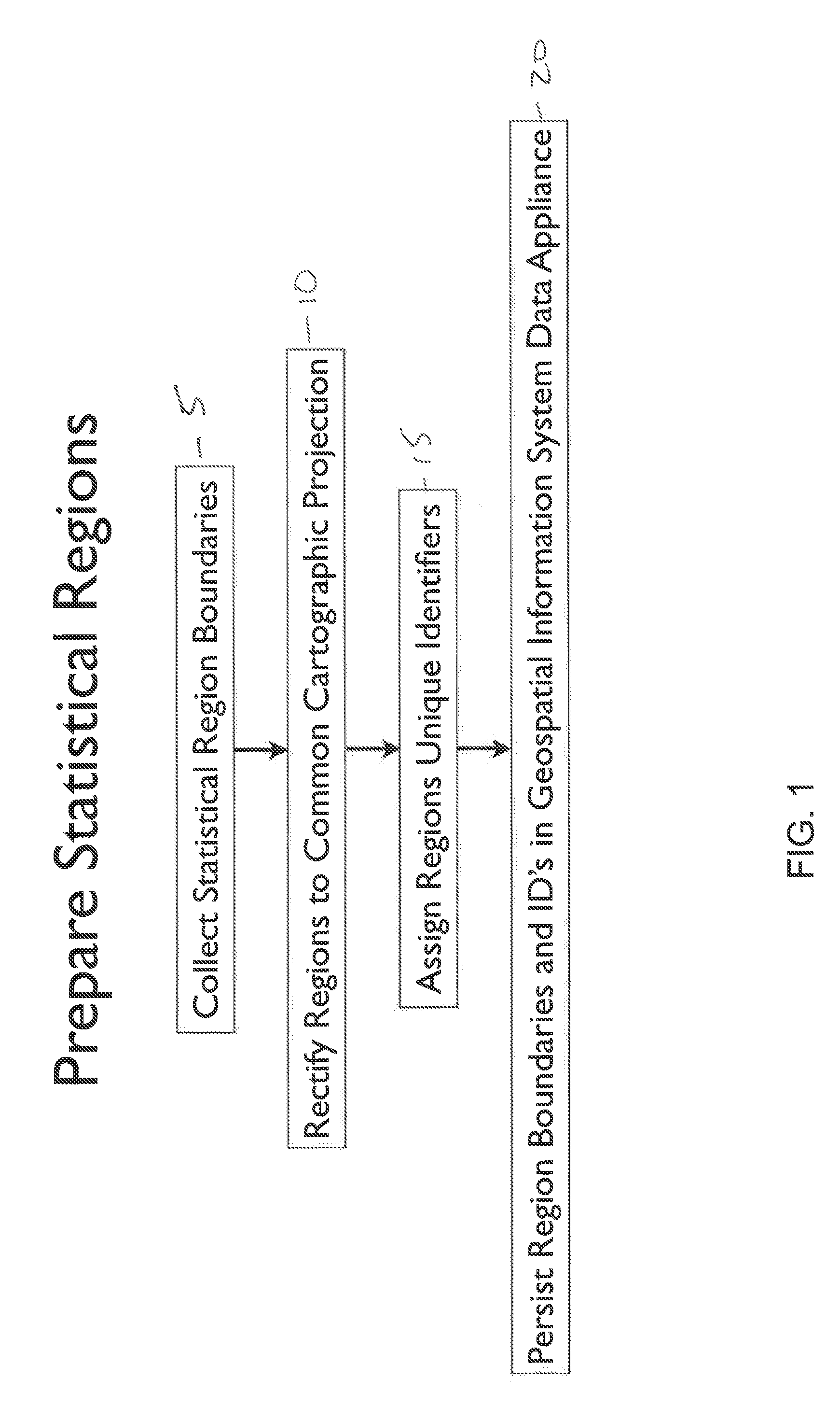
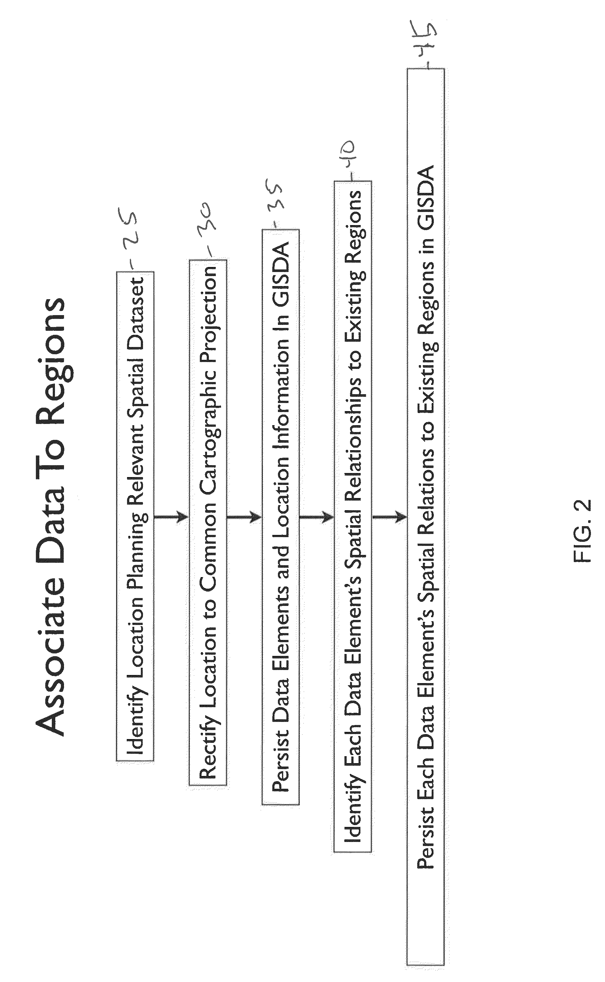
[0035]The present invention is described below with reference to the illustrative diagrams in accordance with the invention. It is understood that the systems and methods described in each of the diagrams may be implemented by means of analog or digital hardware and computer program instructions. These computer program instructions may be provided to a processor of a general purpose computer, a special purpose computer, or other programmable data processing apparatus, such that the instructions, which execute via the processor of a computer or other programmable data processing apparatus, implement and provide the functions / acts specified in the diagrams and text of this application.

[0036]Headings used herein are for organizational purposes only and are not meant to be used to limit the scope of the description or the claims. As used throughout this application, the word “may” is used in a permissive sense (i.e., meaning having the potential to), rather than the mandatory sense (i.e...


PUM


Abstract

The invention includes systems and methods that permit users to research, identify and compare geographical regions for purposes of business formation, expansion or relocation decision making. The systems and methods include receiving, compiling and formatting data from a plurality of sources for use in the GIS system, populating a searchable database with the GIS data, and enabling the user to search the data using demographic, economic and other search parameters to identify and compare geographic locations of interest. The data further includes information provided by participating economic development organizations, enabling such data to be included in user search parameters, and permitting such third parties to provide commentary on regional data, and to market their regions and services to prospective businesses. The systems and methods also enable a user compare multiple regions of interest via an interface that displays different datasets selected by the user via tabs or buttons, and to generate reports using comparative data specifically selected by the user.

Description

BACKGROUND OF THE INVENTION[0001]A geographic information system (GIS) is a system that associates data according to the geographic coordinates of its elements. Such a system generally utilizes a variety of data types, including, for example, imagery, maps, and location based-information, such as retail stores and restaurants.[0002]GIS data systems are now commonly used for a variety of services, including through online and mobile devices. These systems typically enable a user to locate desired information (data) by inputting the geographic region of interest. For example, such systems enable a user to identify real estate listings in a desired geographic area. In some cases, these systems also enable a user to interact with a map to locate data of interest.[0003]GIS data systems should be useful to businesses that are considering expansion, relocation, or entry into new territories by enabling a person to identify appropriate geographic regions. However, existing systems are inade...

Claims


Application Information

Patent Timeline
IPC IPC(8): G06Q30/02G06F3/0484G06F3/0482G06F17/30
CPCG06Q30/0205G06F17/30241G06F3/0482G06F17/30554G06F3/04842G06F17/30395G06F16/29
Inventor CRUICKSHANK, CALANDRASCHUMAN, IRA
Owner STATEBOOK INT INC
Why Eureka
Try Eureka