
Map-based remarks

a map and comment technology, applied in the field of maps and publishing tools, can solve the problems of inability to teach or fairly suggest a streamlined publishing system, inability to significantly modify a map image, and limited social media sharing, etc., to achieve simple steps, easy-to-use posting, and streamlined publishing

Inactive Publication Date: 2015-11-19
FELDMAN DOUGLAS E
View PDF10 Cites 53 Cited by
  • Summary
  • Abstract
  • Description
  • Claims
  • Application Information

AI Technical Summary

Benefits of technology

The present invention is a system that allows users to easily search and share their experiences on social networks using a mobile app. It allows users to easily create maps with location information and geographic comments about events or places. The system is designed to be user-friendly and efficient, with simple steps for both searching and publishing. Overall, the invention simplifies the process of sharing and creating maps, making it more accessible to users.

Problems solved by technology

The scope of the related art concerns simple social media sharing which is significantly limited by the number of characters and therefore the complexity of a given posting.
However, such social networks generally do not provide substantial visual editing interfaces to significantly modify a map image, let alone how a map is tagged and displayed to users.
However, such related art fails to teach or fairly suggest a streamlined publishing system which is easy to use through reduced steps leading to sharing of a map via a sharing application capable of posting to a third party social network.
However, merely providing geographical position on a network map to enhance credibility of comments fails to provide searchability of a conventional geographically-oriented post in a desired searchable area as specified by the posting comment.
Furthermore, limiting to social media sharing, particularly when limited to a specific social media network, is not conducive to widespread dissemination of information targeted to the designated post area.
Further, conventional approaches to simple social media sharing of map locations and content associated with maps were unable to permit rapid selection and sharing of a geographically tagged location and are typically tied to the mobile user's location, based on their GPS location.
For example, conventional social networks such as Twitter do not currently permit specifying a radius beyond one's location as a criterion or metadata at the same time the content is shared.
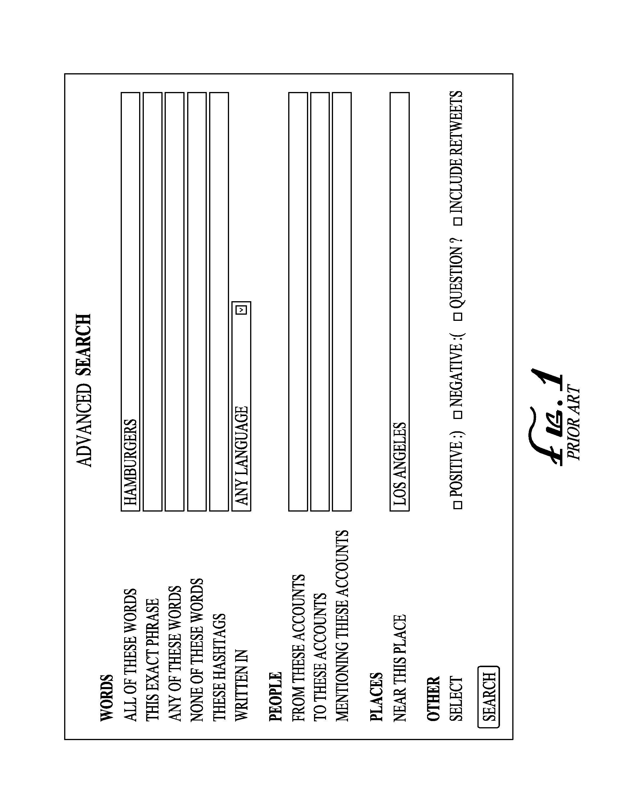
In addition, searching content by precise location within a radius using social media tools such as Twitter is highly limited.
For example, on Twitter, it is not possible to search for “hamburger” within two kilometers of a specified location.
Conventional social media apps do not simultaneously provide both geosearch and geopublish map-displays.
Map-based tools, like Waze, do not by default create independently shared maps designed to be sharable with third party social networks.
Such systems do not facilitate rapid creation and sharing of map-based social posts that are also searchable as one of a few prominent, simple functions within the same app.
However, Waze is not designed to easily designate an expandable or retractable radius included in a post to third party social networks.
A disadvantage of short-post social networks and applications is the failure to provide simple, easy to use creation tools for map-related posts, and further to dynamically generate such maps associated with posts quickly and easily without numerous user interface options.
Such social networks do not easily create marked sharable images of geotagged maps in social media.
Moreover, conventional text-based posts lack GPS information, and such text-based posts generally do not indicate one's present geolocation nor a desired geolocation about a third party location.
Furthermore, conventional posts even with a location associated thereto may not provide geopost-searchable functions within a specific radius along with such rapid map sharing.
Maps, and MapQuest conventionally require an address or other information and do not provide posting capabilities via social networks as a regular or primary function.
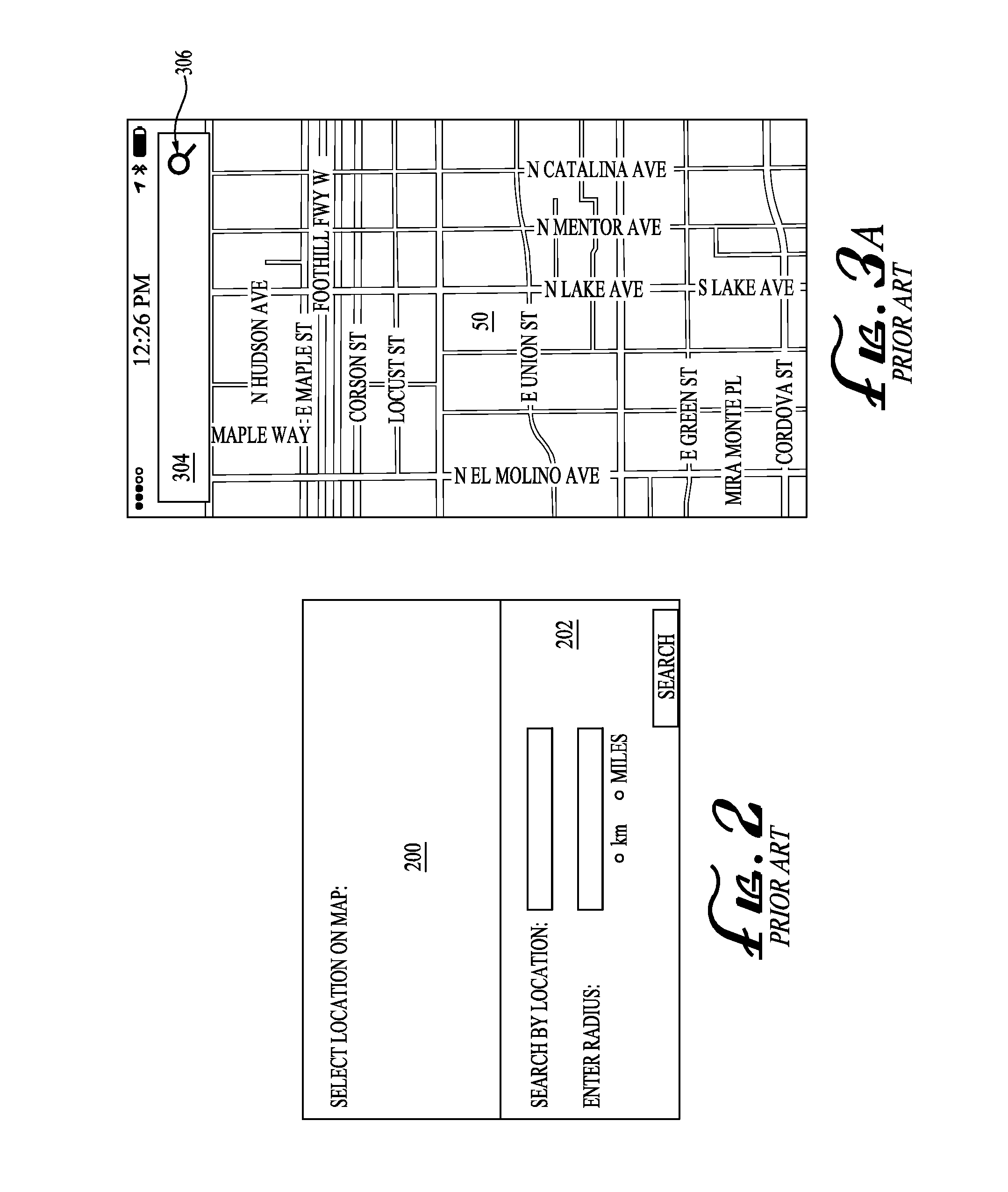
Manual GPS location inputs, or manually inputting a radius around a pinpoint on the map—two distinct steps—can be time-consuming and may deter prospective posting of map-related posts in social networks.
Complete publication processes can result in user fatigue, distraction, interruption, or any other reason that severs that completion to full publishing.
Requiring multiple steps increases the difficulty for a user to complete a multi-step process to obtain a desired search or post with simultaneous parameters of one or more keywords (e.g. “burger”), within a specified area or radius (e.g., “5 miles”), and social network (e.g., “Twitter”).

Method used


Image

  • Map-based remarks
  • Map-based remarks
  • Map-based remarks

Examples


Embodiment Construction

[0031]As used herein, the following terms are defined as follows:

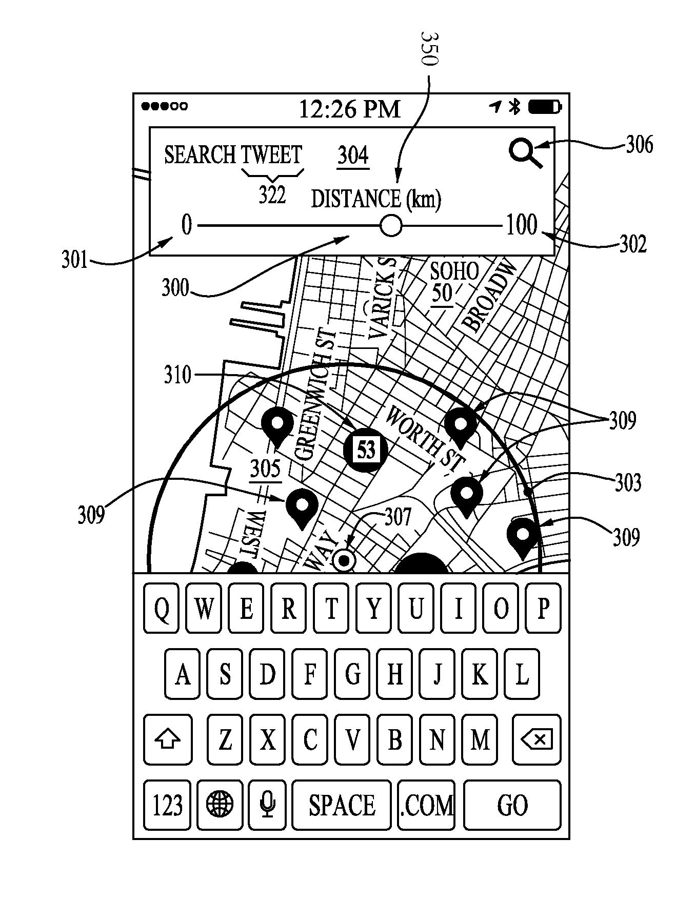
[0032]The term “geopost” can refer to posting of information or metadata, including but not limited to any of the following: location, area, region, map, coordinates, position, or any combination thereof, relative or absolute, now known or future developed.

[0033]The term “geosearch” can refer to searching of information or metadata, including but not limited to any of the following: location, area, region, map, coordinates, position, or any combination thereof, relative or absolute, now known or future developed.

[0034]The term “geotag” can refer to the inclusion of geographical information along with any other information or metadata, including but not limited to any of the following: location, area, region, map, coordinates, position, or any combination thereof, relative or absolute, now known or future developed.

[0035]The term “select-and-drag” can refer to touch-and-drag on a touchscreen, click-and-drag on a mouse o...


PUM


Abstract

A method for sharing a geopost includes controlling a shared map image post via a sharing application, capable of sharing a post on a social network, wherein the sharing application comprises a map with a GPS location capable of being authenticated by at least two authentication inputs, providing a prebuilt application protocol which sends the at least two authentication inputs to the third party social network, authorizing a third party social network with a posting permission, where the posting is both shared and sharable, and the sharing application is stored on a non-transitory computer-readable medium, superimposing a semitransparent circle on a map in the user interface, around the GPS location, providing a search input filed and a search function, and providing a hidden posting function capable of publishing to the third party social network only upon touching a portion of the map via the user interface in the mobile software application.

Description

CROSS-REFERENCE TO RELATED APPLICATIONS[0001]This application is a non-provisional of provisional app. Ser. No. 61 / 994,591 to Feldman filed on May 16, 2014 in the U.S. Patent & Trademark Office.BACKGROUND OF THE INVENTION[0002]1. Field of Invention[0003]The present invention relates to maps and publishing tools, including the creation and sharing of geographically associated remarks to third party systems.[0004]2. Description of the Related Art[0005]The scope of the related art concerns simple social media sharing which is significantly limited by the number of characters and therefore the complexity of a given posting. Some social networks systems such as Twitter limit characters to 140 characters and a single image. Other social networks, such as Instagram.com, permit filters of pre-created works, though not geared toward maps. However, such social networks generally do not provide substantial visual editing interfaces to significantly modify a map image, let alone how a map is ta...

Claims


Application Information

Patent Timeline
IPC IPC(8): H04L12/58G06F3/0481G06F3/0484
CPCH04L51/32G06Q50/01G06F3/04817G06F3/04842G06F3/0481G06F3/0484G06F3/0488H04L51/222H04L51/52
Inventor FELDMAN, DOUGLAS E.
Owner FELDMAN DOUGLAS E
Learn More