
Accurate curvature estimation algorithm for path planning of autonomous driving vehicle

a technology of autonomous driving and estimation algorithm, which is applied in the direction of navigation instruments, instruments, transportation and packaging, etc., can solve the problems of generating curve errors, affecting vehicle stability, and affecting the harshness of lane chang

Inactive Publication Date: 2016-01-21
GM GLOBAL TECH OPERATIONS LLC
View PDF0 Cites 31 Cited by
  • Summary
  • Abstract
  • Description
  • Claims
  • Application Information

AI Technical Summary

Benefits of technology

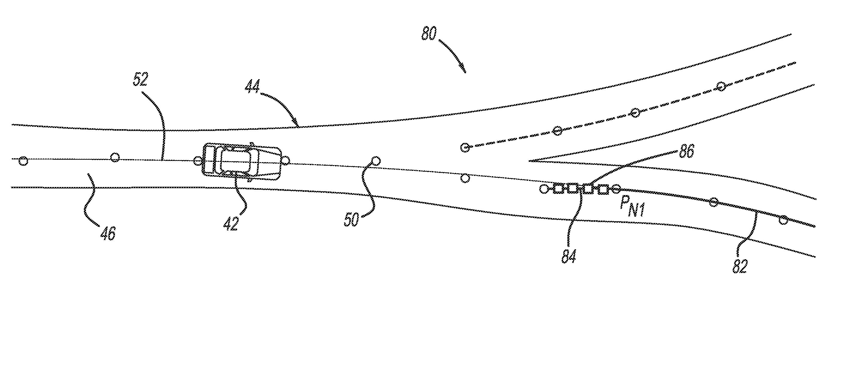
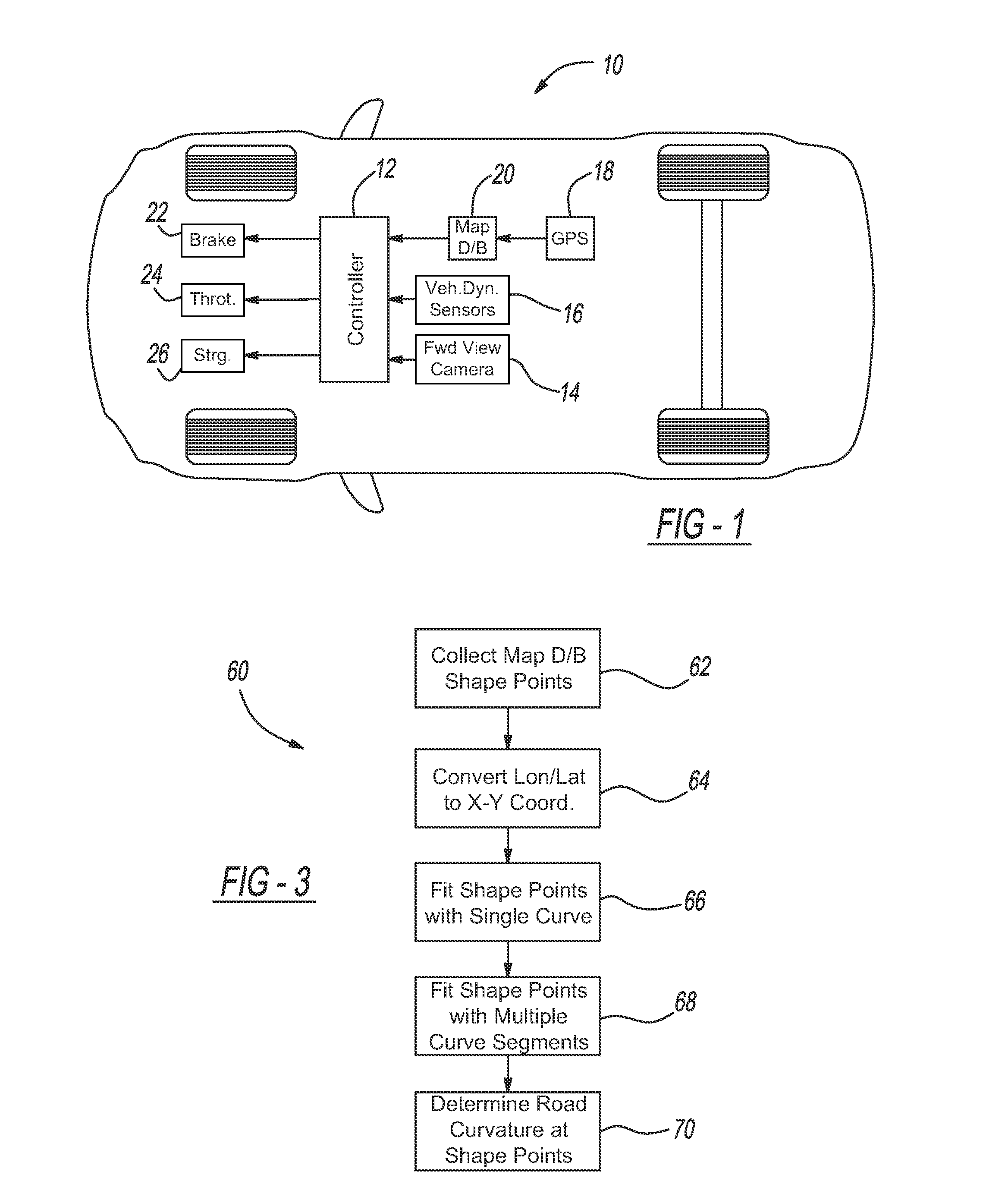
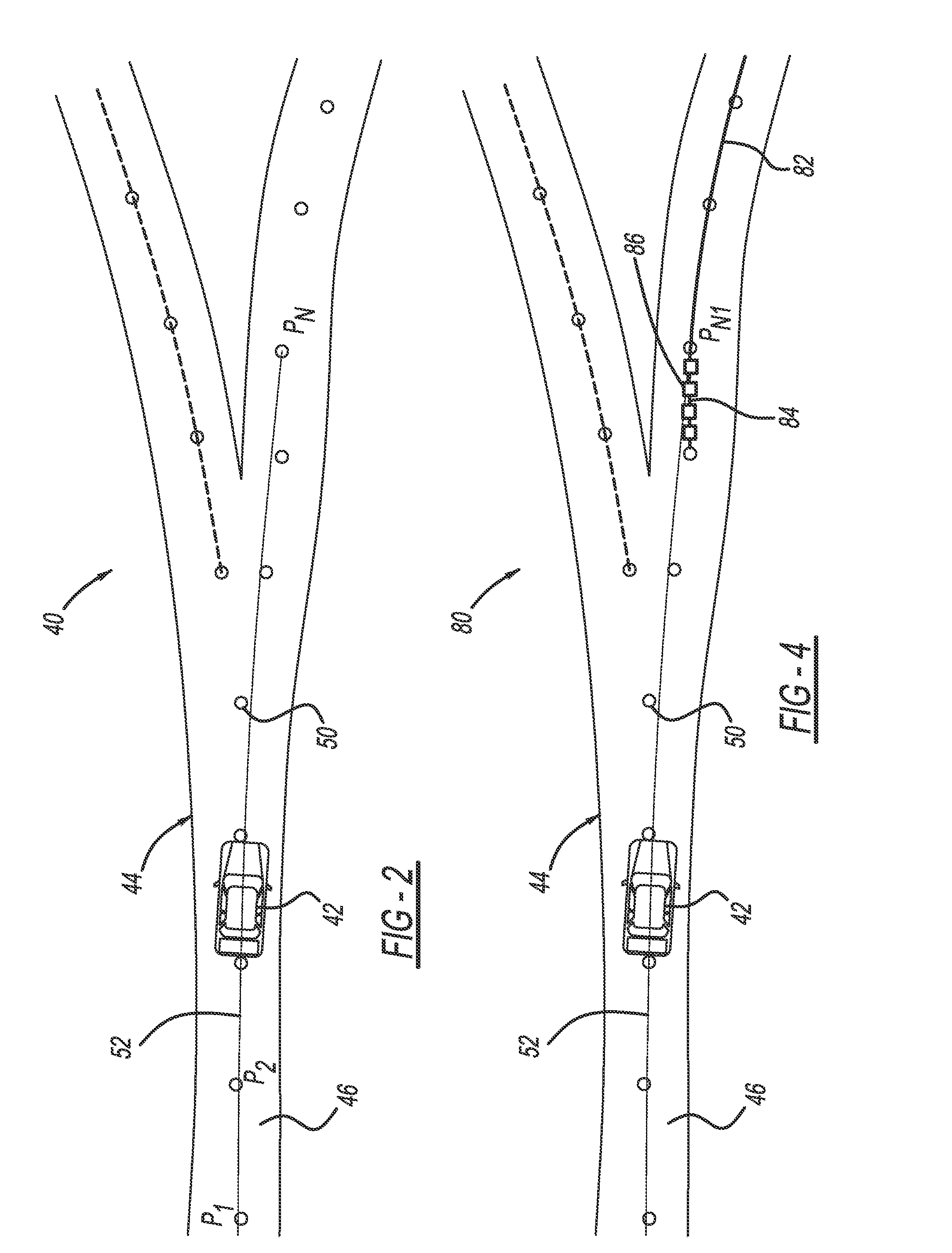
The present invention is about a system and method for identifying curved roads in a vehicle system using map database. It uses shape points from the map database to determine the roadway curvature at any location. The method first determines a range of interest and collects shape points from the map database from the current position of the vehicle to the end of the range of interest that define the location of the roadway. The shape points are then converted to UTM coordinates and fitted into a single polynomial equation to define the curve using the converted shape points. If the single polynomial equation exceeds a predetermined curvedness threshold, multiple sets of polynomial equations are fitted to multiple contiguous roadway segments over the range of interest. The roadway curvature at any location is then determined using the solutions to the multiple polynomial equations. The invention provides an accurate and efficient way to identify curved roads for vehicle navigation systems.

Problems solved by technology

Some vehicle systems intervene if the driver makes harsh steering changes that may affect vehicle stability.
However, as a result of sensor and actuator latency, measured vehicle states may be different from actual vehicle states.
This difference may cause improper path generation, which will affect lane changing harshness.
However, because there are errors in the survey of the roadway, the map database shape points may not be exactly at the center of the roadway and may be somewhat off the roadway, which creates errors in the curve that is generated by the shape points.
Because the shape point locations have errors, the curvature of the line between the shape points may not accurately identify the proper radius of curvature of the road at any particular location.
Because the outliers in the shape points in the map database are significant enough to cause the radius of curvature of the road to be significantly inaccurate, known techniques for identifying roadway curvature using map database shape points cannot be reliably employed.

Method used


Image

  • Accurate curvature estimation algorithm for path planning of autonomous driving vehicle
  • Accurate curvature estimation algorithm for path planning of autonomous driving vehicle
  • Accurate curvature estimation algorithm for path planning of autonomous driving vehicle

Examples


Embodiment Construction

[0016]The following discussion of the embodiments of the invention directed to a system and method for determining roadway curvature using map database shape points is merely exemplary in nature, and is in no way intended to limit the invention or its applications or uses. For example, as discussed herein, the system and method of the invention have particular application for a semi-autonomous or autonomously driven vehicle. However, as will be appreciated by those skilled in the art, the invention may have non-automotive applications.

[0017]FIG. 1 is an illustration of a vehicle 10 including a controller 12 that performs all of the necessary processes, calculations, algorithms, etc. discussed herein to provide path prediction, generation and control of the vehicle 10 driven in a semi-autonomous or autonomous manner, where the controller 12 can be any number of independent or combined processors, electronic control units (ECUs), devices, etc. The controller 12 receives signals from o...


PUM


Abstract

A method for identifying roadway curvature that includes determining a range of interest and collecting shape points from a map database from a current position of the vehicle to an end of the range of interest that define the location of the roadway. The method converts the shape points from World Geodetic System 84 (WGS84) coordinates to UTM coordinates, and then fits a single set of polynomial equations to define a curve using the converted shape points. The method determines whether the single set of polynomial equations exceeds a predetermined curvature accuracy threshold, and if so, fits multiple sets of polynomial equations to multiple roadway segments over the range of interest using the converted shape points. The method then determines the roadway curvature at any roadway location using solutions to the multiple sets of polynomial equations.

Description

BACKGROUND OF THE INVENTION[0001]1. Field of the Invention[0002]This invention relates generally to a system and method for identifying the curvature of a roadway using map database shape points and, more particularly, to a system and method for identifying roadway curvature in a semi-autonomous or autonomously driven vehicle using map database shape points and a multi-point polynomial curve fitting algorithm.[0003]2. Discussion of the Related Art[0004]The operation of modern vehicles is becoming more autonomous, i.e., vehicles are able to provide driving control with less and less driver intervention. Cruise control systems have been on vehicles for a number of years where the vehicle operator can set a particular speed of the vehicle, and the vehicle will maintain at that speed without the driver operating the throttle. Adaptive cruise control systems have been recently developed in the art where not only does the system maintain the set speed, but also will automatically slow the...

Claims


Application Information

Patent Timeline
IPC IPC(8): G01C21/34B60W30/12B60W30/14B60W40/072
CPCG01C21/34B60W30/12B60W30/14B60W2550/146B60W2550/143B60W2750/30B60W30/10B60W40/072G01C21/26B60W2556/50B60W2420/403B60W2552/20B60W2552/30B60W2754/10B60W60/001
Inventor LEE, JIN-WOO
Owner GM GLOBAL TECH OPERATIONS LLC
Learn More