
Rule based completion of maps with partial data
a technology of partial data and completion rules, applied in the direction of navigation instruments, instruments, image enhancement, etc., can solve the problems of crowdsourcing suffering from potential coverage problems, difficult problems in creating indoor places maps, and lots of manual effor
- Summary
- Abstract
- Description
- Claims
- Application Information
AI Technical Summary
Benefits of technology
Problems solved by technology
Method used
Image

Examples
Embodiment Construction
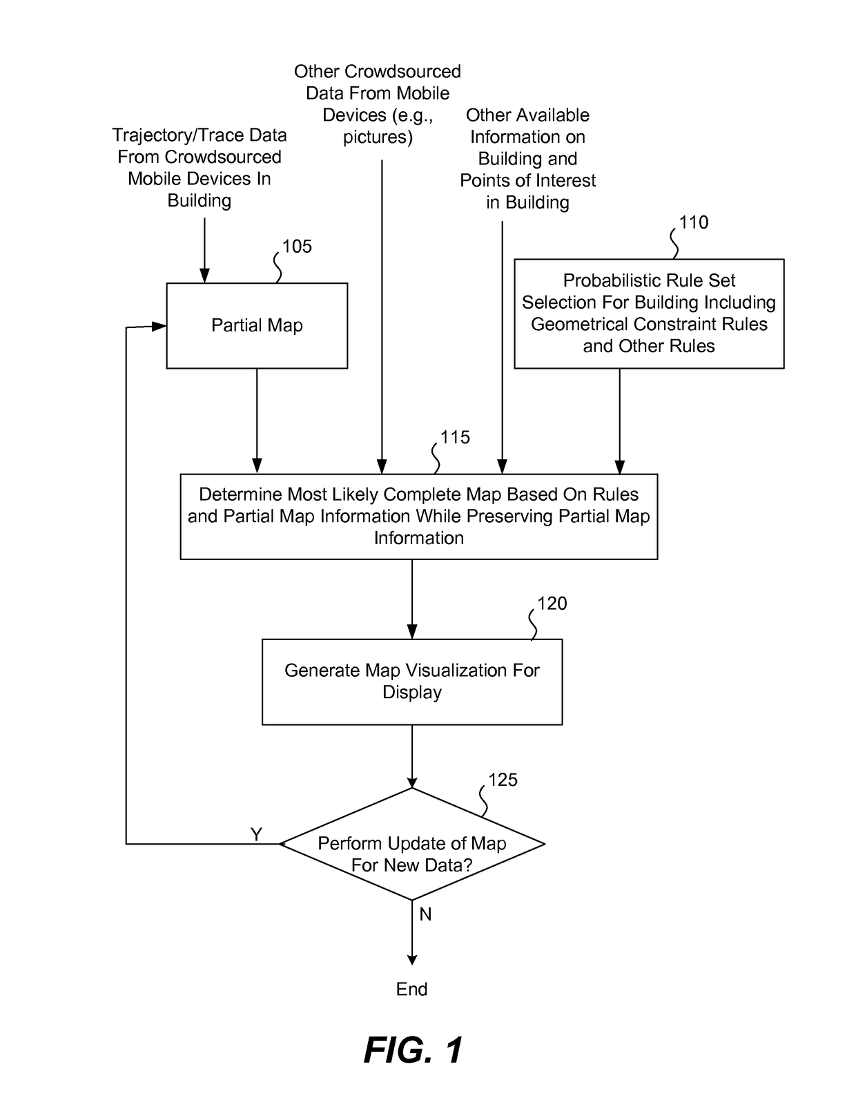
[0019]FIG. 1 is a flow chart illustrating an embodiment of a computer implemented method of using a set of rules to complete a partially completed map of a building in a region of interest. In one embodiment, a partial map 105 is obtained of a layout of an arrangement of areas, such as a layout of the interior of a building. However, more generally, the partial map may include at least some exterior spaces.
[0020]In one embodiment, the partial map 105 is generated or otherwise provided based on trajectory (e.g., trace) data crowd sourced from one or more mobile devices and corresponds to regions traversed by mobile device users. As examples, the trajectory data may be based on sensor data from sensors disposed on individual mobile devices. For example, individual mobile devices may include sensors, such as accelerometers, to determine position based on user movement. Additionally, individual mobile devices may include position sensors to determine position based on global positioning...
PUM
 Abstract
Description
Claims
Application Information