Drone-mounted imaging hyperspectral geometric correction method and system

a geometric correction and hyperspectral technology, applied in the field of image processing technology, can solve the problems of obvious geometric distortion of imaging spectral data, high cost, and low stability of the loaded platform of the drone,

Active Publication Date: 2017-07-13
BEIJING RES CENT FOR INFORMATION TECH & AGRI
View PDF0 Cites 11 Cited by
  • Summary
  • Abstract
  • Description
  • Claims
  • Application Information

AI Technical Summary

Benefits of technology

[0037]By adopting the drone-mounted imaging hyperspectral geometric correction method and system disclosed by the present invention, the high-precision POS information calculated from drone area array digital imaging data is used to perform

Problems solved by technology

However, a satellite remote sensing platform is limited by an orbit, so its over-the-top time is fixed every day, and emergency observation cannot be implemented thereby; and acquisition of image data through piloted aerial remote sensing leads to a high cost and is greatly affected by weather conditions.
A loaded platform of a drone is low in stability and greatly influenced by the airflow speed, and most imaging hyper-spectrometers adopt a linear array sensor push-broom imaging mode, and the linear array spectral position and attitude change all the time during imaging, causing obvious geometr

Method used


Image

  • Drone-mounted imaging hyperspectral geometric correction method and system
  • Drone-mounted imaging hyperspectral geometric correction method and system
  • Drone-mounted imaging hyperspectral geometric correction method and system

Examples


embodiment i

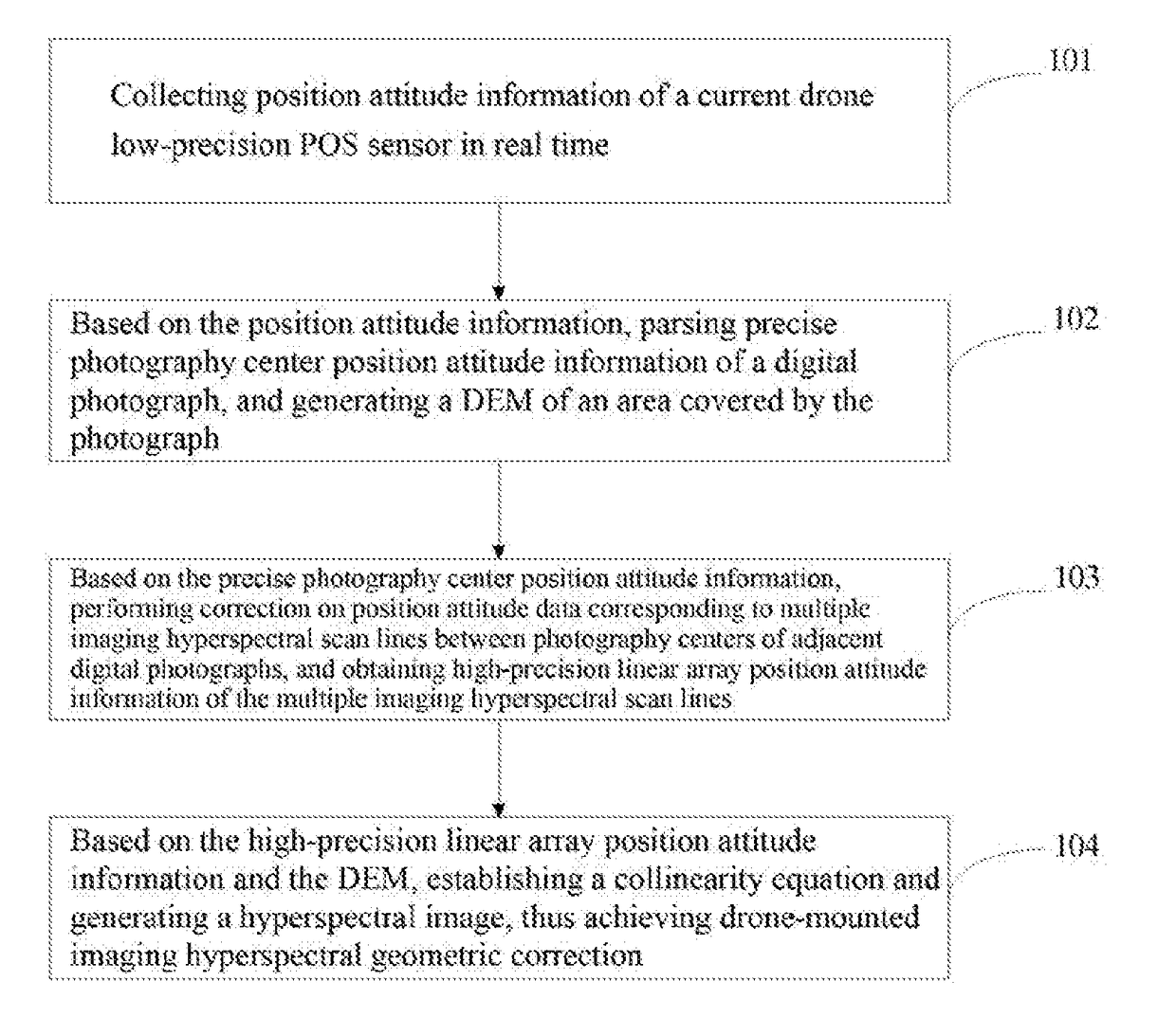
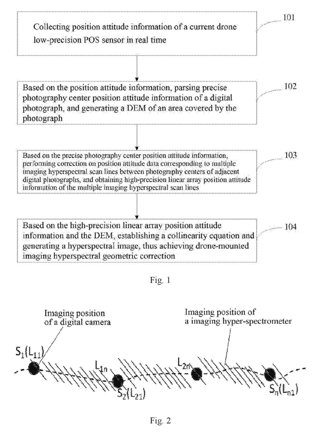
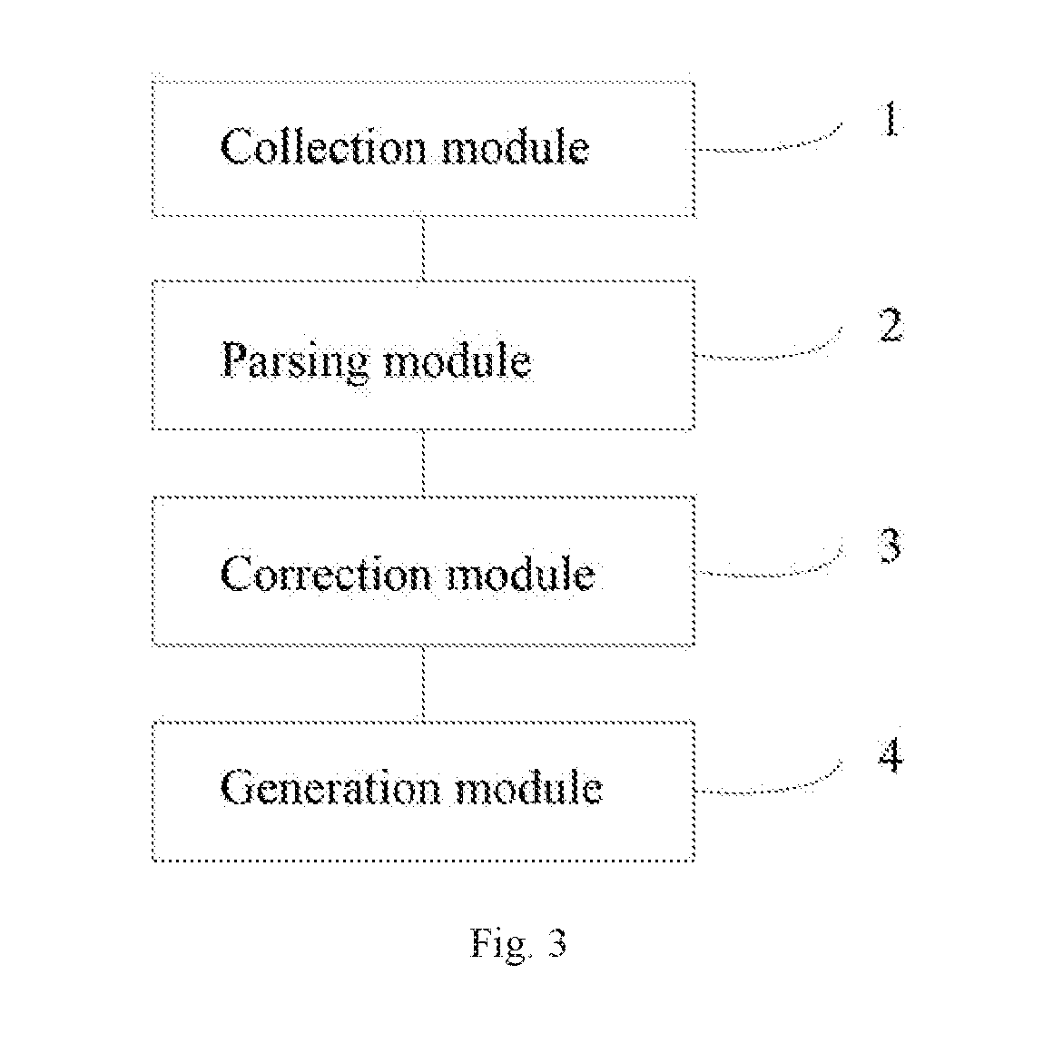
[0044 of the present invention provides a drone-mounted imaging hyperspectral geometric correction method, as shown in FIG. 1, including the following steps:

[0045]step 101, collecting position attitude information of a current drone low-precision POS sensor in real time;

[0046]step 102, based on the position attitude information, parsing precise photography center position attitude information of a digital photograph, and generating a DEM of an area covered by the photograph;

[0047]step 103, based on the precise photography center position attitude information, performing correction on position attitude data corresponding to multiple imaging hyperspectral scan lines between photography centers of adjacent digital photographs, and obtaining high-precision linear array position attitude information of the multiple imaging hyperspectral scan lines; and

[0048]step 104, based on the high-precision linear array position attitude information and the DEM, establishing a collinearity equation a...


PUM


Abstract

Related are a drone-mounted imaging hyperspectral geometric correction method and a system, comprising: collecting position attitude information of a current drone low-precision POS sensor in real time; based on the position attitude information, parsing precise photography center position attitude information of a digital photograph, and generating a DEM of an area covered by the photograph; based on the precise photography center position attitude information, performing correction on position attitude data corresponding to multiple imaging hyperspectral scan lines between photography centers of adjacent digital photographs, and obtaining high-precision linear array position attitude information of the multiple imaging hyperspectral scan lines; based on the high-precision linear array position attitude information and the DEM, establishing a collinearity equation and generating a hyperspectral image.

Description

FIELD OF THE INVENTION[0001]The present invention relates to the field of image processing technology, and particularly relates to a drone-mounted imaging hyperspectral geometric correction method and system.BACKGROUND OF THE INVENTION[0002]A POS (Position and. Orientation System) sensor is used for acquiring position and attitude information.[0003]A DEM (Digital Elevation Model) is a virtual representation of typography, and can be obtained by means of photogrammetry based on aerial or satellite images. As basic data for orthorectification of digital images, a DEM is a necessary condition for establishing a collinearity equation in photogrammetry.[0004]In recent years, imaging hyper-spectrometer remote sensing technology, with the characteristics of images and spectrum integration, high spatial and spectral resolution and the like, has promoted agricultural remote sensing quantitative development, and has a great potential of applications. However, a satellite remote sensing platfo...

Claims


Application Information

Patent Timeline
IPC IPC(8): G06T5/00H04N5/232G06T7/50
CPCG06T5/006G06T2207/10036H04N5/23222G06T7/50H04N23/81H04N23/64
Inventor YANG, GUIJUNZHAO, CHUNJIANGYU, HAIYANGYANG, XIAODONGXU, XINGANGGU, XIAOHEFENG, HAIKUANYANG, HAOYAN, HUA
Owner BEIJING RES CENT FOR INFORMATION TECH & AGRI
Why Eureka
Try Eureka