

Systems and Methods for Using Real-Time Imagery in Navigation
a real-time imagery and navigation technology, applied in the direction of navigation instruments, instruments, surveying and navigation, etc., can solve the problems of poor street signs, difficulty in accurately judging distance, and difficulty in driving to see street signs, so as to improve the subsequent reference to visual landmarks
- Summary
- Abstract
- Description
- Claims
- Application Information
AI Technical Summary
Benefits of technology
Problems solved by technology
Method used
Image

Examples
Embodiment Construction
Overview
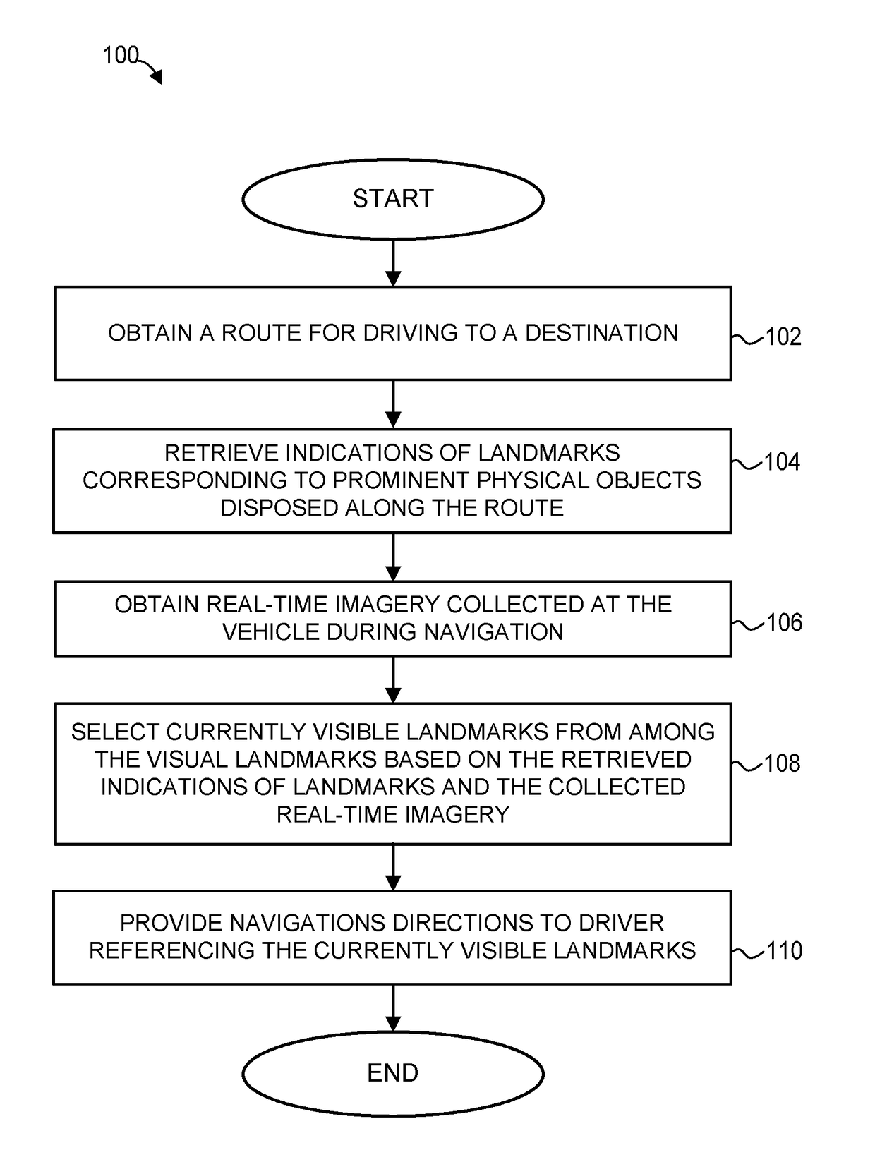
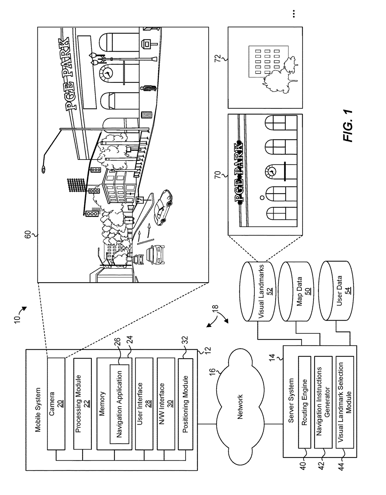
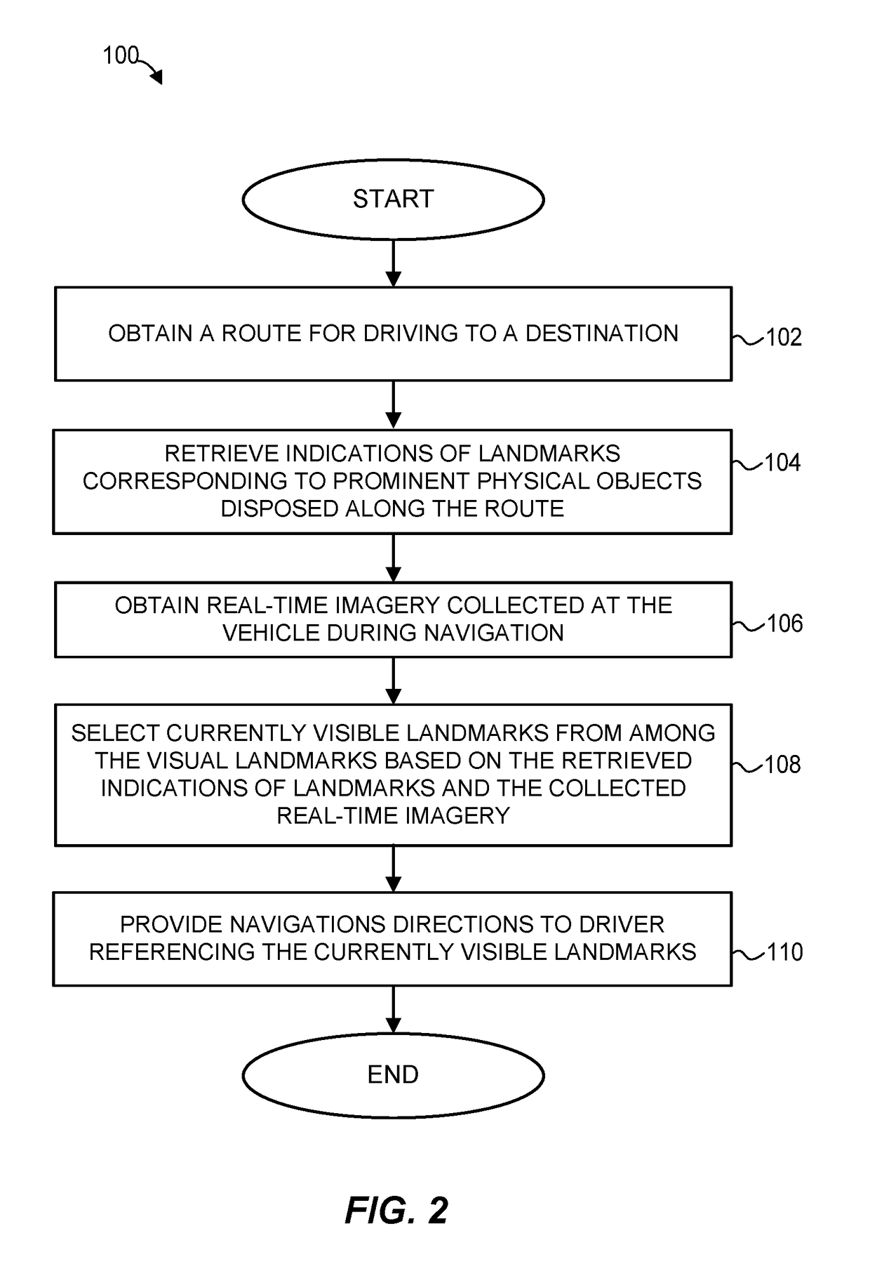
[0018]To better guide a driver along a navigation route, a system collects real-time imagery from approximately the user's vantage point (e.g., using a dashboard camera, a camera built into the vehicle, the user's smartphone mounted on the dashboard), retrieves a set of visual landmarks for the user's current position along the navigation route, and uses the real-time imagery to determine which of the retrieved visual landmarks should be used to augment step-by-step navigation directions for the navigation route, according to one implementation. In this manner, the system omits visual landmarks that are occluded by trees or vehicles, obscured due to current lighting conditions, or poorly visible from the user's current vantage for some other reason.
[0019]In addition to selecting salient visual landmarks from among pre-stored static landmarks, the system can identify dynamic visual landmarks, such as changing electronic billboards or trucks with machine-readable text. When ca...
PUM
 Abstract
Description
Claims
Application Information