Method and device for judging intercity transportation mode based on mobile phone data

a technology of intercity transportation and mobile phone data, applied in the field of communication technology/computer technology, can solve the problems of consuming a lot of manpower and material resources, difficult to obtain complete transportation statistics, and difficult to aggregate for analysis, and achieves low data acquisition cost, wide spatial coverage, and long time span.

Active Publication Date: 2019-06-13
SHANGONG PROVINCIAL COMM PLANNING & DESIGN INST GRP CO LTD +1
View PDF5 Cites 9 Cited by
  • Summary
  • Abstract
  • Description
  • Claims
  • Application Information

AI Technical Summary

Benefits of technology

[0035]It can be seen from the above technical solutions that, due to the use of the mobile phone big data proposed by the present invention, the mobile phone signaling data collected and provided by the operator are used, so that the data acquisition cost is low. The mobile phone signaling data covers almost all intercity travelers, so the user coverage is high, and the intercity traffic data finally output after calculation is more trustworthy. The trajectory corresponding to the mobile phone signaling data is continuous and has a long time span and wide spatial coverage, therefore, in addition to studying the current transportation modes of people, it can also be used for studying the changes of the transportation modes of people. By adoption of the method herein, the identification of five intercity transportation modes is accomplished by feature extraction and classification under the assistance of matching key locations, and compared with the prior art, the calculation difficulty is small, and the calculation amount is small.

Problems solved by technology

For a planning and design department, it is very difficult to obtain complete transportation statistics, and the data formats and statistical specifications of different modes of transportation are inconsistent and are difficult to aggregate for analysis.
The traditional transportation mode survey adopts manual roadside inquiry, sample survey and other manners, which consume a lot of manpower and material resources, and has problems such as limited survey scope and time, low sampling rate and low data processing efficiency.
Although mobile phone GPS data has high positioning accuracy, it is difficult to obtain when users turn off GPS; the road network matching needs detailed road information, which is often difficult to obtain or is obtained incompletely, and requires a large amount of data processing and complex calculation.

Method used


Image

  • Method and device for judging intercity transportation mode based on mobile phone data
  • Method and device for judging intercity transportation mode based on mobile phone data
  • Method and device for judging intercity transportation mode based on mobile phone data

Examples


Embodiment Construction

[0042]The present invention will be described below in combination with exemplary embodiments.

[0043]The present invention provides a method of judging an intercity transportation mode based on mobile phone data, including:

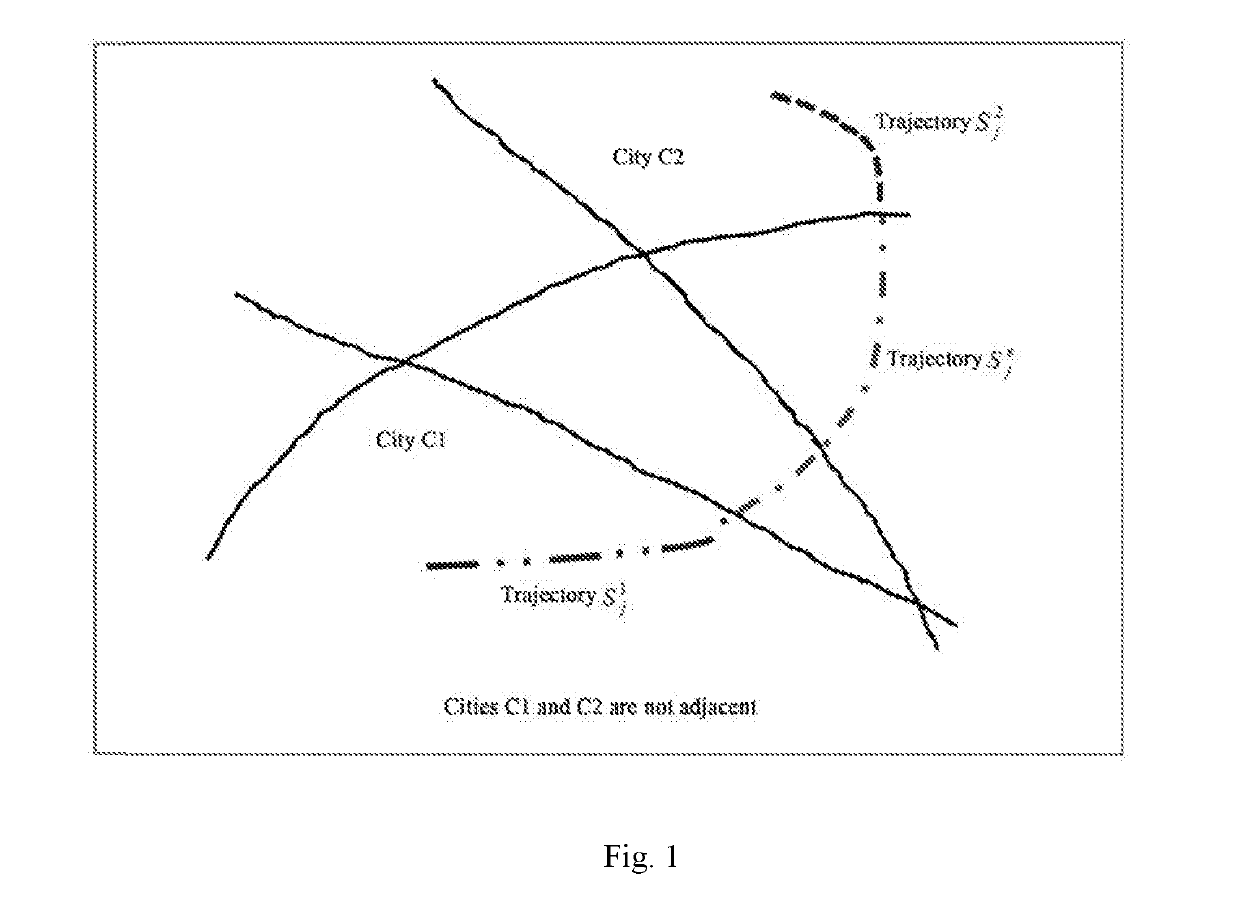
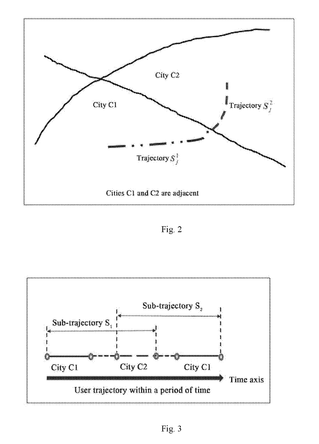
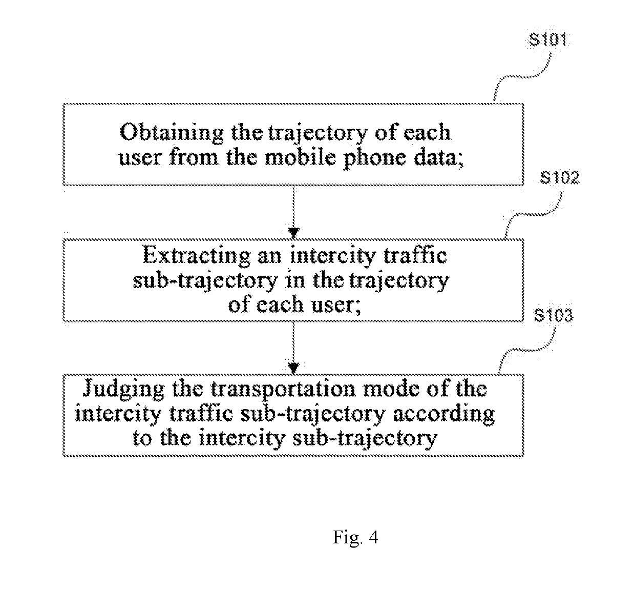
[0044]S101 obtaining trajectory of each user from the mobile phone data; S102 extracting an intercity traffic sub-trajectory in the trajectory of each user; and S103 judging the transportation mode of the intercity traffic sub-trajectory.

[0045]The trajectory data of the user means that when the user uses the phone card, a base station records the location of a phone card to generate the trajectory data. The users are distinguished according to the phone cards used by the users, and different phone numbers correspond to different trajectory data in the base station, that is, the space-time location of the mobile phone signaling data (user ID|connected timestamp| connected base station) is extracted, and continuous space-time location records form the trajectory of t...


PUM


Abstract

A method and device for judging intercity transportation modes based on mobile phone data solves the problems of difficult data acquisition and low data processing efficiency in the existing solutions. The method includes: obtaining the trajectory of each user from the mobile phone data; extracting an intercity traffic sub-trajectory in the trajectory of each user; and judging the transportation mode of the intercity traffic sub-trajectory. The solution has the advantages of easy data acquisition, high data processing efficiency and capability of achieving long-term monitoring.

Description

FIELD OF THE INVENTION[0001]The present invention relates to communication technology / computer technology, and in particular to a method and device for judging an intercity transportation mode based on mobile phone data.BACKGROUND OF THE INVENTION[0002]Traffic survey is the basic work for traffic planning and the feasibility study of highways, railways, aviation and other construction projects, and is mainly to fully understand public travel characteristics in the area where the project is located, grasp the traffic volumes, origins and destinations, the model split and other data, and provide basic data for the prediction of the traffic volume or throughput so as to provide reference for the subsequent project construction and evaluation. In a comprehensive transportation system of China, various modes of transportation are managed by different departments. For a planning and design department, it is very difficult to obtain complete transportation statistics, and the data formats ...

Claims


Application Information

Patent Timeline
Patent Type & Authority Applications(United States)
IPC IPC(8): H04W4/02H04W64/00H04M1/72457
CPCH04W4/027H04W64/006H04M1/72457H04W4/029
Inventor LI, YONGLIU, WEITU, ZHENWU, WEILINGSU, LIJIN, DEPENGMU, TAOWEI, QIYUNHAN, GUOHUAMA, CHUANYIZHOU, PENGFEIWANG, KAI
Owner SHANGONG PROVINCIAL COMM PLANNING & DESIGN INST GRP CO LTD
Why Eureka
Try Eureka