
Vehicle platoon system control for intersections

a technology of vehicle platoons and intersections, applied in the direction of vehicle position/course/altitude control, process and machine control, instruments, etc., can solve the problems of reducing fuel efficiency in conventional driving, driving through highway or arterial roads with signalized intersections, and intersections to be crowded,

Active Publication Date: 2019-08-15
HERE GLOBAL BV
View PDF1 Cites 30 Cited by
  • Summary
  • Abstract
  • Description
  • Claims
  • Application Information

AI Technical Summary

Benefits of technology

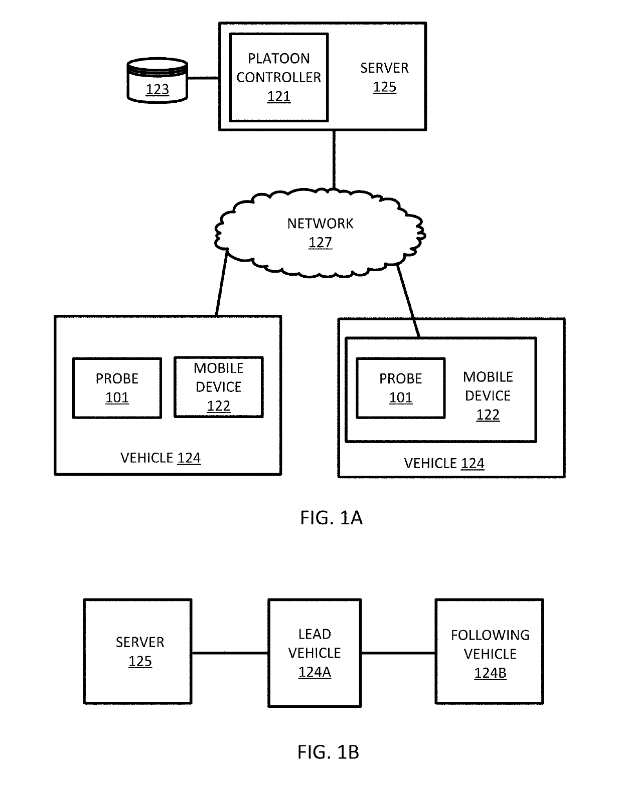
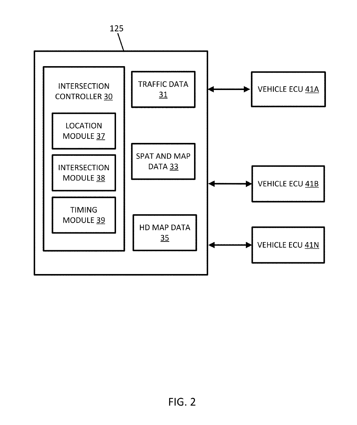
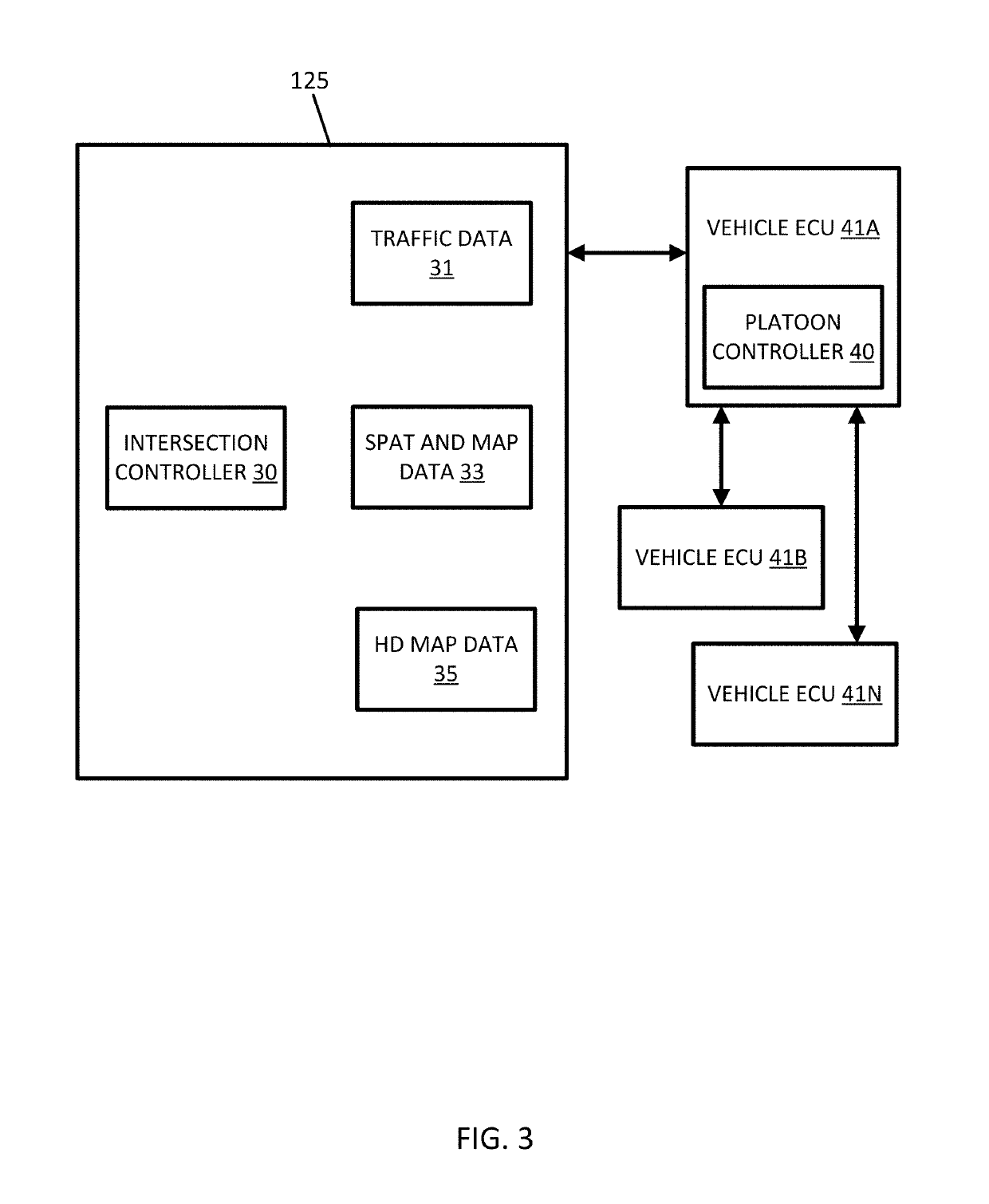
The patent describes a system and method for controlling a platoon of vehicles through an intersection. The system receives location data from the first vehicle in the platoon and matches it to a road network to identify the intersection. It calculates the distance between the second vehicle and the intersection and the time it takes to reach the intersection based on the distance. The system compares the time with the time needed for the first vehicle to pass through the intersection and generates a command based on the comparison. This system helps to optimize the passage of a platoon of vehicles through an intersection, ensuring that they can pass without interruption.

Problems solved by technology

Maintaining the cohesion of the platoon improves the fuel consumption because vehicles are maintained at a nearly constant speed by reducing fluctuations in acceleration and deceleration, which decrease fuel efficiency in conventional driving.
For vehicle platoons, driving through highway or arterial roads with signalized intersection, stop signs, entrance or exit ramps are facing technical challenges.
In the signalized intersection case, the lead vehicle might drive through such intersections including a left turn, a right turn, or driving straight without leaving enough time for the following vehicles in the platoon to drive through, which may cause the intersection to be congested.
For highway ramp entrances and exits, a ramp entrance and exit may be congested, and as a result, the vehicle platoon system could not fit on the ramp or otherwise cannot drive onto the ramp without causing even more road congestion.
In a highway ramp, only a low degree of accuracy may be required to estimate the traffic back up on the ramp.
In addition, congestion on the minor road may easily back up to the major road.
Additionally, the illustrations are merely representational and may not be drawn to scale.

Method used


Image

  • Vehicle platoon system control for intersections
  • Vehicle platoon system control for intersections
  • Vehicle platoon system control for intersections

Examples


embodiment 1

[0146]A method for controlling a platoon of vehicles through an intersection, the method comprising:

[0147]receiving location data for at least a first vehicle of the platoon of vehicles;

[0148]map matching the location data for the first vehicle to a road network;

[0149]identifying an intersection in the road network in response to the matched location data;

[0150]determining a time period for the intersection;

[0151]calculating, by a processor, a distance to the intersection for a second vehicle of the platoon of vehicles;

[0152]calculating, by the processor, a travel time based on the distance to the intersection for the second vehicle of the platoon of vehicles;

[0153]performing, by the processor, a comparison of the time period for the intersection to the travel time for the second vehicle; and[0154]generating, by the processor, a platoon command in response to the comparison.

embodiment 2

[0155]The method of embodiment 1, further comprising:

[0156]receiving signal phase data for the intersection, wherein the intersection is a signalized intersection and the time period is determined based on the signal phase data for the intersection.

embodiment 3

[0157]The method of any of embodiments 1 and 2, wherein the signal phase data includes a signal phase and timing (SPaT) message.


PUM


Abstract

A vehicle platoon control system performs techniques for controlling a platoon of vehicles through an intersection. The platoon of vehicles is controlled through receiving location data for at least a first vehicle of the platoon of vehicles, map matching the location data for the first vehicle to a road network, identifying an intersection in the road network in response to the matched location data, determining a time period for the intersection, calculating a distance to the intersection for a second vehicle of the platoon of vehicles, calculating a travel time based on the distance to the intersection for the second vehicle of the platoon of vehicles, performing a comparison of the time period for the intersection to the travel time for the second vehicle, and generating a platoon command in response to the comparison.

Description

FIELD[0001]The following disclosure relates to the control of vehicle platoons in relationships to one or more intersections.BACKGROUND[0002]The Global Positioning System (GPS) or another global navigation satellite system (GNSS) provides location information to a receiving device anywhere on Earth as long as the device has a substantial line of sight without significant obstruction to three or four satellites of the system. Highly automated driving (HAD) and autonomous driving technology utilize GNSS data to automate various driving tasks.[0003]HAD and autonomous driving technologies may be used in platooning in which vehicles are organized into groups or platoons on a roadway. The platoons may be groups of buses for public transportation, groups of trucks for shipping, or groups of passenger vehicles that are associated with each other. Challenges arise in platooning vehicles in HAD and autonomous driving technologies that may be improved with specialized algorithms for controllin...

Claims


Application Information

Patent Timeline
Patent Type & Authority Applications(United States)
IPC IPC(8): G05D1/02G08G1/0968G08G1/00
CPCG05D1/0293G05D1/0297G08G1/096822G08G1/22B60W2050/048G08G1/20G05D1/0223G08G1/096827G08G1/0112G08G1/0133G08G1/0145G08G1/096775G08G1/096741G08G1/096725G08G1/07
Inventor XU, JINGWEIBERNHARDT, BRUCE
Owner HERE GLOBAL BV
Learn More