
Method of processing a geospatial dataset

a geospatial dataset and dataset technology, applied in the direction of processing architecture/configuration, instruments, measurement devices, etc., can solve the problems of insufficient speed of interactive analysis, insufficient deployment, and inability to meet the needs of geospatial dataset load-balancing strategy,

Active Publication Date: 2019-09-19
SHELL USA INC
View PDF0 Cites 5 Cited by
  • Summary
  • Abstract
  • Description
  • Claims
  • Application Information

AI Technical Summary

Benefits of technology

The present invention is a method for processing a geospatial dataset. The method involves arranging a plurality of data objects in a way that there is no discrepancy between the data objects within a specific range. The method also involves using a distributed computer system with multiple computing units to process the data objects simultaneously. The technical effects of this invention include faster processing times and better data accuracy.

Problems solved by technology

Reading large datasets from disk-based storage is not fast enough for interactive analysis; therefore, the datasets have to be stored in random-access memory (RAM).
A single compute node may not have enough RAM to store the complete dataset and therefore, the dataset has to be loaded into distributed compute nodes.
Although there are some big data analytics platforms available in the market, they are not widely deployed in the petroleum industry since there is a big gap between these platforms and the special needs of the industry.
One of the shortcomings is that a suitable load-balancing strategy for geospatial datasets is lacking.

Method used


Image

  • Method of processing a geospatial dataset
  • Method of processing a geospatial dataset
  • Method of processing a geospatial dataset

Examples


Embodiment Construction

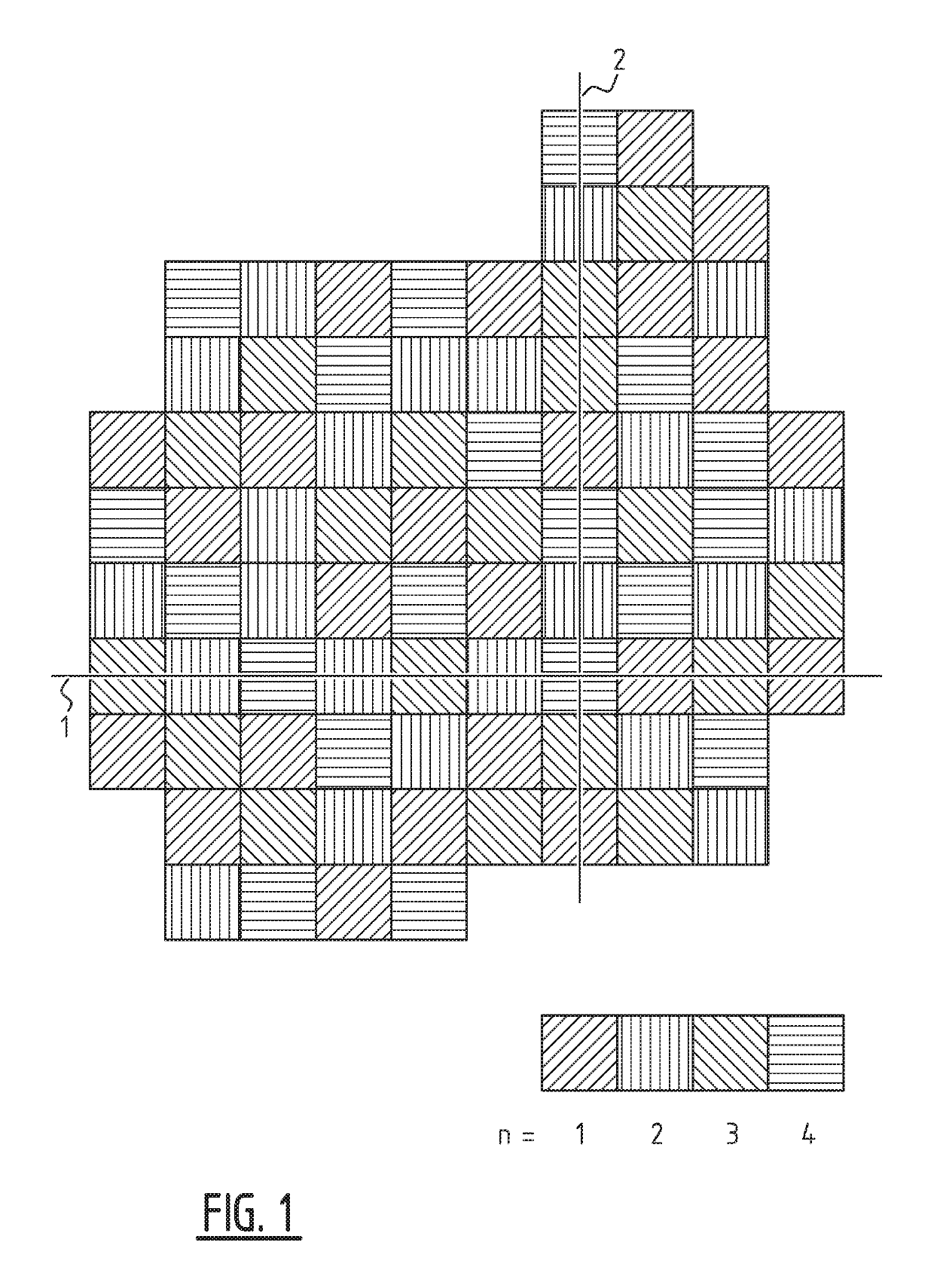
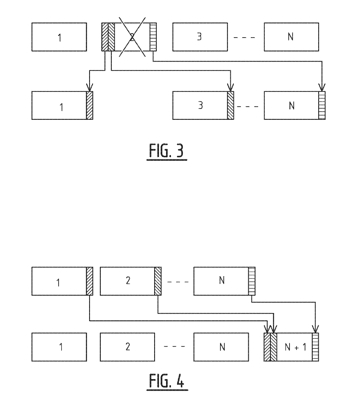
[0019]It has been found that the compute power of a single computing unit may not be sufficient for interactive analysis and thus the dataset may also be spread across multiple computing units to increase performance. The interactivity of the analysis is directly governed by the distribution of the dataset across such a distributed system. If the dataset is distributed such that the computation is equally balanced across all the computing units, then maximum performance can be obtained. This disclosure presents a novel way of distributing geospatial data across a set of compute computing units in a load-balanced way.

[0020]The term “computing unit” as used herein can be an actual (physical) computer node. However, it may also be interpreted as a distinct computer process whereby multiple of such processes may reside on a single computer node.

[0021]In the presently proposed method, the data objects of the geospatial data set are arranged in a low-discrepancy sequence spanning over a p...


PUM


Abstract

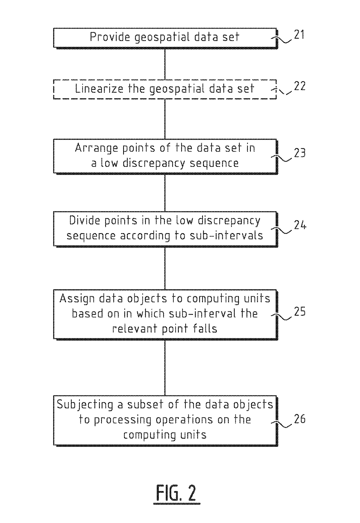
Data objects of a geospatial data set are arranged in a low-discrepancy sequence spanning over a pre-defined interval, and assigned to N computing units based on in which sub-interval within the pre-defined interval the point, to which the data object belongs, falls. A subset of the data objects that have been distributed over the N computing units is subjected to processing operations by computer readable instructions loaded on each of the N computing units.

Description

FIELD OF THE INVENTION[0001]The present invention relates to a method of processing a geospatial dataset. Examples of geospatial datasets include seismic survey datasets and electromagnetic survey datasets.BACKGROUND OF THE INVENTION[0002]Geospatial datasets are prevalent in the oil and gas exploration industry. Seismic surveys, optionally supplemented with electromagnetic surveys, are conducted for locating hydrocarbon reservoirs below the earth's surface both onshore and offshore. The costs of drilling a well for extraction are extremely high, and therefore making an accurate and a quick decision on the location and the volume of hydrocarbons is advantageous. These analyses typically refine and interpret geophysical imagery by enhancing the signal to noise ratio.[0003]Large geophysical datasets (which nowadays can be as large as multiple terabytes) are pervasive in the industry and in-memory computing is now being developed to handle such datasets. Reading large datasets from disk...

Claims


Application Information

Patent Timeline
IPC IPC(8): G01V99/00
CPCG01V99/00G01V1/50G01V3/38G01V1/28G06T1/20
Inventor NYBERG, TIMOTHY PAULAGGARWAL, VIBHOR
Owner SHELL USA INC
Learn More