
Computer-assisted aerial surveying and navigation

a technology of applied in the field of computer-aided aerial surveying and navigation, can solve the problems of aircraft deviating significantly from the planned flight path, challenging conventional aerial surveying, and prone to errors

Active Publication Date: 2019-11-07
ARKIDAN SYST INC
View PDF13 Cites 5 Cited by
  • Summary
  • Abstract
  • Description
  • Claims
  • Application Information

AI Technical Summary

Benefits of technology

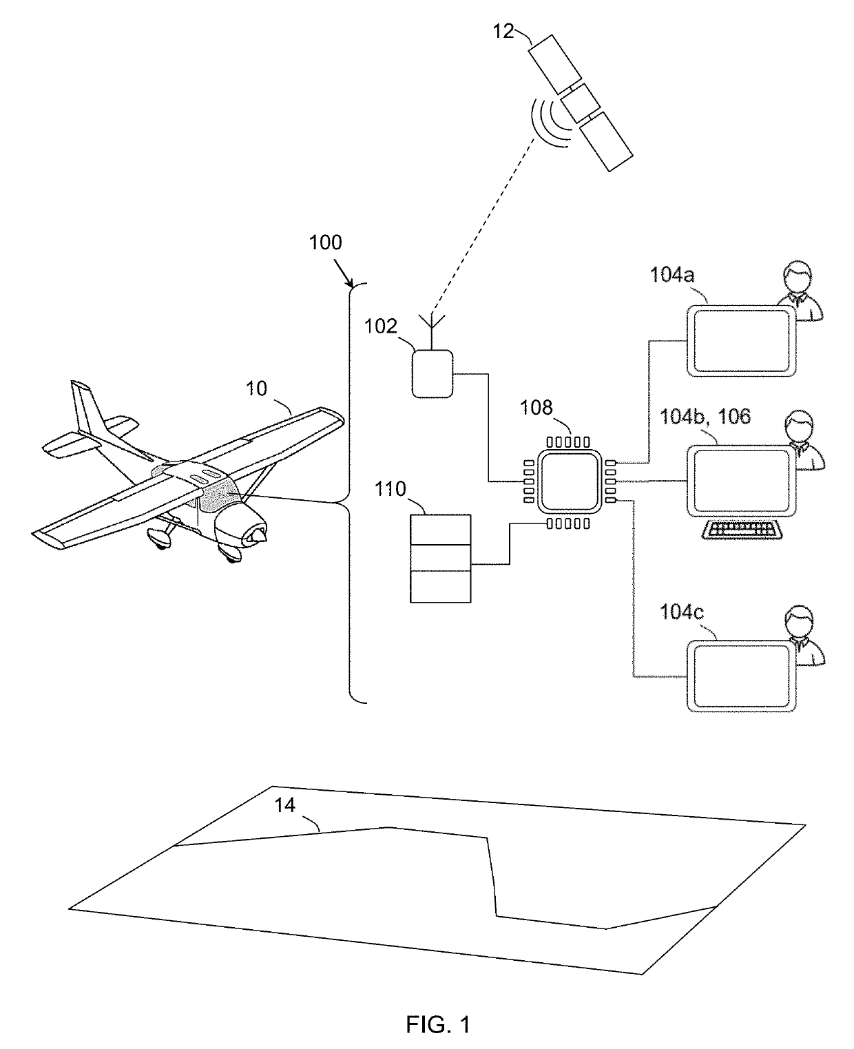
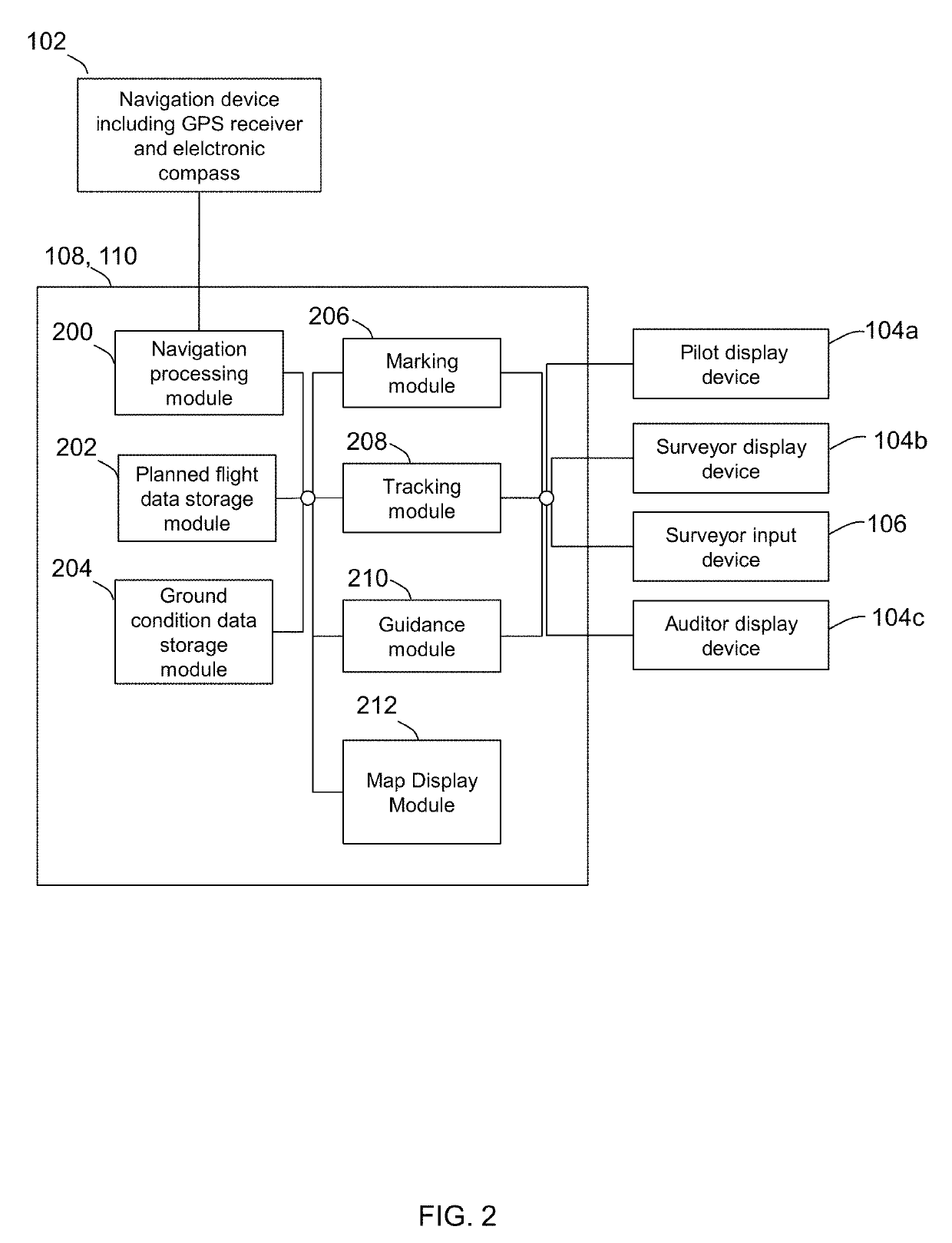
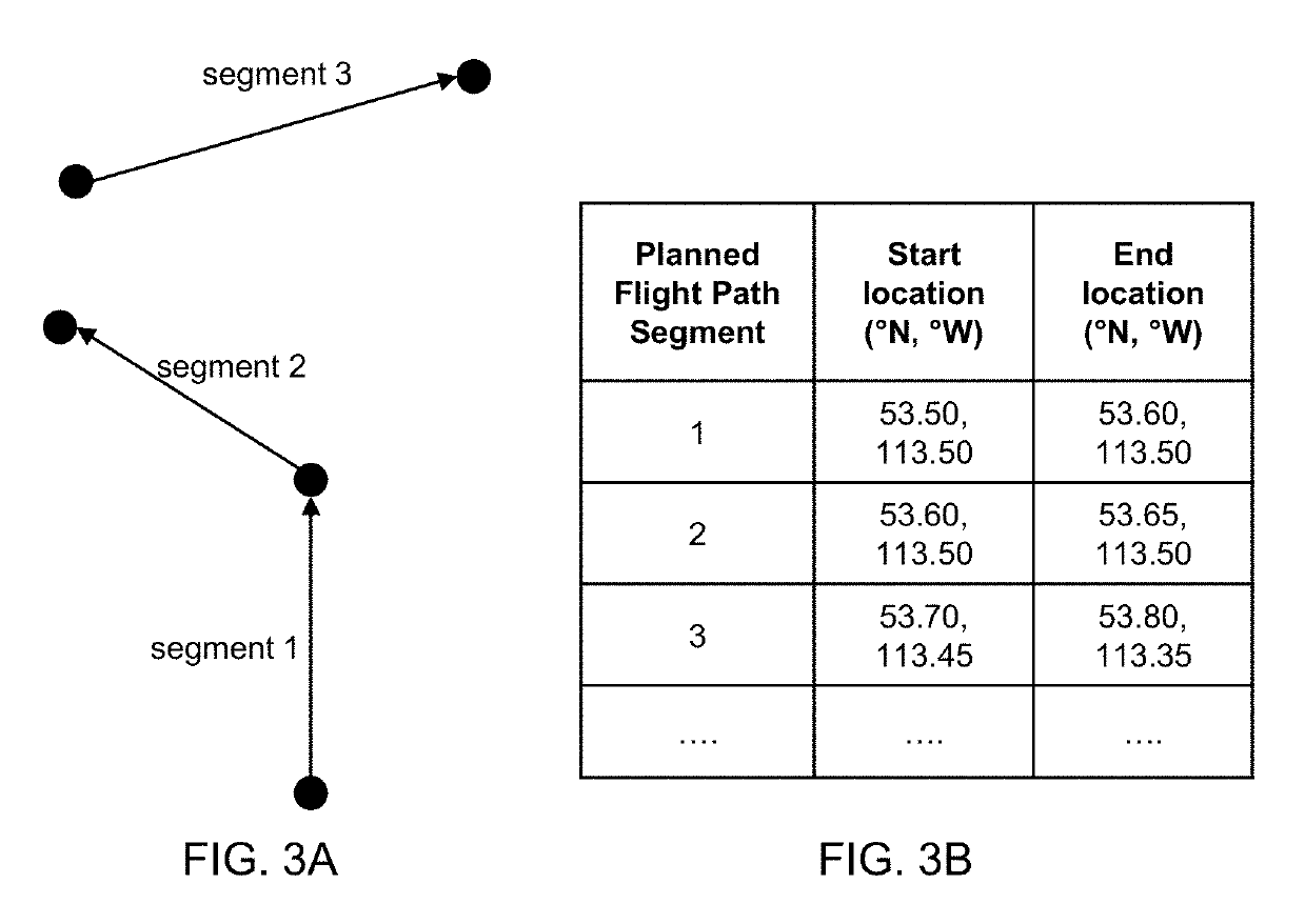
The present invention provides a method for displaying a planned flight path on a computer device using GPS data. The method involves periodically determining the current aircraft location and identifying which part of the planned flight path is being tracked. The method can also display markers on a map based on the distance between the current location and the planned flight path segment. The invention also includes a system for marking ground conditions during an aerial survey, where the system receives GPS data and updates a map with markers based on the location of the aircraft. The technical effects of the invention include improved flight planning and better ground condition identification.

Problems solved by technology

Conventional aerial surveying is challenging and error prone.
However, landmarks can be sparse in featureless terrain.
If the aircraft inadvertently misses a turn on the planned flight path, the aircraft will deviate significantly from the planned flight path, given the high speed and limited maneuverability of the aircraft.
Making corrective turns to return towards missed portions of the planned flight path wastes time and fuel.
On the other hand, not covering portions of the planned flight path compromises the integrity of the aerial survey.

Method used


Image

  • Computer-assisted aerial surveying and navigation
  • Computer-assisted aerial surveying and navigation
  • Computer-assisted aerial surveying and navigation

Examples


Embodiment Construction

Definitions

[0104]Any term or expression not expressly defined herein shall have its commonly accepted definition understood by a person skilled in the art. As used herein, the following terms have the following meanings.

[0105]“Aircraft” includes both a fixed-wing plane, and a helicopter.

[0106]“Computer device” refers to a device that comprises at least one computer processor.

[0107]“Computer processor” refers to an electronic device that is capable of processing data in accordance with a set of instructions stored on a non-transitory computer readable medium. Non-limiting examples of a computer processor may include one or more devices commonly referred to as a programmable logic controller, a printed circuit board, an integrated circuit, a CPU, a microcontroller, and the like.

[0108]“Electronic compass” refers to a device that comprises or can be operatively connected to a computer processor to provide information about the geographical heading of an aircraft. Non-limiting examples o...


PUM


Abstract

Computer-implemented methods, systems, and program products are provided that assist in aspects of aerial surveying, including selective display of planned flight path segments, marking of ground conditions, monitoring coverage of a planned flight path, and providing guidance information for aircraft navigation, including speed and turns.

Description

FIELD OF THE INVENTION[0001]The present invention relates to computer-implemented methods, systems, and program products that assist in aerial surveying, including more particularly, selective display of planned flight path segments, marking of ground conditions, monitoring coverage of a planned flight path, and providing guidance information for aircraft speed and turns.BACKGROUND OF THE INVENTION[0002]Regulations in some jurisdictions require periodic inspection of oil and gas pipeline right of ways for ground conditions and hazards that may affect pipeline operation and safety. Pipelines can be arranged in geometrically complex networks with tens of thousands of segments collectively spanning thousands of kilometers. Aerial surveying using either a fixed-wing plane or a helicopter is used to efficiently inspect these right of ways.[0003]Conventional aerial surveying is challenging and error prone. The surveyor's attention is divided between observing ground conditions, recording ...

Claims


Application Information

Patent Timeline
IPC IPC(8): G08G5/00G01C23/00
CPCG01C23/005G08G5/0086G08G5/003G08G5/0047G08G5/0021G08G5/0052G01C11/02G01C23/00G01C21/20G06F3/0482G08G5/0039
Inventor AKLILU, NOAH
Owner ARKIDAN SYST INC
Learn More