
Method for representing data in a vehicle

a vehicle and data technology, applied in the field of vehicle data representation methods, can solve problems such as disjointed and independent fashion, and achieve the effect of improving the navigation of the driver of the vehicl

Inactive Publication Date: 2019-12-05
VISTEON GLOBAL TECH INC
View PDF9 Cites 1 Cited by
  • Summary
  • Abstract
  • Description
  • Claims
  • Application Information

AI Technical Summary

Benefits of technology

The patent describes a system that uses data from sensors in other vehicles to improve the driver's view of the surrounding environment. This helps to eliminate errors or inaccuracies in the map view and allows for a more detailed or larger zoom factor. The system can also detect and take into consideration dynamic objects on the travel route, improving navigation for the driver.

Problems solved by technology

However, this is done in a disjointed and independent fashion from the navigation system.

Method used


Image

  • Method for representing data in a vehicle
  • Method for representing data in a vehicle

Examples


Embodiment Construction

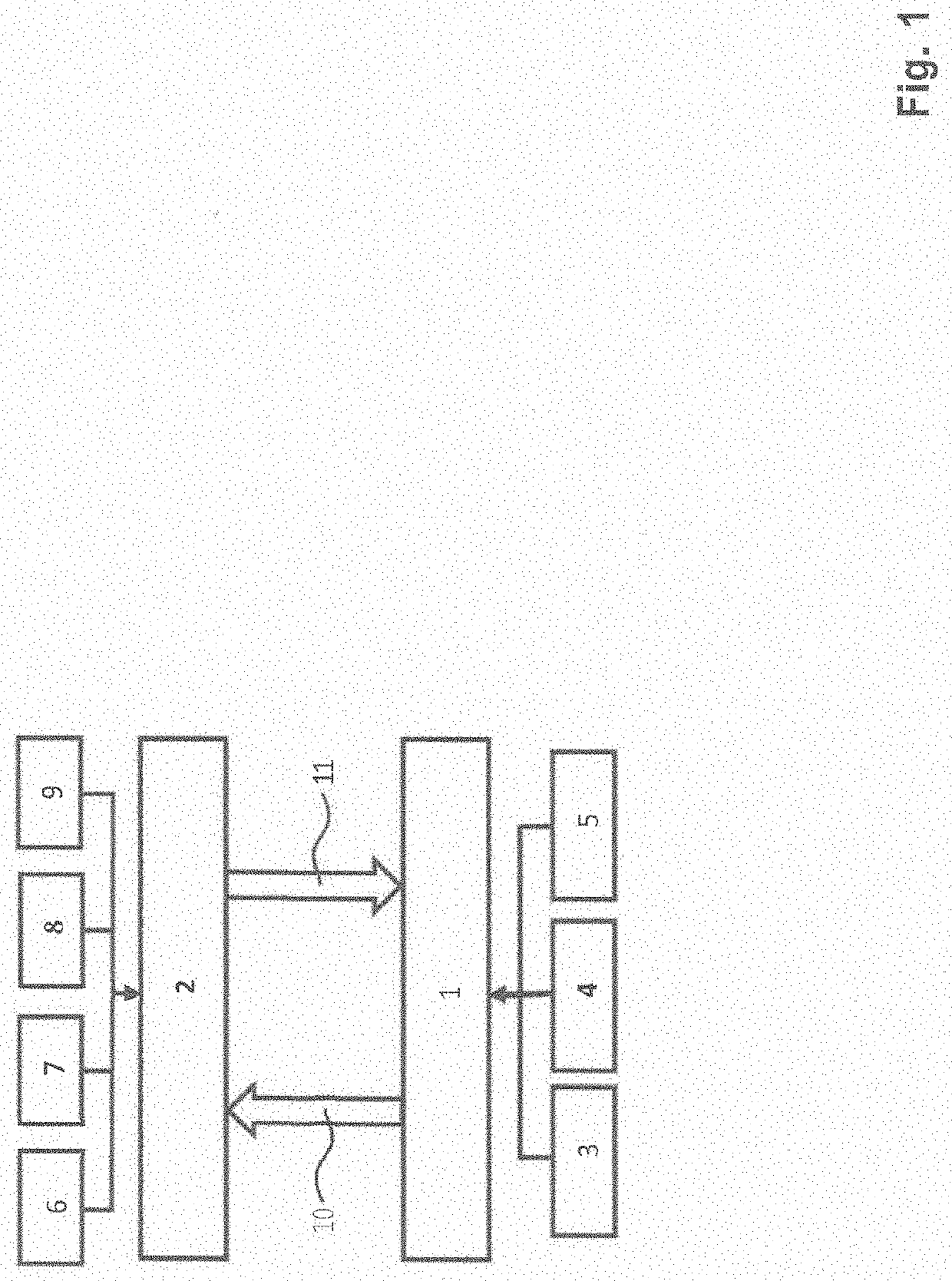
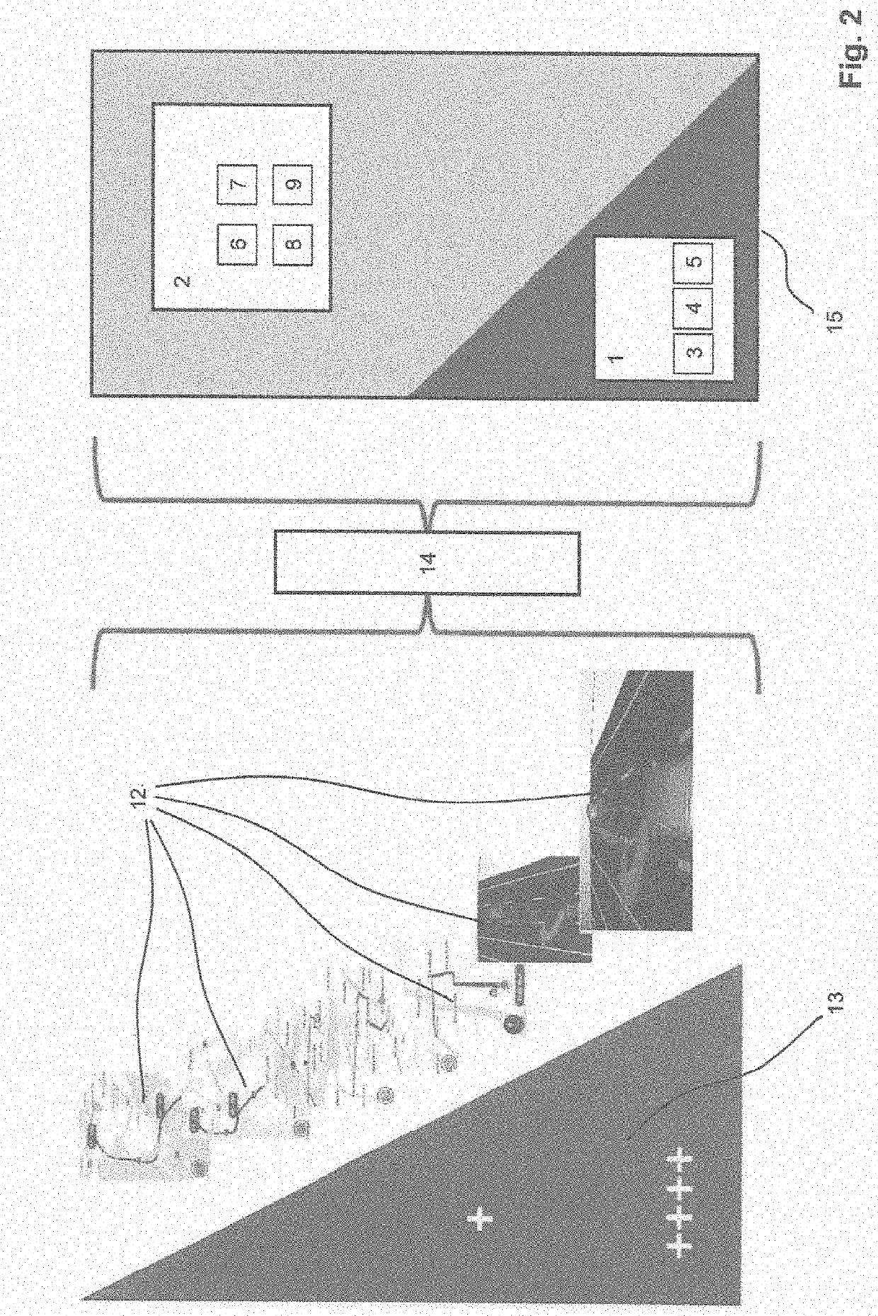
[0023]FIG. 1 shows a schematic diagram of the data combined in the method for representing data in a vehicle in a collective view 12 with its sources.

[0024]A dynamic environment model 1, generated for example in a sensor data processing unit, receives input data from a first sensor 3 and a second sensor 4, whereby the number of sensors used is not limited. In the example the first sensor 3 could be a video camera and the second sensor 4 a radar unit. In addition, the dynamic environment model 1 may receive further data via a communication interface 5. Such a communication interface 5 may be designed for communication of the vehicle with its surrounding area (V2X) or for vehicle-to-vehicle communication (V2V), or for both. Thus data is provided which is processed in the dynamic environment model 1.

[0025]FIG. 1 also shows data from a map view 2, which is stored for example as data in a navigation system of a vehicle. Such data usually comprises map data 6 with information on the cours...


PUM


Abstract

A method for representing data in a vehicle. The method includes representing data from a map view (2) and data from a dynamic environment model (1) in linked form, whereby this representation occurs on a user interface, such as human-machine interface (HMI). The data from the dynamic environment model (1) is provided. The data from the map view (2) is combined with the data from the dynamic environment model (1). The data from the map view (2) and the data from the dynamic environment model (1) are represented in a collective view (12).

Description

CROSS-REFERENCE TO RELATED APPLICATIONS[0001]This application claims the benefit of and priority to European Application No. 18175935.8, filed Jun. 5, 2018, which is incorporated herein by reference in its entirety.FIELD[0002]Embodiments herein generally relate to a method for representing data in a vehicle, whereby data from a map view from a navigation system is made available and whereby this data is displayed to an occupant, such as a driver.RELATED ART[0003]A vehicle may include a navigation system for creating a route between a starting point and an ending destination. The navigation system may utilize a global positioning system (GPS) to determine position of the vehicle and other coordinates. The navigation may utilize GPS and data stored on-board the navigation system to generate the route. The data stored in the system usually comprises information on the course of roads, available traffic lanes, points of interest (POI), and speed limits. The navigation system includes a ...

Claims


Application Information

Patent Timeline
IPC IPC(8): G01C21/36
CPCG01C21/3691G01C21/367G01C21/3664G01C21/365G01C21/343G01C21/3626G01C21/3635G01C21/3667G01C21/3638G01C21/3694
Inventor TORSCHMIED, AXELTUZAR, GERD-DIETERPFEIFLE, MARTIN
Owner VISTEON GLOBAL TECH INC
Learn More