Systems and methods for determining land use development potential

a technology of development potential and system and method, applied in the field of system and method for determining the development potential of a tract of land, can solve the problems of prior art not providing an efficient manner to enable a user, prior art not providing real-time customization and feedback for potential building and land use systems, etc., and achieves the effect of high efficiency, visualization and problem solving

Pending Publication Date: 2020-08-13
GRIDICS
View PDF18 Cites 14 Cited by
  • Summary
  • Abstract
  • Description
  • Claims
  • Application Information

AI Technical Summary

Benefits of technology

[0018]Furthermore, none of the prior art discloses a system for land development analysis and visualization that includes a unique graphical user interface with search, compliance, and solution functions. Additionally, none of

Problems solved by technology

Prior art fails to provide real-time customization and feedback for potential building and land use systems.
Prior art does not provide an efficient manner to enable a user to quickly find a tract of land that meets the unique, specific requirements of the user, such as maximum builda

Method used


Image

  • Systems and methods for determining land use development potential
  • Systems and methods for determining land use development potential
  • Systems and methods for determining land use development potential

Examples


Embodiment Construction

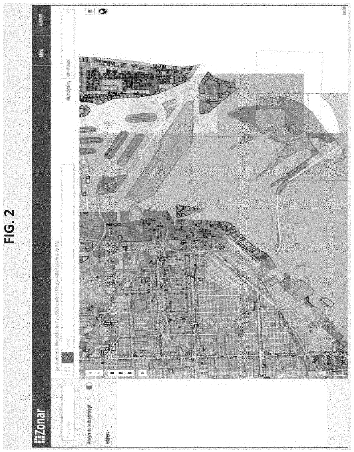
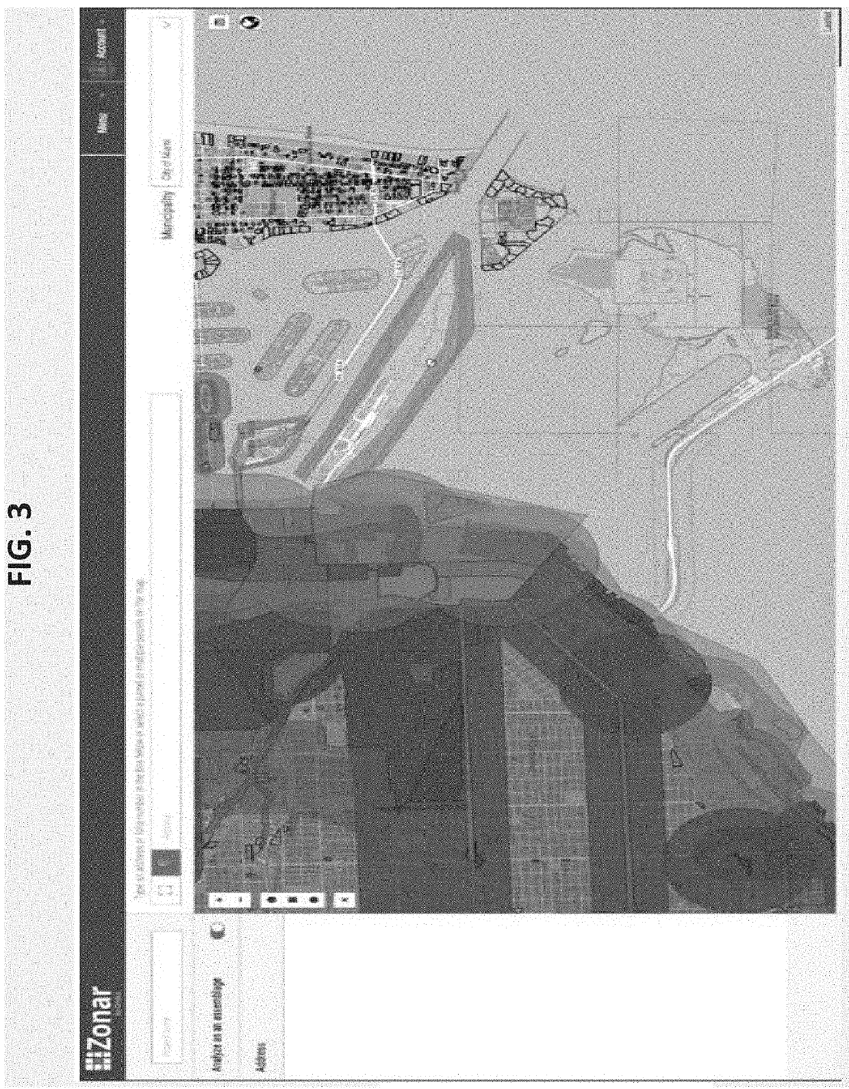
[0064]The present invention is generally directed to determining development potential of a tract of land. The invention generally includes systems and methods directed to collecting relevant geographic information for a particular tract of land, analyzing the relevant geographic data to determine the actual maximum density and intensity allowed, and outputting the results to a graphical user interface. The systems and methods of the present invention provide for improved analysis, search functions, and efficiency of land development potential.

[0065]In one embodiment, a system for real-time analysis of a geographic area of interest including a computing platform constructed and configured for network communication with at least one remote device and at least one database, wherein the computing platform includes a search module, an analytics module, and a compliance module, wherein the at least one remote device includes a graphical user interface (GUI), software, memory, and a proce...


PUM


Abstract

Systems and methods for determining land use development potential are provided, including a graphical user interface for real-time analysis. The systems and methods further implement search functions and real-time feedback and recommendations for real-time adjustment of a proposed land use development plan to ensure compliance with environmental and regulatory information.

Description

CROSS REFERENCES TO RELATED APPLICATIONS[0001]This application is related to and claims priority from the following US patents and patent applications. This application claims the benefit of U.S. provisional Application No. 62 / 805,047, filed Feb. 13, 2019, which is incorporated herein by reference in its entirety.BACKGROUND OF THE INVENTION1. Field of the Invention[0002]The present invention relates to systems and methods for determining development potential of a tract of land and more specifically relates to analysis and modeling of the tract of land with real-time customization of potential land uses.2. Description of the Prior Art[0003]It is generally known in the prior art to provide computer-implemented methods and systems that allow users to obtain geographic information pertaining to a tract of land, to calculate maximum density capacity and intensity, and to create a 3D visualization of a building.[0004]Prior art patent documents include the following:[0005]U.S. Pat. No. 10...

Claims


Application Information

Patent Timeline
IPC IPC(8): G06Q50/16G06F16/29
CPCG06T17/10G06F16/29G06Q50/165G06Q50/163G06T17/05
Inventor RODRIGUEZ, MAX ENRIQUE ZABALA
Owner GRIDICS
Why Eureka
Try Eureka