
High precision GPS/RTK and laser machine control

a laser machine control and high-precision technology, applied in the field of machine control systems, can solve the problems of system inability to use for three-dimensional navigation, the reach of satellite navigational systems, and the accuracy of millimeters

Inactive Publication Date: 2002-08-13
TRIMBLE NAVIGATION LTD
View PDF8 Cites 146 Cited by
  • Summary
  • Abstract
  • Description
  • Claims
  • Application Information

AI Technical Summary

Problems solved by technology

However, the millimeter level of accuracy is still beyond the reach of the satellite navigational systems.
However, this systems can not be used for the three dimensional navigational purposes because they can define only the level plane.

Method used


Image

  • High precision GPS/RTK and laser machine control
  • High precision GPS/RTK and laser machine control
  • High precision GPS/RTK and laser machine control

Examples


Embodiment Construction

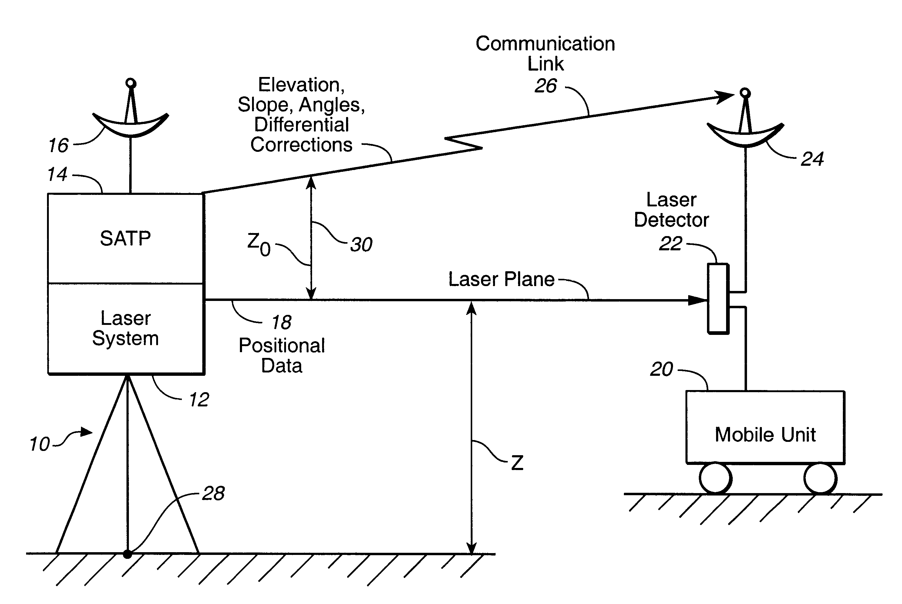
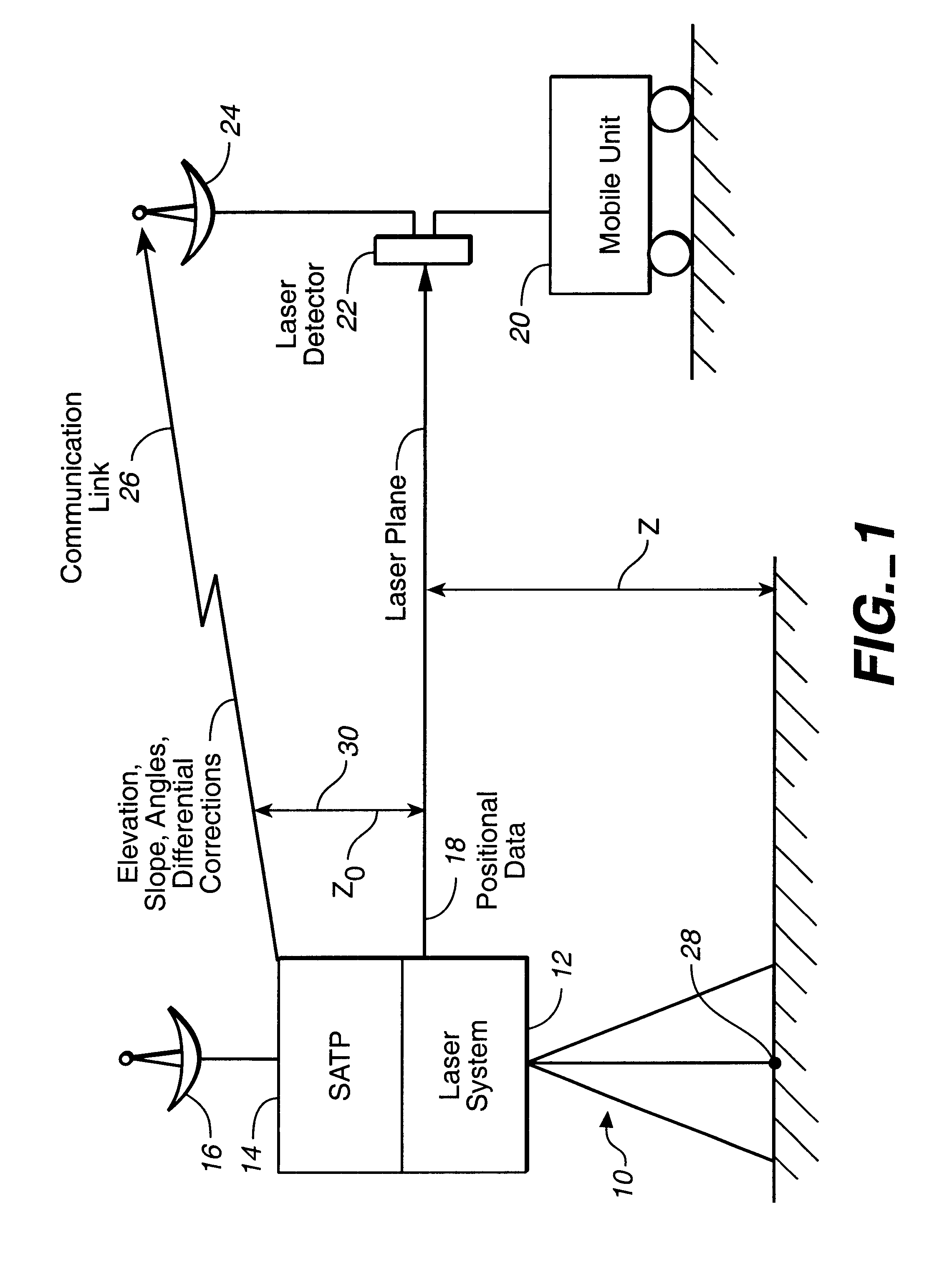
The present invention can be best understood by focusing on FIG. 1 that depicts an integrated laser and satellite positioning system (LASATPS) (10). The (LASATPS) system (10) comprises: (1) a laser system (12) generating a laser beam (18) and a satellite positioning system (SATPS) receiver (14) integrated with the laser system (18). The integrated laser and SATPS system (10) (LASATPS) provides a number of benefits to a potential user comparatively with a system that mechanically combines a laser system (see full description below) and a SATPS receiver system.

Indeed, the integrated LASATPS system has the reduced cost as opposed to the cost of the combined laser and SATPS system because the integrated LASATPS system requires only one set of packaging, can utilize a shared computer memory and can use a common power supply. In the integrated LASATPS system the laser beam and the electrical phase center of the SATPS stationary antenna ((16 of FIG. 1) are separated by a known and fixed di...


PUM


Abstract

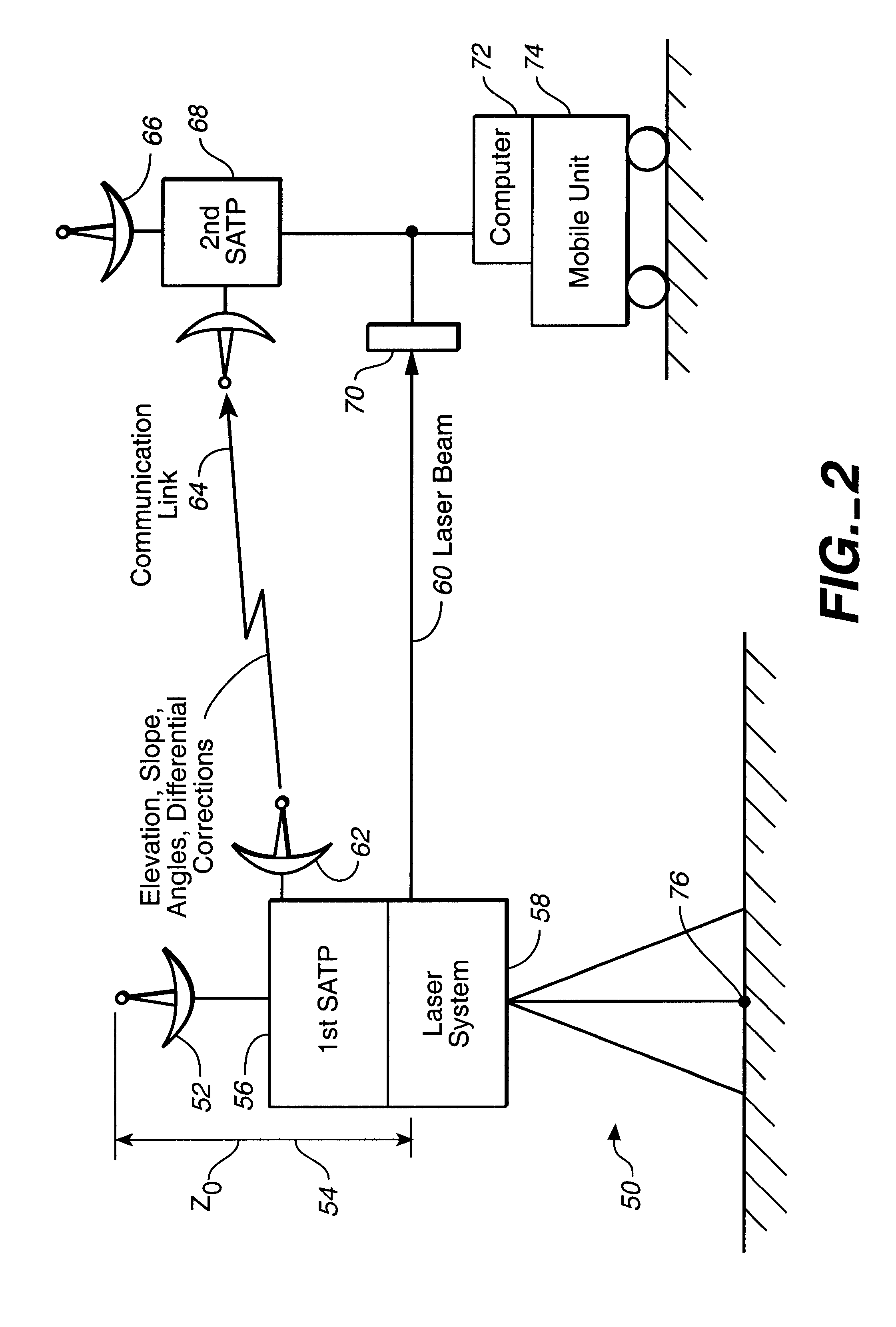
The integrated laser and satellite positional system receiver is disclosed. The integrated laser and satellite positioning system receiver can provide a plurality of mobile units with a laser plane data determined with a millimeter relative accuracy. The integrated laser and differential satellite positioning system receiver can also generate and transmit the differential correctional data to a plurality of mobile units. Each mobile unit equipped with a mobile satellite positioning system receiver can use the differential correction data and the high precision laser plane data to improve its position determination capabilities.

Description

The present invention relates generally to the field of machine control systems, and more specifically, to the field of laser machine control systems.DESCRIPTION OF THE BACKGROUND ARTIn one prior art related to machine control systems, different satellite navigational systems, like GPS, GLONASS, and GPS / GLONASS are used to determine position coordinates and to control a mobile unit. An autonomous navigational system that includes the satellite receiver and a navigational computer can achieve the 10-meter level of accuracy in the position determination of a mobile unit. The differential navigational systems that utilize differential corrections in addition to the satellite signals can determine the positional information with the meter-range accuracy. The real-time kinematic (RTK) GPS systems that are capable of utilizing in real time not only code but also carrier information transmitted from satellites can achieve the centimeter level of accuracy in the position determination of a ...

Claims


Application Information

Patent Timeline
Patent Type & Authority Patents(United States)
IPC IPC(8): G01C15/00G01S17/00G01S5/00G01S17/02G01S5/14G01S17/42G01S7/481G01S17/86G01S19/04G01S19/10G01S19/44
CPCG01C15/004G01S7/4811G01S17/023G01S17/42G01S19/04G01S19/07G01S19/10G01S19/46G01S17/86G01S19/072G01S19/071
Inventor NICHOLS, MARK EDWARD
Owner TRIMBLE NAVIGATION LTD
Learn More