
Display method and apparatus for navigation system

a navigation system and display method technology, applied in navigation instruments, maps/plans/charts, navigation instruments, etc., can solve the problems of inability to perform route guidance functions, failure of satellite navigation, and inability to determine the destination, so as to achieve easy and quick change of navigation system, easy and quick determination of destination, and easy and quick position.

Inactive Publication Date: 2005-02-22
ALPINE ELECTRONICS INC
View PDF9 Cites 46 Cited by
  • Summary
  • Abstract
  • Description
  • Claims
  • Application Information

AI Technical Summary

Benefits of technology

It is, therefore, an object of the present invention to provide a navigation system which enables a user to easily and quickly change the navigation system to a map image for finding and specifying a destination on the map image.
It is another object of the present invention to provide a navigation system which enables a user to easily and quickly find a position on the selected street on the map screen for specifying the destination.
It is a further object of the present invention to provide various display methods for promoting easy and quick operations for selecting an address number of the destination on the map image.
In the present invention, the navigation system is designed to enable a user to quickly select a street name and easily specify the address number of the destination. The navigation system includes a menu for changing a screen for inputting the address number to a map image of the selected street. By selecting the specific position on the selected street by a cursor point, the address of the destination can be easily and quickly specified because it is not necessary to input the address number through the keyboard.
According to the present invention, the vehicle navigation system enables the user to determine the destination easily and quickly. First, the user selects the particular name of the street on the keyboard, then changes to the map screen displaying the image of the selected street. The user is able to find a position on the selected street in the map screen to determine the specific address of his destination.
The navigation system of the present invention enables the user to easily and quickly change the navigation system to the map image of the selected street for finding and specifying the destination on the map image. The user can easily and quickly find a position on the map image of the selected street. The various display methods provided in the navigation system promote easy and quick operations for selecting the destination on the map image.

Problems solved by technology

However, the satellite navigation involves problem of position detection failure such as in a tunnel or a building where the satellite radio signals are obstructed.
In this manner, the locator map display shows the current position of the vehicle on the map image, however, it does not perform the route guidance function because the destination is not set in the navigation system.
This input method takes time and may adversely affect the safe driving.
In the conventional navigation system, however, it is not designed to easily and quickly display the street image or easily change the location on the street image.

Method used


Image

  • Display method and apparatus for navigation system
  • Display method and apparatus for navigation system
  • Display method and apparatus for navigation system

Examples


Embodiment Construction

The navigation system of the present invention is designed to enable a user to specify the destination quickly when the user is familiar with the map associated with a particular destination. In accordance with the present invention, a user such as a driver can quickly specify the street name and address number and find an exact location of his destination on the street through the map image. Examples of operation process and display screen in the present invention are shown in FIGS. 6-15.

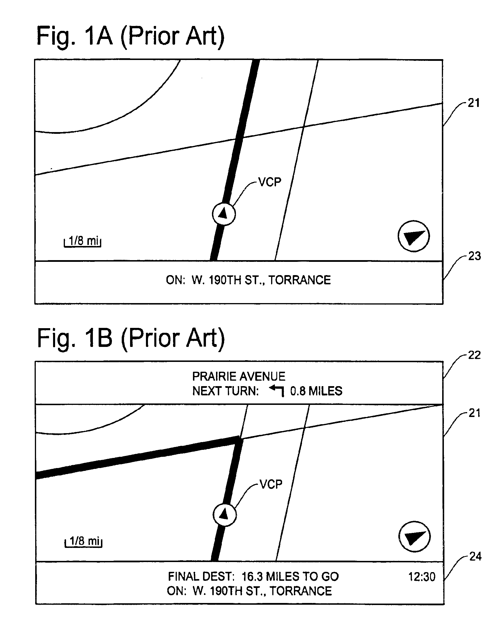
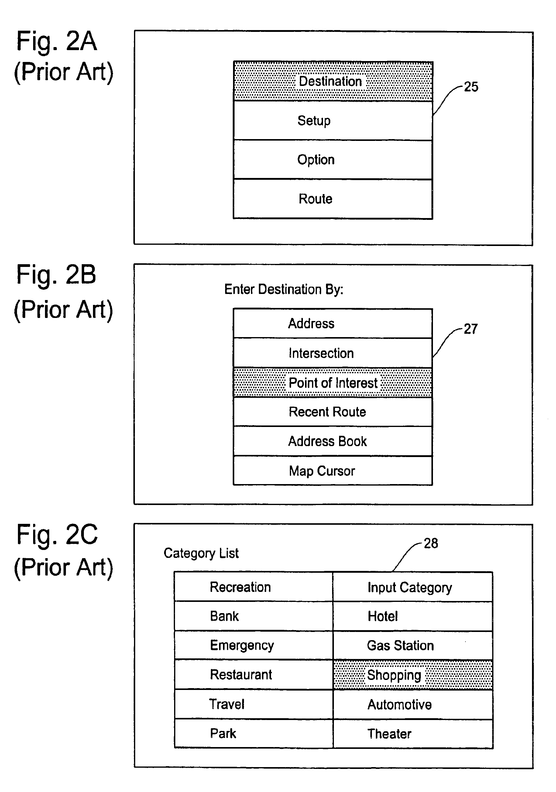
Before going into details of the display examples of FIGS. 6-15, a brief description is made regarding the basic structure of the navigation system with reference to FIG. 3 and an example of remote controller for the navigation system with reference to FIGS. 4A and 4B. Further, to facilitate a better understanding of the present invention, a typical process and display examples for specifying a destination in the conventional technology will be explained with reference to FIGS. 5A-5F.

In the block d...


PUM


Abstract

A display method and apparatus for navigation system for specifying the destination easily and quickly. The navigation system is designed to enable a user to quickly select a street name and easily specify the address number of the destination through a map image of the selected street. The navigation system includes a menu for changing a keyboard screen or other input screen to a map screen showing the image of the selected street. A user can find a location of the destination on the image of the selected street. Various display methods are provided to promote quick and easy operations for finding the location on the selected street. When there are two or more streets having same street name with different street types or street prefixes, the navigation system displays selection means for a user to select one of the streets.

Description

FIELD OF THE INVENTIONThis invention relates to a display method and apparatus for navigation system, and more particularly, to a display method and apparatus which is capable of easily specifying an address of a destination in a navigation system through a map image of a selected street.BACKGROUND OF THE INVENTIONA navigation system performs travel guidance for enabling a user to easily reach the selected destination. A typical example is a vehicle navigation system. The present invention is not limited to a vehicle navigation system but is applicable to other types of navigation system such as a PDA (Personal Data Assistant), a cellular phone, and other portable navigation devices. However, for the convenience of explanation, the following description is made mainly for the vehicle navigation system.Such a navigation system detects the position of the vehicle, reads out map data pertaining to an area at the vehicle current position from a data storage medium, for example, a CD-ROM...

Claims


Application Information

Patent Timeline
Patent Type & Authority Patents(United States)
IPC IPC(8): G01C21/34G01C21/36G09B29/00G01C21/00G08G1/0968G08G1/0969G09B29/10
CPCG01C21/3611G08G1/096894G01C21/3614
Inventor YOKOTA, TATSUO
Owner ALPINE ELECTRONICS INC
Learn More