Navigational instrument, method and computer program product for displaying ground traffic information

a technology of navigation instruments and ground traffic information, applied in the field of navigation instruments, can solve the problems of limited information presented by gauges, not all of the information can be effectively processed by pilots, etc., and achieve the effect of increasing safety

Active Publication Date: 2005-10-18
GARMIN AT
View PDF18 Cites 51 Cited by
  • Summary
  • Abstract
  • Description
  • Claims
  • Application Information

AI Technical Summary

Benefits of technology

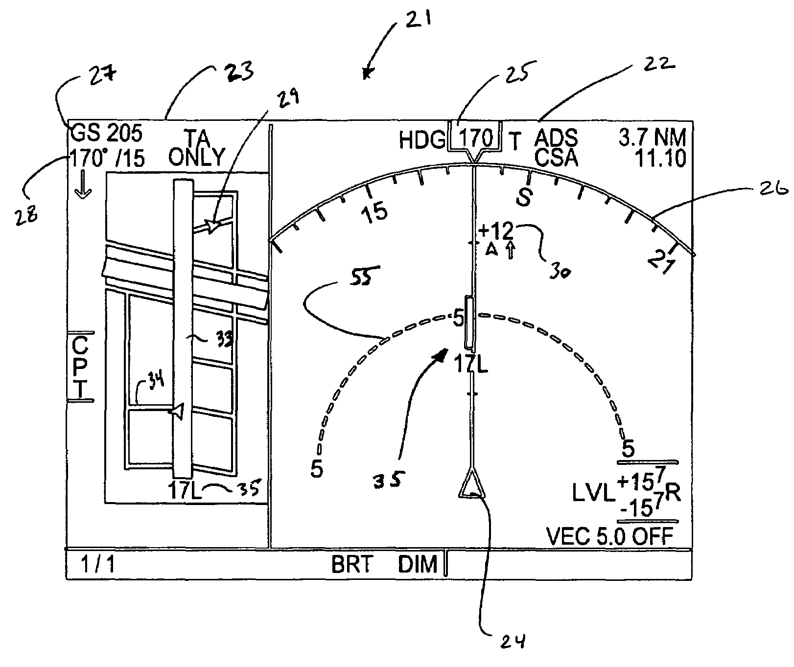
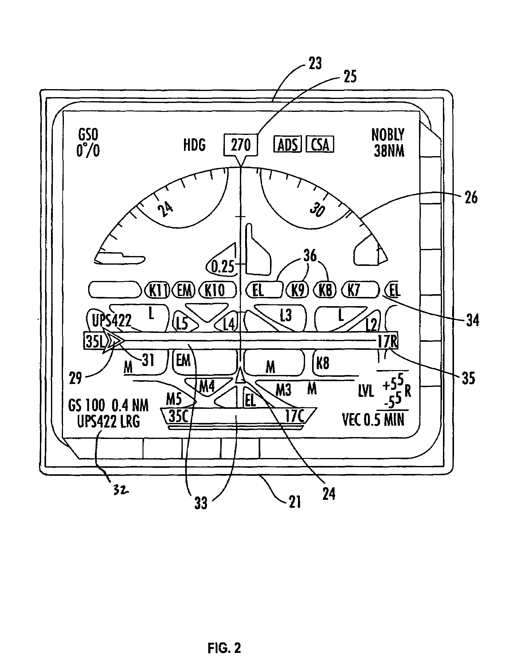
[0025]Advantageously, the provision of ground traffic information on the ground traffic panel allows the pilot to detect aircraft on runways, and other ground obstacles. Detection of other aircraft and obstacles allows the pilot to avoid those obstacles, resulting in increased safety. Simultaneous display of the air traffic panel with the ground traffic panel prior to, and during, landing allows the pilot to peek ahead at the conditions of the runway and airport. Similarly, when the Own Ship is on the ground, the display allows the pilot to avoid potential collisions. Automatic switching between single and double panel display allows the pilot to focus on other tasks during takeoff or landing, such as manually controlling the airplane.

Problems solved by technology

However, so much navigational information is now available from navigational devices that not all of the information can be effectively processed by the pilot.
Initially, presentation of the navigational information consisted of careful arrangement of various mechanical gauges, but the amount of information presented by gauges is limited due to the physical size of the gauges and the limited space on the flight deck.

Method used


Image

  • Navigational instrument, method and computer program product for displaying ground traffic information
  • Navigational instrument, method and computer program product for displaying ground traffic information
  • Navigational instrument, method and computer program product for displaying ground traffic information

Examples


Embodiment Construction

[0031]The present inventions now will be described more fully hereinafter with reference to the accompanying drawings, in which some, but not all embodiments of the invention are shown. Indeed, these inventions may be embodied in many different forms and should not be construed as limited to the embodiments set forth herein; rather, these embodiments are provided so that this disclosure will satisfy applicable legal requirements. Like numbers refer to like elements throughout.

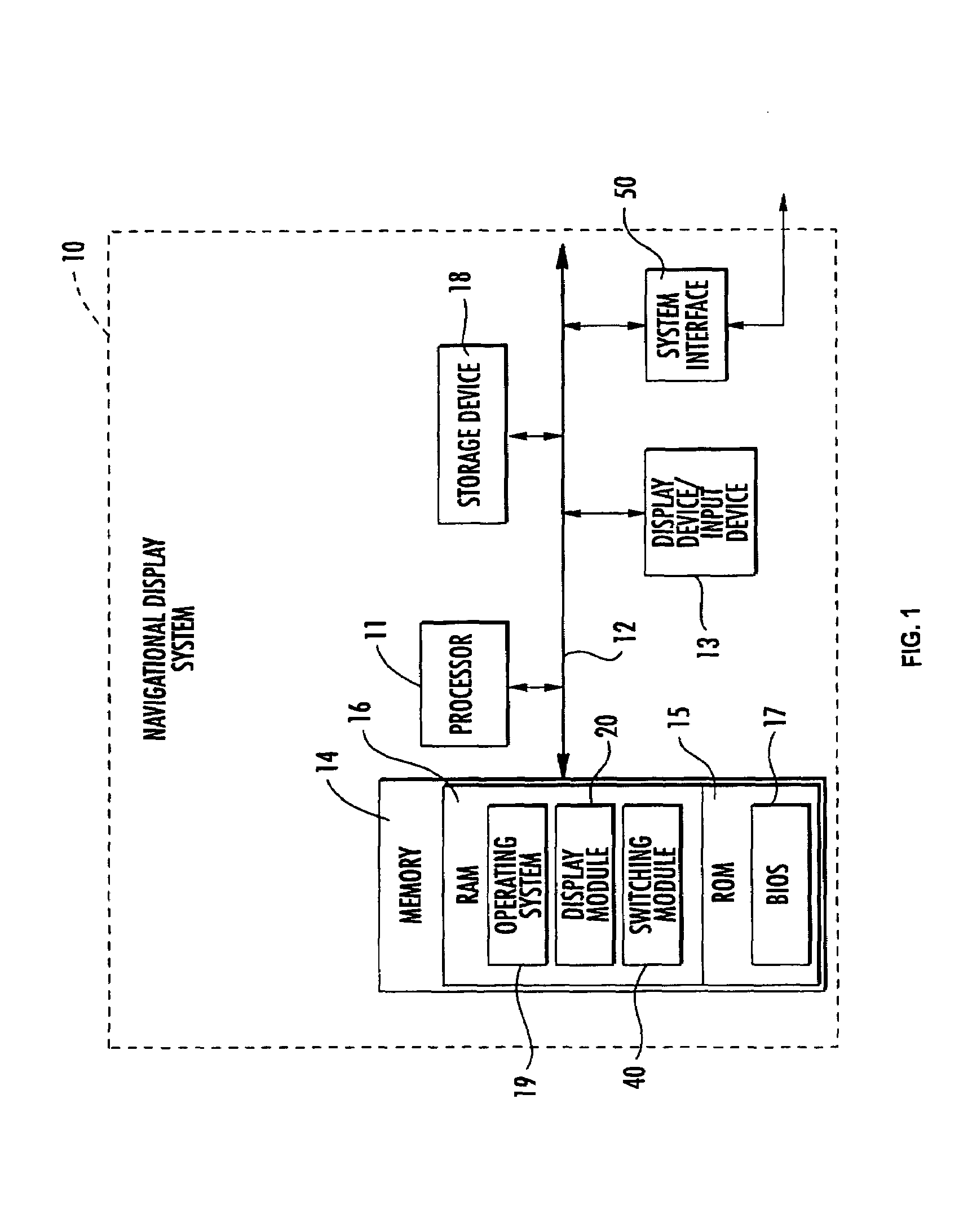
[0032]As will be appreciated by one skilled in the art, the present invention may be embodied as a method, a data processing system, or a computer program product. Accordingly, the present invention may take the form of an entirely hardware embodiment, an entirely software embodiment or an embodiment combining software and hardware aspects. Furthermore, the present invention may take the form of a computer program product on a computer-readable storage medium having computer-readable program code means embodied...


PUM


Abstract

The present invention provides an aircraft navigational system including a graphical user interface that is capable of displaying navigational information in a split-screen format. The split-screen format includes displaying multiple graphical user panels, each depicting different traffic information. For example, one of the panels displays a plurality of air traffic symbols corresponding to airborne obstacles and another of the panels simultaneously displays ground traffic symbols representing ground obstacles. The obstacles can include other aircraft in the air and on runways as the pilot's aircraft approaches for a landing. The navigational system also is capable of switching between a single graphical user panel and multiple panels in response to a triggering event, such as a change in the course of the aircraft.

Description

BACKGROUND OF THE INVENTION[0001]1. Field of the Invention[0002]The present invention is related to the field of navigational instruments, and in particular, to the electronic display of navigational information for aircraft.[0003]2. Description of Related Art[0004]A pilot's awareness of her aircraft and its relationship to the surrounding environment is a large factor in ensuring safe flight. Originally, such information was provided by the pilot's own visual, tactile and other senses. Eventually, various devices were developed to augment the pilot's senses including compasses to determine direction, altimeters to measure altitude and Pitot tubes to determine airspeed velocity. Another example includes radar that uses radio signals to accurately indicate the location of the pilot's aircraft, ground contours and other aircraft.[0005]Generally, more, and more accurate, information about the location and movement of the aircraft with respect to obstacles is a boon to aviation safety. ...

Claims


Application Information

Patent Timeline
Patent Type & Authority Patents(United States)
IPC IPC(8): G05D1/00G05D21/00G08G5/04G08G5/00G01C23/00G08G5/06
CPCG01C23/00G08G5/0021G08G5/0052G08G5/0078G08G5/025G08G5/0013G08G5/0008G08G5/0082
Inventor HORVATH, STEVENHILB, ROBERT C.WALTON, JAMES C.
Owner GARMIN AT
Why Eureka
Try Eureka