Altitude measurement system and associated methods

a technology of altimeter system and associated methods, which is applied in the direction of distance measurement, navigation instruments, instruments, etc., can solve the problems of inability to achieve a technique, the system is not easily adapted to the altimeter system, and other uncertainties in the barometric system degrade accuracy

Inactive Publication Date: 2006-08-22
THE BOEING CO
View PDF34 Cites 48 Cited by
  • Summary
  • Abstract
  • Description
  • Claims
  • Application Information

AI Technical Summary

Benefits of technology

[0010]Accordingly, one embodiment of the present invention includes an altitude measuring system for aircraft. The altitude measuring system comprises a plurality of altitude sensors disposed on the aircraft. Each altitude sensor provides data to an altitude processing unit in communication with each of the plurality of altitude sensors, the altitude processing unit being capable of spatially averaging each output to deter...

Problems solved by technology

This technique is not possible, however, over large expanses of ocean where no barometric stations exist.
Furthermore, even if barometric pressure were known exactly, other uncertainties in t...

Method used


Image

  • Altitude measurement system and associated methods
  • Altitude measurement system and associated methods
  • Altitude measurement system and associated methods

Examples


Embodiment Construction

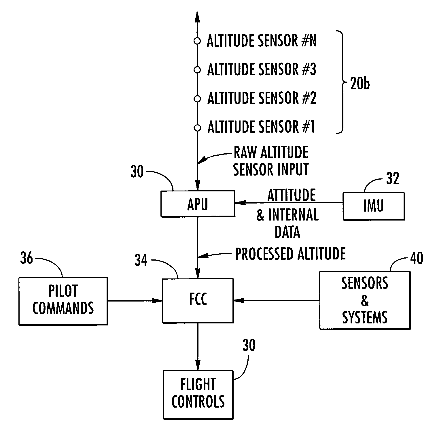
[0020]The present inventions now will be described more fully hereinafter with reference to the accompanying drawings, in which some, but not all embodiments of the inventions are shown. Indeed, these inventions may be embodied in many different forms and should not be construed as limited to the embodiments set forth herein; rather, these embodiments are provided so that this disclosure will satisfy applicable legal requirements. Like numbers refer to like elements throughout.

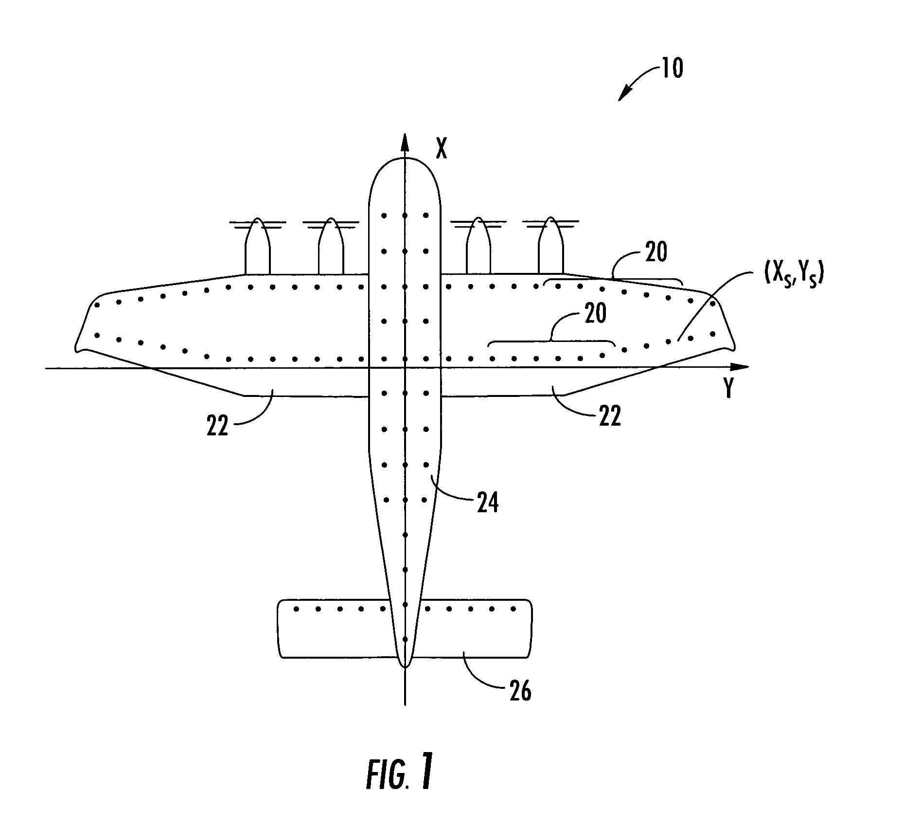
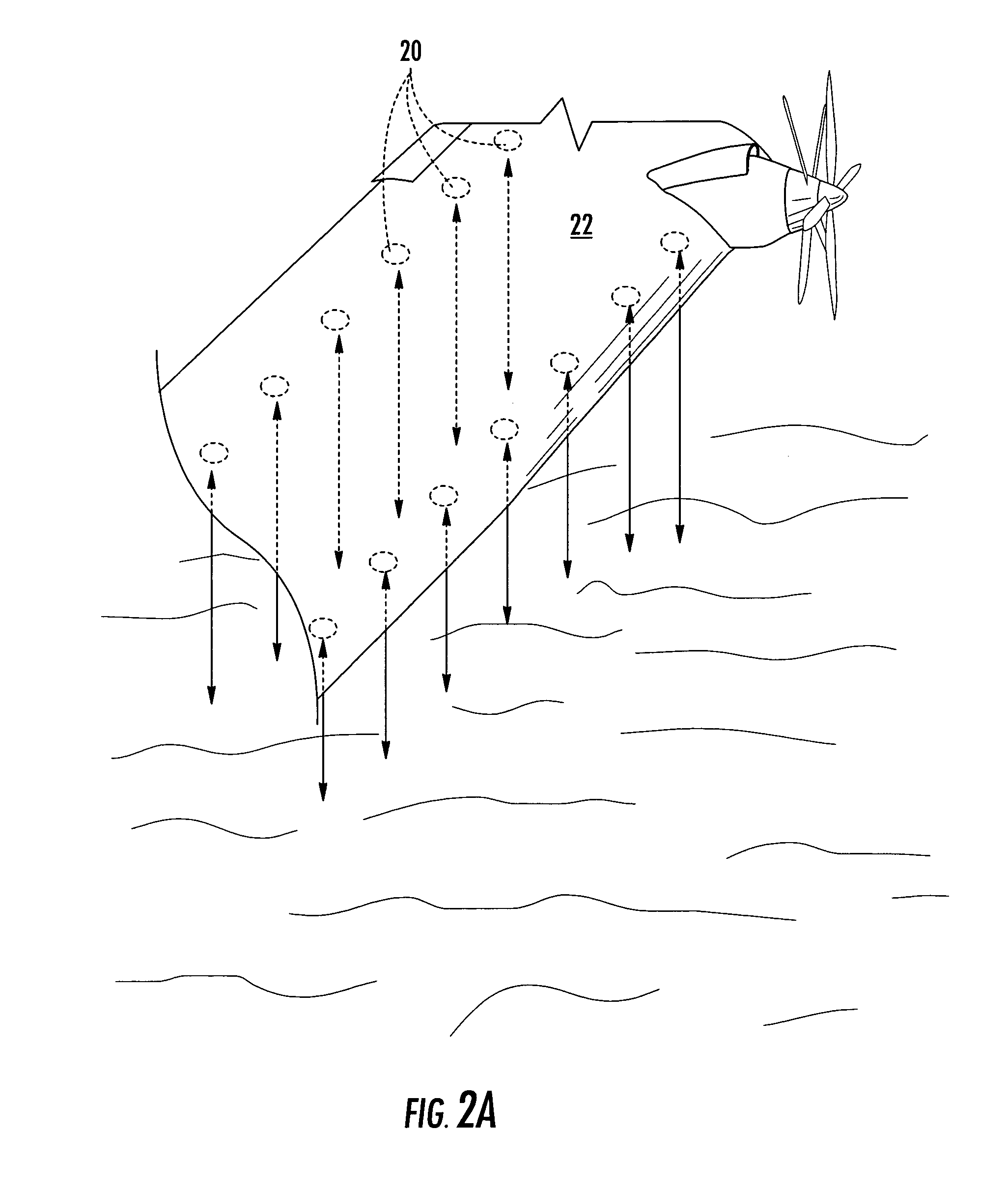
[0021]Referring now to FIG. 1, a ground effect aircraft is depicted including a plurality of altitude sensors 20 disposed on the underside of wings 22, fuselage 24 and stabilizer 26. Altitude sensors 20 typically include, but are not limited to, radio altimeters, laser or other electro-optic distance measuring altimeters. These sensors measure a time delay between the outgoing and reflected signals. Other types of sensors that may be employed include a sensor that uses the principle of parallax with sending an...


PUM


Abstract

An altitude measuring system and method for aircraft is provided. The altitude measuring system includes altitude sensors for providing data to an altitude processing unit. The altitude processing unit spatially averages each output to determine a mean altitude. Pitch and roll are accounted for by correction. A method of determining aircraft altitude from a plurality of altitude sensors includes receiving altitude sensor data from each sensor and spatially averaging the altitude sensor outputs to determine aircraft altitude. A method of estimating the maximum height of an ocean surface includes receiving a plurality of altitude sensor data and determining a mathematical description of the ocean surface from the sensor data. The maximum probable wave height of the ocean surface is estimated from the mathematical description. From the maximum wave height, a cruise altitude may be determined.

Description

FIELD OF THE INVENTION[0001]The present invention relates generally to altimeter systems and, more particularly, to altimeter systems for ground effect vehicles.BACKGROUND OF THE INVENTION[0002]Ground effect vehicles have been developed in both fields of aeronautics and marine craft. Ground effect vehicles are those vehicles which receive reduced drag due to the reduction of wing-tip vortices while traveling at low altitudes near ground, and more typically, near water. The closer the wing tip is to the ground or water, the lower the drag.[0003]Ground effect vehicles generally include marine craft and aircraft. The two are typically distinguished by those that can sustain extended flight without the aid of ground effect (aircraft) and those that cannot (marine craft). The International Civil Aviation Organization (ICAO) and International Maritime Organization (IMO), both organizations of the United Nations, jointly exercise jurisdiction over these vehicles. The ICAO and IMO have also...

Claims


Application Information

Patent Timeline
IPC IPC(8): G01S13/08G01S13/88G01S13/95G01S15/08G01S15/88G01S13/935
CPCG01S13/08G01S13/953G01S13/87G01S13/882Y02A90/10G01S17/08G01S17/933G01S13/935
Inventor RAWDON, BLAINE K.HOISINGTON, ZACHARY C.
Owner THE BOEING CO
Why Eureka
Try Eureka