
Automatic generating device for 3-d structure shape, automatic generating method, program therefor, and recording medium recording the program
- Summary
- Abstract
- Description
- Claims
- Application Information
AI Technical Summary
Benefits of technology
Problems solved by technology
Method used
Image

Examples
Embodiment Construction
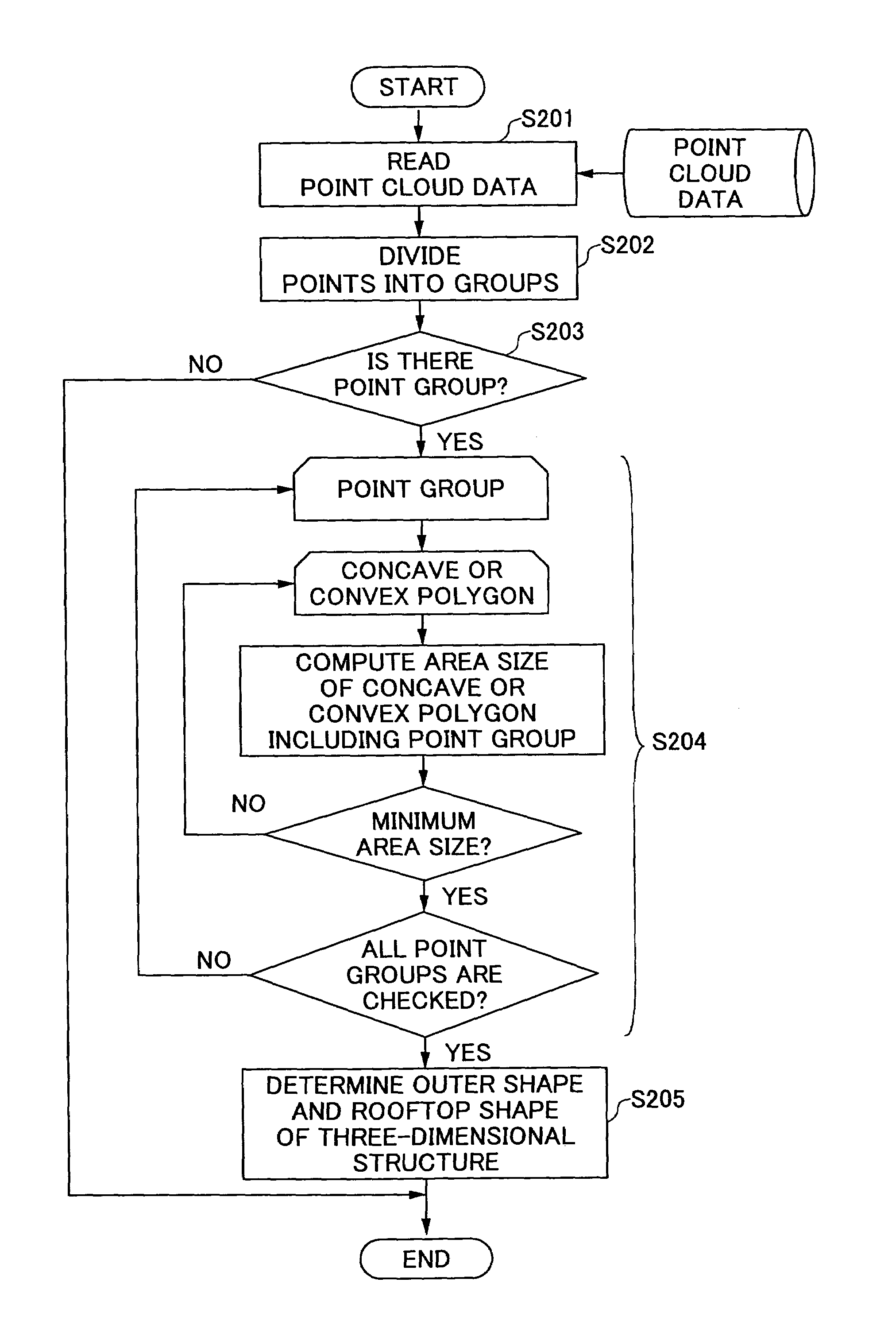
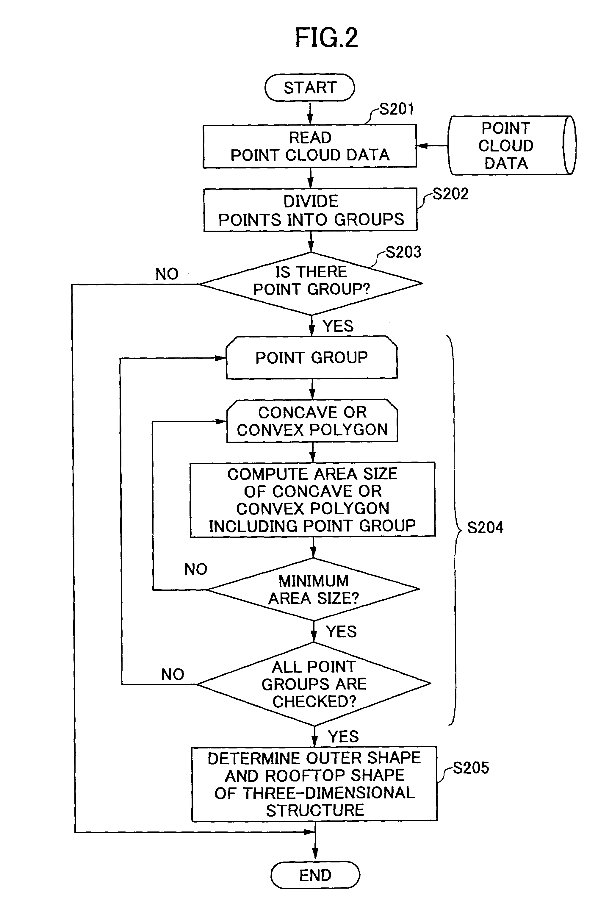
[0040]In the present invention, point cloud data, which are obtained through a laser profiler or other apparatuses, are used to form point groups each of which is constituted of points. The points are grouped in such a way that three-dimensional distances between the points are within a predetermined threshold or both two-dimensional distances and height differences thereof are within predetermined thresholds. For each point group, at least one prepared polygon is used to include all points thereof. At this time, the direction (orientation) of the polygon is determined as such a direction that the polygon occupies the minimum area required to include the points, and then the minimum area is measured. The above measurement is conducted for all prepared polygons. The polygon having the minimum area is selected among the prepared polygons, and an outer shape or a rooftop shape of a three-dimensional structure is generated based on the selected polygon.
[0041]Here, the above-mentioned th...
PUM
 Abstract
Description
Claims
Application Information