Positioning system for a geostationary satellite

a positioning system and satellite technology, applied in vehicle position/course/altitude control, process and machine control, instruments, etc., can solve the problem that the global positioning system (gps) of the united states or the global navigation satellite system (glonass) of russia is not useful for position determination

Inactive Publication Date: 2006-09-12
KOREA AEROSPACE RES INST
View PDF13 Cites 10 Cited by
  • Summary
  • Abstract
  • Description
  • Claims
  • Application Information

AI Technical Summary

Benefits of technology

[0005]An object of the present invention is to provide a positioning system for a geostationary satellite that causes the s

Problems solved by technology

In addition, several dozens of people and lots of money are needed to maintain the satellite until its life is over.
A global positioning system (GPS) of the United States or global navigation satellite system (GLONASS) of

Method used


Image

  • Positioning system for a geostationary satellite
  • Positioning system for a geostationary satellite
  • Positioning system for a geostationary satellite

Examples


Embodiment Construction

[0014]Hereinafter, referring to the following appended drawings, the preferred embodiments of the present invention will be explained in detail.

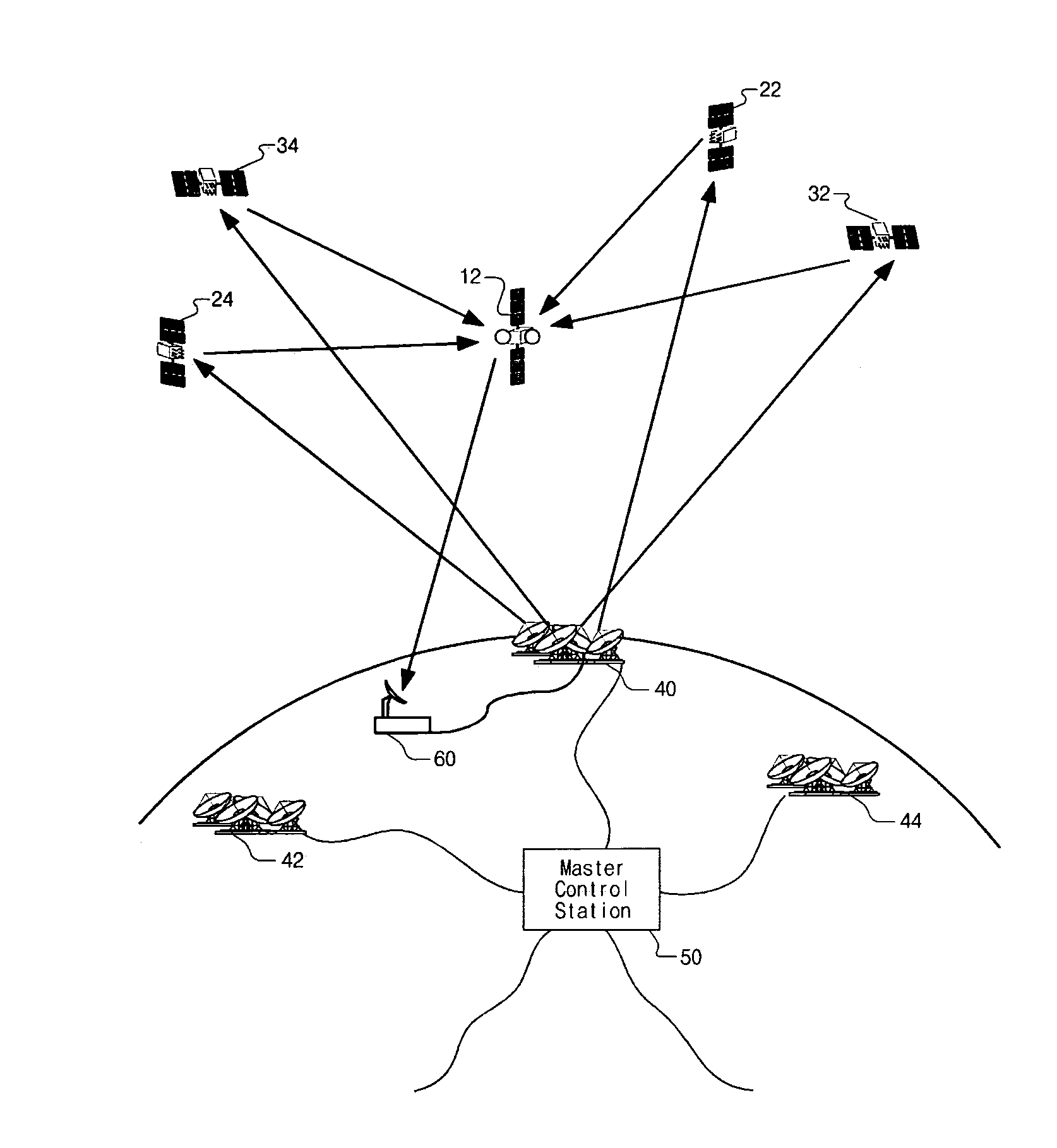
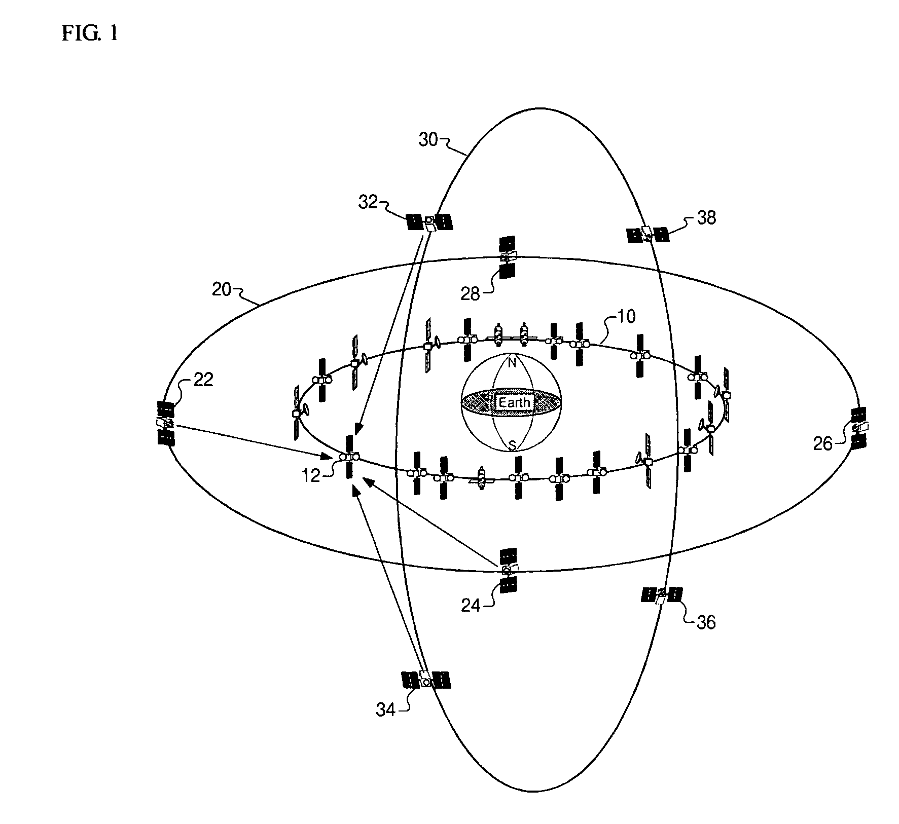
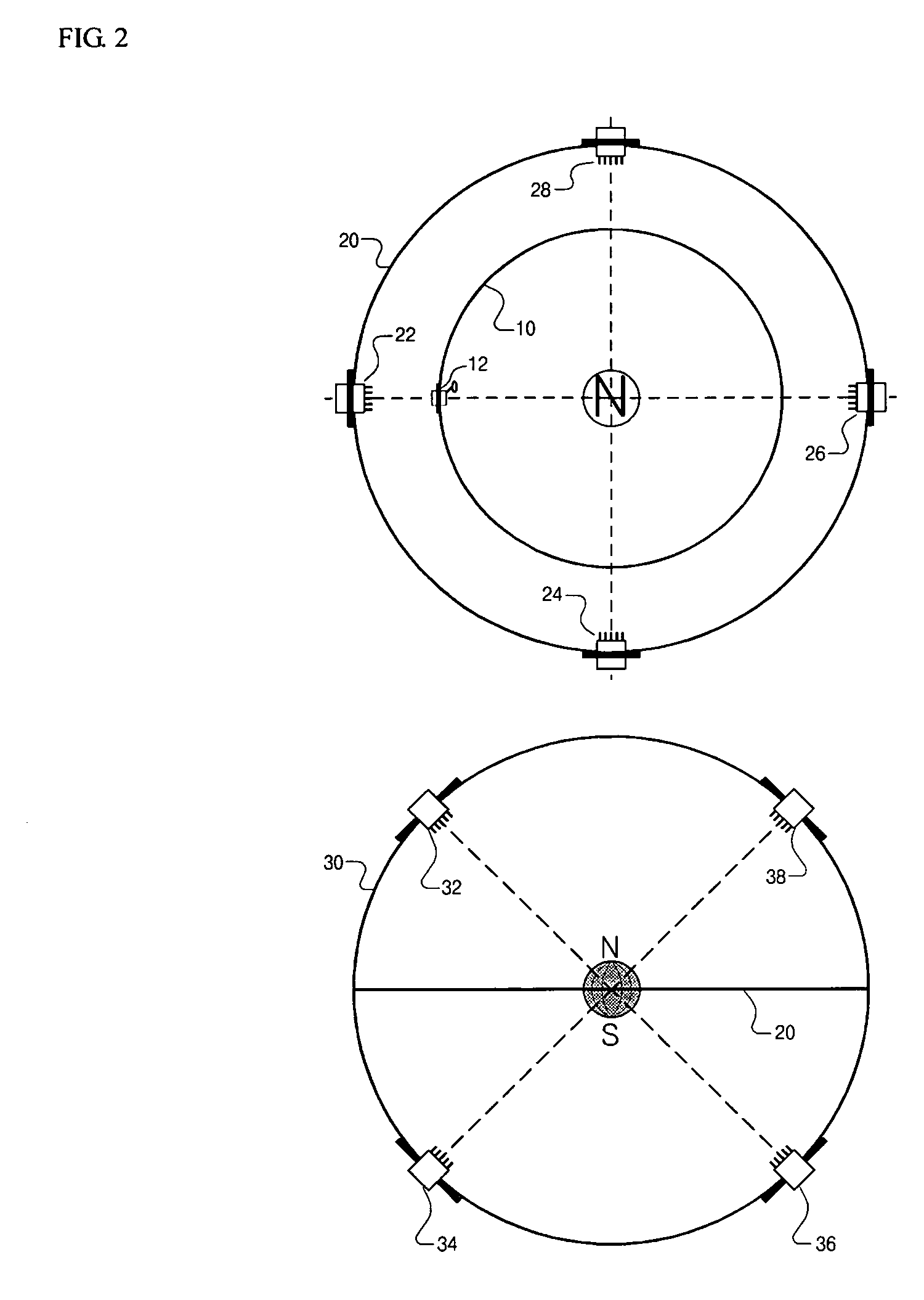
[0015]Referring to FIG. 3, a positioning system for a geostationary satellite according to the present invention comprises a plurality of outer orbit satellites 22, 24, 32, 34 revolving around the earth in equatorial orbit and polar orbit having higher altitude than that of the geostationary satellite 12; and at least one control station 40, 42, 44, 50 performing orbit determination using tracking data of the outer orbit satellites 22, 24, 32, 34, and then transmitting consequent orbit data to the outer orbit satellites 22, 24, 32, 34.

[0016]Referring to FIGS. 3 and 4, the outer orbit satellites 22, 24, 32, 34 transmit to the geostationary satellite 12 their own navigation data, clock data and correction data generated using the orbit data received from the control station 40. Examples of the navigation data are position data, health data, an...


PUM


Abstract

A positioning system for a geostationary satellite according to the present invention comprises a plurality of outer orbit satellites revolving around the earth in equatorial orbit and polar orbit having higher altitude than that of the geostationary satellite; and at least one control station performing orbit determination using tracking data for the outer orbit satellites, and then transmitting consequent orbit data to the outer orbit satellites. The outer orbit satellites transmit to the geostationary satellite their own navigation data, clock data and correction data generated using the orbit data received from the control station. The geostationary satellite calculates its own position using the navigation data, the clock data and the correction data, and performs position control and attitude control autonomously with onboard sensors and actuators.

Description

BACKGROUND OF THE INVENTION[0001]The present invention relates to a system that can perform position determination for a geostationary satellite.[0002]In general, geostationary satellites are designed and manufactured to perform their functions autonomously using an onboard computer, sensors and actuators without aid of a control station. However, orbit determination, station keeping and orbit maneuver of the satellite are possible only with aid of a control station. Orbit determination precision of the satellite is not high because the satellite revolves around the earth at the same angular velocity as that for the rotation of the earth on its axis and so the satellite looks stopped when it is observed from the control station. In addition, several dozens of people and lots of money are needed to maintain the satellite until its life is over.[0003]A global positioning system (GPS) of the United States or global navigation satellite system (GLONASS) of Russia is not useful for posit...

Claims


Application Information

Patent Timeline
IPC IPC(8): H04B7/185
CPCH04B7/18513G01S19/00
Inventor LEE, SANG-CHERLKIM, BANG-YEOPPARK, BONG-KYU
Owner KOREA AEROSPACE RES INST
Why Eureka
Try Eureka