Aircraft navigation aid method and device

a technology for aircraft and navigation aids, applied in the direction of navigation instruments, process and machine control, instruments, etc., can solve the problems of not providing continuous monitoring and often not being able to avoid vertical maneuvers, and achieve the effect of increasing the safety margin of the method

a technology for aircraft and navigation aids, applied in the direction of navigation instruments, process and machine control, instruments, etc., can solve the problems of not providing continuous monitoring and often not being able to avoid vertical maneuvers, and achieve the effect of increasing the safety margin of the method

US7173545B2Active Publication Date: 2007-02-06THALES SA

Image

  • Aircraft navigation aid method and device
  • Aircraft navigation aid method and device
  • Aircraft navigation aid method and device

Examples


Embodiment Construction

[0033]The invention relates to an aircraft navigation aid; in the description that follows, an airplane will be taken as a typical aircraft. It will also be assumed that the navigation aid relates to the pilot; it may more generally relate to a piloting system in particular in the case of an automatic pilot.

[0034]The method according to the invention comprises a number of steps mainly consisting in sensing, along a hypothetical path of the aircraft and to each side of the latter, the relief underlying a strip of terrain identified by grids, identifying the grids presenting a potential danger and, for these grids, the time remaining before undertaking an avoidance maneuver.

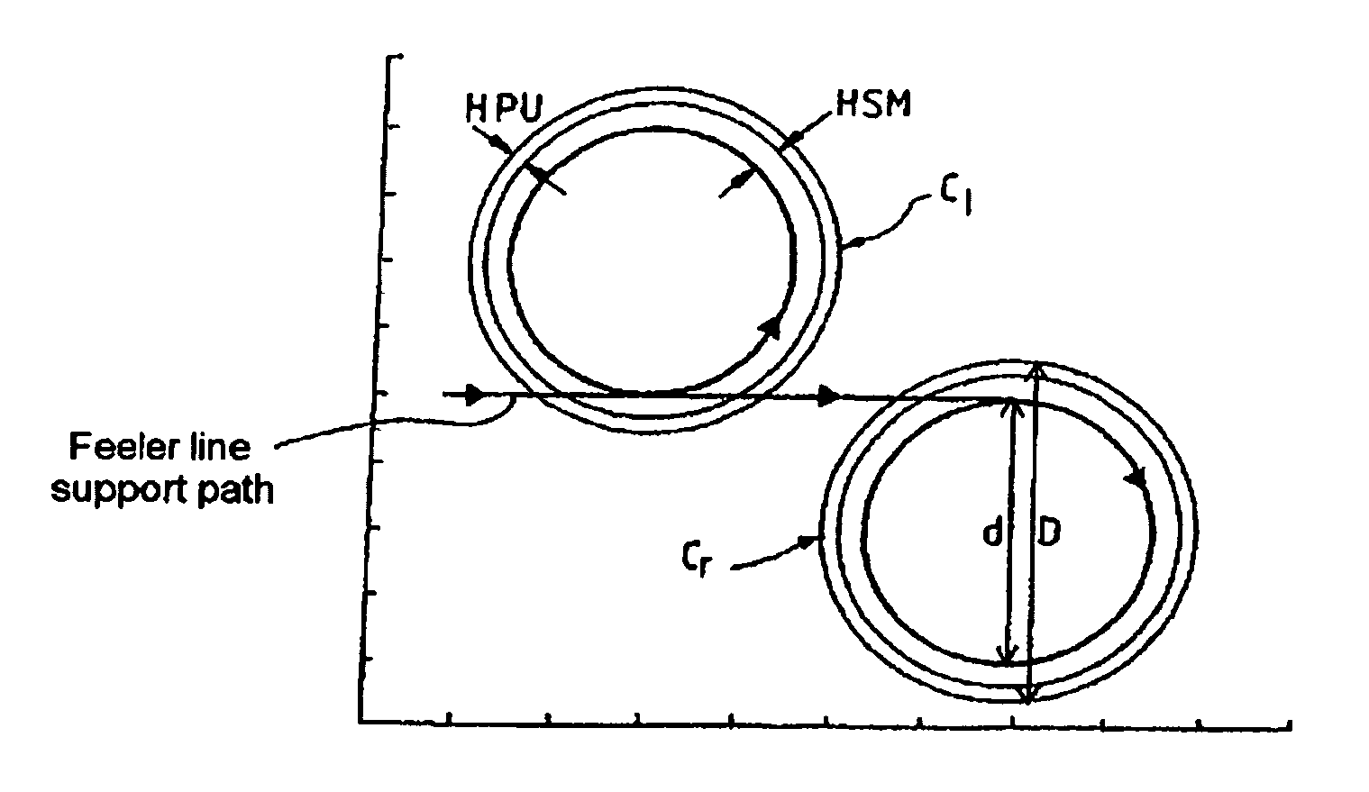
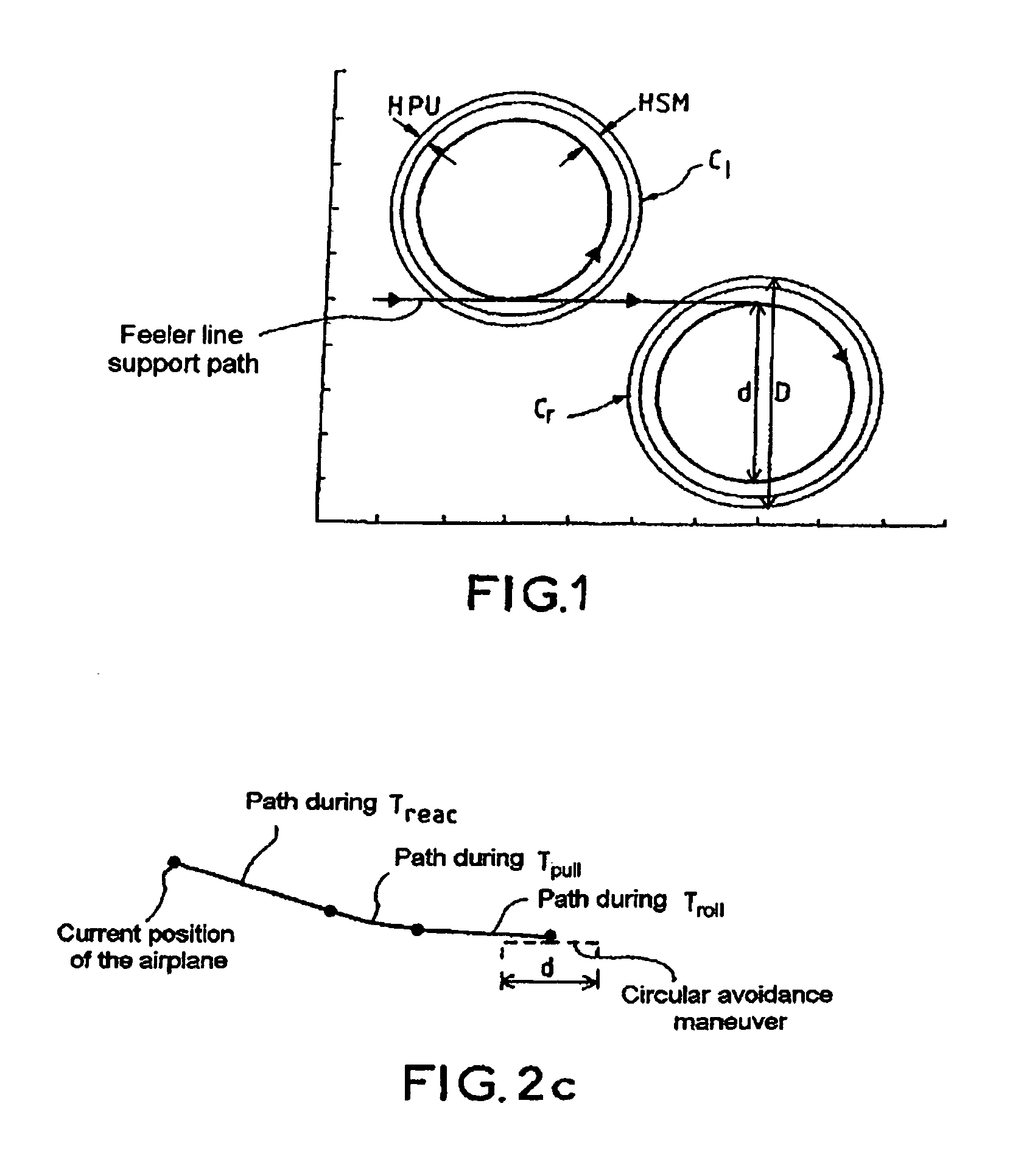
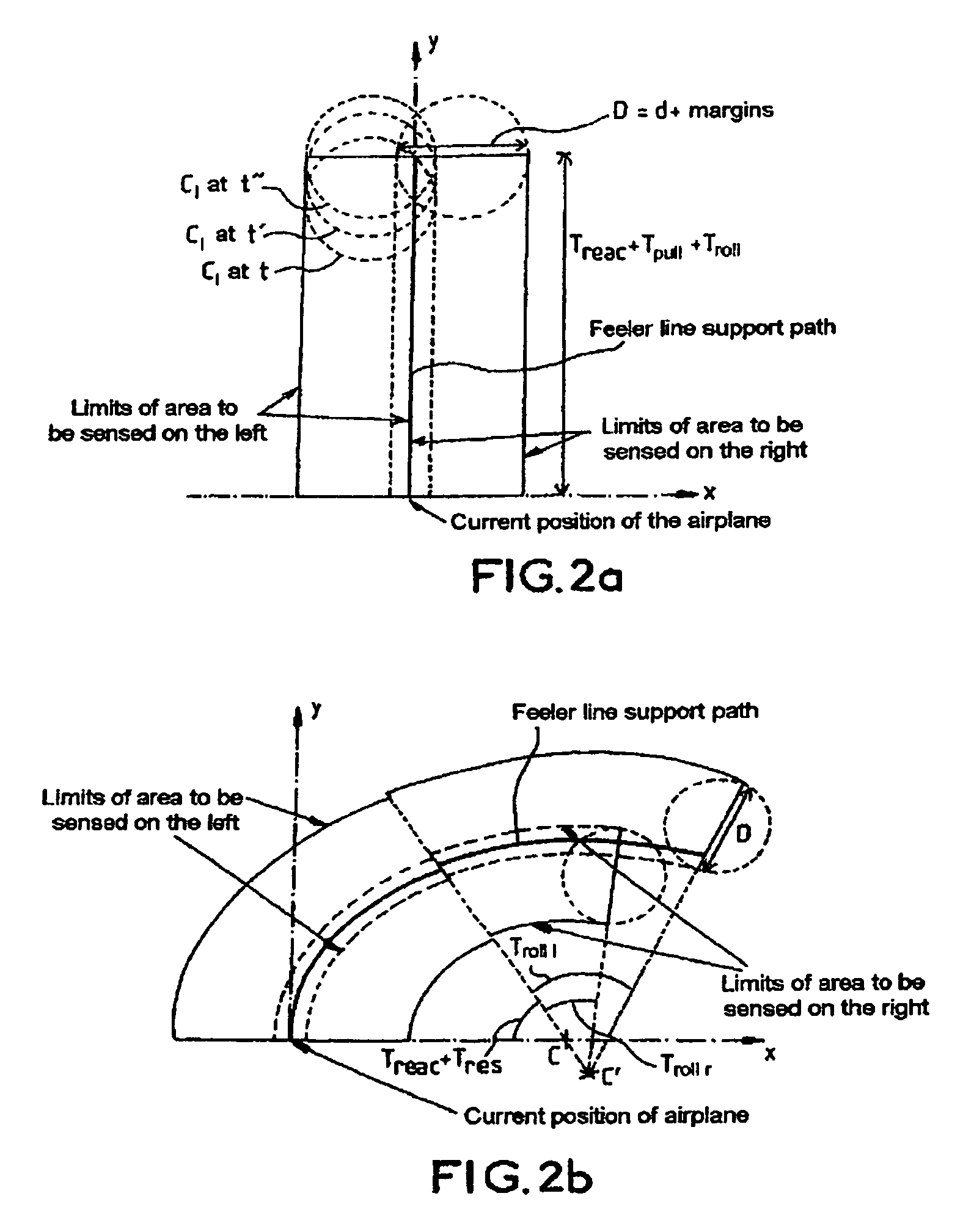
[0035]The first step consists in defining an area to be sensed to the right and to the left of a hypothetical path of the airplane which is designated in the description below as a feeler line support path and which is determined for a time T as will be seen later.

[0036]The term feeler line or area to be sensed is ...


PUM


Abstract

The invention relates to an aircraft navigation aid method. It comprises the following steps of defining an area to be sensed to the right and to the left of a first hypothetical path of the aircraft, sensing, for each of the two areas to be sensed to the right and to the left, a corresponding predefined underlying relief, in order to identify dangerous sub-zones to the right and / or to the left, computing, for each of the dangerous sub-zones to the right and / or to the left, a time ΔT remaining to begin an avoidance maneuver before a point of no return, and determining for the dangerous sub-zones to the right a minimum ΔT denoted ΔT right and / or for the dangerous sub-zones to the left a minimum ΔT denoted ΔT left, establishing a navigation aid from ΔT right and / or ΔT left.

Description

CROSS-REFERENCE TO RELATED APPLICATIONS[0001]The present Application is based on International Application No. PCT / FR2003 / 002082, filed on Jul. 4, 2003, which in turn corresponds to FR 02 / 09208 filed on Jul. 19, 2002, and priority is hereby claimed under 35 USC §119 based on these applications. Each of these applications are hereby incorporated by reference in their entirety into the present application.FIELD OF THE INVENTION[0002]The invention relates to an aircraft navigation aid method.[0003]The field of the invention is that of air navigation and safety aid and relates more particularly to ground avoidance maneuvers.DESCRIPTION OF THE PRIOR ART[0004]Onboard devices for performing vertical avoidance maneuvers are already known.[0005]Such a device described in patent EP 0 565 399 comprises in particular a mass memory for storing topographical data representing a substantial portion of the surface of the earth, a fast-access working memory into which is transferred the topographica...

Claims


Application Information

Patent Timeline
06 Feb 2007
Publication
US7173545B2
IPC
G08G5/04; G01C5/00
CPC
G01C5/005
Inventors
BERTHE, BENO T