Method for acoustic imaging of the earth's subsurface using a fixed position sensor array and beam steering

a technology of a fixed position sensor array and a beam steering device, which is applied in the field of seismic evaluation of formations in the earth's subsurface, can solve the problems of resolution limitations, limited array aperture and sensor spacing, and relatively limited vertical and lateral resolution of seismic surveying known in the ar

Active Publication Date: 2010-11-09
ACOUSTIC ZOOM
View PDF10 Cites 16 Cited by
  • Summary
  • Abstract
  • Description
  • Claims
  • Application Information

AI Technical Summary

Problems solved by technology

Seismic surveying known in the art has relatively limited vertical and lateral resolution.
Resolution limitations result from the fact that the Earth's subsurface functions as a low pass filter to seismic energy.
The array aperture and sensor spacing ultimately will be limited by the cost in data processing time.

Method used


Image

  • Method for acoustic imaging of the earth's subsurface using a fixed position sensor array and beam steering
  • Method for acoustic imaging of the earth's subsurface using a fixed position sensor array and beam steering
  • Method for acoustic imaging of the earth's subsurface using a fixed position sensor array and beam steering

Examples


Embodiment Construction

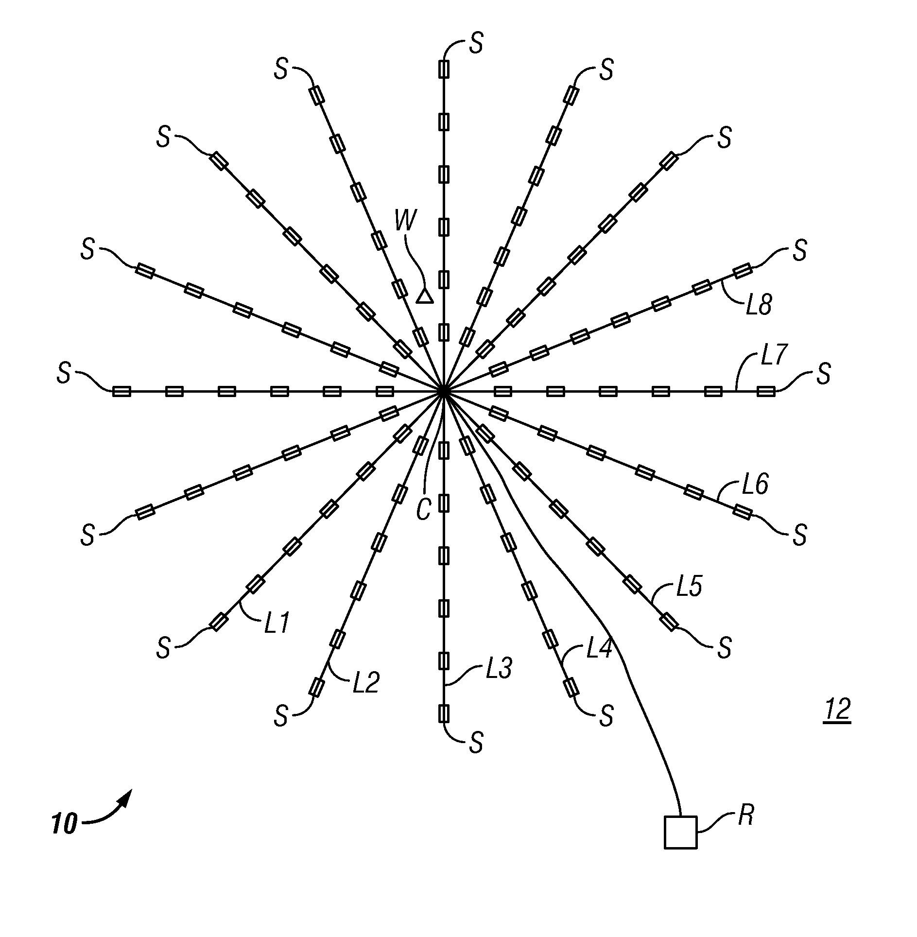
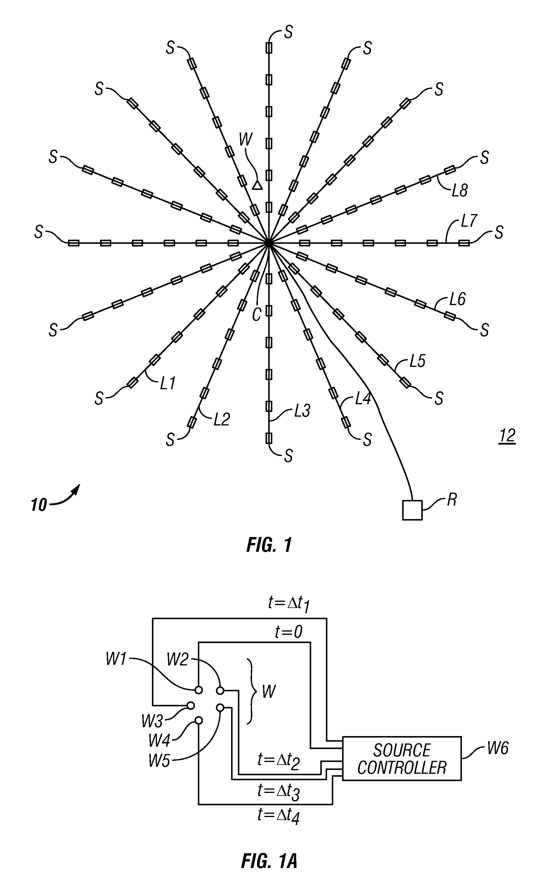
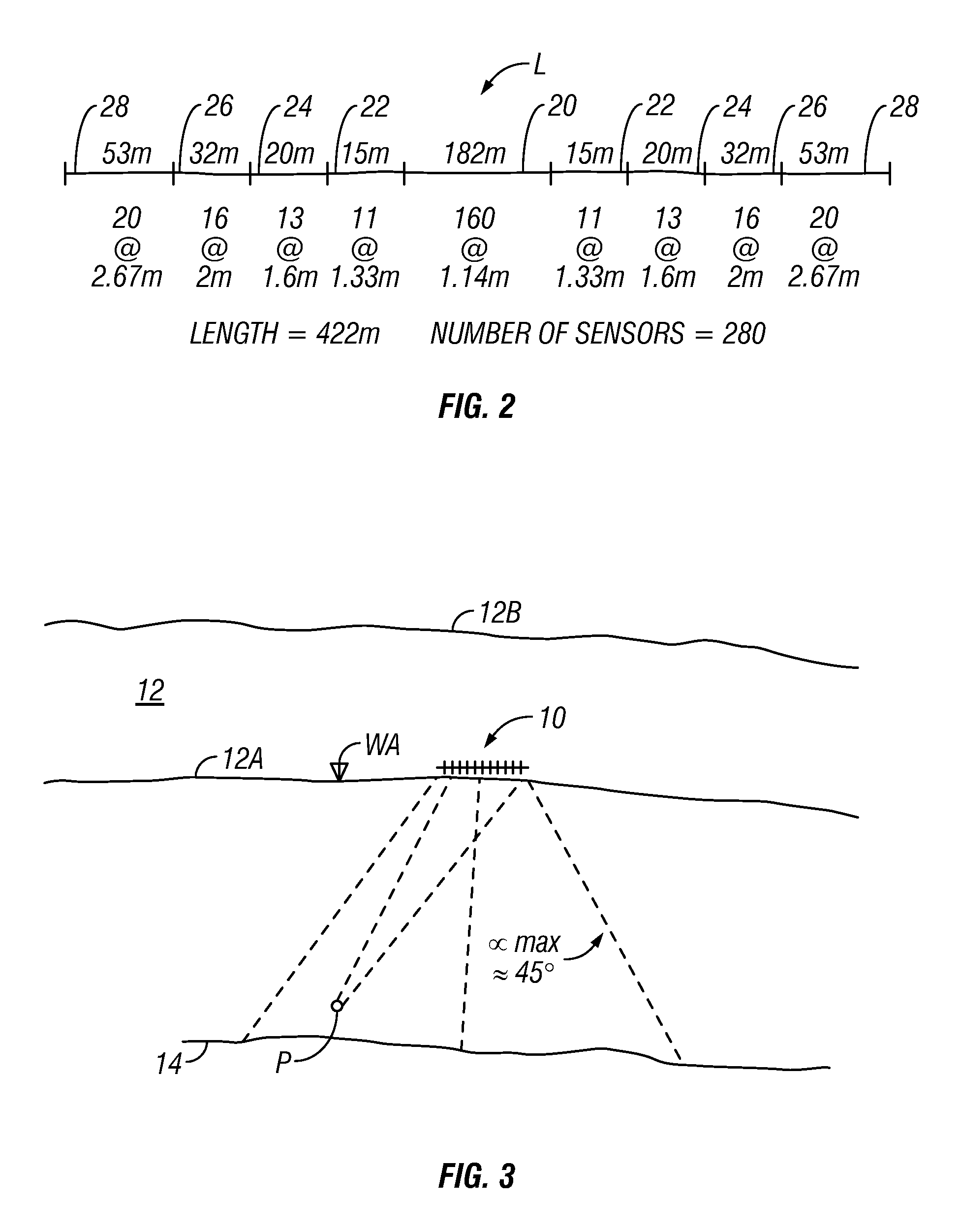
[0018]An objective of methods according to the present invention is to provide a localized examination of subsurface Earth structures with higher resolution (both laterally and vertically) than is typically possible using conventional seismic surveying. In some examples, the localized examination may be repeated at selected times to determine changes in spatial distribution of fluids in subsurface rock formations. Various examples of methods according to the invention may provide such enhanced resolution examinations at depths of 1.0 km to 3.5 km below the Earth's surface, or in examples in marine environments within a similar range of distances below the water bottom. The particular examined volume within the Earth's subsurface to be evaluated may be selected from prior, conventional seismic surveys, for example. In methods according to the invention relatively high frequency (as contrasted with conventional seismic) seismic energy is used, and coherent stacking from multiple actua...


PUM


Abstract

A method for seismic surveying includes disposing a plurality of seismic sensors in a selected pattern above an area of the Earth's subsurface to be evaluated. A seismic energy source is repeatedly actuated proximate the seismic sensors. Signals generated by the seismic sensors, indexed in time with respect to each actuation of the seismic energy source are recorded. The recorded signals are processed to generate an image corresponding to at least one point in the subsurface. The processing includes stacking recordings from each sensor for a plurality of actuations of the source and beam steering a response of the seismic sensors such that the at least one point is equivalent to a focal point of a response of the plurality of sensors.

Description

CROSS-REFERENCE TO RELATED APPLICATIONS[0001]Priority is claimed from U.S. Provisional Application No. 60 / 987,784 filed on Nov. 14, 2007.STATEMENT REGARDING FEDERALLY SPONSORED RESEARCH OR DEVELOPMENT[0002]Not applicable.BACKGROUND OF THE INVENTION[0003]1. Field of the Invention[0004]The invention relates generally to the field of seismic evaluation of formations in the Earth's subsurface. More specifically, the invention relates to methods for determining seismic attributes in specific formations in the subsurface to a relatively high lateral and vertical resolution.[0005]2. Background Art[0006]Seismic surveying techniques are known in the art for determining structure and composition of rock formations in the Earth's subsurface. Reflection seismic techniques known in the art include deploying an array of seismic sensors above a part of the subsurface to be evaluated. The sensor array may be deployed on the land surface, or in marine surveys may be towed by a vessel near the surfac...

Claims


Application Information

Patent Timeline
Patent Type & Authority Patents(United States)
IPC IPC(8): G01V1/28
CPCG01V1/28G01V2210/58
Inventor GUIGNE, JACQUES Y.PACE, NICHOLAS G.
Owner ACOUSTIC ZOOM
Why Eureka
Try Eureka