Database assisted OCR for street scenes and other images
a data base and street scene technology, applied in the field of optical character recognition (ocr), can solve the problems of not always very accurate mapping from a gps location to a street address, and vice versa
- Summary
- Abstract
- Description
- Claims
- Application Information
AI Technical Summary
Benefits of technology
Problems solved by technology
Method used
Image
Examples
example application
[0017
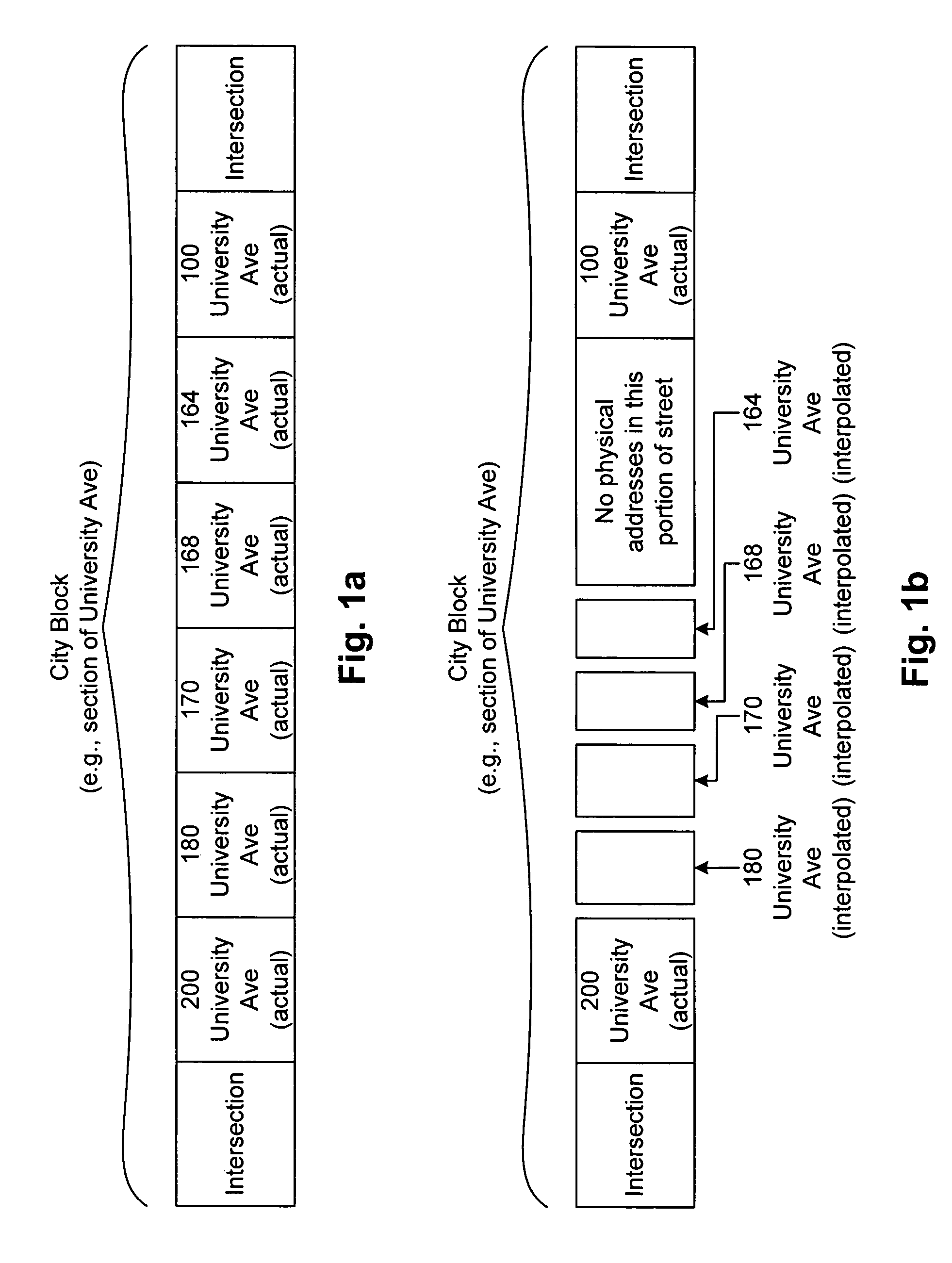
[0018]Consider the following example shown in FIG. 1a, which shows a typical city block (University Ave) that includes a number of addresses, ranging from 100 to 200, and their actual locations. This range of addresses are included between two intersections, as are most city blocks. An image of the entire city block could be captured, for example, in a panoramic photograph. Other features typically found in such a city block scene, such as parked cars, curb, sidewalk, trees and planters, retaining walls, glass storefronts, signage, addresses, etc may also be included in a given city block. Note that the use of terms such as “city block” and “intersection” is not intended to exclude other streets that include a range of addresses, whether residential or commercial.
[0019]FIG. 1b illustrates a conventional mapping system's representation of the city block shown in FIG. 1a. An underlying digital map system database (e.g., Navteq) has an actual GPS location for 100 University Ave an...
PUM
 Abstract
Description
Claims
Application Information
 - R&D
- Intellectual Property
- Life Sciences
- Materials
- Tech Scout
- Unparalleled Data Quality
- Higher Quality Content
- 60% Fewer Hallucinations
Browse by: Latest US Patents, China's latest patents, Technical Efficacy Thesaurus, Application Domain, Technology Topic, Popular Technical Reports.
© 2025 PatSnap. All rights reserved.Legal|Privacy policy|Modern Slavery Act Transparency Statement|Sitemap|About US| Contact US: help@patsnap.com


