

Assistance to a mobile SPS receiver
a technology of mobile sps and receiver, which is applied in the direction of satellite radio beaconing, measurement devices, instruments, etc., can solve the problems that the sps receiver cannot directly determine the range of the measurement of the range to the satellite, the pseudo-range measurement contains a number of errors, and the sps receiver cannot determine the range. the effect of communication burden
- Summary
- Abstract
- Description
- Claims
- Application Information
AI Technical Summary
Benefits of technology
Problems solved by technology
Method used
Image

Examples
Embodiment Construction
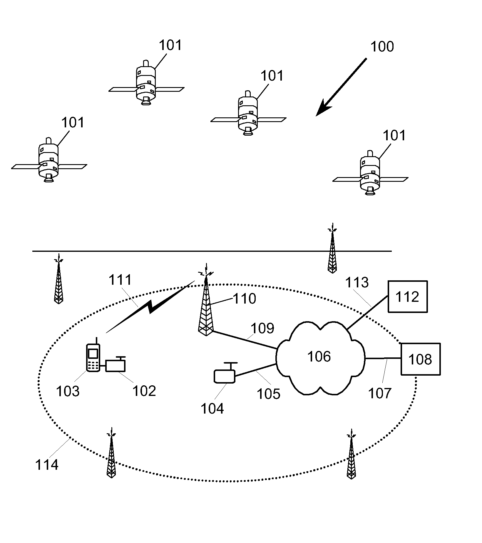
[0087]FIG. 1 depicts a constellation of satellites 101 of a satellite positioning system 100. An SPS receiver 102 attached to a mobile terminal 103, whose position is to be determined, receives the ranging signals from the satellites 101. A reference SPS receiver 104 is at a known reference point and it uses the signals from the satellites 101 to determine the ranges, satellite clock biases, and satellite clock bias rates of the satellites in view. These determinations are sent via link 105, network 106, and link 107 to a computing node 108 where they are used to construct a compact assistance vector and a corresponding validity information vector. The links 105 and 107 may be implemented by any convenient means, for example they may be cable links or radio links.
[0088]The compact assistance vector and validity information vector are sent to a second computing node 112 via link 107, network 106, and link 113. The second computing node 112 also receives pseudo range measurements from...
PUM
 Abstract
Description
Claims
Application Information