
Systems and methods for combining a plurality of terrain databases into one terrain database

a technology of plurality of terrain databases and database, applied in the field of terrain elevation databases, can solve the problems of high resolution, high noise of srtm terrain elevation data set, and low resolution elevation data not advantageous to a system such as taws

Active Publication Date: 2011-09-13
ROCKWELL COLLINS INC
View PDF21 Cites 16 Cited by
  • Summary
  • Abstract
  • Description
  • Claims
  • Application Information

AI Technical Summary

Benefits of technology

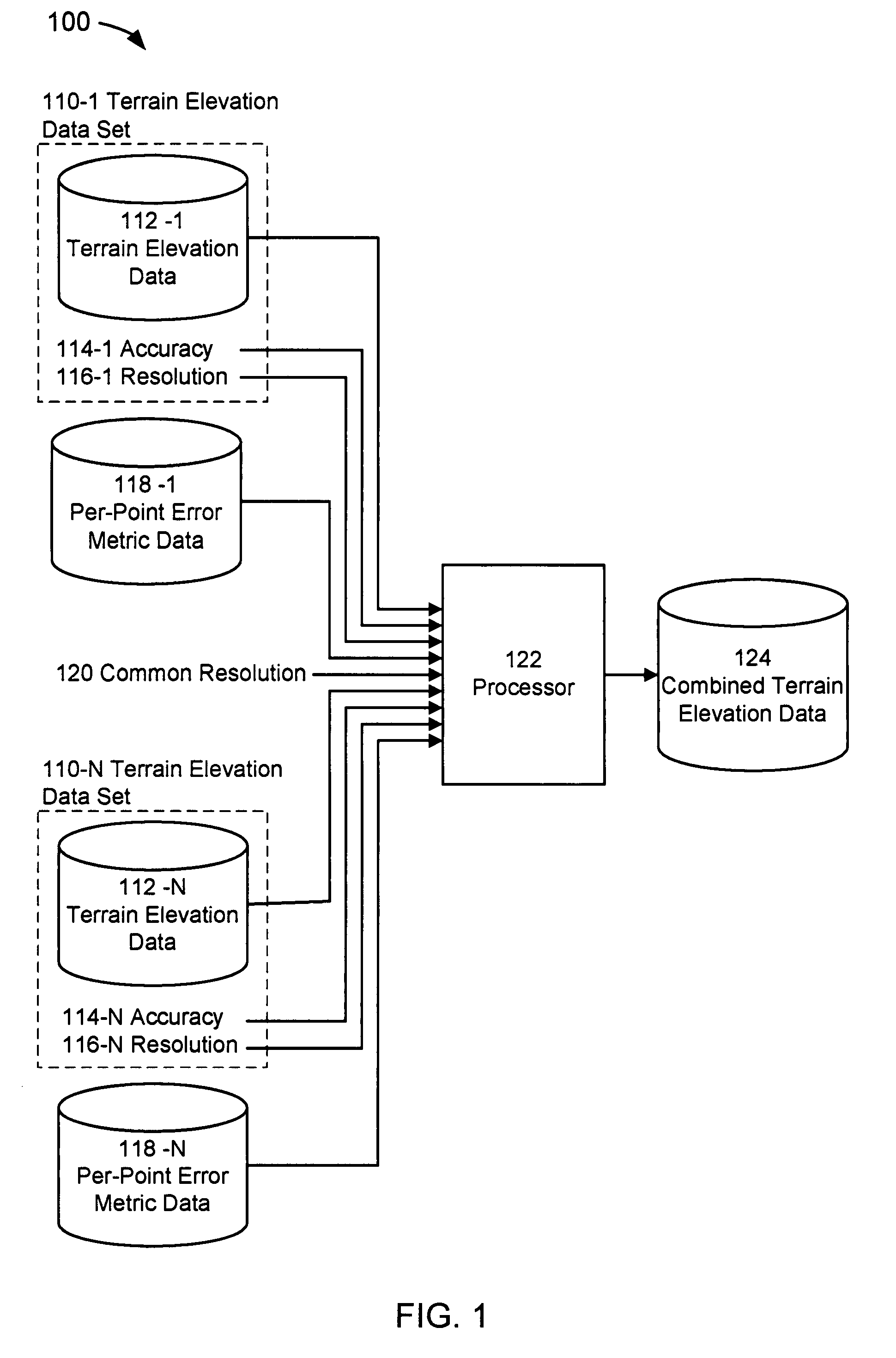
[0011]In one embodiment herein, a system is disclosed that could provide a processor with terrain elevation data from a plurality of terrain elevations data sets having different resolutions and accuracy parameters, per-point error metric data from a plurality of

Problems solved by technology

While the whole coverage of the terrain elevation data is positive, the low-resolution elevation data is not advantageous for a system such as TAWS because changes in terrain are reported at a one kilometer interval.
While the resolution of the terrain elevation data set is positive, there are three significant drawbacks of SRTM.
Second, the SRTM terrain elevation data set is affected by mountainous and desert areas.
On the other hand, SRTM terrain elevation data set is high resolution and often contains high-frequency noise that may have been caused by radar artifacts of the Interferometric Synthetic Aperture Radar technique employed during the Shuttle mission to acquire the SRTM data.

Method used


Image

  • Systems and methods for combining a plurality of terrain databases into one terrain database
  • Systems and methods for combining a plurality of terrain databases into one terrain database
  • Systems and methods for combining a plurality of terrain databases into one terrain database

Examples


Embodiment Construction

[0017]In the following description, several specific details are presented to provide a thorough understanding of embodiments of the invention. One skilled in the relevant art will recognize, however, that the invention can be practiced without one or more of the specific details, or in combination with other components, etc. In other instances, well-known implementations or operations are not shown or described in detail to avoid obscuring aspects of various embodiments of the invention.

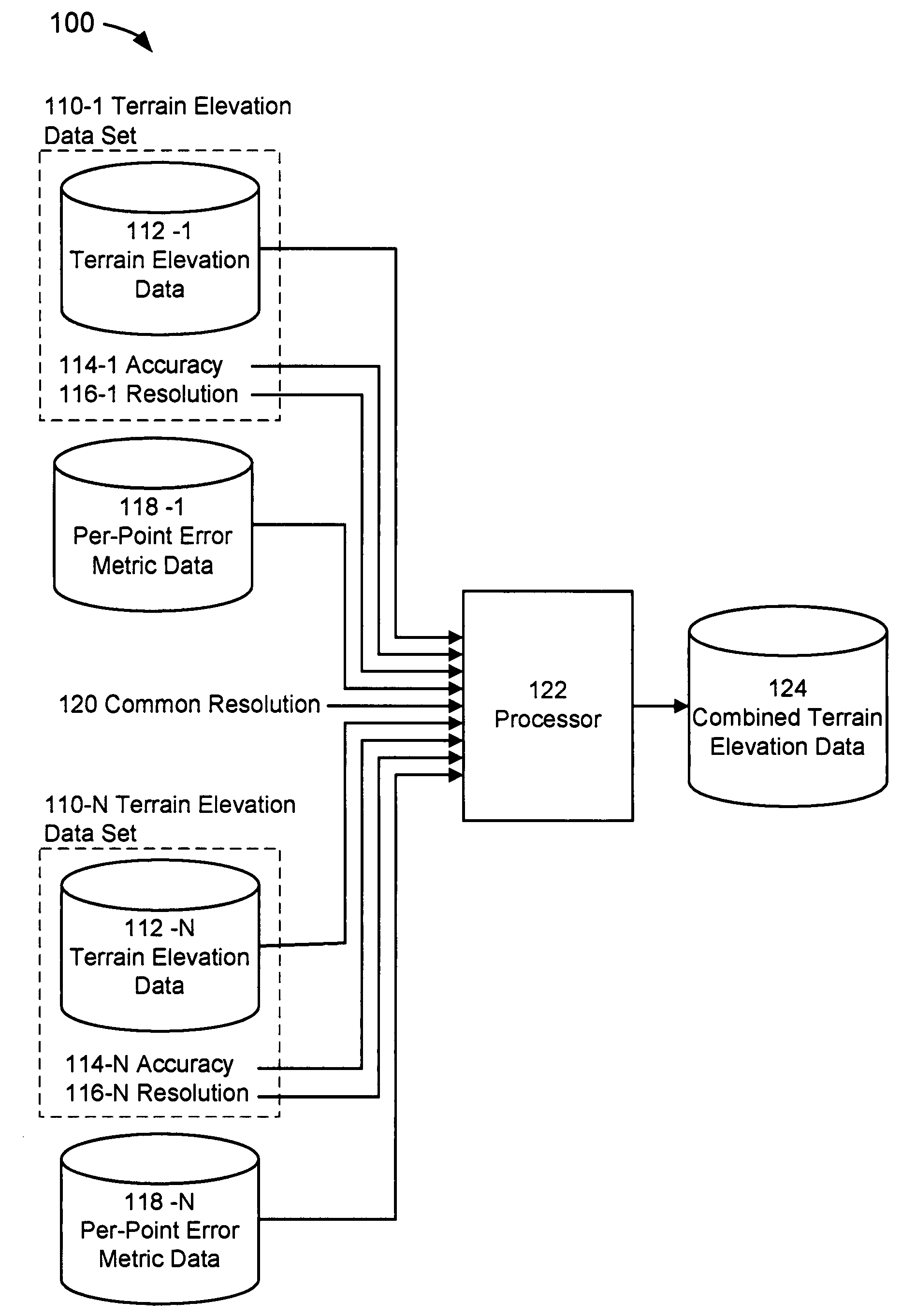
[0018]FIG. 1 depicts a system 100 for combining a plurality of terrain databases into one database which is suitable for implementation of the techniques described herein. The system may be comprised of a plurality of terrain elevation data sets 110-1 to 110-N (collectively, singular or plural, “terrain data sets 110”), a plurality of per-point error metric data 118-1 to 118-N (collectively, “per-point error metric data 110”), a common resolution parameter 120, a processor 122 and combined terrain e...


PUM


Abstract

A present novel and non-trivial system and methods for exacting terrain elevation data contained in a plurality of terrain elevation databases or data sets, combining the terrain elevation data contained in each terrain elevation data set to produce a single, combined terrain database of a common resolution. A system is disclosed that could provide a processor with terrain elevation data from a plurality of terrain elevations data sets having differing resolution and accuracy parameters, a per-point error metric data from a plurality of error metric data sets, and a common resolution parameter. A method is disclosed which for combining terrain elevation data sets having difference resolutions into a single, combined terrain elevation data set having a common resolution utilizing a per-point error metric data from a plurality of error metric data sets. A second method is disclosed for combining a plurality of terrain elevation data sets having different resolutions into terrain elevation data of a single, combined terrain elevation data set having a common resolution by transforming the plurality of terrain elevation data sets into a plurality of terrain frequency data sets and filtering the terrain frequency data sets utilizing a Kalman filter.

Description

BACKGROUND OF THE INVENTION[0001]1. Field of the Invention[0002]This invention pertains to terrain elevation databases as applied in the field of avionics. The embodiments herein contain a system and methods for combining a plurality of terrain elevation databases having varying resolutions and parameters into a single database of a common resolution.[0003]2. Description of the Related Art[0004]Beginning in the early 1970's, a number of studies looked at the occurrence of “controlled flight into terrain” (CFIT)-type accidents, where a properly functioning airplane under the control of a fully qualified and certificated crew is flown into terrain (or water or obstacles) with no apparent awareness on the part of the crew. Findings from these studies indicated that many such accidents could have been avoided if a warning device called a ground proximity warning system (“GPWS”) was used. Thereafter, advances in terrain mapping technology permitted vendors and designers of avionics equip...

Claims


Application Information

Patent Timeline
IPC IPC(8): G06F7/00G06F17/30G06T17/00G06F17/00
CPCG06F17/30241G06T17/05G06F16/29
Inventor POSTNIKOV, ALEXWENGER, JASON C.WALLING, KAREN L.PELZER, ANDREW M.BOWMAN, VICTORIA C.
Owner ROCKWELL COLLINS INC
Learn More