
Methods and systems for determining location using a hybrid satellite and WLAN positioning system by selecting the best SPS measurements

a positioning system and hybrid technology, applied in the field of hybrid positioning system, to achieve the effect of improving the accuracy of location estimation

Active Publication Date: 2011-11-22
SKYHOOK WIRELESS
View PDF147 Cites 25 Cited by
  • Summary
  • Abstract
  • Description
  • Claims
  • Application Information

AI Technical Summary

Benefits of technology

The patent text describes a method and system for improving the accuracy of location estimation in a hybrid positioning system using satellite and WLAN information. The method involves determining a WLAN based location estimate using WLAN access points and selecting satellite measurements that are consistent with the WLAN based location estimate. The selected satellite measurements can include a set of satellite based location estimates or a single location estimate. The system can include a hybrid positioning module with WLAN and satellite positioning modules for obtaining satellite measurements and a logic for selecting the consistent satellite based location estimate. The technical effect of the patent text is to increase the accuracy of location estimation in a hybrid positioning system by integrating satellite and WLAN positioning information.

Problems solved by technology

Each of these approaches has its strengths and weaknesses depending upon the nature of the signals and measurements, and the positioning algorithms employed.

Method used


Image

  • Methods and systems for determining location using a hybrid satellite and WLAN positioning system by selecting the best SPS measurements
  • Methods and systems for determining location using a hybrid satellite and WLAN positioning system by selecting the best SPS measurements
  • Methods and systems for determining location using a hybrid satellite and WLAN positioning system by selecting the best SPS measurements

Examples


Embodiment Construction

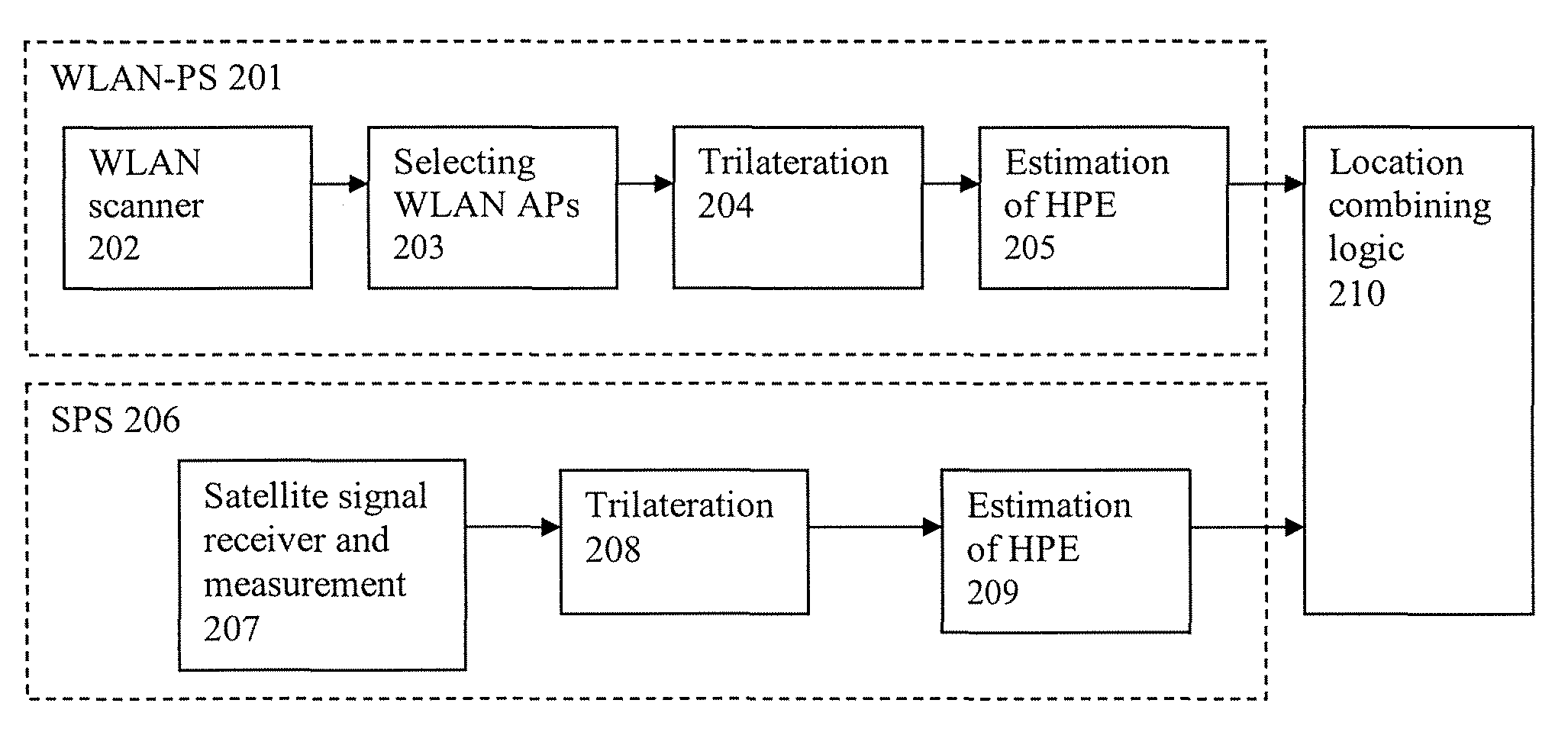
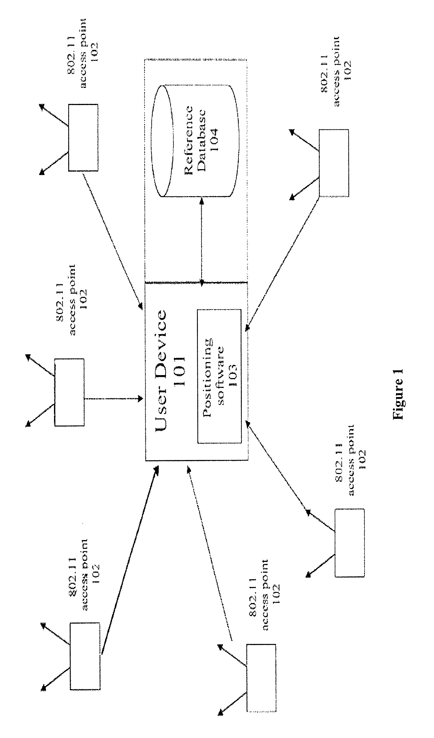
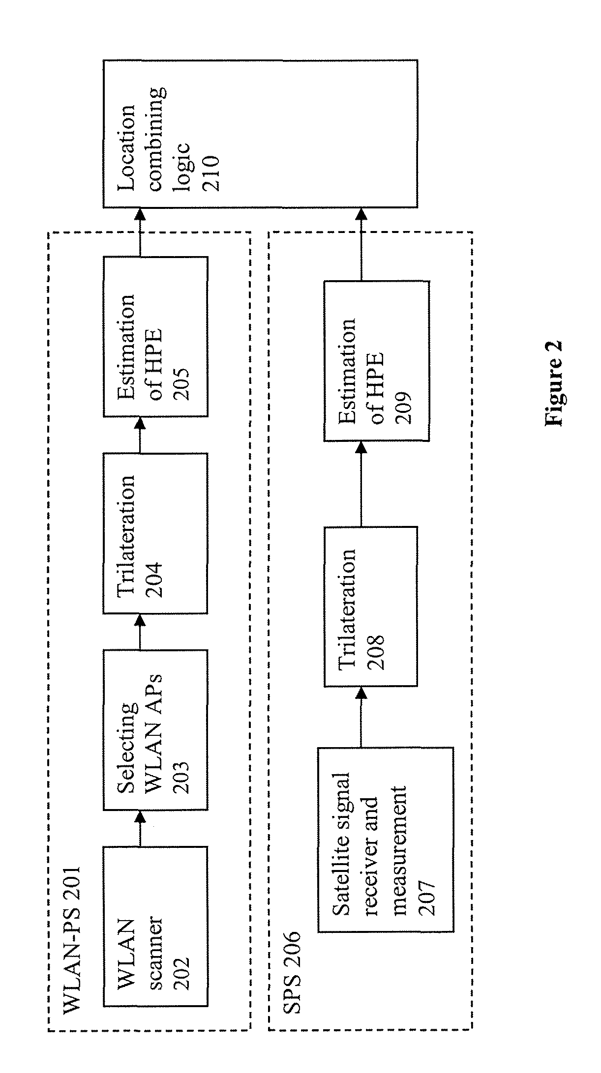
[0061]Embodiments of the disclosure provide systems and methods for detecting moved WLAN access points in an integrated or hybrid system of WLAN-based positioning system (WLAN-PS) and satellite-based positioning system (SPS) by using received signals from two or more satellites. The WLAN-based positioning system relies on knowing the location of WLAN access points and using them as reference points to estimate a location of a mobile device. The mobile device is equipped with both a satellite receiver and a WLAN receiver for receiving signals from satellite and WLAN access points (APs), respectively. If a WLAN access point moves and the WLAN-based positioning system still uses the old location of the WLAN access point as the reference location, then the WLAN-PS will report a location corresponding to the old location of the WLAN access point, which might be far from its current location. In an integrated system of a WLAN-based positioning system and a satellite-based positioning syst...


PUM


Abstract

The disclosed subject matter generally relates to hybrid positioning systems and methods, more specifically, systems and methods of integrating a wireless local area network (WLAN) based positioning system (WLAN-PS) and a satellite positioning system (SPS) to improve accuracy of location estimates by selecting the best set of measurements from both systems.

Description

CROSS-REFERENCE TO RELATED APPLICATIONS[0001]This application is related to U.S. patent application Ser. No. 12 / 504,373, filed Jul. 16, 2009 and entitled “Systems and Methods for Using a Satellite Positioning System to Detect Moved WLAN Access Points.”BACKGROUND[0002]1. Field[0003]The disclosed subject matter generally relates to a hybrid positioning system and, more specifically, to selecting the best set of measurements between WLAN Access Points and satellite measurements to estimate the location of a mobile device.[0004]2. Description of Related Art[0005]In recent years the number of mobile computing devices has increased dramatically, creating the need for more advanced mobile and wireless services. Mobile email, walkie-talkie services, multi-player gaming and call-following are examples of how new applications are emerging for mobile devices. In addition, users are beginning to demand / seek applications that not only utilize their current location but also share that location i...

Claims


Application Information

Patent Timeline
Patent Type & Authority Patents(United States)
IPC IPC(8): G01S19/33
CPCG01S19/46
Inventor ALIZADEH-SHABDIZ, FARSHID
Owner SKYHOOK WIRELESS
Learn More