Systems, methods, and computer-readable media for verifying traffic designations of roads

a technology of traffic designation and computer-readable media, applied in the field of computer-implemented geographic maps, can solve the problems of existing geographic map data, difficult to determine or verify if a road is a one-way road, and difficulty in determining the type of road

Active Publication Date: 2014-09-02
GOOGLE LLC
View PDF48 Cites 26 Cited by
  • Summary
  • Abstract
  • Description
  • Claims
  • Application Information

AI Technical Summary

Benefits of technology

[0006]Various embodiments of systems, methods, and computer-readable media for verifying traffic designations of roads are provided herein. In some embodiments, a method for verifying a traffic designation of a road is provided. The method includes obtaining, by one or more processors, location data in a geographic area, the location data including a plurality of points each having a heading and a speed and associating, by one or more processors, a first group of the plurality of points with a selected road in the geographic area, the selected road having a traffic designation. The method further includes counting, by one or more processors, a first number of the first group of points having a heading in a first direction and counting, by one or more processors, a second number of the first group of points having a heading in a second direction substantially opposite the first direction. Additionally, the method includes determining a traffic direction of the road based on the first number and the second number and determining, by one or more processors, whether a conflict exists between the determined traffic direction and the traffic designation of the road.
[0007]In another embodiment, a non-transitory tangible computer-readable storage medium having executable computer code stored thereon for verifying a traffic designation of a road is provided. The computer code includes a set of instructions that causes one or more processors to perform the following: obtaining, by one or more processors, location data in a geographic area, the location data including a plurality of points each having a heading and a speed and associating, by one or more processors, a first group of the plurality of points with a selected road in the geographic area, the selected road having a traffic designation. The computer code further includes a set of instructions that causes one or more processors to perform the following: counting, by one or more processors, a first number of the first group of points having a heading in a first di

Problems solved by technology

However, determining the type of road may be difficult based on the geographic data included in the geographic maps.
For example, it may be difficult to determine or verify if a road is a one-way road or a two-way road

Method used


Image

  • Systems, methods, and computer-readable media for verifying traffic designations of roads
  • Systems, methods, and computer-readable media for verifying traffic designations of roads
  • Systems, methods, and computer-readable media for verifying traffic designations of roads

Examples


Embodiment Construction

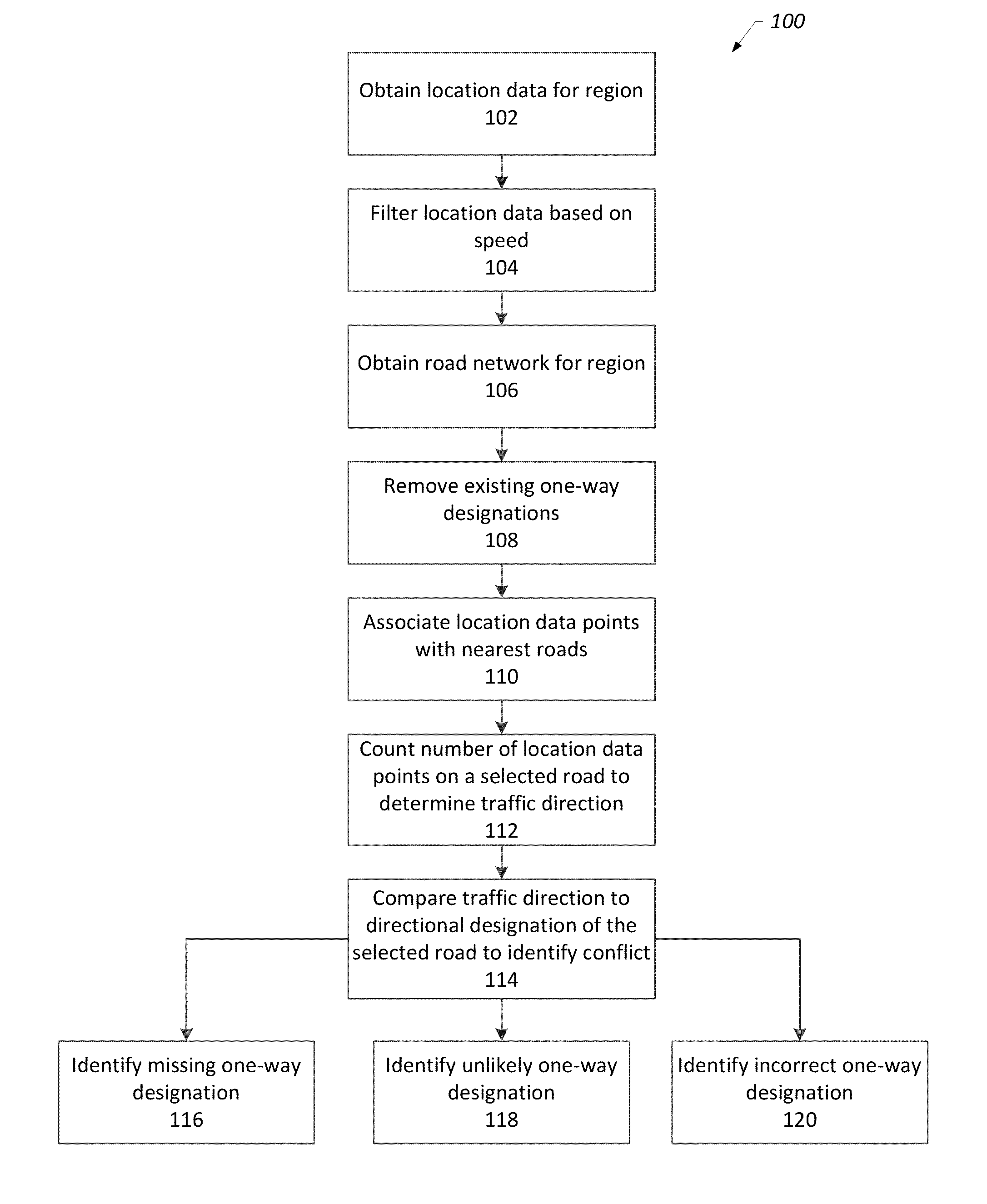
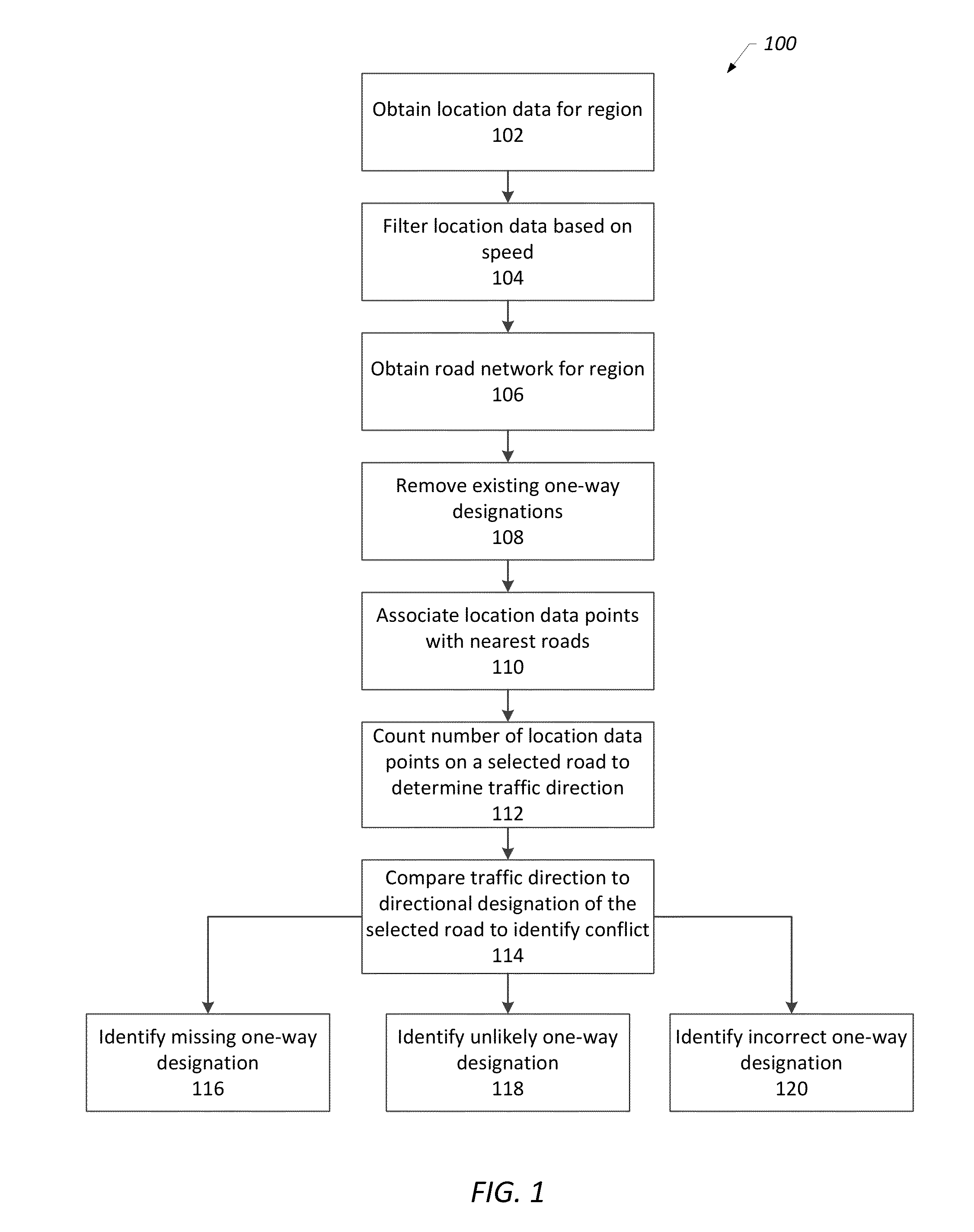
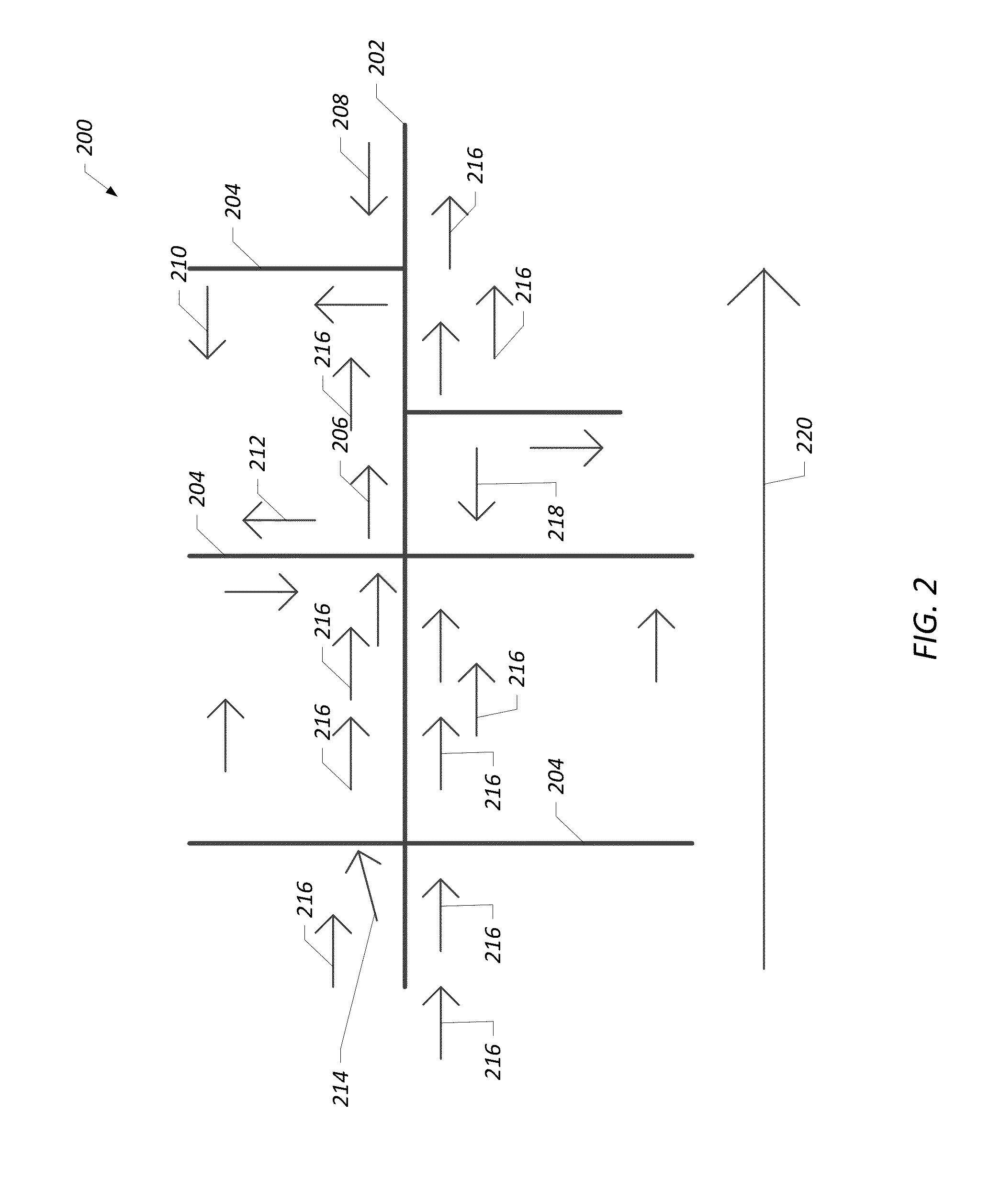
[0015]As discussed in more detail below, provided in some embodiments are systems, methods, and computer-readable media for verifying traffic designations of roads. Location data is obtained, such as from a location-based service. The location data includes location data points having a heading and a speed. The location data is filtered based on speed, such that all data points below a speed threshold are discarded. A road network for a geographic area is obtained that includes roads having traffic designations, such as one-way designations and two-way designations. The one-way designations for the obtained roads are removed. The filtered location data points are then associated with a road and a first direction or second direction of the road. In some embodiments, the association between a location data point and a road is a function of the proximity of the data point to the road and the heading of the data point with respect to the orientation of the road.

[0016]Next, for a selecte...


PUM


Abstract

Provided are systems, methods, and computer-readable for verifying the traffic designations of roads of a geographic map. Location data for a geographic area is obtained and location data points are filtered based on speed. A road network for the geographic area is obtained, and location data points are associated with a road based on proximity and heading with respect to the orientation of the road. The associated location data points in each direction are counted and used to determine a traffic direction. The traffic direction is compared to the existing traffic designation for the road, and conflicts are identified, such as missing one-way designations, unlikely one-way designations, and incorrect one-way designations.

Description

BACKGROUND OF THE INVENTION[0001]1. Field of the Invention[0002]This invention relates generally to computer-implemented geographic maps and, more particularly, to determining traffic designations of roads.[0003]2. Description of the Related Art[0004]Computer-implemented geographic maps are useful for a variety of purposes. For example, users may interact with computer-implemented geographic maps to learn about a geographic area, to identify the location of geographically-distributed objects (e.g., man-made structures or natural features) in a geographic area, search for categories of objects in a geographic area (e.g., restaurants in a given city), identify routes between locations in a geographic area (e.g., driving directions from a current location to a desired destination), and so on.[0005]Such geographic maps may include features such as roads, intersections, and various other features. However, determining the type of road may be difficult based on the geographic data include...

Claims


Application Information

Patent Timeline
IPC IPC(8): G01C21/26G08G1/08
CPCG01C21/26G08G1/08G08G1/0112G08G1/0133G01C21/32
Inventor WOLF, DANIEL
Owner GOOGLE LLC
Why Eureka
Try Eureka