

Systems and methods for modeling floods
a flood system and flood technology, applied in the field of systems and methods for modeling floods, can solve the problems of limiting the effectiveness and usefulness of flood maps, difficulty in predicting flooding, and current techniques for estimating the amount of water that overflows the banks of streams or rivers are much less accura
- Summary
- Abstract
- Description
- Claims
- Application Information
AI Technical Summary
Benefits of technology
Problems solved by technology
Method used
Image

Examples
Embodiment Construction
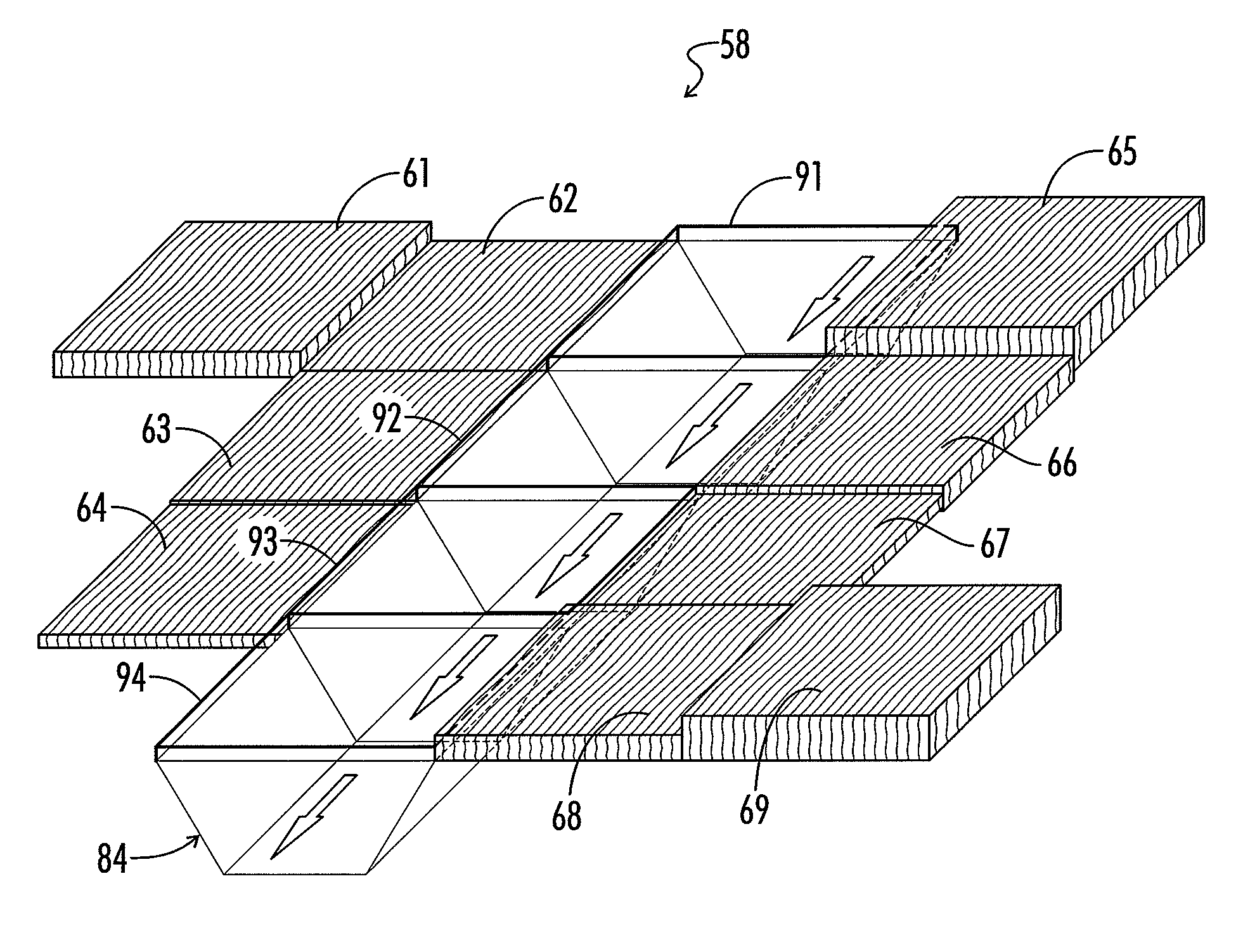
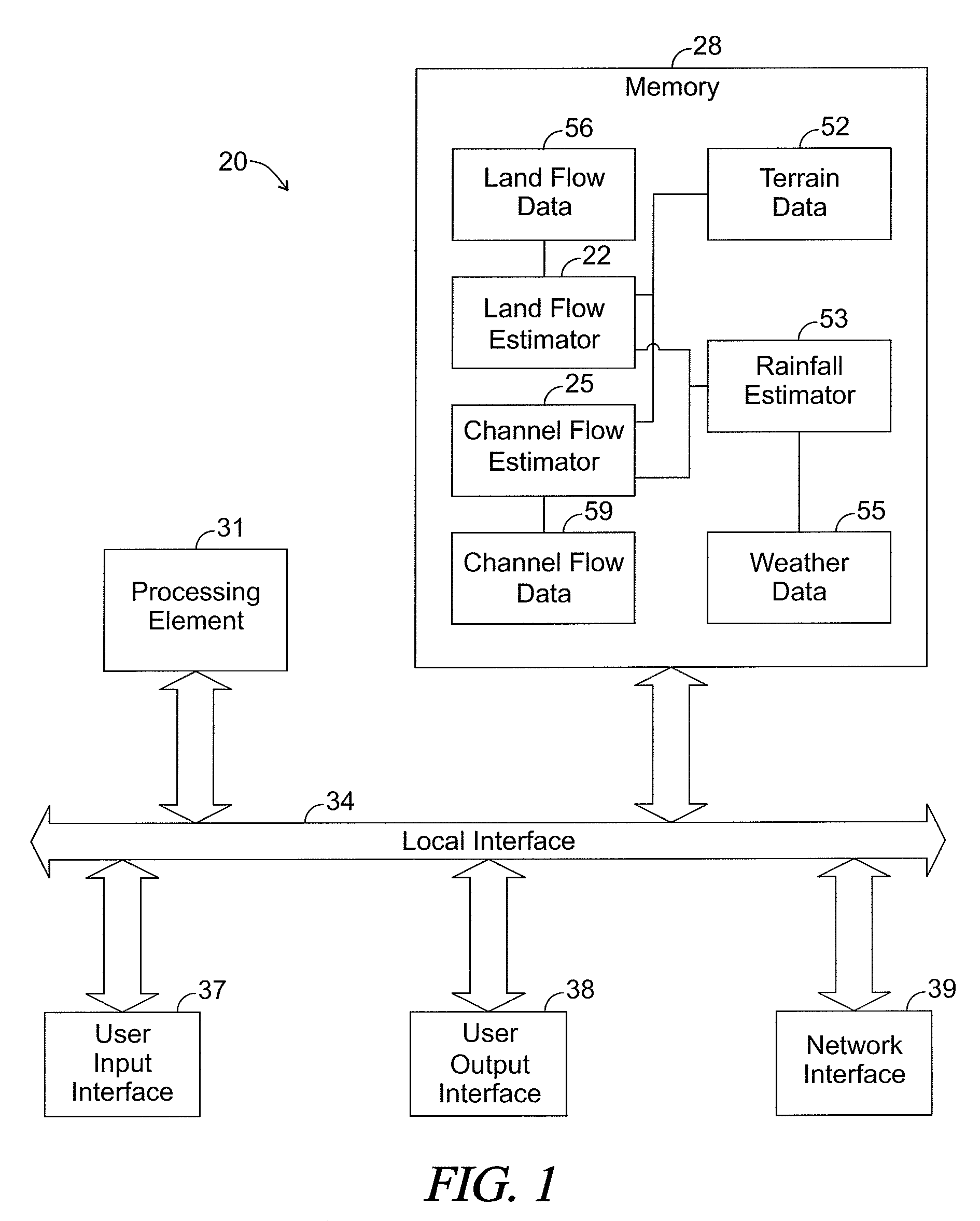
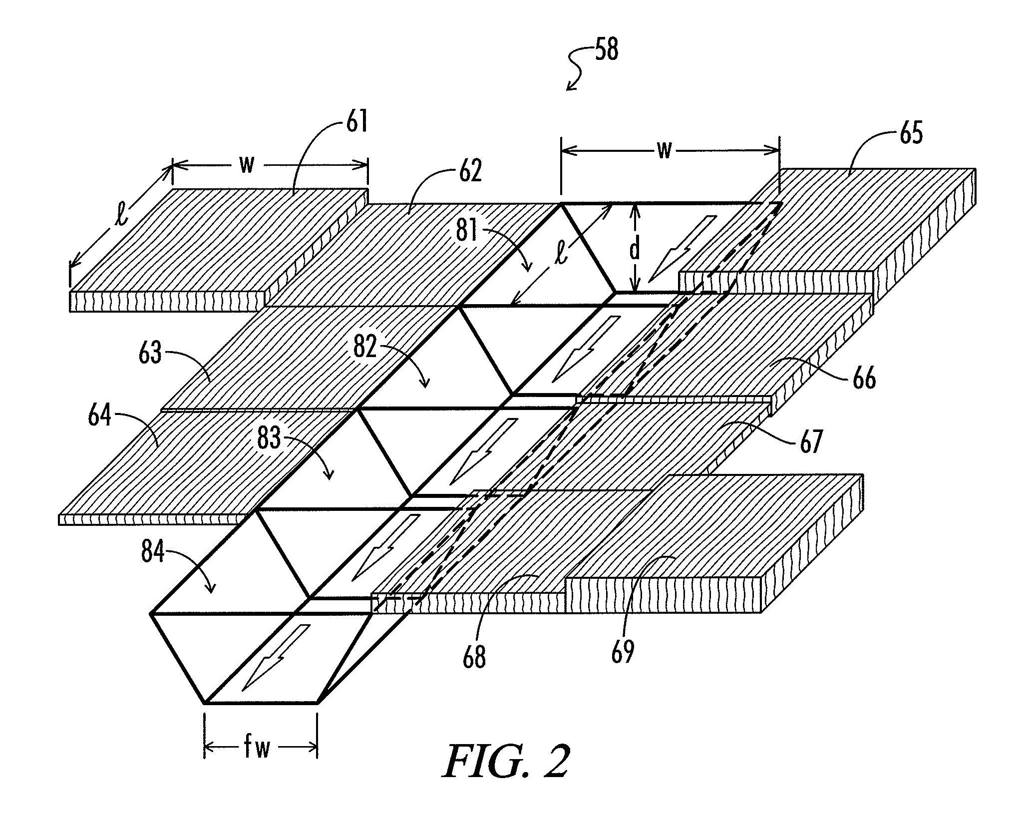
[0024]The present disclosure generally pertains to systems and methods for modeling floods. A flood modeling system in accordance with one exemplary embodiment of the present disclosure defines cells, which virtually represents different areas of a geographic region. Some of the cells, referred to as “channel cells,” represent areas within a channel for a moving body of water, such as a stream or river. Other cells, referred to as “land cells,” represent areas external to the channels within the geographic region. The flow of water through the geographic region is modeled as a virtual flow of water through the channel cells and the land cells. The virtual flow of water through the channel cells is modeled via one algorithm, referred to as a “channel flow algorithm,” and the virtual flow of water through the land cells is modeled via another algorithm, referred to as a “land flow algorithm.”
[0025]The virtual flow of water over time is estimated in a series of time steps in which each...
PUM
 Abstract
Description
Claims
Application Information