Integrated aerial photogrammetry surveys

a photogrammetry and integrated technology, applied in the field of aerial photography, can solve the problems of large investment in time and money, high equipment cost, and measurement cost, and achieve the effect of reducing the cost of a survey

Active Publication Date: 2016-01-12
TRIMBLE INC
View PDF120 Cites 110 Cited by
  • Summary
  • Abstract
  • Description
  • Claims
  • Application Information

AI Technical Summary

Benefits of technology

[0006]A set of embodiments provides novel solutions for generating survey data about a survey site. In an aspect, some embodiments employ aerial photography of at least part of the survey site, and in another aspect, some embodiments analyze the aerial photography using photogrammetric techniques. Certain embodiments employ an unmanned aerial system (“UAS”) to collect site imagery. The use of a UAS can reduce the cost of a survey, compared to the use of other aerial imagery (e.g., conventional aerophotography and / or satellite imagery), which can require interaction with regulatory authorities, leasing of expensive equipment, and / or significant advanced planning.
[0007]Further, some embodiments can provide accuracy and / or precision comparable to a conventional terrestrial survey at a lower cost, due to a need for fewer (or no) measurements taken using terrestrial survey equipment. Instead, such embodiments can employ aerial photography to capture site data relatively quickly. Unlike conventional aerial photographs, however, the images captured by certain embodiments can have sufficient resolution to allow photogrammetric analysis to generate relatively precise and / or accurate position data about features of interest on the survey site. For example, in some embodiments, the UAS can capture site imagery from a height of less than 800 feet, which would be infeasible for conventional aerophotography.

Problems solved by technology

The expense of the equipment involved, along with the required time commitment and labor-intensive nature of the measurements, necessarily requires considerable investment in time and money prior to beginning any development activities.
Such photography, however, generally is performed using aircraft and / or satellites, which necessarily entail significant costs and administrative inconvenience.
Moreover, aerial photographs, which necessarily are taken from altitudes ranging from several thousand feet to several miles, cannot provide imagery with sufficient resolution to allow analysis with the precision required for a land survey.

Method used


Image

  • Integrated aerial photogrammetry surveys
  • Integrated aerial photogrammetry surveys
  • Integrated aerial photogrammetry surveys

Examples


Embodiment Construction

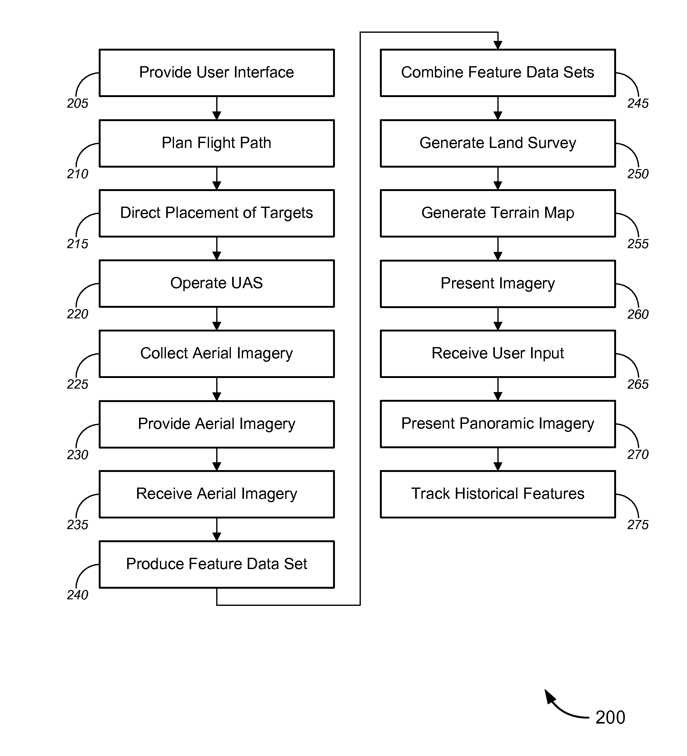
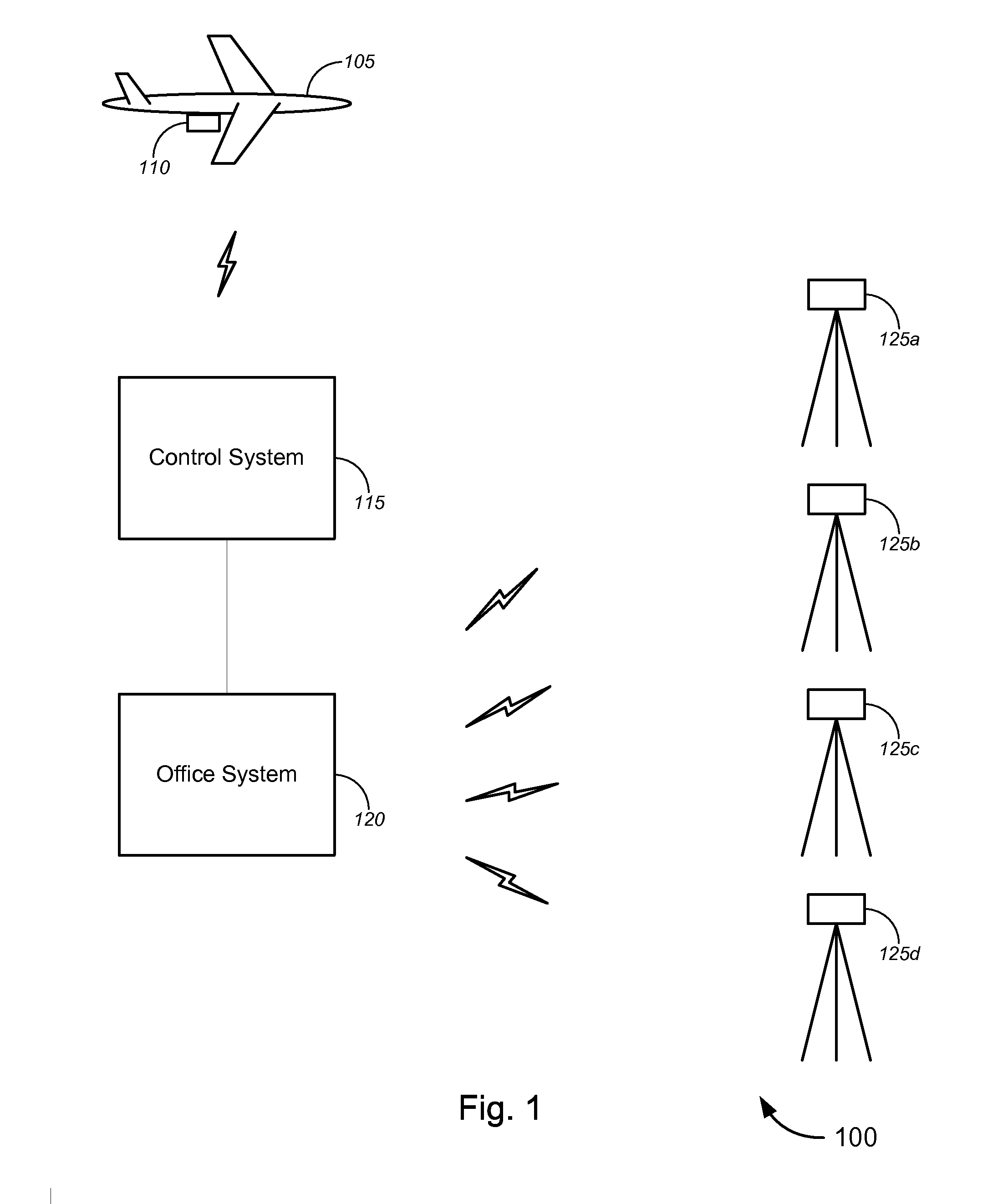
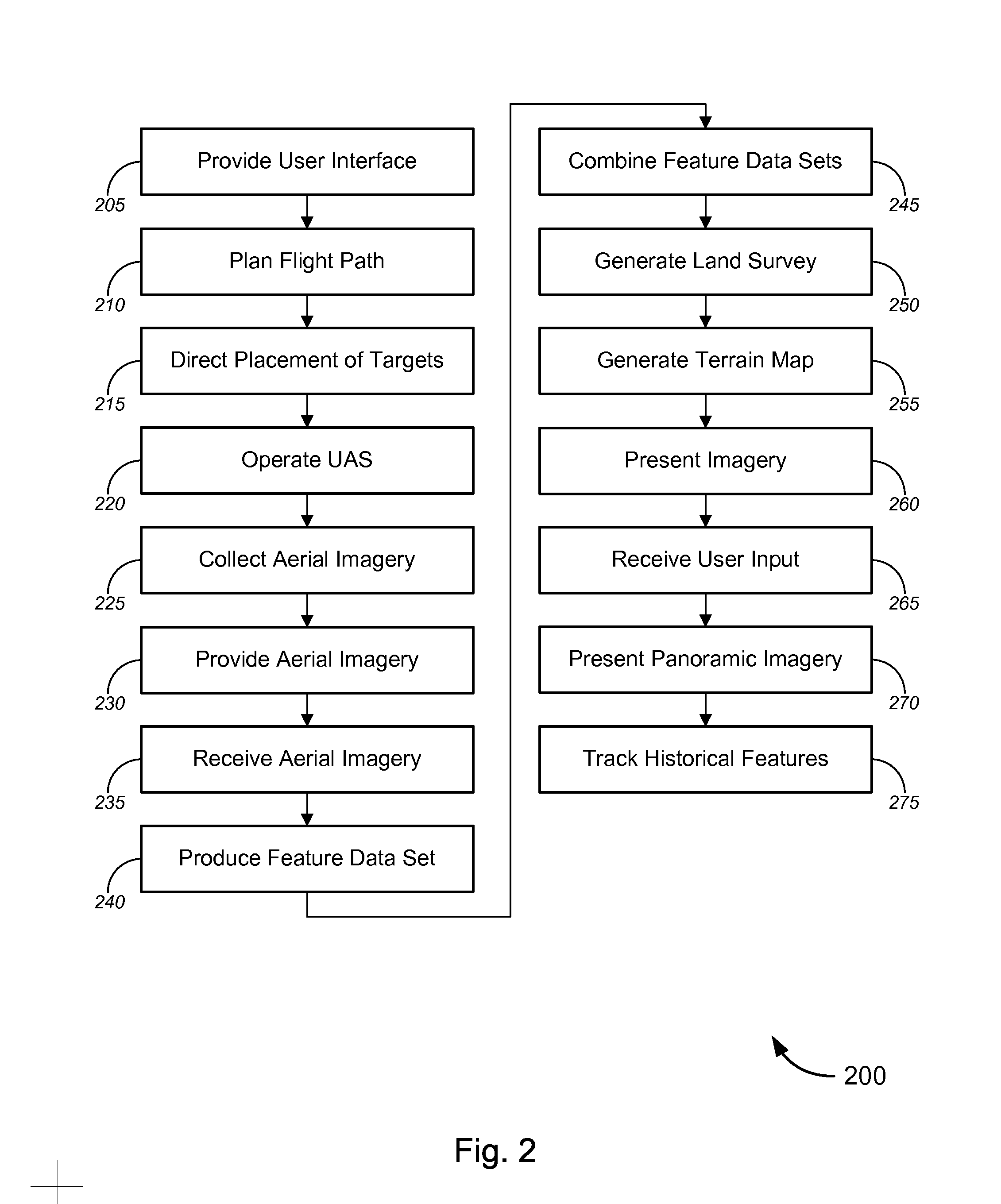
[0025]While various aspects and features of certain embodiments have been summarized above, the following detailed description illustrates a few exemplary embodiments in further detail to enable one of skill in the art to practice such embodiments. The described examples are provided for illustrative purposes and are not intended to limit the scope of the invention.

[0026]In the following description, for the purposes of explanation, numerous specific details are set forth in order to provide a thorough understanding of the described embodiments. It will be apparent to one skilled in the art, however, that other embodiments of the present may be practiced without some of these specific details. In other instances, certain structures and devices are shown in block diagram form. Several embodiments are described herein, and while various features are ascribed to different embodiments, it should be appreciated that the features described with respect to one embodiment may be incorporate...


PUM


Abstract

Novel tools and techniques for generating survey data about a survey site. Aerial photography of at least part of the survey site can be analyzed using photogrammetric techniques. In some cases, an unmanned aerial system can be used to collect site imagery. The use of a UAS can reduce the fiscal and chronological cost of a survey, compared to the use of other types aerial imagery and / or conventional terrestrial surveying techniques used alone.

Description

COPYRIGHT STATEMENT[0001]A portion of the disclosure of this patent document contains material that is subject to copyright protection. The copyright owner has no objection to the facsimile reproduction by anyone of the patent document or the patent disclosure as it appears in the Patent and Trademark Office patent file or records, but otherwise reserves all copyright rights whatsoever.FIELD[0002]The present disclosure relates, in general, to aerial photography and more particularly, to novel solutions employing photogrammetric analysis of aerial photography.BACKGROUND[0003]Land surveys are an important part of the planning and construction processes. Conventionally, preparing a land survey required extensive use of terrestrial survey instruments to obtain position measurements of various features within the survey site. The expense of the equipment involved, along with the required time commitment and labor-intensive nature of the measurements, necessarily requires considerable inv...

Claims


Application Information

Patent Timeline
Patent Type & Authority Patents(United States)
IPC IPC(8): H04N7/18G01C11/04G01C15/00G06K9/00
CPCG06K9/0063G01C11/04G01C15/00H04N7/183
Inventor JOYCE, KENNETH R.BROWN, TROY L.
Owner TRIMBLE INC
Why Eureka
Try Eureka